My Authors
Read all threads
The latest #BusConnects Core Bus Corridor plans have been released today by the NTA. From first glance at the northside routes (CBC1-5) there are good improvements for cycling. Though there are still tons of issues to work through.

A quick overview of the northside CBCs
CBC1 runs from Clongriffin to Marino via the Malahide Road. The junctions were the main issue with this route for people cycling. They are much improved in places (though some issues remain). The majority of bus stops do not cut into the cycle track

Map: busconnects.ie/media/1816/01-…
The NTA are keeping the quiet cycling diversion through Marino residential streets. The Malahide Road from Griffith Avenue to Marino Mart is too narrow to add dedicated cycle tracks. Haverty Road will be traffic filtered to remove rat running cars.
There's issues to be worked through.

The most obvious remaining issue the lack of *horizontal buffer* between the cycle track and 60-80km/h parts of the Malahide Road.

A grass buffer between fast moving traffic and the cycle track improves safety and comfort for people cycling
CBC2 runs from the south edge of Swords to the city centre along Swords Road and Drumcondra Road.

The proposals here are a mixed bag. Large changes around Santry, including a less isolated cycle route through Santry Village.

Map: busconnects.ie/media/1817/02-…
The junctions on the Swords Route are a total mix mash of high quality safe protected junctions (Dutch style 🥳🎉) or the normal Irish death traps 💀💀💀. Here's examples of two good and two bad.
The largest change on CBC2 Swords is around Santry. The residents wishes to widen the road to support two general traffic lanes and two bus lanes is in this plan. The isolated two-way cycle track along the edge of the Santry bypass has been replaced with quiet residential streets
Core Bus Corridor 3: Ballymun starts at St Margetts Road (near IKEA) and runs to city centre via Glasnevin, Heart's Corner, Phisborough to the River. There are a huge number of changes here.
Huge improvements to the junctions along the massive Ballymun Road. There are interesting changes to the messy junction of Ballymun Road, St Mobhi Road and Griffith Avenue (2nd image). Surprisingly that map shows an improvement, though clearly not pedestrian and cycle friendly.
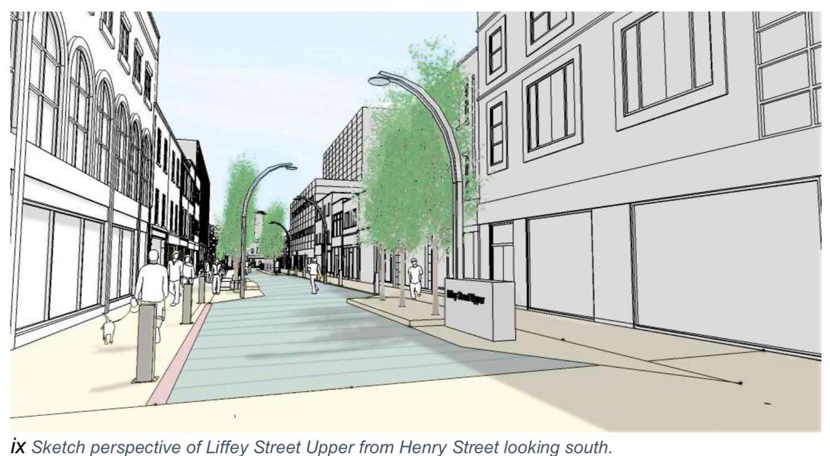
One of the under appreciated parts of BusConnects is how this project is a massive opportunity to reallocate public space away from transport towards public realm. This proposal in Glasnevin shows how to create a more inviting public space.
The preferred option for Mobhi Road is to maintain the beautiful street trees. This means compromises for people cycling with narrow cycle tracks in places. There will be a bus gate added northbound to provide bus priority.
There's a new section of cycle track in Glasnevin. To be honest I haven't had a chance to figure out why.
CBC3 joins CBC4 from Finglas at Hart's Corner. There are changes here that create a more continuous cycle track using two-way sections. This is a tricky spot, but these are improvements. More can probably be changed to provide a more coherent route.
CBC3 continues past the proposed @MetroLink_ie and Irish Rail combined station at the Royal Canal between Phisborough/Glasnevin. It'll also connect to the Royal Canal Greenway

The NTA are proposing a two-way cycle track and a new bridge over the canal.
From here the cycle route avoids the traffic filled Phibsborough village using Royal Canal Bank. It's great for those heading to the city bad for those who want to go to Phibsborough. It'll pass under North Circular Road on a new /reopened underpass where the old canal spur was.
The cycle route at Royal Canal Bank finishes at Western Way and rejoins the main road on a new two-way cycle track along Constitution Hill.
From here the proposals need a lot of work. There's proposals to run the cycle route via quiet streets to the river, avoiding the busy Church Street. Avoiding Church Street is in the cycle network plan. The NTA's proposed routing is not via Greek Street though.
CBC4 Finglas uses the Finglas Road past Glasnevin Cemetary to Hart's Corner where it connects with CBC3.

There are good improvements on this route but more work to be done for people cycling.

Map: busconnects.ie/media/1819/4-b…
The junctions are improved in many places for people cycling. Full protected junctions are proposed, which is a huge improvement on the death traps from before.
There's still no cycling improvements on the northern end of this Core Bus Corridor. The cycle route ends at Church Street (in Finglas). It doesn't connect up to quiet North Road or into Mellows Park and all of the residential areas from there.
As mentioned earlier. There are good improvements for people cycling at Hart's Corner. Hart's Corner must be one of the most cycling hostile places in the city at the minute.
Core Bus Corridor 5: Blanchardstown is a complex one. It starts around Blanchardstown shopping centre. There's no new cycling in the middle over the M50. Then it follows the Navan Road through Stoneybattter.

Map: busconnects.ie/media/1820/05-…
Around Blanchardstown was an absolute death trap in the last designs. The NTA don't disappoint in this round, with the same death traps /sarcasm.

Both the junction design here and that cycle murder lane with 60km/h fast moving traffic is 💀💀💀
There is a large bus interchange proposed at Blanchardstown shopping centre. The cycling proposals near here have improved a bit with more use of two-way cycle tracks. Two-way cycle tracks are necessary imho when the roads are as large as this.
Let's skip to the other side of the M50. The 80km/h sections of the Navan Road are mostly unchanged with the exception of Halfway House roundabout. The last designs proposed removing the roundabout.
Along the residential parts of Navan Road the cycle tracks are now continuous. This section is quiet constrained so there are compromises. Last picture is the junction at Old Cabra Road/Navan Road.
Into Stoneybatter there are large changes. The cycle route will now continue into Stoneybatter village instead of through TU Dublin's Grangegorman Campus. Brunswick Street will be closed to motor traffic and a new public space will be created there.
Those are all of the north side Core Bus Corridors.

Overall I'm mostly happy. There's more continuous cycle tracks, protected junctions in more places, parking protected cycle tracks and better bus stop designs.

There's loads more work to be done. Generally well done NTA.
I need to start reading the south west corridors now (CBC7-12). I'll post a new twitter thread for those corridors when I've finished reading through them all.
Here's the thread for the south west side of the city. This includes the corridors from: Lucan, Liffey Valley, Clondaklin Tallaght/Greenhills, Kimmage and Rathfarnham.

Missing some Tweet in this thread? You can try to force a refresh.

Enjoying this thread?

Keep Current with Kevin Baker

Profile picture

Stay in touch and get notified when new unrolls are available from this author!

Read all threads

This Thread may be Removed Anytime!

Twitter may remove this content at anytime, convert it as a PDF, save and print for later use!

Try unrolling a thread yourself!

how to unroll video

1) Follow Thread Reader App on Twitter so you can easily mention us!

2) Go to a Twitter thread (series of Tweets by the same owner) and mention us with a keyword "unroll" @threadreaderapp unroll

You can practice here first or read more on our help page!

Follow Us on Twitter!

Did Thread Reader help you today?

Support us! We are indie developers!


This site is made by just three indie developers on a laptop doing marketing, support and development! Read more about the story.

Become a Premium Member ($3.00/month or $30.00/year) and get exclusive features!

Become Premium

Too expensive? Make a small donation by buying us coffee ($5) or help with server cost ($10)

Donate via Paypal Become our Patreon

Thank you for your support!