,
10 tweets,
7 min read
Read on Twitter
1/9: Over the last 24 hours there have been large eastward shifts in #Dorian's track. It may now just clip #PuertoRico to the east! How?
Let's start with Dorian's vertical structure. One critical change is how vertically coherent Dorian's vortex has become, as seen below.
Let's start with Dorian's vertical structure. One critical change is how vertically coherent Dorian's vortex has become, as seen below.
2/9: Here is another way to view it, this time from a lat-lon map. Over the last four GFS model cycles, the separation between the low & mid level centers of #Dorian decreases until they are on top of each other.
Correspondingly the low-level vortex migrates to the northeast.
Correspondingly the low-level vortex migrates to the northeast.
3/9: Since #Dorian's vortex is more vertically stacked, it feels a deeper steering layer, moving it more north vs. the low-level flow.
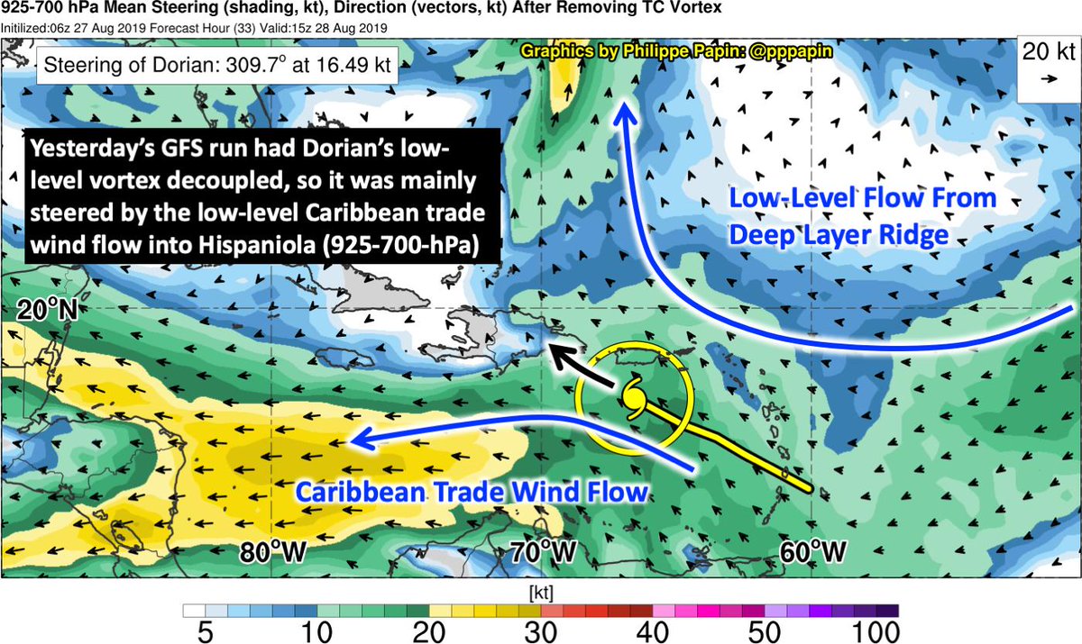
Yesterday's 06z GFS run had a shallow vortex, & its steering was impacted by the low-level Caribbean trade winds (925-700-hPa) into #Hispaniola.
Yesterday's 06z GFS run had a shallow vortex, & its steering was impacted by the low-level Caribbean trade winds (925-700-hPa) into #Hispaniola.
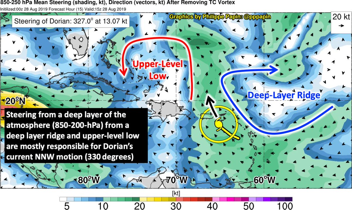
4/9: Compare that run to the 00z GFS run today. #Dorian's vertically deep vortex is more influenced by the combination of deep-layer ridge to the northeast & upper-level low north of #Hispaniola. Using the 850-250-hPa layer best captures Dorian's current motion.
5/9: So now we have some sense of why #Dorian is moving further east than forecasted yesterday, but how did the TC become vertically coupled?
My hypothesis is that yesterday's center reformation further north helped couple it with the mid-level center.
My hypothesis is that yesterday's center reformation further north helped couple it with the mid-level center.
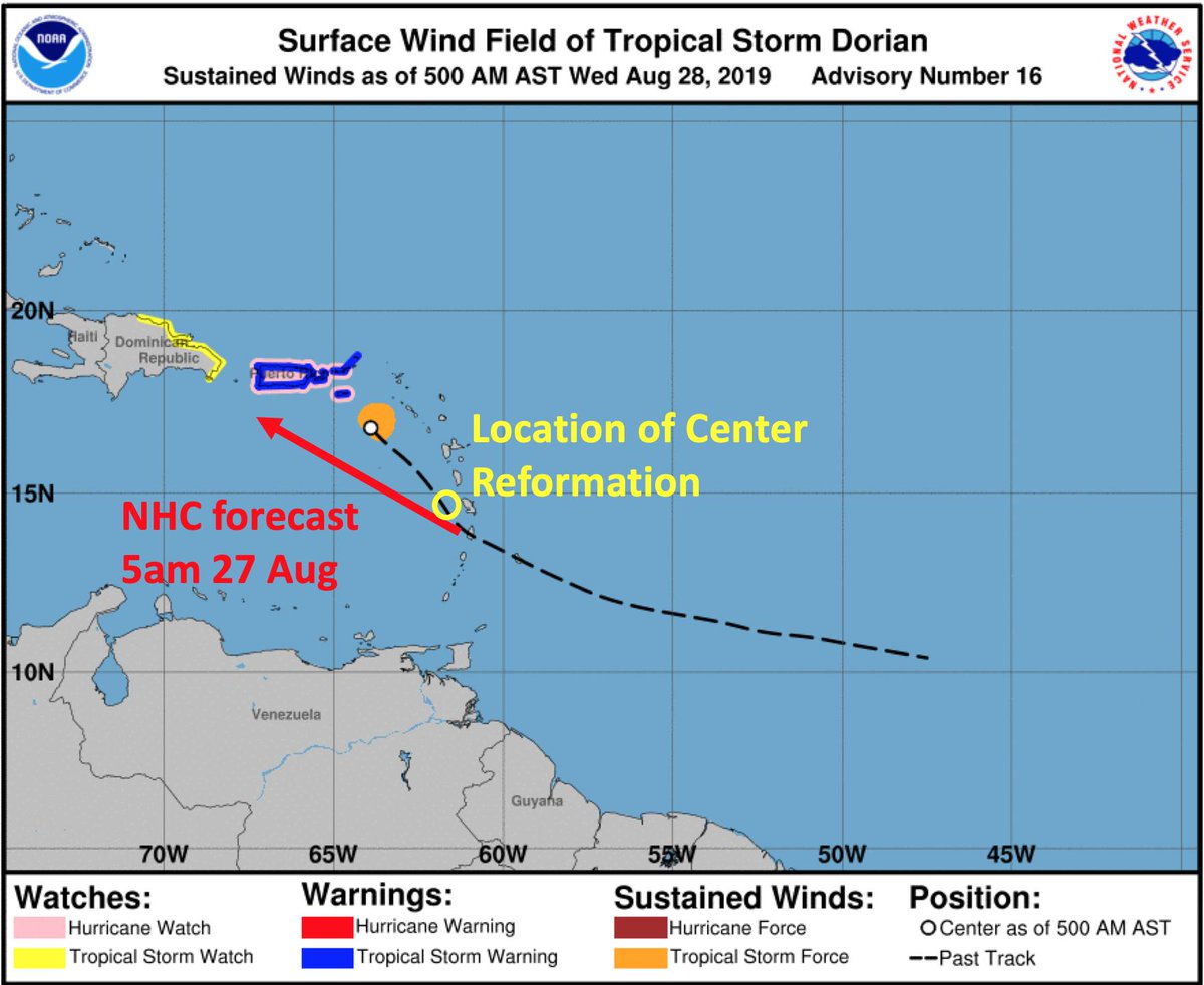
6/9: After yesterday's center reformation, there was a distinct bend north in #Dorian's track.
This was not fcasted before the center reformation. Even after reformation, the track heading shifted more poleward, possibly due to the deeper vortex feeling deeper layer steering.
This was not fcasted before the center reformation. Even after reformation, the track heading shifted more poleward, possibly due to the deeper vortex feeling deeper layer steering.
7/9: Of course this short-term shift in #Dorian's track has implications on intensity downstream. Now that Dorian misses #Hispaniola & even most of #PuertoRico it likely will start out stronger. Most models now depict a deepening #Hurricane in 3-5 days.
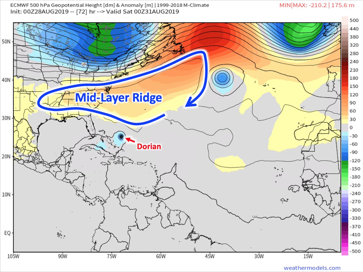
8/9: However, it does not mean that #Dorian's track will stay east of the guidance. After Dorian makes it poleward of #PuertoRico it will hit an expanding mid-level ridge, w/ clockwise flow forcing Dorian back west.
This ridge is critical to Dorian's track after Puerto Rico.
This ridge is critical to Dorian's track after Puerto Rico.
9/9: That's a story I'll save for another time. Until then, I hope this was a useful thread to explain some of Dorian's recent track deviations.
Fin.
Fin.
Thanks to @TropicalTidbits, @Weathernerds, & @weathermodels_ for having some wonderful graphics that I can attempt to illustrate my thoughts with. 👍