, 32 tweets, 21 min read
My Authors
Read all threads
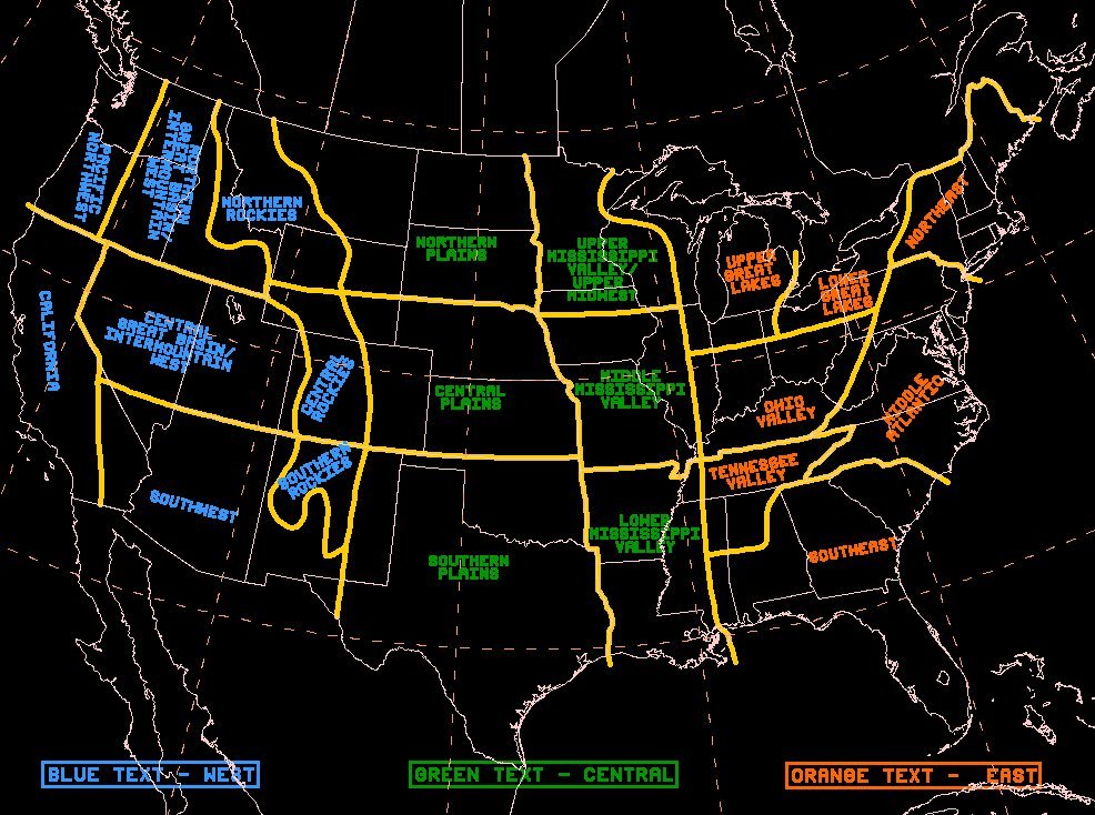
As has been recently noted on Twitter, what was then HPC came up with a regional name map for the United States about 20 years ago. It was simple, and meant to acquaint new forecasters to the lower 48. @TornadoQuest @AndrewWxCenter (1 of x).
@TornadoQuest @AndrewWxCenter After its creation, a more detailed map seemed necessary as local forecast offices referred to areas that were smaller in scale which we were unfamiliar. Three years ago, WPC worked on a new regional map for the United States, using input from other NWS offices. (2 of x)
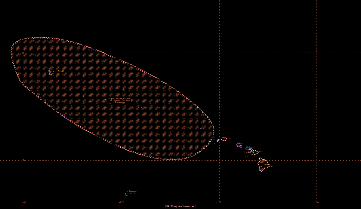
@TornadoQuest @AndrewWxCenter These are sections of that map that we refer to in WPC discussions. For the area around Hawai'i... (3 of x)
@TornadoQuest @AndrewWxCenter For the area around AK... (4 of x)
@TornadoQuest @AndrewWxCenter The Pacific Northwest... (5 of x)
@TornadoQuest @AndrewWxCenter Around northern California... (6 of x)
@TornadoQuest @AndrewWxCenter Around southern California... (7 of x)
@TornadoQuest @AndrewWxCenter Around southern Nevada... (8 of x)
@TornadoQuest @AndrewWxCenter Around Arizona... (9 of x)
@TornadoQuest @AndrewWxCenter Utah and Colorado... (10 of x)
@TornadoQuest @AndrewWxCenter Nevada... (11 of x)
@TornadoQuest @AndrewWxCenter Montana... (12 of x)
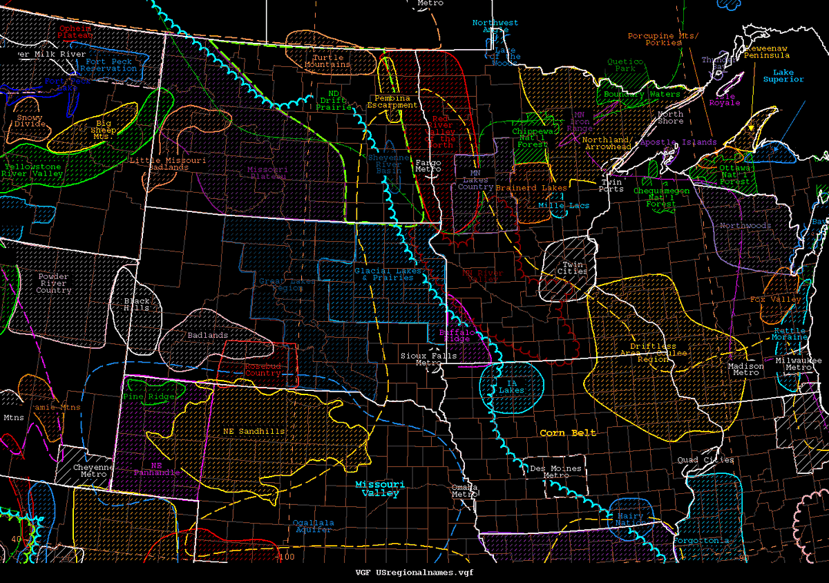
@TornadoQuest @AndrewWxCenter The Northern Plains/Upper Midwest/Upper Mississippi Valley... (13 of x)
@TornadoQuest @AndrewWxCenter Central Plains/portions of the Midwest... (14 of x)
@TornadoQuest @AndrewWxCenter New Mexico... (15 of x)
@TornadoQuest @AndrewWxCenter Northern TX and Oklahoma... (16 of x)
@TornadoQuest @AndrewWxCenter Southern TX... (17 of x)
@TornadoQuest @AndrewWxCenter Louisiana... (18 of x)
@TornadoQuest @AndrewWxCenter Eastern Gulf coast and Southeast... (19 of x)
@TornadoQuest @AndrewWxCenter Florida... (20 of x)
@TornadoQuest @AndrewWxCenter Northwest Caribbean... (21 of x)
@TornadoQuest @AndrewWxCenter Northeast Caribbean... (22 of x)
@TornadoQuest @AndrewWxCenter Carolinas... (23 of x)
@TornadoQuest @AndrewWxCenter Mid South... (24 of x)
@TornadoQuest @AndrewWxCenter Illinois/portions of Midwest... (25 of x)
@TornadoQuest @AndrewWxCenter Ohio... (26 of x)
@TornadoQuest @AndrewWxCenter Great Lakes... (27 of x)
@TornadoQuest @AndrewWxCenter Southern Mid-Atlantic... (28 of x)
@TornadoQuest @AndrewWxCenter Northern Mid-Atlantic... (29 of x)
@TornadoQuest @AndrewWxCenter And New England... (30 of 30)
@TornadoQuest @AndrewWxCenter It should be noted that @NWSElPaso shared a file they use with area names near the TX/NM border which we tried to faithfully duplicate for our purposes. :)
@TornadoQuest @AndrewWxCenter For eastern ME, @NWSCaribou had a map of the regional names they use which we tried to replicate as close as possible for this map.
Missing some Tweet in this thread? You can try to force a refresh.

Enjoying this thread?

Keep Current with NWS WPC

Profile picture

Stay in touch and get notified when new unrolls are available from this author!

Read all threads

This Thread may be Removed Anytime!

Twitter may remove this content at anytime, convert it as a PDF, save and print for later use!

Try unrolling a thread yourself!

how to unroll video

1) Follow Thread Reader App on Twitter so you can easily mention us!

2) Go to a Twitter thread (series of Tweets by the same owner) and mention us with a keyword "unroll" @threadreaderapp unroll

You can practice here first or read more on our help page!

Follow Us on Twitter!

Did Thread Reader help you today?

Support us! We are indie developers!


This site is made by just three indie developers on a laptop doing marketing, support and development! Read more about the story.

Become a Premium Member ($3.00/month or $30.00/year) and get exclusive features!

Become Premium

Too expensive? Make a small donation by buying us coffee ($5) or help with server cost ($10)

Donate via Paypal Become our Patreon

Thank you for your support!