Data from space are helping track damage from earthquakes in Puerto Rico. @NASA scientists have created and provided maps of likely damaged areas to agencies like @USGS, @fema and @HHSGov to assist in disaster response.
go.nasa.gov/2FY6CdF
go.nasa.gov/2FY6CdF
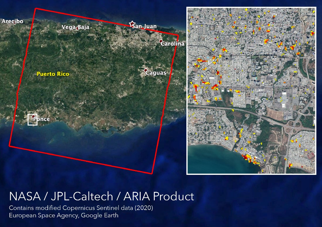
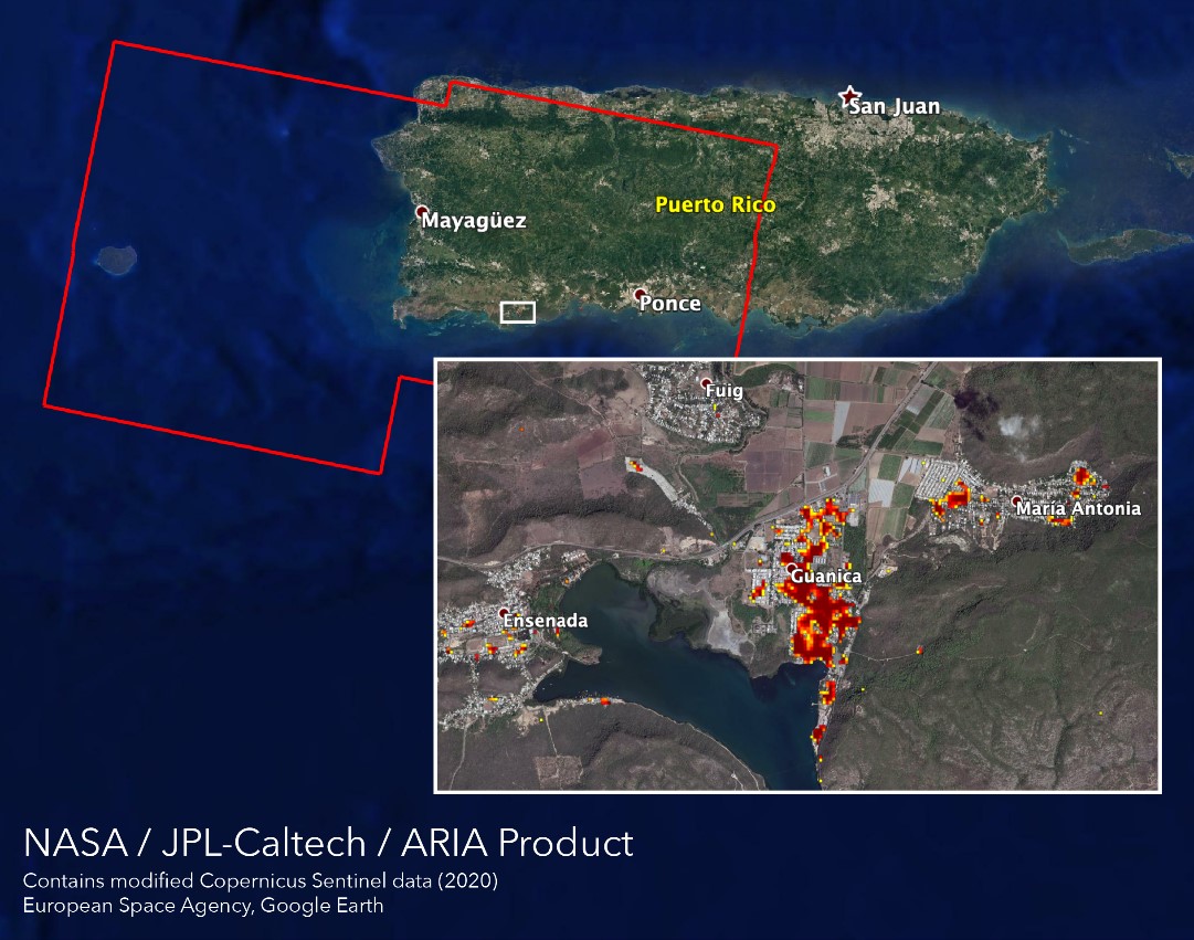
Maps of surface displacement show where elevation changed between Jan. 2 and Jan. 14, indicating around 6 inches of surface lowering in the southern region of Puerto Rico. A second map shows 120 landslides, which indicate the areas of greatest shaking.