
We have another large #ArabianStorm which was not anticipated by the global weather models. And like those before it, it is fueled by the #WestAfricaMonsoon and a #WestAfricaWaterPlume. This time across the Red Sea in the vicinity of #Makkah.
Today's rainfall forecasts follow.
Today's rainfall forecasts follow.
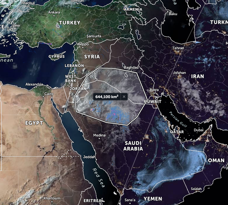
This animation shows the current state of a weather event that has been a few days in coming. #ArabianStorms
@Arab_Storms
@Arab_Storms
The origin of this event is very similar to that which caused several days of extremely severe thunderstorms in #Oman earlier in the month. This animation is from May 18th shortly after it first appeared in the @zoom_earth satellite imagery.
Current precipitable water model observations for the #MiddleEast. The flow of water vapor from central Africa into northern #SaudiArabia is continuing. 


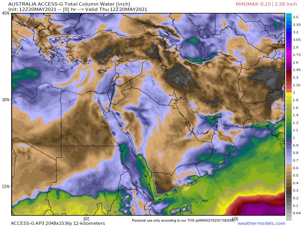
10 Day Rainfall forecasts for 20 May follow:
First North Africa where a spectacular #DesertRain Western Sahara rain event is forecast.


First North Africa where a spectacular #DesertRain Western Sahara rain event is forecast.


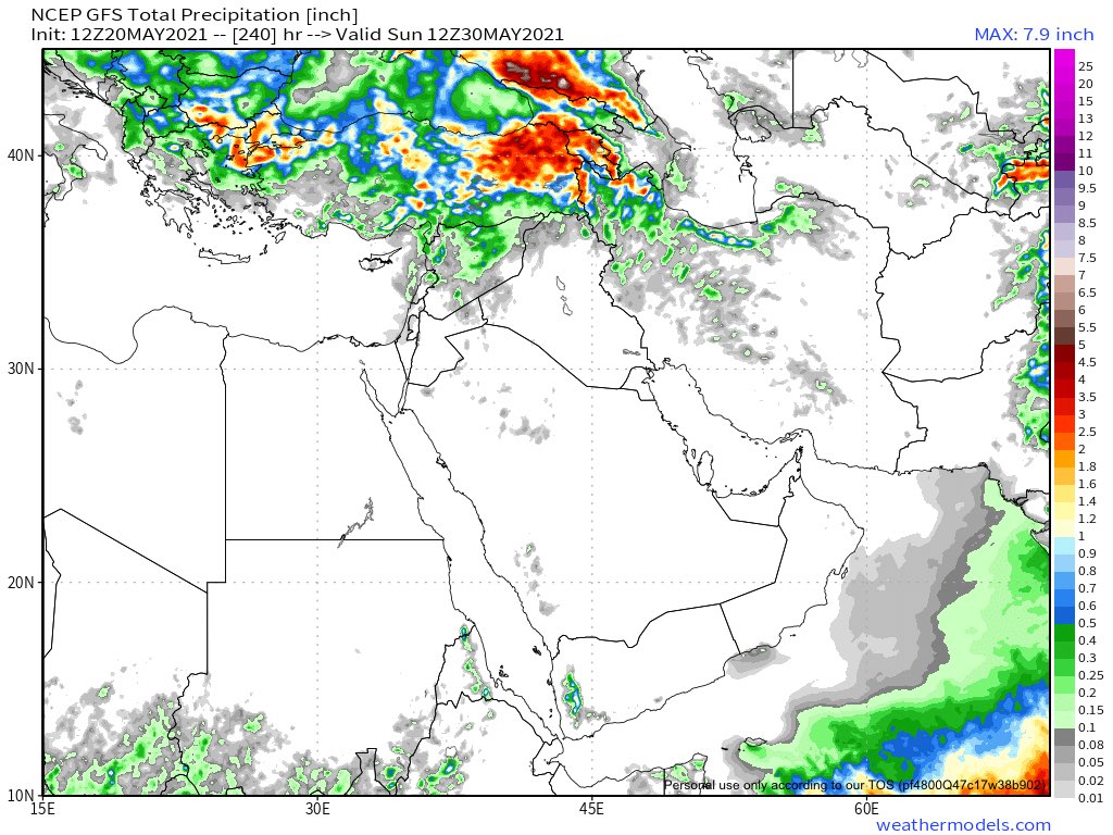
4th #MiddleEast long range 16 and 12 day forecasts. 

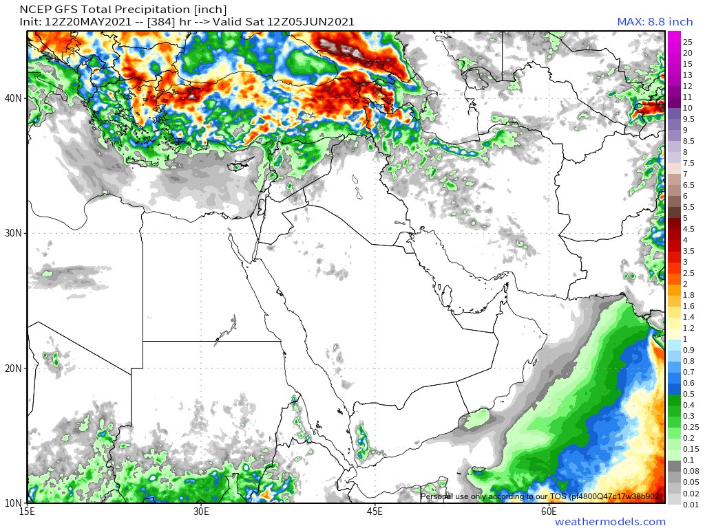

It’s clear from the latest forecasts that the @NOAA GFS and @ECMWF models are still struggling to model the significantly more complex Middle East weather situation & its African Monsoon origins. Neither model is showing any Levant and Northern #ArabianPeninsula rainfall. 


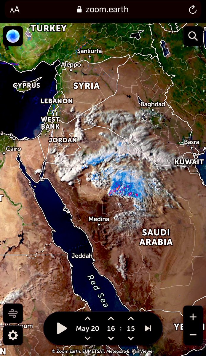

You can watch the latest unusual #ArabianStorms causing event live at this link. zoom.earth/#view=26.25,39… on zoom_earth 

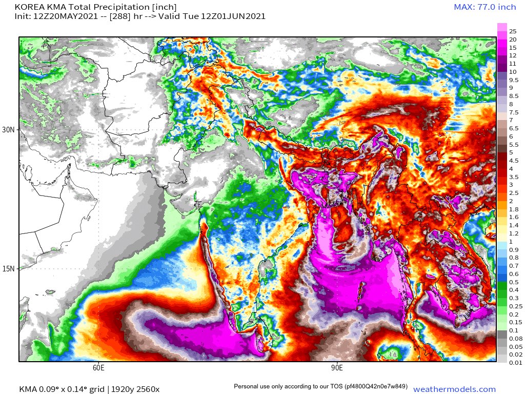
None of this is a criticism of the leading GFS and ECMWF global models. They remain preeminent among supercomputer model. Their forecasts for Cyclone #Tauktae were spot on. Both models are now predicting a tropical storm in the Bay of Bengal. 

Long range 10, 12 and 16 day rainfall forecasts for the Indian sub-continent and it’s attendant increasingly active adjacent seas, #ArabianSea #BayOfBengal 




• • •
Missing some Tweet in this thread? You can try to
force a refresh


