Today's #NorthAfrica, #HornOfAfrica and #ArabianStorms rainfall forecasts follow.
I was wondering if this might happen. With all the moisture streaming along the North African coast and north east from central Africa. Also some forecasts had this indicated as a possibility.
I was wondering if this might happen. With all the moisture streaming along the North African coast and north east from central Africa. Also some forecasts had this indicated as a possibility.
Admittedly the rain is very light. But it is June and close to Solstice, the hottest month in this part of the world. Here we see the broader picture. The #EuropeBigWet is continuing in a fairly stable pattern for another 48 hours still.
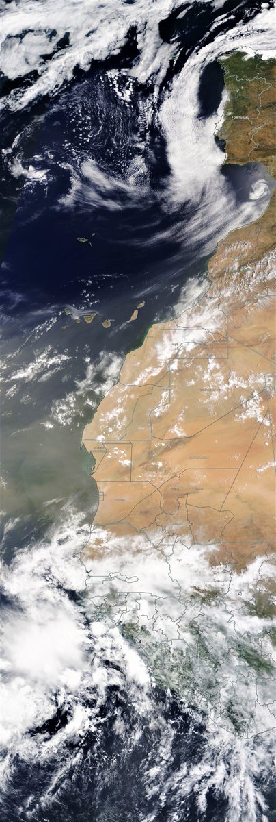
Here's a close up of the North Western quadrant with some big storms bursting to life near the Morocco/Algeria border.
Another view of this area showing the rainfall associated with these clouds.
Morocco is supposed to be dry this time of year. In fact they have had a fair bit of rain there continuously since March. [Ref. tripsavvy.com/morocco-weathe…] 
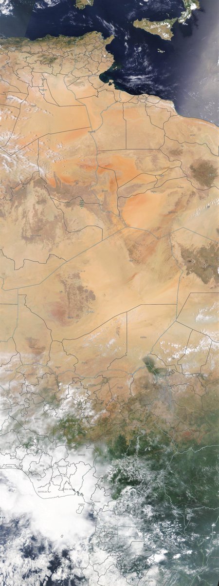
To the south east we have the engine room of the West African Monsoon over and inland from Nigeria. Today there are two big storms over Niger and Chad. Both are generating sufficient height to inject moisture into the north easterly jets at around 10,000m alt.
This map shows 300 hpa winds which are as you see heading north east from where those two storms are. This pattern has been place for some time now bringing clouds across Egypt. And this is contributing to the rain over Lebanon this evening.

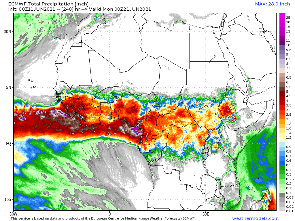
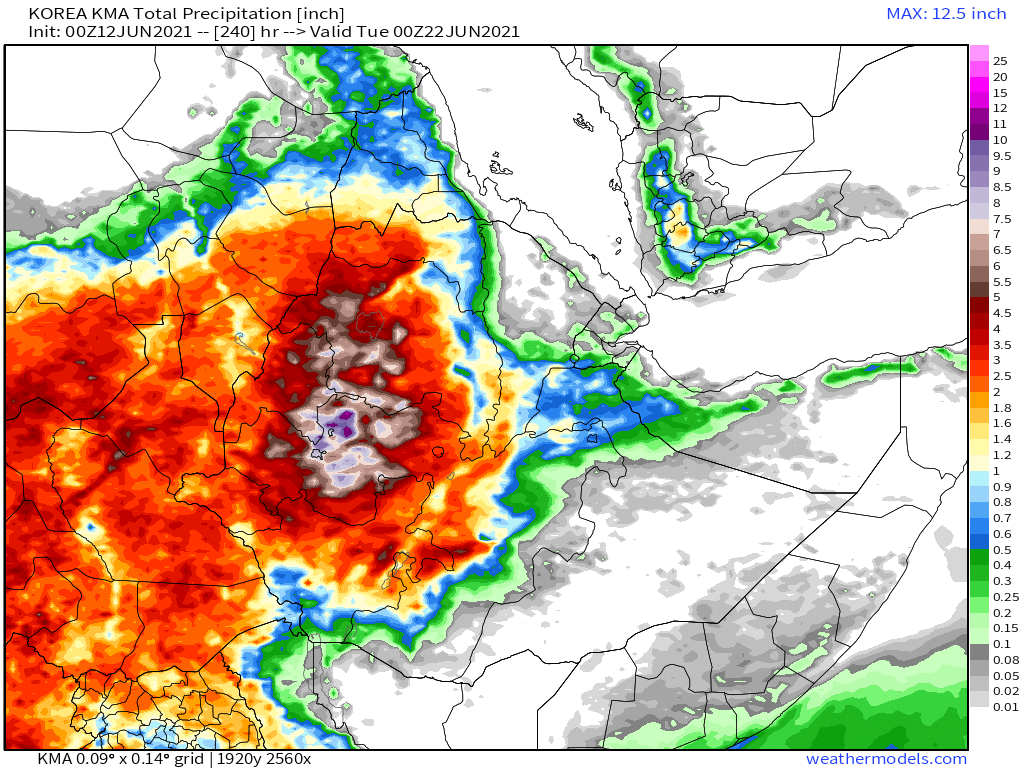
Here are today's 10-day rainfall forecasts for the broader region three of the four models continue to show a fair bit of #DesertRain.


And here are 48 hour forecasts (rainfall today and tomorrow) from the same four models. Unfortunately its impossible to know which one is getting it right.


Rainfall was light in the #HornofAfrica. #ArabianStorms were also subdued, though there was another storm south of Mecca as the evening approached, the third day running rain has been close to the holy city during a month where the average rainfall is zero.
10-Day rainfall forecasts for June 12th of the #HornOfAfrica including, #Somalia, #Somaliland, #Djibouti, #Ethiopia and parts of #Sudan and #SouthSudan.
+ bonus 12-day forecast from KMA.
+ bonus 12-day forecast from KMA.


48 hour rainfall forecasts for June 12th of the #HornOfAfrica including #Somalia, #Somaliland, #Djibouti, #Ethiopia and parts of #Sudan and #SouthSudan.


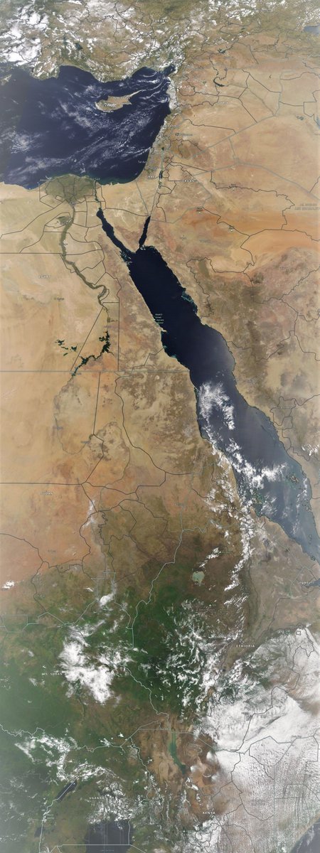
Introducing the #MiddleEast segment here's a wind map from this morning. 850hpa is typically about 1500m but probably higher given the heat at the moment. This is the wind that is driving a massive dust river south from Iraq over Kuwait and into Yemen.

You have to look close to see it and its clearer as the sun sets - but this dust river is huge. Interestingly it is also connected to the Central Africa monsoon jet which is bringing the cloud onshore into Lebanon. From there it curls east and then south east picking up the dust.
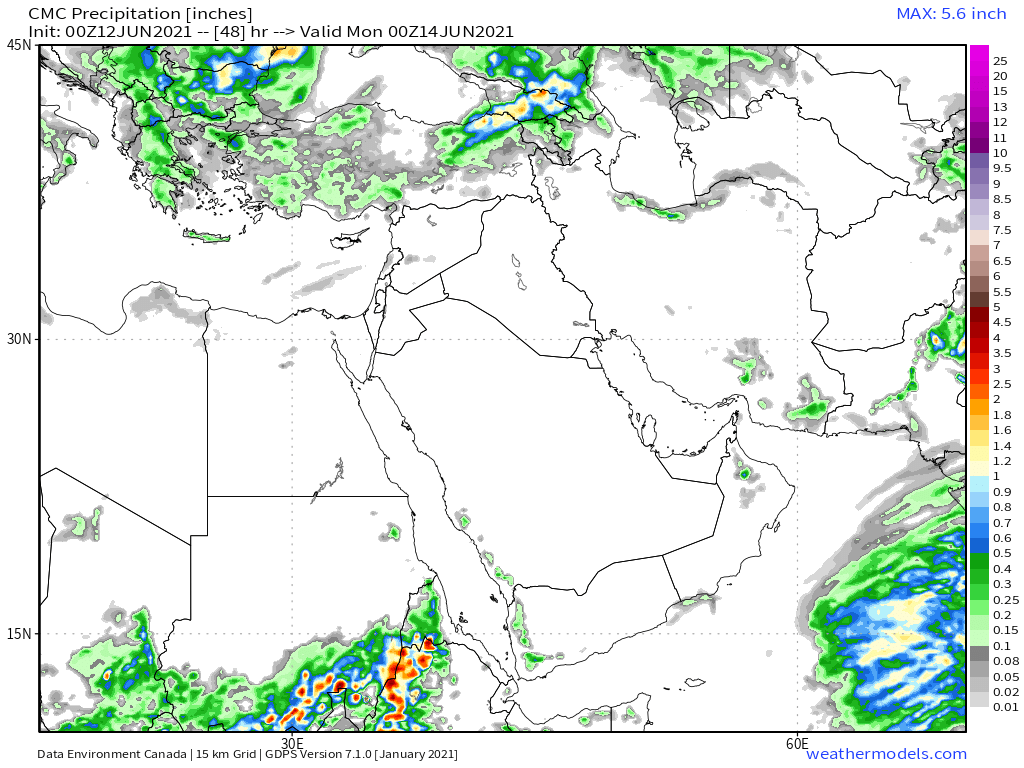
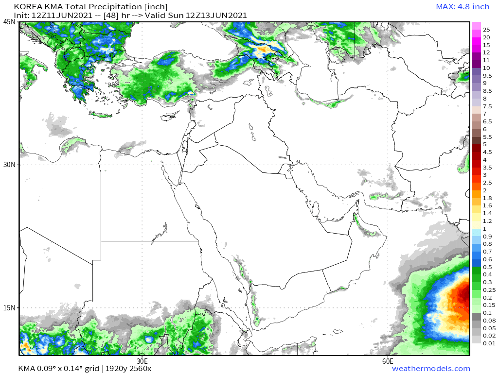
10-Day June 12th, accumulated rain forecasts for the #MiddleEast from the GFS, CMC & KMA weather models.
#ArabianStorms
#KSA #Yemen #Oman #Jordan #Sudan #Iran #Syria #GERD #Sudan #DesertRain
الله أعلم
#ArabianStorms
#KSA #Yemen #Oman #Jordan #Sudan #Iran #Syria #GERD #Sudan #DesertRain
الله أعلم


48 Hour June 12th (today and tomorrow), accumulated rain forecasts for the #MiddleEast from the GFS, CMC & KMA weather models.
#ArabianStorms
#KSA #Yemen #Oman #Jordan #Sudan #Iran #Syria #GERD #Sudan #DesertRain
الله أعلم
#ArabianStorms
#KSA #Yemen #Oman #Jordan #Sudan #Iran #Syria #GERD #Sudan #DesertRain
الله أعلم

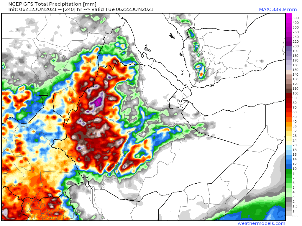
And finally, June 12th 16-day (GFS) and 12-day (KMA) accumulated rainfall forecasts for the Middle East.
The GFS is again showing rains over the Arabian Sea getting very close to Yemen. This 16 day forecast also shows very heavy rains in #Ethopia in bottom left.
The GFS is again showing rains over the Arabian Sea getting very close to Yemen. This 16 day forecast also shows very heavy rains in #Ethopia in bottom left.


And this is relevant to the question of when the #HornOfAfrica Big Rains will begin. On June 8th I addressed this (thread below) in the daily forecasts.
https://twitter.com/althecat/status/1402329810152701952?s=20
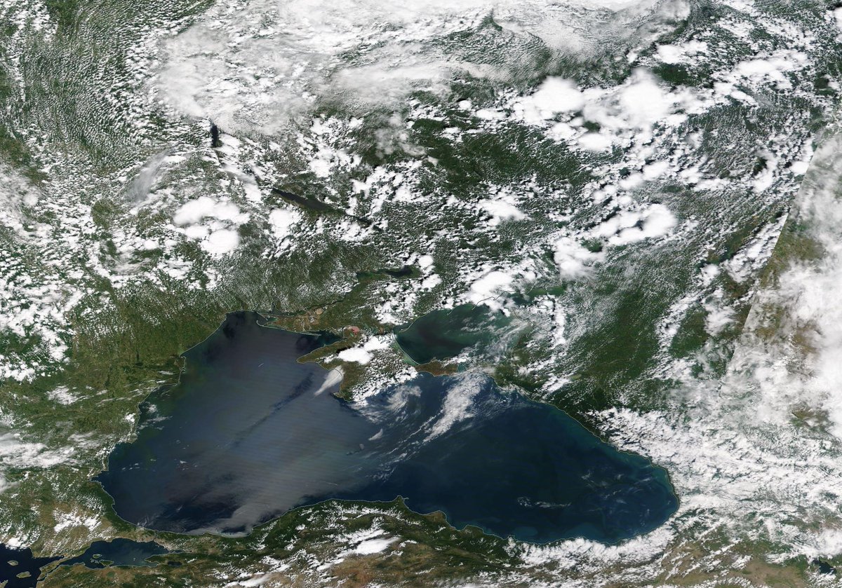
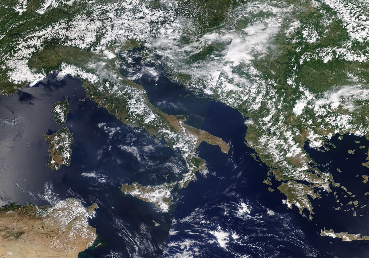
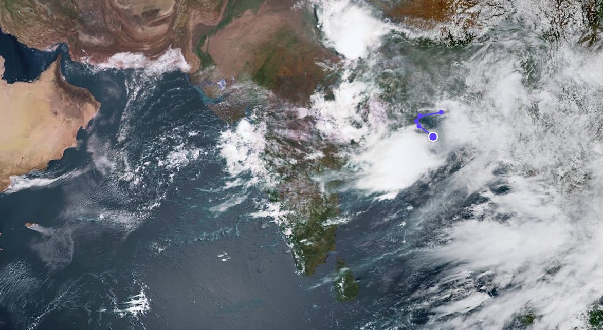
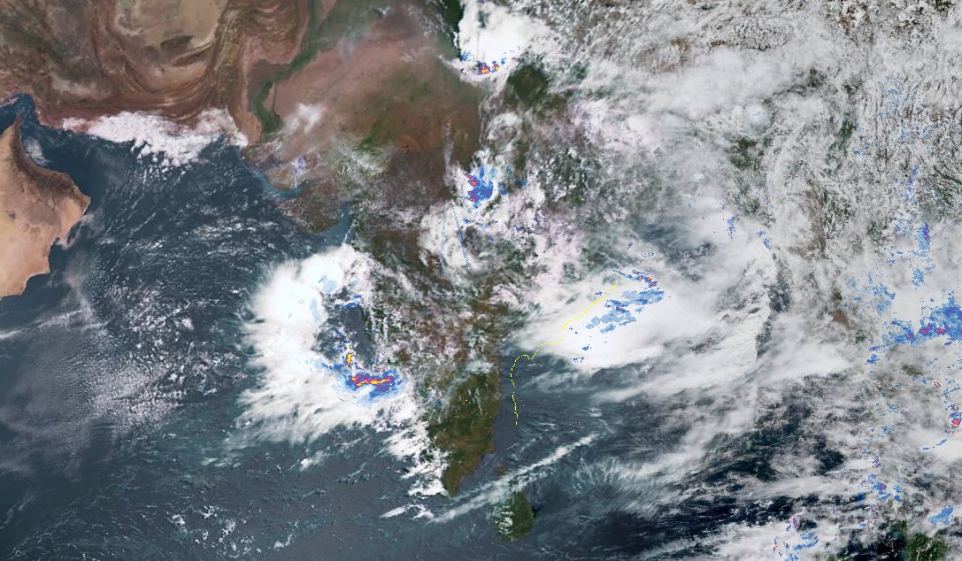
Here's an interim update. We are expecting the Indian Monsoon to be spreading west into Pakistan and into the Arabian Sea. Here are four satellite images each taken at the same time from the 9th 10th 11th and 12th of June.
And this is indeed happening.
And this is indeed happening.


Finally. Make sure to check out @Arab_Storms for the latest storm videos, from Oman, Saudi Arabia and Kuwait. A small selection follows. Beginning with this video of a thunderstorm downburst, which can generate very strong winds.
https://twitter.com/Arab_Storms/status/1403691872397139975?s=20
This video from Kuwait shows what the dust storm was like today.
https://twitter.com/Arab_Storms/status/1403649685429030914?s=20
And finally some heavy rain run-off in Saudi Arabia today in the Asir Region.
https://twitter.com/Arab_Storms/status/1403696104340746243?s=20
/ENDS
@Threadreaderapp unroll
@Threadreaderapp unroll
• • •
Missing some Tweet in this thread? You can try to
force a refresh