It's morning in Europe after a day of destructive weather in Spain and the Netherlands in particular. The low discussed in recent #EuropeBigWet updates has arrived and as expected is bringing a significant change in the pattern over Europe.
Extended update follows.
Extended update follows.
#EuropeBigWet coverage of began on June 4th. But April & May were weird too.
Recaps...
6 June: threadreaderapp.com/thread/1401635…
7 June: threadreaderapp.com/thread/1401903…
8 June: threadreaderapp.com/thread/1402294…
10 June: threadreaderapp.com/thread/1403067…
17 June: threadreaderapp.com/thread/1405502…
https://twitter.com/althecat/status/1400818873105108993?s=20
Recaps...
6 June: threadreaderapp.com/thread/1401635…
7 June: threadreaderapp.com/thread/1401903…
8 June: threadreaderapp.com/thread/1402294…
10 June: threadreaderapp.com/thread/1403067…
17 June: threadreaderapp.com/thread/1405502…
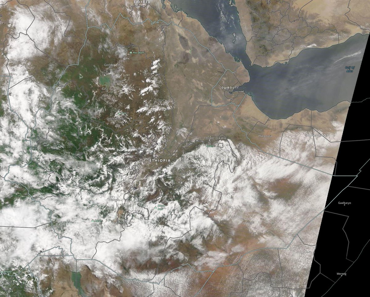
The cause of the unusual weather being experienced in Europe, Sahara, the United States and he Middle East is the same. Very high levels of airborn water vapour in northern hemisphere.
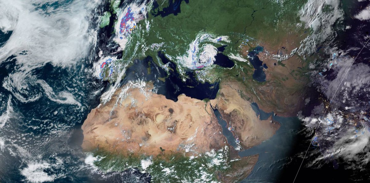
These two images 18th June show the visible part, cloud cover in the North Atlantic/Pacific.
These two images 18th June show the visible part, cloud cover in the North Atlantic/Pacific.


Here are corresponding current images showing water vapour, for the North Atlantic and North Pacific as of 6am today. Offered here to show the global nature of this phemonena. The focus in the remainder of this update will be the ongoing #EuropeBigWet.

This years Atlantic Hurricane season is also unusual. So far all three named tropical storms have been in the North Atlantic. Here we see the paths for the first two, Ana and Bill. The third tropical storm Claudette which was named yesterday is following this pattern.

This is relevant to Europe as these storms are playing a significant role in the #EuropeBigWet.
Claudette is as of now coming ashore in Louisiana. And the storm you see top right is associated with Bill.
Claudette is as of now coming ashore in Louisiana. And the storm you see top right is associated with Bill.

A few days ago the extratropical low which was formerly TS Bill combined with a low sitting over Eastern Canada and then transited the Atlantic moving due east.
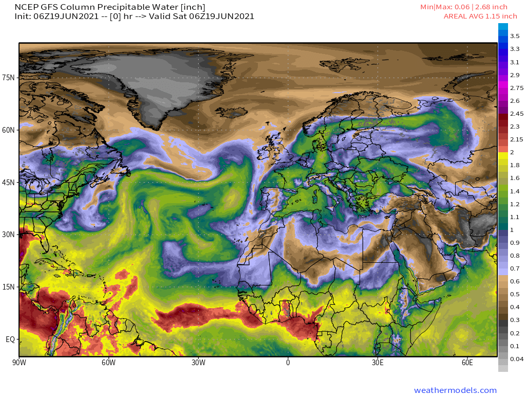
This animation shows the next 24 hours in terms of atmospheric PWAT aka Precipitable Water.
This animation shows the next 24 hours in terms of atmospheric PWAT aka Precipitable Water.
Apart from the ongoing disruption to the Cricket that this will cause, there is another feature of this which is helpful to understand. Air containing water also contains greater mass and as a result more energy (=lightning) and more intertia (=slow moving).
What we see now in the simulation above is very different from earlier simulations which showed the low stalling over the UK.
The latest version is better for the NZ vs England Cricket in Southhampton. It still contains rain. Overnight tonight and Monday afternoon.
The latest version is better for the NZ vs England Cricket in Southhampton. It still contains rain. Overnight tonight and Monday afternoon.


Next we have four current 5-day rainfall forecast for Europe as a whole from GFS, ECMWF, CMC and KMA models. The UK is now getting of significantly more lightly in rain, with France, Germany, Switzerland & Scandinavia now getting the most rain.


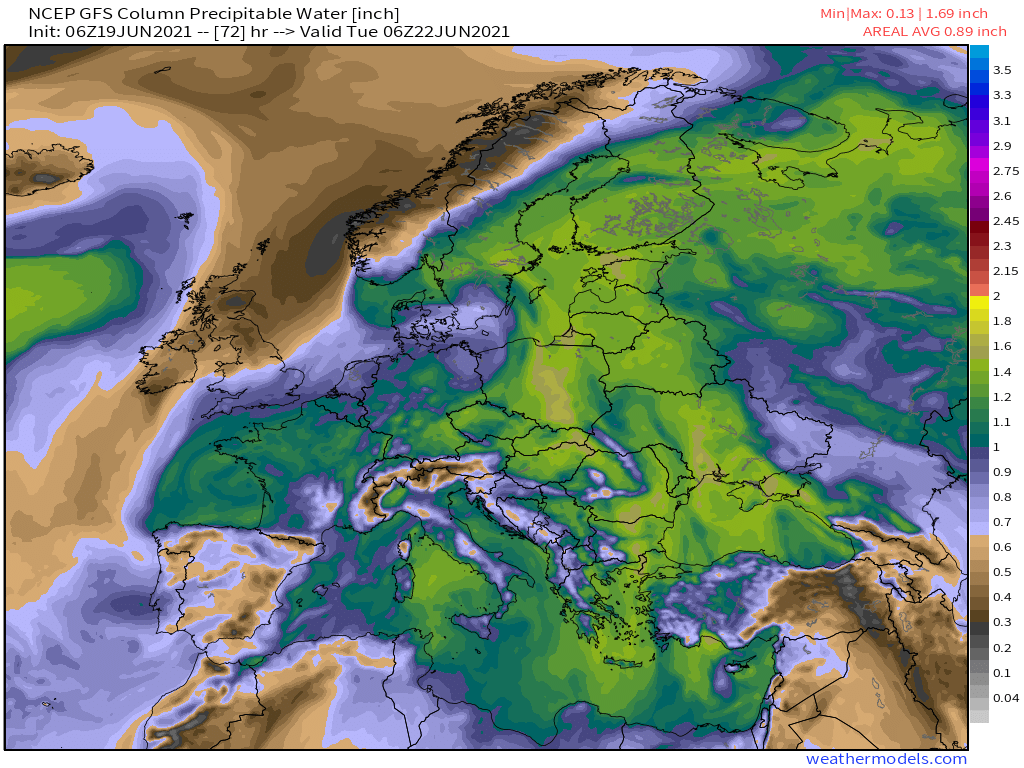
Over a longer time frame there appears to be littlle prospect of the the overall wet pattern changing. These four images, 72 hours apart.


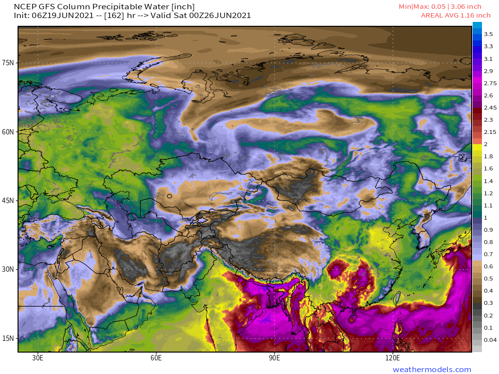
Over the next 16 days the Northern Hemisphere PWAT / Water Vapour traffic jam is simulated to spread east.


These two images show the global water vapour picture today and in 10 days time.


These four images Access-G model (Australia) & GEFS model (US) show the global water vapour picture today and in 10 days and 16 times time, globally and in the Northern Hemisphere.


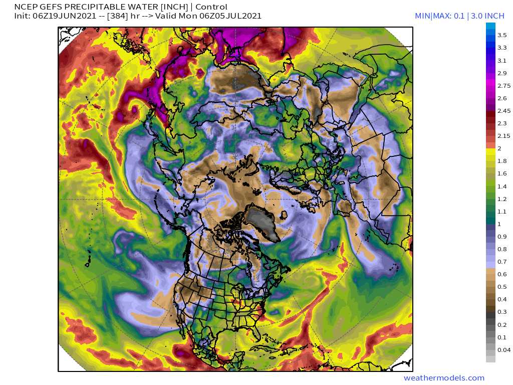
While this thread is a #EuropeBigWet update. The phenomena which are bring moisture to Europe are not confined to Europe, or the Atlantic. What we are seeing in the data is that the world is getting wetter. Everywhere.
/Ends
@Threadreaderapp unroll
/Ends
@Threadreaderapp unroll
• • •
Missing some Tweet in this thread? You can try to
force a refresh