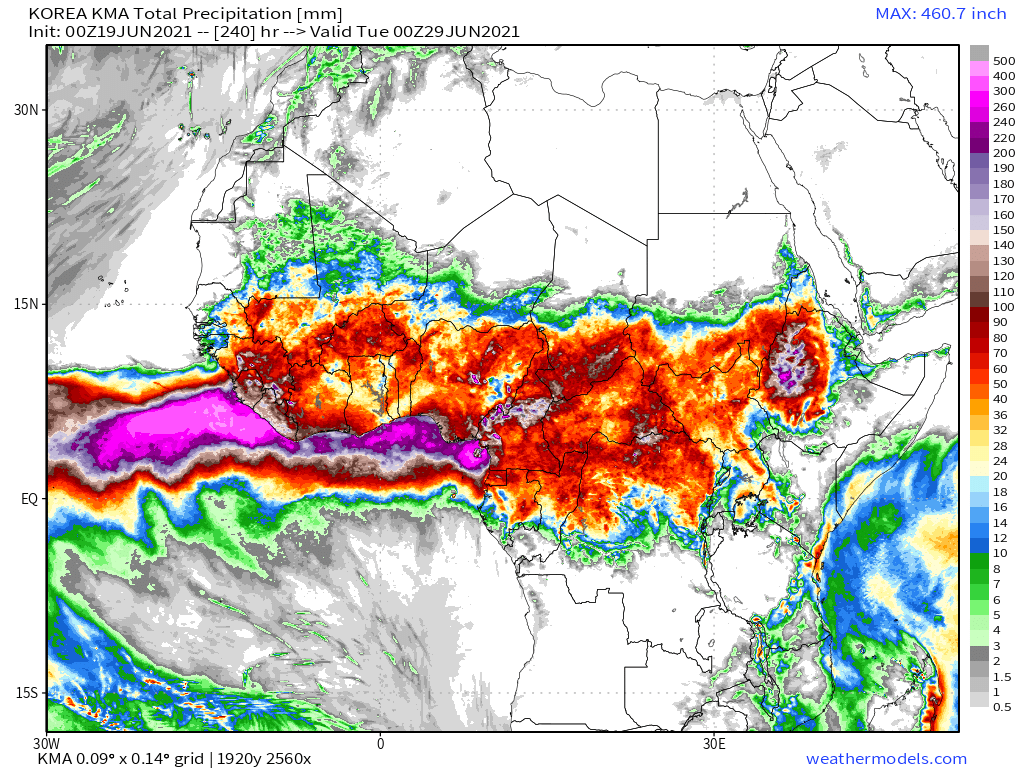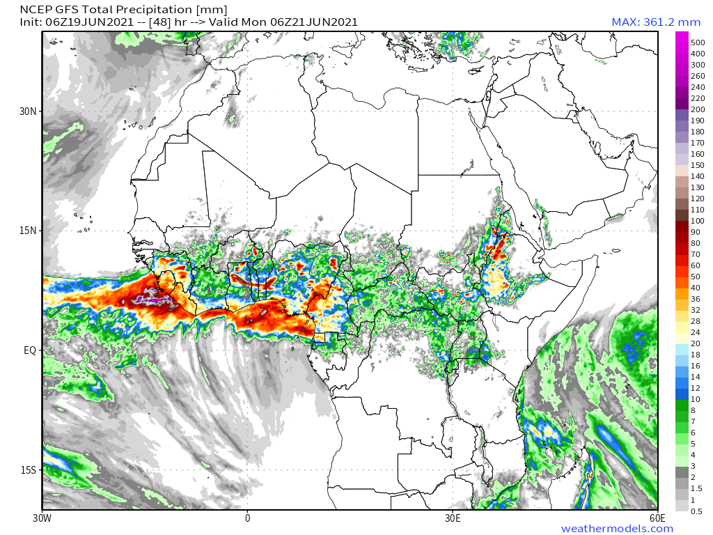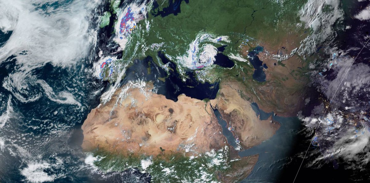
See four satellite images taken today of major water transport events from @NASA Modis below.
1. Monsoon winds leaving India
2. Monsoon winds arriving Africa
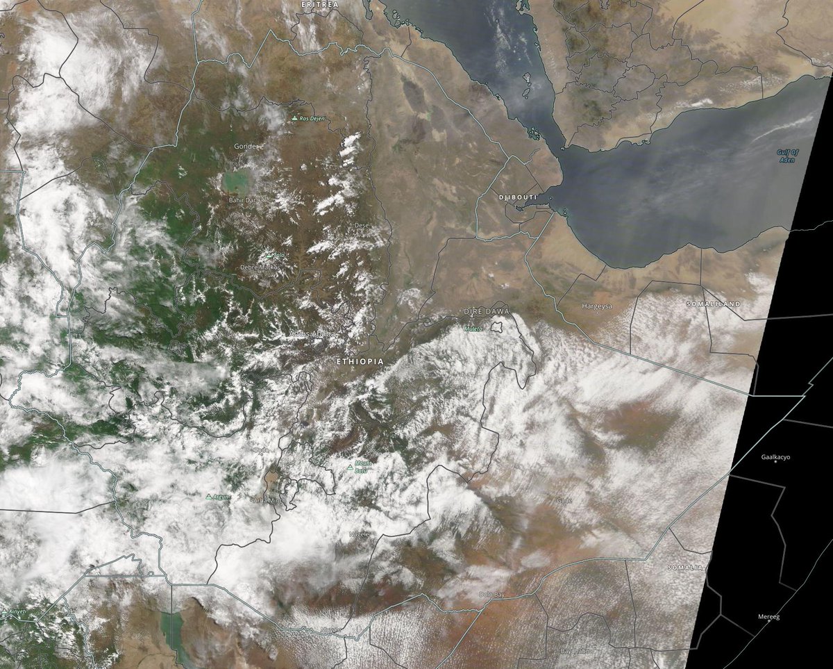
3. Closeup of the #HornOfAfrica
4. The latest WMA plume.
Today's #Africa and #Middle East rainfall forecasts follow.


1. Monsoon winds leaving India
2. Monsoon winds arriving Africa
3. Closeup of the #HornOfAfrica
4. The latest WMA plume.
Today's #Africa and #Middle East rainfall forecasts follow.


A big picture view from the Atlantic to the Bay of Bengal. It is extraordinary how long the Leviathan storm has been stationary in the middle of the picture near the Black Sea. It started in late May! 

The even bigger picture:
In the latest #EuropeBigWet update I discuss the global perspective. It appears now that the entire Northern Hemisphere has unusually high levels of atmospheric moisture this year.
In the latest #EuropeBigWet update I discuss the global perspective. It appears now that the entire Northern Hemisphere has unusually high levels of atmospheric moisture this year.
https://twitter.com/althecat/status/1406195298473500674?s=20
A satellite image of today's rains in the Ethiopian Highlands which are as strong as they have ever been so far this year. Rains are also strong over the Tigray region today.
These rains feed the Abbay river and provide the majority of water to the Nile's flow each year.
These rains feed the Abbay river and provide the majority of water to the Nile's flow each year.

10-Day rainfall (+1 12-day) forecasts for June 19th of the #HornOfAfrica including, #Somalia, #Somaliland, #Djibouti, #Ethiopia and parts of #Sudan and #SouthSudan
Rains are currently expected to be so heavy this year they will limit the amount of filling possible for the #GERD.


Rains are currently expected to be so heavy this year they will limit the amount of filling possible for the #GERD.


48 hour forecasts for June 18th (today and tomorrow) for the #HornOfAfrica. Including #Somalia, #Somaliland, #Djibouti, #Ethiopia and parts of #Sudan and #SouthSudan.
#GERD


#GERD


Today's #ArabianStorms at Sunset. 
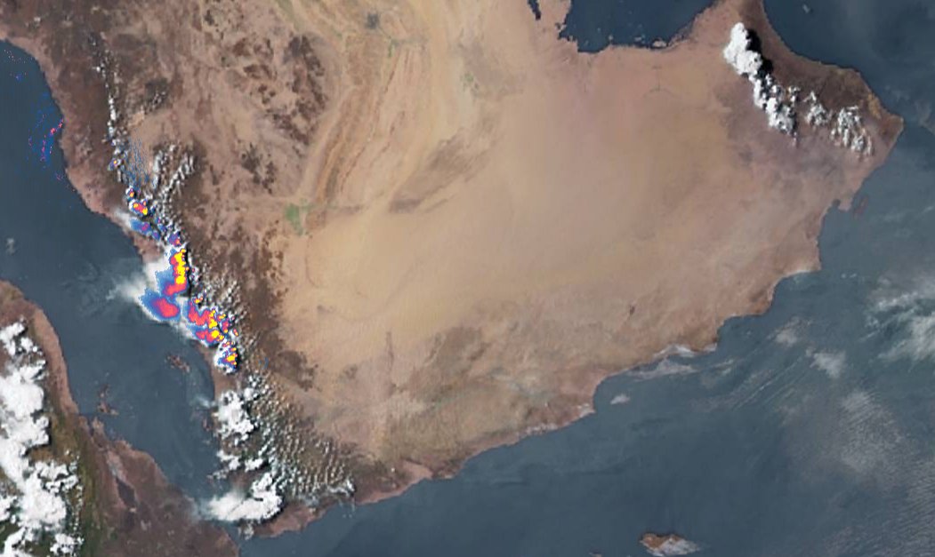
Today we have several new #ArabianStorms videos from @Arab_Storms The first from #KSA Saudi Arabia.
https://twitter.com/Arab_Storms/status/1406257502040334339?s=20
Torrential rains in the Jazan mountains #SaudiArabia.
https://twitter.com/Arab_Storms/status/1406262792458473477?s=20
And finally, glimpses of a road-trip on a wet motorway in the #UAE United Arab Emirates.
https://twitter.com/Arab_Storms/status/1406267151934267393?s=20
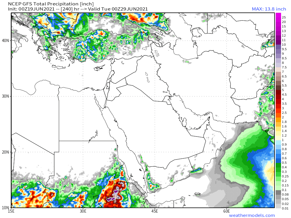
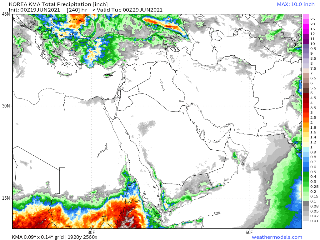
10-Day June 19th, accumulated rain forecasts for the #MiddleEast from the GFS, CMC & KMA weather models.
#ArabianStorms
#KSA #Yemen #Oman #Jordan #Sudan #Iran #Syria #GERD #Sudan #DesertRain
الله أعلم


#ArabianStorms
#KSA #Yemen #Oman #Jordan #Sudan #Iran #Syria #GERD #Sudan #DesertRain
الله أعلم


48 Hour June 19th (today and tomorrow), accumulated rain forecasts for the #MiddleEast from the GFS, CMC & KMA weather models.
#ArabianStorms
#KSA #Yemen #Oman #Jordan #Sudan #Iran #Syria #GERD #Sudan #DesertRain
الله أعلم


#ArabianStorms
#KSA #Yemen #Oman #Jordan #Sudan #Iran #Syria #GERD #Sudan #DesertRain
الله أعلم


And finally, June 18th 16-day (GFS) and 12-day (KMA) accumulated rainfall forecasts for the Middle East.
Rainfall on the Arabian Peninsula looks set to continue.
[Note: Several long range forecasts now show rainfall on the Southern Yemen Coast.]
الله أعلم

Rainfall on the Arabian Peninsula looks set to continue.
[Note: Several long range forecasts now show rainfall on the Southern Yemen Coast.]
الله أعلم


As we are now keeping a close eye on the monsoon winds here are two sets of side by side comparisons in PWAT (GFS and ECMWF) for the source area over India for today and midnight Friday next week. 


The other factor in the strength and direction of the East Africa Monsoon transport wind. Again two sets of side by side comparison from GFS and ECMWF. They show today and next Friday at midnight. 


In these forecasts we see:
1. An increase in the strength of the source PWAT moisture.
&
2. Increasing strength and better directionality in the transport winds.
1. An increase in the strength of the source PWAT moisture.
&
2. Increasing strength and better directionality in the transport winds.
We shall see what happens :)
By then we should also have the first democratically elected Government in Ethiopia, elected in a freely contested election, albeit one being held under somewhat complicated circumstances.
/ENDS
@Threadreaderapp Unroll
By then we should also have the first democratically elected Government in Ethiopia, elected in a freely contested election, albeit one being held under somewhat complicated circumstances.
/ENDS
@Threadreaderapp Unroll
• • •
Missing some Tweet in this thread? You can try to
force a refresh


