Tomorrow Ethiopia will go to the polls. #GERD, the Great Ethiopian Renaissance Dam, a project announced back in 2011 is a key election issue. The dam filling is about to begin.
This image shows Lake Tana, where the #Abbay river begins.
Today's rainfall forecasts follow.
This image shows Lake Tana, where the #Abbay river begins.
Today's rainfall forecasts follow.

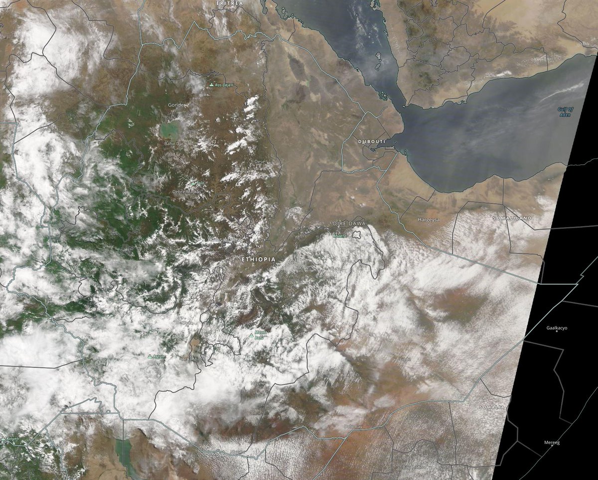
Zooming out to show North Ethiopia this morning we can now see Tigray, where a horrific war began in November 2020, another key issue in this election. 

Zooming out still further we can now see all of the ancient nation of Ethiopia. At the top right (the triangle bordered by cloud, we can see the northern end of the great rift where the Indian and African tectonic plates are slowly pulling away from each other. 

Zooming out still further we can see the full Nile Basin from the great lakes region in the South to Cairo a distance of 4000 kms. 

Today I send my prayers and best wishes to all the peoples of Ethiopia. I pray for a peaceful and orderly election, your first truly open one. And I sincerely hope that this will be the first step towards much needed peace & reconciliation in your great and ancient nation.
To begin today's rainfall forecasts here we can see the interconnected weather systems that surround the great Sahara Desert, which is currently sending a great plume of airborne water into Europe. 

Here we can see the Monsoon Winds which are bringing the moisture across the Arabian Sea that powers the big rainy season which is in beginning in the Horn of Africa. 

These four pictures show rain bearing clouds forming over the #HornOfAfrica today in the morning at midday, 4pm and 7pm. 


& 7pm. Rains will continue into the night. Possibly till as late as midnight.
[apologies for the delays I am having internet issues :( ]
[apologies for the delays I am having internet issues :( ]

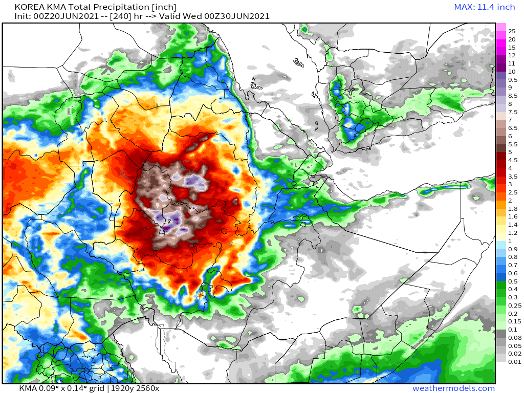
10-Day rainfall (+1 12-day) forecasts for June 20th of the #HornOfAfrica including, #Somalia, #Somaliland, #Djibouti, #Ethiopia and parts of #Sudan and #SouthSudan
Rains now expected to be so heavy this year they will limit the amount of filling possible for the #GERD.


Rains now expected to be so heavy this year they will limit the amount of filling possible for the #GERD.


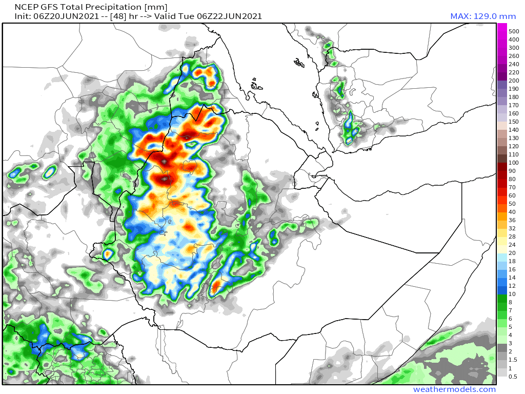
48 hour forecasts for June 18th (today and tomorrow) for the #HornOfAfrica. Including #Somalia, #Somaliland, #Djibouti, #Ethiopia and parts of #Sudan and #SouthSudan.
#GERD


#GERD


And another view of the monsoon winds this evening which are making this miracle of nature possible. 

Here we can see today's #ArabianStorms, which are unusual in June. There is also a lot of cloud over Sudan extending up to the Egypt border. The label shows the length of the band of storms, 1700kms. 

10-Day June 20th, accumulated rain forecasts for the #MiddleEast from the GFS, ECMWF, CMC & KMA weather models.
#ArabianStorms
#KSA #Yemen #Oman #Jordan #Sudan #Iran #Syria #GERD #Sudan #DesertRain
الله أعلم


#ArabianStorms
#KSA #Yemen #Oman #Jordan #Sudan #Iran #Syria #GERD #Sudan #DesertRain
الله أعلم


48 Hour June 20th (today and tomorrow), accumulated rain forecasts for the #MiddleEast from the GFS, CMC & KMA weather models.
#ArabianStorms
#KSA #Yemen #Oman #Jordan #Sudan #Iran #Syria #GERD #Sudan #DesertRain
الله أعلم


#ArabianStorms
#KSA #Yemen #Oman #Jordan #Sudan #Iran #Syria #GERD #Sudan #DesertRain
الله أعلم


And finally, June 20th 16-day (GFS) and 12-day (KMA) accumulated rainfall forecasts for the Middle East.
Rainfall on the Arabian Peninsula looks set to continue.
[Note: Several long range forecasts now show rainfall on the Southern Yemen Coast.]
الله أعلم

Rainfall on the Arabian Peninsula looks set to continue.
[Note: Several long range forecasts now show rainfall on the Southern Yemen Coast.]
الله أعلم


All the best tomorrow Ethiopia! I'll be watching here :)
And vote!
It's the way we get to choose our Governments. To have our say.
It's not perfect but it's much better than not getting to choose your Govt.
@Threadreaderapp unroll
/ENDS
And vote!
It's the way we get to choose our Governments. To have our say.
It's not perfect but it's much better than not getting to choose your Govt.
@Threadreaderapp unroll
/ENDS
"We don't need the news... just need the weather." - Dido
• • •
Missing some Tweet in this thread? You can try to
force a refresh


