Satellite images of the monsoon winds path to the #HornOfAfrica and #MiddleEast in three pictures.
1. The source... Bay of Bengal
2. The voyage.... The Arabian Sea
3. Landfall
Today's rainfall forecasts for the wider area follow.
1. The source... Bay of Bengal
2. The voyage.... The Arabian Sea
3. Landfall
Today's rainfall forecasts for the wider area follow.


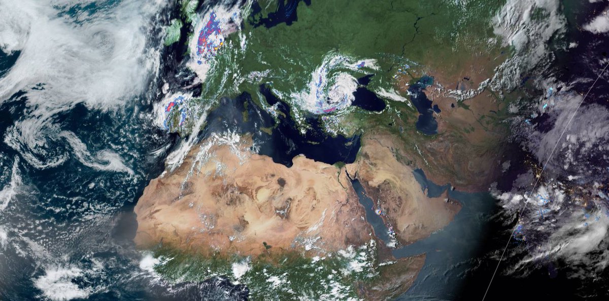
The big picture this evening.
Europe is stormy in the East and the West.
#ArabianStorms have returned to a less unusual format.
Big Rains continue in the Nile Basin.
And night has fallen on the Indian monsoon.
Europe is stormy in the East and the West.
#ArabianStorms have returned to a less unusual format.
Big Rains continue in the Nile Basin.
And night has fallen on the Indian monsoon.
Four North Africa 10-Day rainfall forecasts for today June 18th. Forecasts for the West Africa Monsoon are continuing to move north particularly in the West.


48-Hour rainfall forecasts from the same three models.


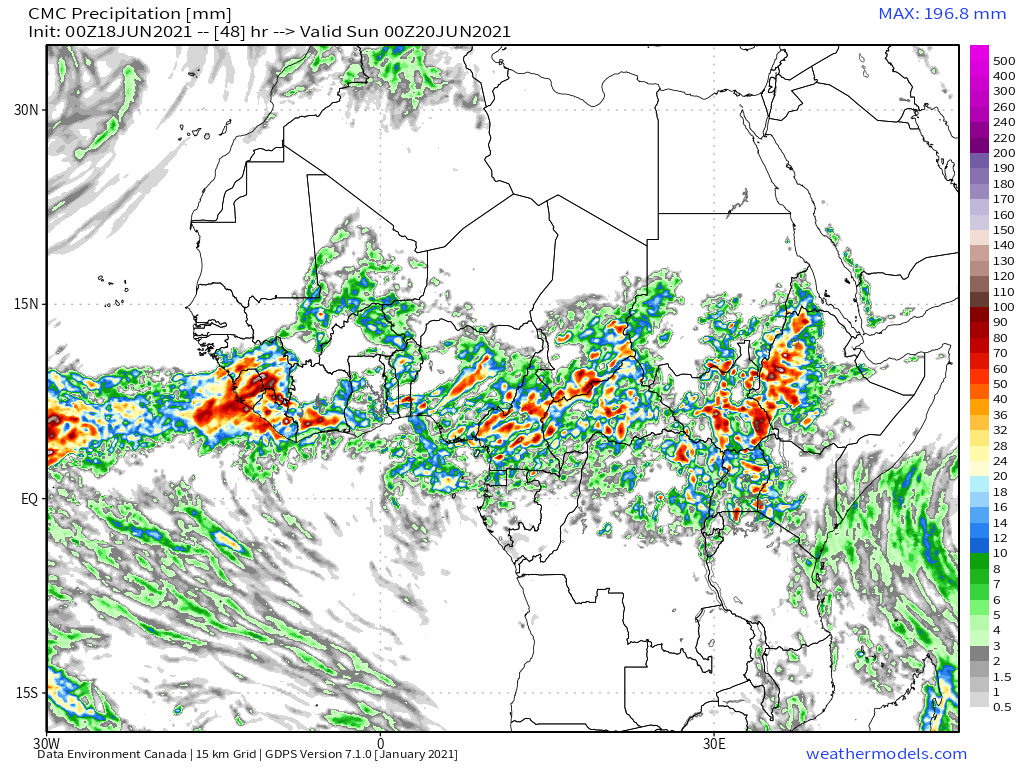
A North West Sahara #WestAfricaWaterPlume event is once again running hot.
The formation you see closely matches the current jet-stream pattern. Storms over Iberia, left, are powered by the cold air coming down on the far left turning 180 degrees off Morroco.
The formation you see closely matches the current jet-stream pattern. Storms over Iberia, left, are powered by the cold air coming down on the far left turning 180 degrees off Morroco.
The plume on the right which is coming up across the Sahara is still turning sharp right once it arrives over the Mediterranean and heading east south east.
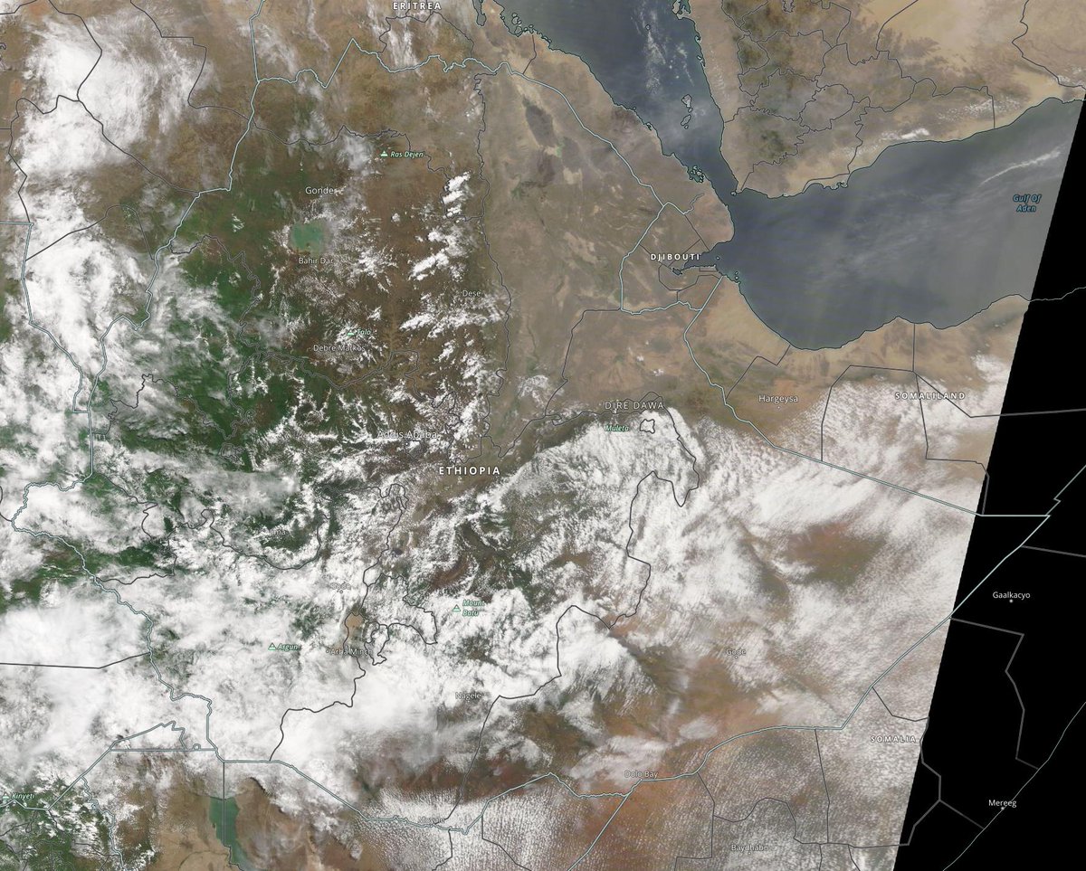
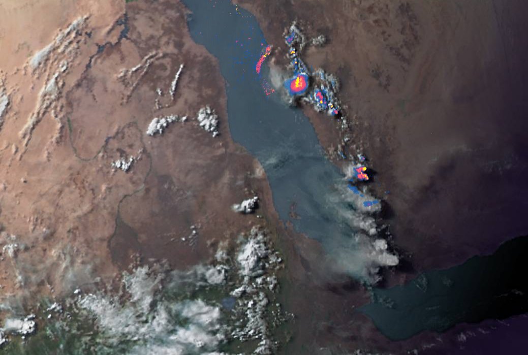
Here we see the transit of more air-born moisture, to the Horn & sourced in South East Asia & the Bay of Bengal.
Here we see the transit of more air-born moisture, to the Horn & sourced in South East Asia & the Bay of Bengal.

10-Day rainfall forecasts for June 18th of the #HornOfAfrica including, #Somalia, #Somaliland, #Djibouti, #Ethiopia and parts of #Sudan and #SouthSudan.
+ bonus 12-day forecast from KMA.
The forecast model consensus is maintained.
+ bonus 12-day forecast from KMA.
The forecast model consensus is maintained.


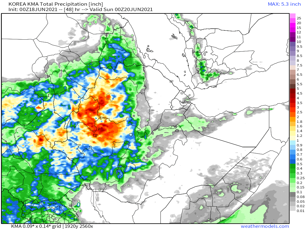
48 hour forecasts for June 18th (today and tomorrow) for the #HornOfAfrica. Including #Somalia, #Somaliland, #Djibouti, #Ethiopia and parts of #Sudan and #SouthSudan.
#GERD Rains continue to increase.
See comparison to yesterday >>
#GERD Rains continue to increase.
See comparison to yesterday >>
https://twitter.com/althecat/status/1405543121421684741?s=20


A view of today over the Horn and the monsoon belt to the West, with today's #ArabianStorms top right.

The Netherlands was the epicenter of some epic storms today and here's a spectacular video from @Arab_Storms. And there is much more #EuropeBigWet yet to come.
https://twitter.com/Arab_Storms/status/1405958462379548674?s=20
Here we see lightning and thunderclouds in Saudi Arabia.
https://twitter.com/Arab_Storms/status/1405925004848492545?s=20
And there have been some seriously lethal rains in Nepal.
https://twitter.com/Arab_Storms/status/1405916246709653507?s=20
And a final video shot today in Taif Saudi Arabia where they have had a very large unseasonal storm again today.
https://twitter.com/Arab_Storms/status/1405904747169652742?s=20
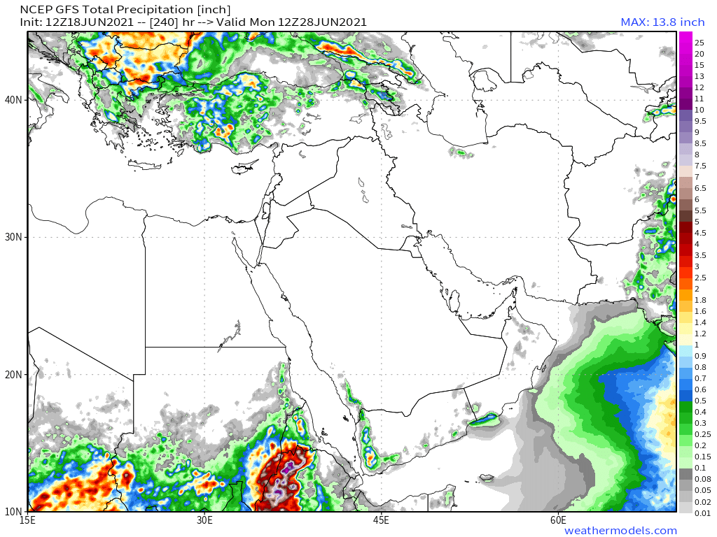
10-Day June 18th, accumulated rain forecasts for the #MiddleEast from the GFS, CMC & KMA weather models.
#ArabianStorms
#KSA #Yemen #Oman #Jordan #Sudan #Iran #Syria #GERD #Sudan #DesertRain
الله أعلم
#ArabianStorms
#KSA #Yemen #Oman #Jordan #Sudan #Iran #Syria #GERD #Sudan #DesertRain
الله أعلم


48 Hour June 18th (today and tomorrow), accumulated rain forecasts for the #MiddleEast from the GFS, CMC & KMA weather models.
#ArabianStorms
#KSA #Yemen #Oman #Jordan #Sudan #Iran #Syria #GERD #Sudan #DesertRain
الله أعلم
#ArabianStorms
#KSA #Yemen #Oman #Jordan #Sudan #Iran #Syria #GERD #Sudan #DesertRain
الله أعلم


Tonight's Arabian Storms at sunset. Winds appear to have stepped up and changed direction, the form of the storms is more similar to what we have seen in April and May.


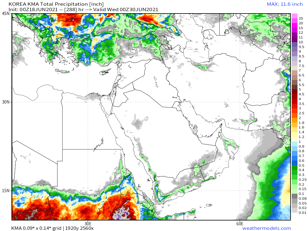
And finally, June 18th 16-day (GFS) and 12-day (KMA) accumulated rainfall forecasts for the Middle East.
Rainfall on the Arabian Peninsula looks set to continue.
الله أعلم
Rainfall on the Arabian Peninsula looks set to continue.
الله أعلم

/ENDS
@Threadreaderapp
unroll
@Threadreaderapp
unroll
• • •
Missing some Tweet in this thread? You can try to
force a refresh