NZ was one of the only populated places on the planet yesterday where there were temperatures under 15 degrees celsius. 


This shit is not normal. (HT @cupoteacoast)
Another perspective on the global heatwave that NZ appears to be missing out on (which may well turn out to be a good thing) motherjones.com/environment/20…
America is discovering this summer in a very ugly way that the lies told by its energy companies for decades have very real consequences.
Acknowledgments: This thread was made possible by the amazing weathermodels.com animation tool provided by @RyanMaue and his colleagues in the @WeatherdotUS team.
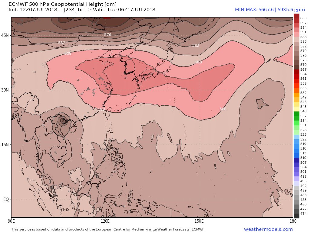
& this beautiful bonus gif shows a battle between the #PolarVortex and a #HeatDome.
& this beautiful bonus gif shows a battle between the #PolarVortex and a #HeatDome.
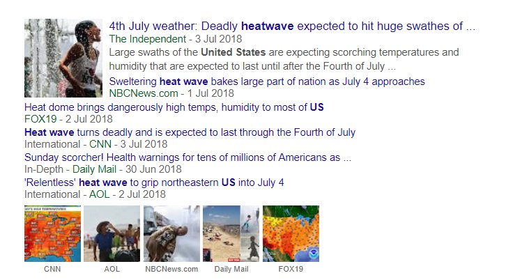
These news headlines about the #Heatwave are all pretty misleading. Its already three days past Independence day and there could well be a minimum of two more weeks of this heat across most of the US.
This report published June 29th on Axios was completely on the money. It seems to be the only report that captured what was coming - albeit not the full magnitude. This monster US #HeatWave really does appear to have just begun. axios.com/scorching-heat…
There are two other active #HeatDomes at present. One over Africa and the mid-Atlantic (which correlates to the Saharan dust cloud). And one over the North Pacific which is responsible for guiding Super Typhoon Maria to a China Landfall.
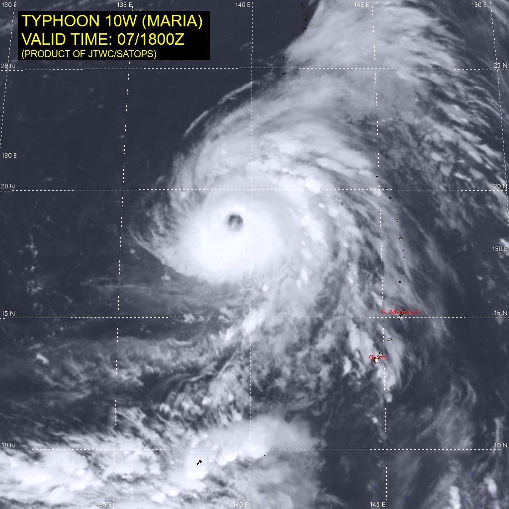
Cat 5 Super Typhoon Maria is one of the most intense and largest super hurricane/typhoons ever recorded, it is forecast to reach 160kt (300kmh) sustained winds today and to landfall on Wednesday as a Cat 5 storm.

I have slowed down the altitude depth animation to make what happens next weekend clearer. After making landfall and turning south Maria heads back out into the sea and tries to head towards Japan before being cut off again by the #HeatDome
Here's a satellite image of Super Typhoon Maria. An animated loop is available here. goes.noaa.gov/jma/jma-wpac-i…
And three stills of when she tries to head back out into the South China Sea towards the end of next week, but gets pushed back. Its going to get very wet in Hong Kong from the look of things.


In the GFS version of Super Typhoon #Maria vs the #HeatDomes a second typhoon makes landfall in China on 22 July.
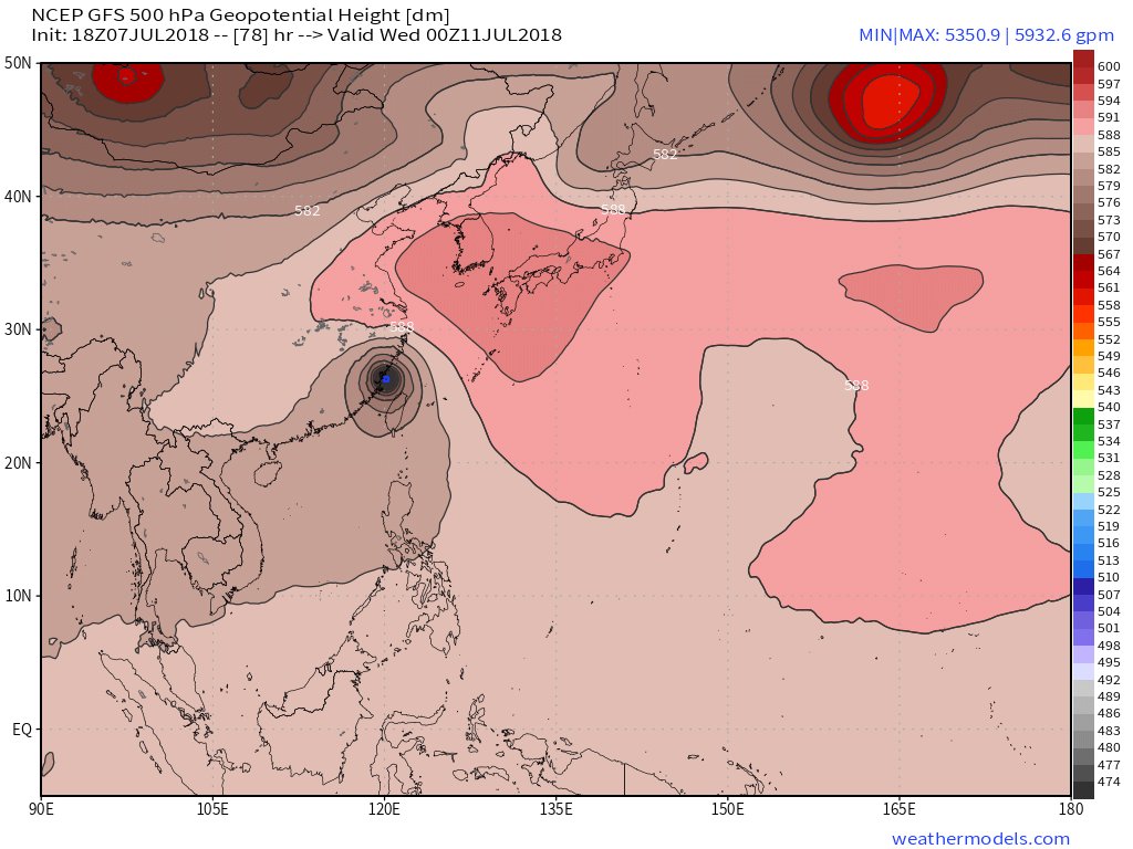
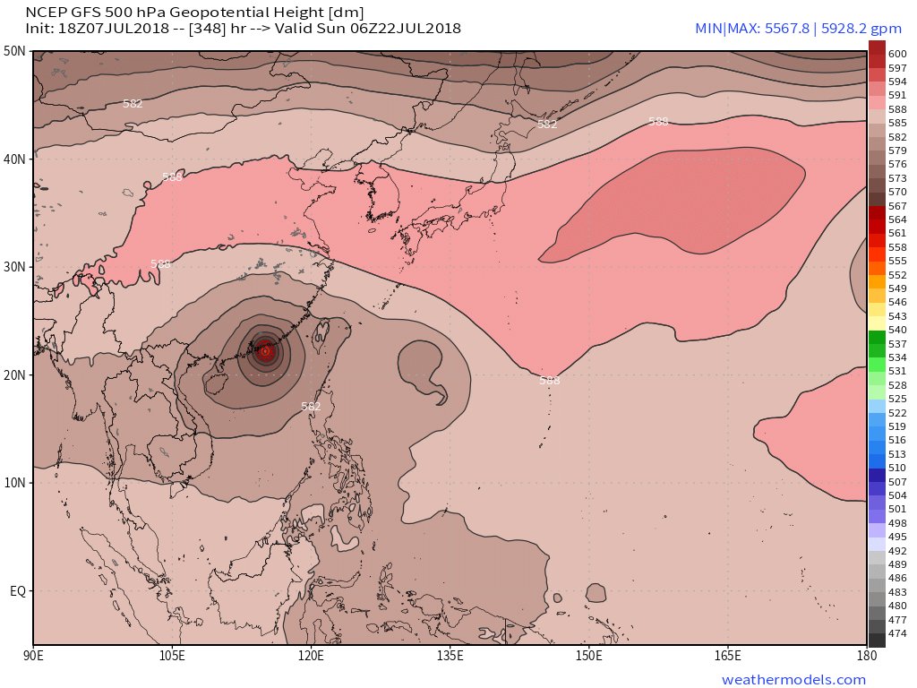
North West Pacific (Cyclone Alley) Animation from GFS Model through 23 July,
(NOTE: The GFS Model is not considered particularly accurate beyond five days.)
(NOTE: The GFS Model is not considered particularly accurate beyond five days.)
@threadreaderapp unroll