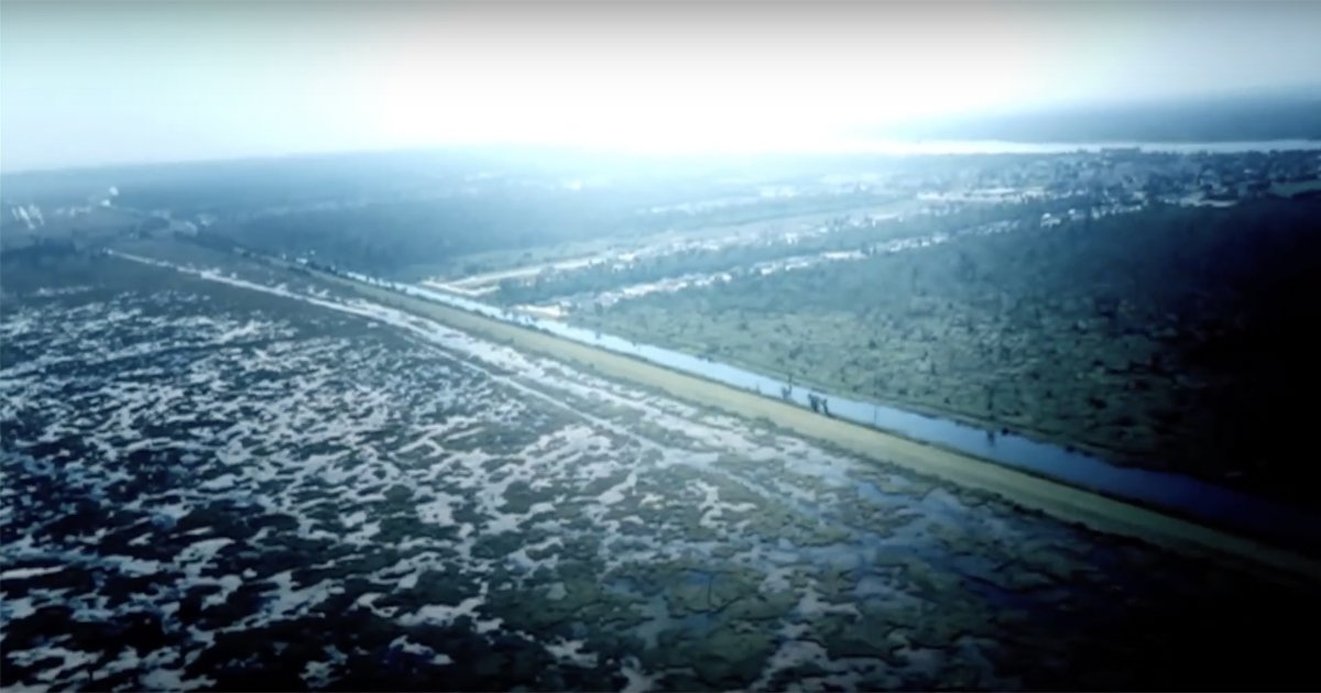
Be safe, New Orleans. If you get evac orders, please get out. Overtopped levees are a big deal & you've got a confluence of events lining up just wrong in the near future.
Warmer oceans means we get more storms, that storms are stronger, and that storms build up from nothing to nightmare faster.
The levees were built for an era long past.
This is a "Shit happens." scenario that emergency managers think about, plan for, and hope doesn't actually happen.
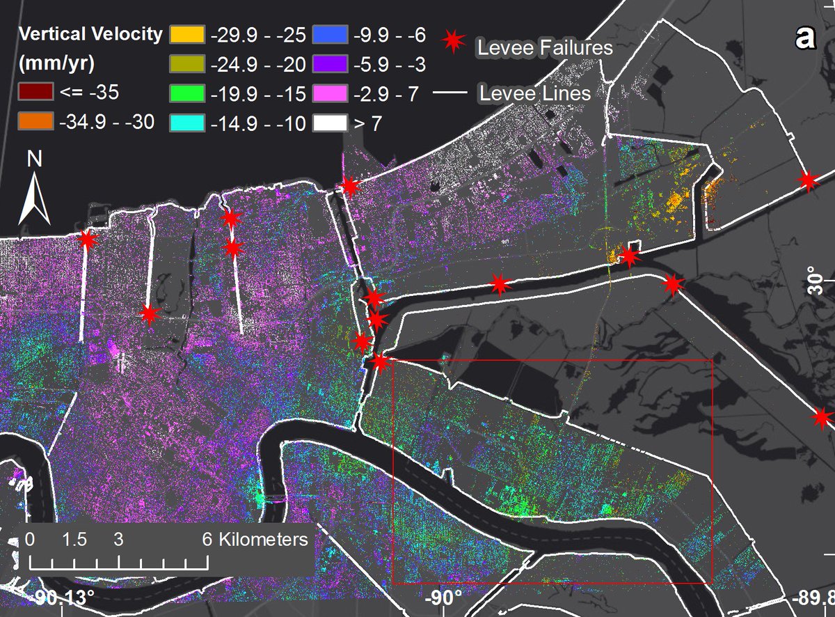
To start with, it's sinking. Literally.
This is subsidence 2009-2012 with stars at Katrina level breaks
Learn more & 📸: jpl.nasa.gov/news/news.php?…
But in an unmanaged system, fresh sediment is always getting deposited by the river (especially from upstream floods carrying floodplain sediments downstream.)
The Mississippi used to do that, but now we control it to minimize floods.
Learn more:
earthobservatory.nasa.gov/images/6887/mi…
blogs.loc.gov/maps/2016/06/t…
When we locked the river mouth in place & started dredging for ports, we cut off delta sediment supply.
It's a managed system now.
Unmanaged environments like mangroves, sand dunes, marshes & bayous are REALLY GOOD at dynamically absorbing storm impacts, flooding, & sediment flux.
But we've stripped them from many coastlines.
But we only engineer so big.
And they create vulnerabilities that tend to amp up the consequences of failures.
They usually to cut out less intense/more frequent hazards (small floods) while having little to negative impact on more intense/less frequent hazards.
But they also create a false sense of security.
What do you do?
It has no good answers.
If you live in New Orleans, refresh your prep & keep an eye on official notices.
If you live far away, keep your compassion central.
Everyone makes the best choices they can with the information and resources they have. Evacuation takes resources (blogs.scientificamerican.com/observations/d…).
If this develops into a life-safety situation, stay off the disaster hashtags.
Leave them for official sources (officials, media) or people impacted. Any thoughts, prayers, theories, or at-home analysis is noise.
The @FEMA app (fema.gov/mobile-app) is very good & includes tools for documenting damage.
Run down the checklist, especially what to pack/move higher up: ready.gov/floods
Find your local officials & info sources (emergency management, utilities, transport department, police, fire, public safety, politicians, local news...) to Follow on social media.
Overwhelmed? That's valid. Breathe & call:
That “calm break” in waves is where the current is strongest & most dangerous.
Swimming against a rip is dangerous & likely futile. Swim sideways (parallel to shore) to escape.
Learn more:
Weather data gathering point:
Water levels in some locations already higher than the peak during Hurricane Michael.
Obey closures pls. The sketch factor just keeps getting worse.
Behold one of the most intense jobs on the planet:
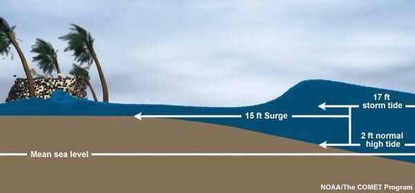
Water from the storm surge. Water from the rain. Water on top of high tides.
Flash floods. Overtops. Drainage failures.
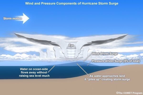
Storm waves ride on top of the surge, getting a height boost. It’s a major source of damage. It’s even worse when it coincides with high tide.
Read more (& good animations): nhc.noaa.gov/surge/
Stay out of the water. Don’t try crossing the water. Don’t try floating on the water. The water is bad news. You don’t know what’s below the surface (contaminants, downed power lines...)
River status:
Hazards from slow-moving storms can creep up on you (& odds of flash flooding climb as storm edges inland)
Last prep:


