The #geobr package in #rstats is probably the easiest and fastest way to download shapefiles and official spatial data sets of Brazil.
👉 github.com/ipeaGIT/geobr
This thread will periodically bring news with updates of the package. RT or Like it to stay tuned!
👉 github.com/ipeaGIT/geobr
This thread will periodically bring news with updates of the package. RT or Like it to stay tuned!


New data: today we added historical shapefiles of states and municipalities for the years 1872, 1900, 1911, 1920, 1933, 1940, 1950, 1960, 1970, 1980, 1991 (request of @antrologos). Easy access e.g. `read_state(year=1872)` and `read_municipality(year=1940)`
New data: today we added a geolocated data set of health facilities in Brazil (source: CNES, DataSUS). Easy access to all health facilities in the country with
`h <- read_health_facilities(code="all")`
`h <- read_health_facilities(code="all")`

update #geobr : new function passed tests. Easy access to weighting areas (áreas de ponderação) of Brazilian 2010 Census. Read all weighting areas
# of a municipality
w <- read_weighting_area(code_weighting=5201108)
# of a state
w <- read_weighting_area(code_weighting="DF")
# of a municipality
w <- read_weighting_area(code_weighting=5201108)
# of a state
w <- read_weighting_area(code_weighting="DF")
Blog post announcing the #geobr package with a quick intro to basic functions urbandemographics.blogspot.com/2019/07/geobr-… #rstats #rspatial

@Demografia_CSIC #geobr update: new data. Easy access to Brazilian census tracts from 2000 & 2010 Censuses. Read tracts of
# Municipality
read_census_tract(code_tract=5201108, year=2000)
# State
read_census_tract(code_tract="AM", year=2010)
# Country
read_census_tract(code_tract="all")
# Municipality
read_census_tract(code_tract=5201108, year=2000)
# State
read_census_tract(code_tract="AM", year=2010)
# Country
read_census_tract(code_tract="all")
@Demografia_CSIC Glad to announce that #geobr v1.0 is available on CRAN! It provides ready access to shapefiles and official spatial data sets of Brazil in #rstats
👉 cran.r-project.org/web/packages/g…
Proud of this team contribution from @ipeaonline to the #rspatial community. Pls help spread the word
👉 cran.r-project.org/web/packages/g…
Proud of this team contribution from @ipeaonline to the #rspatial community. Pls help spread the word


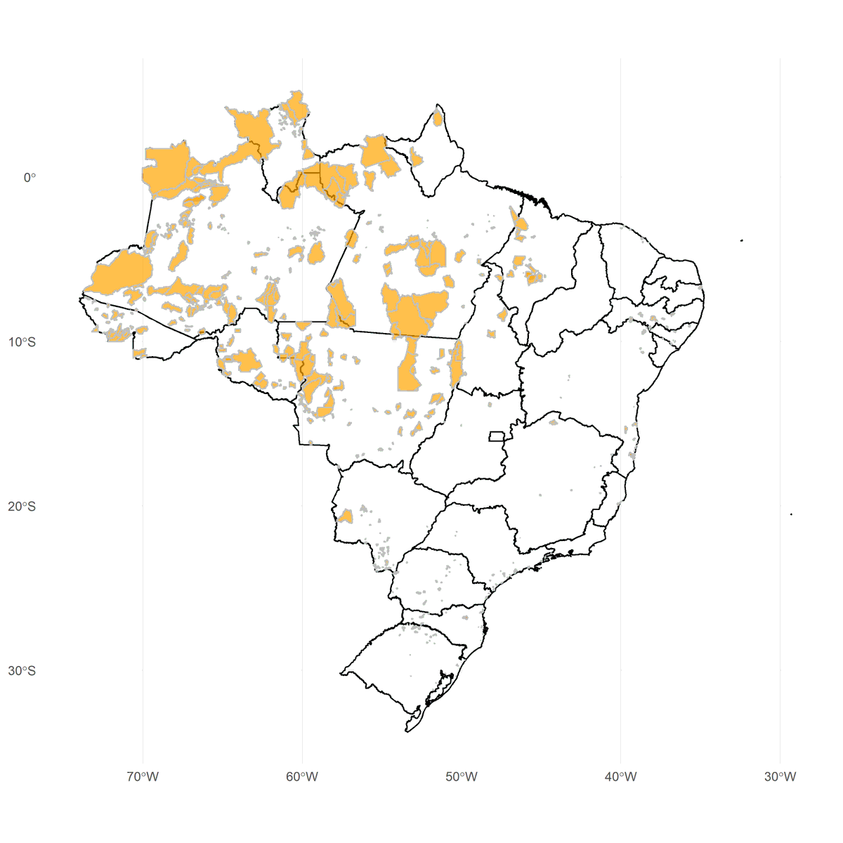
@Demografia_CSIC @ipeaonline #geobr update: new data. Today we added the shapes of #indigenouslands of all ethnicities in Brazil according to stage of demarcation (source: FUNAI). Easy access with a line of code:
i <- read_indigenous_land(date=201907)
Thks
@CSchmert
for suggesting the dataset!
i <- read_indigenous_land(date=201907)
Thks
@CSchmert
for suggesting the dataset!
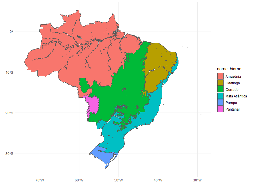
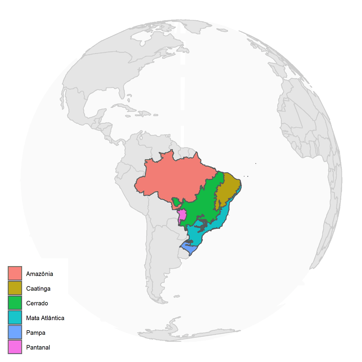
@Demografia_CSIC @ipeaonline @CSchmert #geobr new data set update. The #geobr package now includes the shapes of #biomes in Brazil (source: IBGE). Easy access with a line of code:
b <- read_biomes(year=2004)
more info at: github.com/ipeaGIT/geobr
b <- read_biomes(year=2004)
more info at: github.com/ipeaGIT/geobr
@Demografia_CSIC @ipeaonline @CSchmert Data update. The #geobr package now includes the shapes of risk areas prone to landslides and floods in Brazil (source: IBGE/Cemaden). Download the data with a line of code:
d <- read_disaster_risk_area(year=2010)
more info at: github.com/ipeaGIT/geobr
d <- read_disaster_risk_area(year=2010)
more info at: github.com/ipeaGIT/geobr
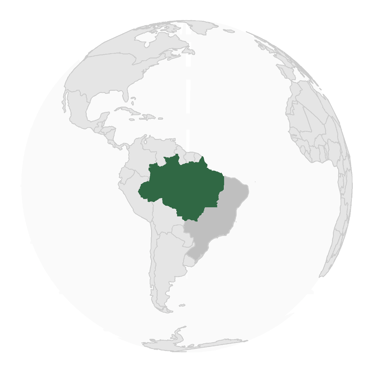
@Demografia_CSIC @ipeaonline @CSchmert Data update. The #geobr package now includes the shape of Brazil's Legal Amazon. Download the data with a line of code:
a <- geobr::read_amazon()
more info at: github.com/ipeaGIT/geobr #rstats #rspatial
a <- geobr::read_amazon()
more info at: github.com/ipeaGIT/geobr #rstats #rspatial
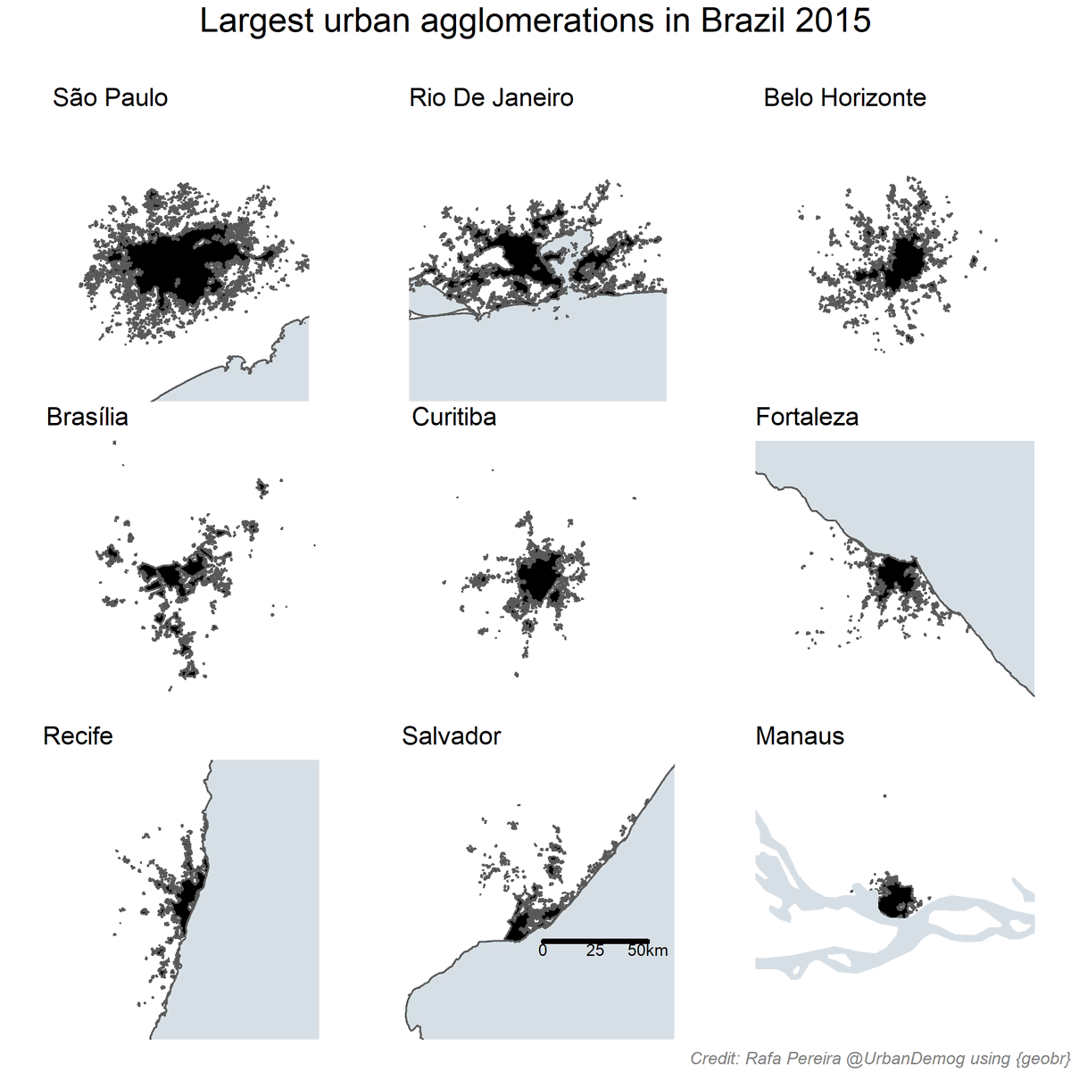
@Demografia_CSIC @ipeaonline @CSchmert Data update. The #geobr package now includes official data on the urban footprint of all Brazilian cities in 2005 and 2015 Download the data with a line of code:
u <- geobr::read_urban_area(year=2015)
more info at: github.com/ipeaGIT/geobr #rstats #rspatial
u <- geobr::read_urban_area(year=2015)
more info at: github.com/ipeaGIT/geobr #rstats #rspatial
@Demografia_CSIC @ipeaonline @CSchmert Data update. #geobr now includes the IBGE's lastest data release on Brazilian biomes at much finer scale (1:250.000)
b <- read_biomes()
more info at github.com/ipeaGIT/geobr
b <- read_biomes()
more info at github.com/ipeaGIT/geobr
@Demografia_CSIC @ipeaonline @CSchmert We just sent out some geobr #HexStickers for production! #geobr #rspatial

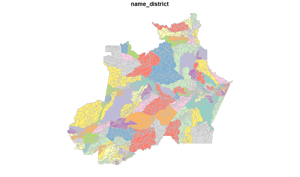
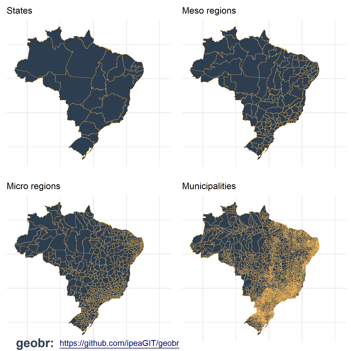
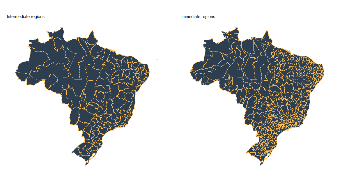
@Demografia_CSIC @ipeaonline @CSchmert Data update. The #geobr package now includes Brazil's Immediate and Intermediate regions, which were created by IBGE to replace Micro and Meso regions. Download the data using:
inter <- read_intermediate_region()
imme <- read_immediate_region()
inter <- read_intermediate_region()
imme <- read_immediate_region()
@Demografia_CSIC @ipeaonline @CSchmert package update! The new version #geobr v1.1 is on CRAN! cran.r-project.org/web/packages/g… #rstats #rspatial. The package currently brings 19 data sets:

@Demografia_CSIC @ipeaonline @CSchmert - country
- region
- state
- meso and micro regions
- intermediate and immediate regions
- municipality
- weighting area
- census tract
- statistical grid
- urban area
- health facility
- indigenous land
- conservation unit
- biome
- legal Amazon
- semiarid
- disaster risk area
- region
- state
- meso and micro regions
- intermediate and immediate regions
- municipality
- weighting area
- census tract
- statistical grid
- urban area
- health facility
- indigenous land
- conservation unit
- biome
- legal Amazon
- semiarid
- disaster risk area
@Demografia_CSIC @ipeaonline @CSchmert We have added more unit tests to #geobr package and the code coverage is at 94% 🧐 github.com/ipeaGIT/geobr
@Demografia_CSIC @ipeaonline @CSchmert new function in #geobr. Now you can look up municipality codes by their name, or you can do the other way around:
> lookup_muni(name_muni = 'Paraty')
> lookup_muni(code_muni = '3303807')
Thanks @ckauebraga for the the contribution!
> lookup_muni(name_muni = 'Paraty')
> lookup_muni(code_muni = '3303807')
Thanks @ckauebraga for the the contribution!
@Demografia_CSIC @ipeaonline @CSchmert @ckauebraga The #geobr package was launched less than 5 months ago and we already have over 3K downloads on CRAN (~700 downloads a month) and 20 spatial datasets. Very glad to see our very 1st package being so well received by the community. #rspatial

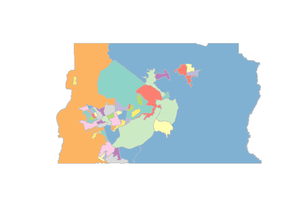
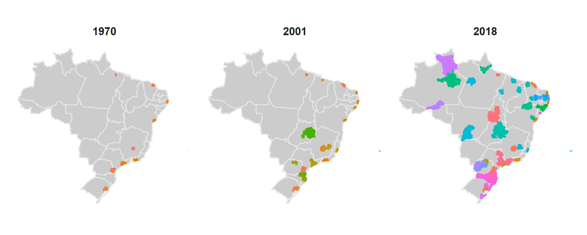
@Demografia_CSIC @ipeaonline @CSchmert @ckauebraga Data update. The #geobr package now includes the shape of Brazil's official metropolitan areas. Download the data with a line of code:
m <- read_metro_area(year = 2001)
Reproducible code for this figure here 👉gist.github.com/rafapereirabr/… #rspatial
m <- read_metro_area(year = 2001)
Reproducible code for this figure here 👉gist.github.com/rafapereirabr/… #rspatial
@Demografia_CSIC @ipeaonline @CSchmert @ckauebraga We've added a new function so the user can check all the datasets currently available in the #geobr package
df <- list_geobr()
df <- list_geobr()
@Demografia_CSIC @ipeaonline @CSchmert @ckauebraga Good news! We have started developing a Python version of #geobr. This will come with a major change to the package that will significantly improve its efficiency. No one left behind! #rstats #rspatial + #python #geopy More on this soon!


@Demografia_CSIC @ipeaonline @CSchmert @ckauebraga @JoaoCarabetta @furtadobb Two major changes to dev #geobr:
- Functions now have a 'tp' argument as in data 'type'. Downloading + plotting the data has become waaaay faster!
- The package now downloads data in #geopackage format. This will simplify our work maintaining both versions in #rstats & #Python
- Functions now have a 'tp' argument as in data 'type'. Downloading + plotting the data has become waaaay faster!
- The package now downloads data in #geopackage format. This will simplify our work maintaining both versions in #rstats & #Python
@Demografia_CSIC @ipeaonline @CSchmert @ckauebraga @JoaoCarabetta @furtadobb package update! New #geobr v1.2 is on CRAN! cran.r-project.org/web/packages/g… #rstats #rspatial
News:
- the package is much faster
- new data on metropolitan areas
- new data on municipal seats
- new fun to look up code of municipalities
- new fun to list all data sets available in geobr
News:
- the package is much faster
- new data on metropolitan areas
- new data on municipal seats
- new fun to look up code of municipalities
- new fun to list all data sets available in geobr
@Demografia_CSIC @ipeaonline @CSchmert @ckauebraga @JoaoCarabetta @furtadobb Ping geobr supporters & enthusiasts @CSchmert @ThomasVConti @lara_mesquita @gzanlorenssi @dannielduque @lmonasterio @CivicAngela @JoaoCarabetta @antrologos @hsvab @carolpos @FelipeSMBarros @NarceliodeSa @drcrescencio @robinlovelace @RLadiesSaoPaulo @pedrov_amaral @furtadobb