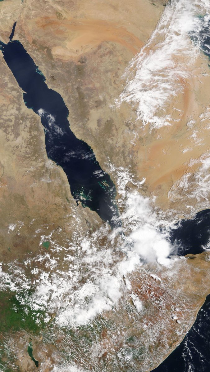
A high resolution taken today by the NASA Modis satellite of the #NileBasin and the #MiddleEast is below.
The day started with storms in the East of the #HornOfAfrica #Yemen and the #KSA and got very busy over the day.
28 April Rain forecasts follow:
The day started with storms in the East of the #HornOfAfrica #Yemen and the #KSA and got very busy over the day.
28 April Rain forecasts follow:

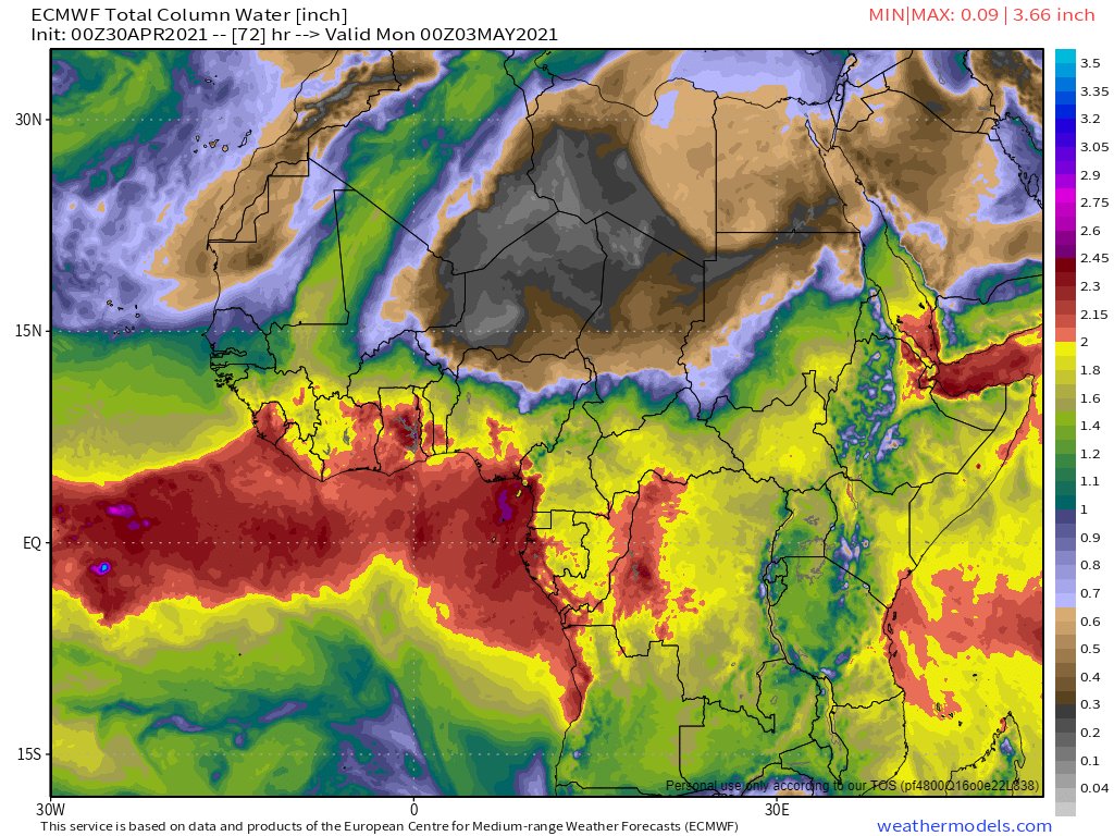
This first animation shows the beginning of a plume of water coming across the Sahara from the Atlantic. Forecasts indicate water from this plume will arrive in the #MiddleEast and #HoA in 10 days time.
This animation shows the West African Monsoon and the plume of précipitable water making its away across over the Sahara over the coming week.
Here's an view of the last three hours over the #HornOf Africa - with particularly vigorous rain visible over #Somaliland and #Yemen.
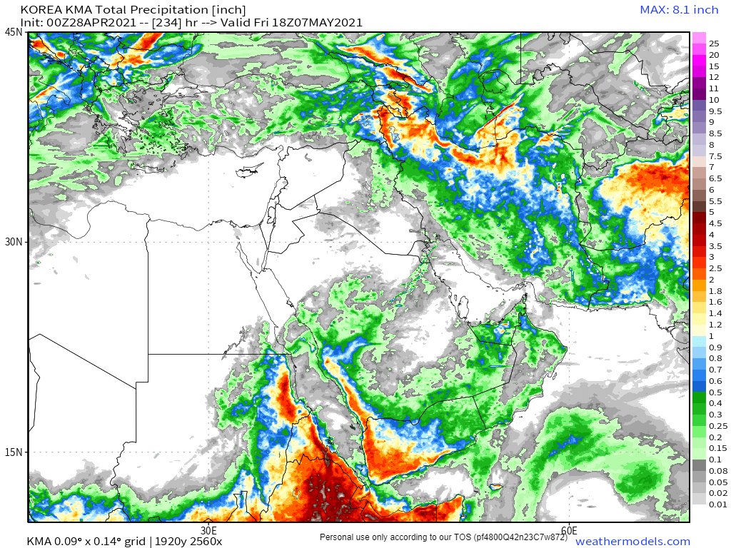
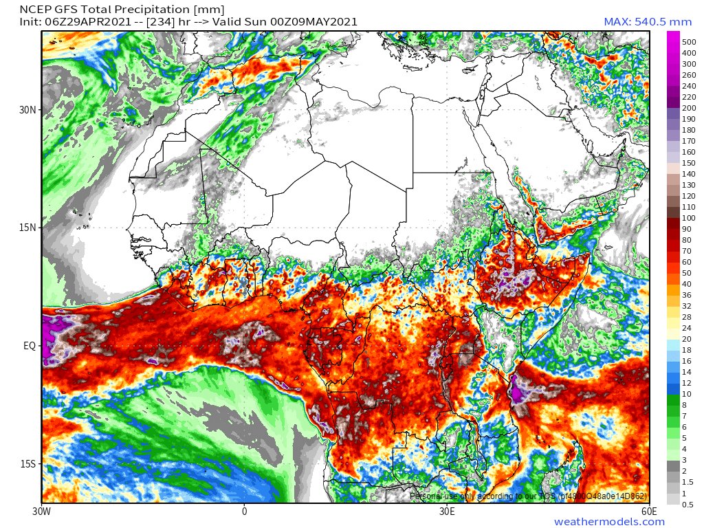
28th April 10-Day accumulated rain forecasts from the ECMWF, GFS and KMA forecast models are below. They are in agreement. Lots of rain across the entire #HornOfAfrica for the foreseeable. 


And an image of #ArabianStorms storming across most of the Arabian Peninsula as the sun went down this evening. Medina, Riyadh, Basra, Dubai, Oman, Yemen and everywhere in between.
Two eyewitness #ArabianStorms videos and image tweets from @Arab_Storms follow. Both from #UAE which received its first rain for the month today.
https://twitter.com/Arab_Storms/status/1387375039595511812?s=20
28 April - 10 day accumulated rain forecasts for the #MiddleEast GFS, CMC (6 days) , KMA & GEFS weather models.
@Arab_Storms
#ArabianStorms
#KSA #Yemen #Oman #Levant #Jordan #Sudan #UAE #Iraq #Iran #Syria #Kuwait #GERD #NileBasin #HornOfAfrica #DesertRain
الله أعلم


@Arab_Storms
#ArabianStorms
#KSA #Yemen #Oman #Levant #Jordan #Sudan #UAE #Iraq #Iran #Syria #Kuwait #GERD #NileBasin #HornOfAfrica #DesertRain
الله أعلم


3 day accumulated rain forecasts (to Saturday at Midnight) for the #MiddleEast from the GFS, CMC, KMA and GEFS weather models.
[Note: A lot of this rain fell today!]
@Arab_Storms
#ArabianStorms
#KSA #Yemen #Jordan #Sudan #Iran #Syria #GERD #Sudan #DesertRain
الله أعلم


[Note: A lot of this rain fell today!]
@Arab_Storms
#ArabianStorms
#KSA #Yemen #Jordan #Sudan #Iran #Syria #GERD #Sudan #DesertRain
الله أعلم


The final 28th April rain forecast for tonight is ultra long-range 16-Day accumulated rain forecasts for the #MiddleEast from the GFS, GEFS models.
[NOTE: CMC and KMA models are not delivering their normal full length forecasts this evening.]
#ArabianStorms #Ramadan
الله أعلم

[NOTE: CMC and KMA models are not delivering their normal full length forecasts this evening.]
#ArabianStorms #Ramadan
الله أعلم


In this thread there are some more animations of today's storm activity from this morning.
https://twitter.com/althecat/status/1387301733848715264?s=20
And here is our first video of #EthiopiaRain! From Addis.
I would very much appreciate being DMed tweets with videos of rain and/or people in the rain from across the #HornOfAfrica to include in these daily forecast reports.
I would very much appreciate being DMed tweets with videos of rain and/or people in the rain from across the #HornOfAfrica to include in these daily forecast reports.
https://twitter.com/DBLaeke/status/1387306451320950785?s=20
And to sign off. A Sahara sunset. /ENDS
@Threadreaderapp unroll
• • •
Missing some Tweet in this thread? You can try to
force a refresh


