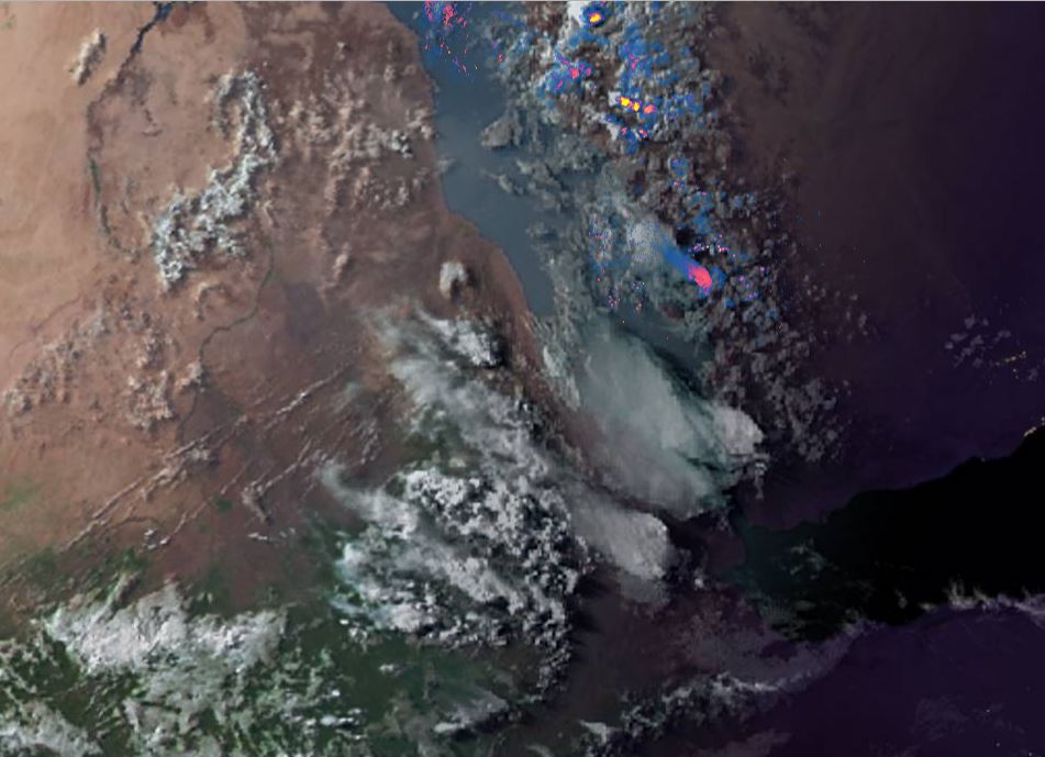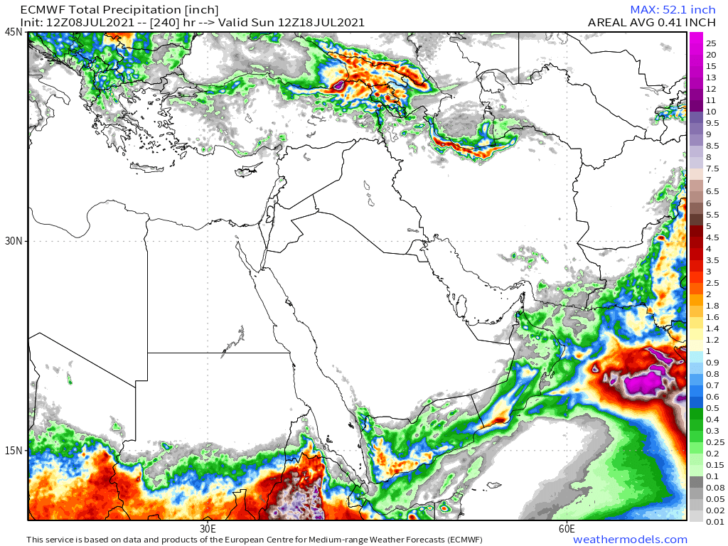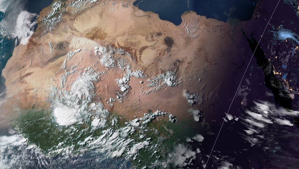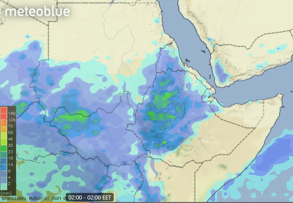
As the UNSC met tonight to discuss the #GERD storms continued to form over Ethiopia's highlands the source of the water which is currently filling the dam.
Today's #NorthAfrica #HornOfAfrica and #MiddleEast rainfall forecasts follow.
Today's #NorthAfrica #HornOfAfrica and #MiddleEast rainfall forecasts follow.
During the UNSC meeting. Ethiopia's water minister explained how this works. "The filling of the dam is part of the construction process.... When the dam is filled the water either flows over the dam or through the bottom outlets." 

The Minister later spoke to media :
Q: (@AJEnglish): Why don't you stop filling the dam?
A: All dams are filling. Why? Because it is the rainy season. In fact it is good to protect from floods. We have bountiful water. It doesn't hurt anyone.
Q: (@AJEnglish): Why don't you stop filling the dam?
A: All dams are filling. Why? Because it is the rainy season. In fact it is good to protect from floods. We have bountiful water. It doesn't hurt anyone.

These two satellite images show the extent of the storms over Sudan, Ethiopia, Saudi Arabia and Yemen as night fell this evening. 


Today's big picture shows the broader region, night falling over the #ArabianStorms and some very large #DesertRain storms in Chad and Niger. Forecasts shows significant rainfall deep into the arid desert parts of the Sahel over the next few days. 

Today's 10-Day Rainfall forecasts for North Africa from July 8th through July 19th.
Most models are now forecasting widespread rainfall over #Yemen #Oman #UAE and #KSA Note also the rainfall in the Sahel. The CMC model may be a over playing this a bit though. We shall soon see.


Most models are now forecasting widespread rainfall over #Yemen #Oman #UAE and #KSA Note also the rainfall in the Sahel. The CMC model may be a over playing this a bit though. We shall soon see.


48-hour rainfall forecasts (today and tomorrow from the same four models: the Euro @ECMWF, U.S. @NOAA's GFS, Canada's CMC and the Korean KMA models. 


And finally for #NorthAfrica we have the long-range 16-day (GFS) and 12-day (KMA) forecasts - which remain remarkably well aligned.
You will get a better view of the forecast rain over the southern Arabian Peninsula later in the bulletin.

You will get a better view of the forecast rain over the southern Arabian Peninsula later in the bulletin.


And here in a wider angle view we can also see the large storms over the White Nile and Baro Akobbo catchment areas. 


Today's July 8th 10-day rainfall forecasts for #Ethiopia (+1 12-day from KMA) and the #HornOfAfrica including #Somalia, #Somaliland, eastern parts of #SouthSudan, south eastern parts of Sudan, #Djbouti and #Eritrea.
The purple areas cover the #Abbay and #TekezeAtbara basins.


The purple areas cover the #Abbay and #TekezeAtbara basins.


48 Hour forecasts (today and tomorrow) from the same three models. Over this period significant rainfall is not yet forecast for #Somaliland, but it does appear to be coming soon. 


Today's #ArabianStorms coming to life and delivering #DesertRain, mostly fairly light, but over a very large area.
The 10-Day accumulated rain forecasts for the #MiddleEast from the GFS, CMC, KMA & ACG weather models are showing increasingly more #DesertRain in #Yemen and #Oman.
#ArabianStorms
#KSA #Yemen #Oman #Jordan #Sudan #Iran #Syria #GERD #Sudan #DesertRain
الله أعلم


#ArabianStorms
#KSA #Yemen #Oman #Jordan #Sudan #Iran #Syria #GERD #Sudan #DesertRain
الله أعلم


The forecast rain we see in ^^ these forecasts deserves an explanation. The cause appears to be monsoon level atmospheric moisture making it all the way across the Arabian Sea.
These PWAT forecasts are for Saturday, then next Monday, Wednesday and Friday.


These PWAT forecasts are for Saturday, then next Monday, Wednesday and Friday.


48 Hour July 8th (today and tomorrow), accumulated rain forecasts for the #MiddleEast from the GFS, CMC, KMA and ACG weather models.
#ArabianStorms
#KSA #Yemen #Oman #Jordan #Sudan #Iran #Syria #GERD #Sudan #DesertRain
الله أعلم


#ArabianStorms
#KSA #Yemen #Oman #Jordan #Sudan #Iran #Syria #GERD #Sudan #DesertRain
الله أعلم


The rainfall forecasts are long-range July 7th rainfall forecasts. The16-day GFS & GEFS models, the 12 day KMA and the 15 day EPS (Euro ensemble) model forecasts for the #MiddleEast.
KMA & EPS models now show #DesertRain in #UAE as well as #Yemen #Oman #SaudiArabia.
الله أعلم


KMA & EPS models now show #DesertRain in #UAE as well as #Yemen #Oman #SaudiArabia.
الله أعلم


Our daily rounded picture of the full North Western Hemisphere. Zero hour simulation data (i.e. now) from the GFS.
1. Precipitable water PWAT anomaly
2. PWAT (potential rain + energy)
3. MLSP (Mean Sea Level Pressure)
4. 250Hpa (jet stream winds approx 11kms high)


1. Precipitable water PWAT anomaly
2. PWAT (potential rain + energy)
3. MLSP (Mean Sea Level Pressure)
4. 250Hpa (jet stream winds approx 11kms high)


/ENDS
@Threadreaderapp unroll
@Threadreaderapp unroll
Here is the full, precise quote of the Ethiopia Water Minister.
https://twitter.com/Ethiopia_UN/status/1413251090296999950?s=20
• • •
Missing some Tweet in this thread? You can try to
force a refresh


