Two Nile dams joined by nile 100kms apart as seen this morning by @NASA's Modis satellite. [Top right Sudan's Roseires and bottom left the #GERD.]
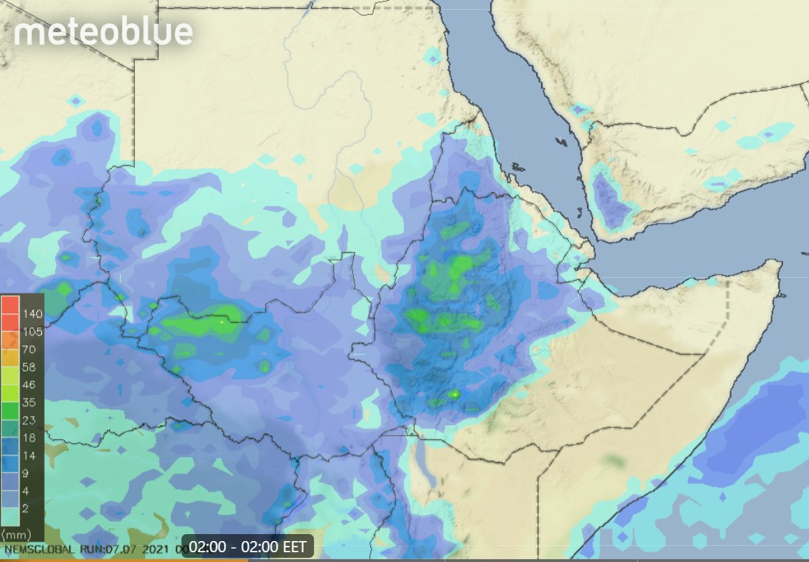
Today's rainfall forecasts for #NorthAfrica, #HornOfAfrica and #MiddleEast follow.
Today's rainfall forecasts for #NorthAfrica, #HornOfAfrica and #MiddleEast follow.

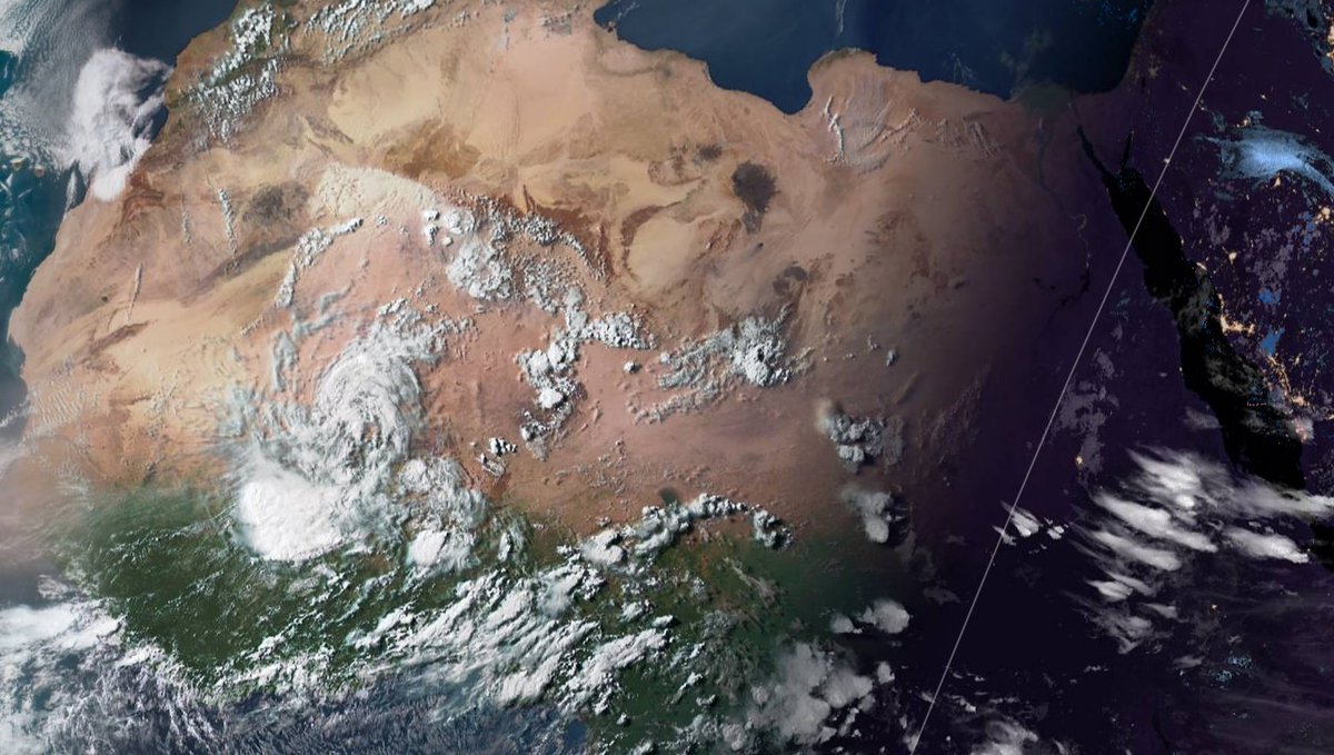
Today's big picture is a dramatic shot of the Sahara at sunset with a massive storm over Mali and a line of clouds from the heart of Algeria's desert south east to Chad. On the right you can see tonight's storms over the #Ethiopia highlands.
The rainfall in the Western Sahara has just started but it has a few more days to run. In this animation of a simulation you see the precipitable water anomaly, which highlights areas which have much more water than normal for this time of year.
This over the same period, 88 hours, shows the overall water picture in the North Western hemisphere and you can see how water flowing south from the eastern Mediterranean is contributing some of the moisture which is creating these desert storms in the west Sahara.
See previous tweet ^^ the #EuropeBigWet is about to enter another peak phase.
The overall picture shows:
1. Monsoon moving west along the equator,
2. Atlantic picking it up and propelling it over the U.S. and Nth Atl. at Europe.
& now we can see some of it is looping back.
The overall picture shows:
1. Monsoon moving west along the equator,
2. Atlantic picking it up and propelling it over the U.S. and Nth Atl. at Europe.
& now we can see some of it is looping back.
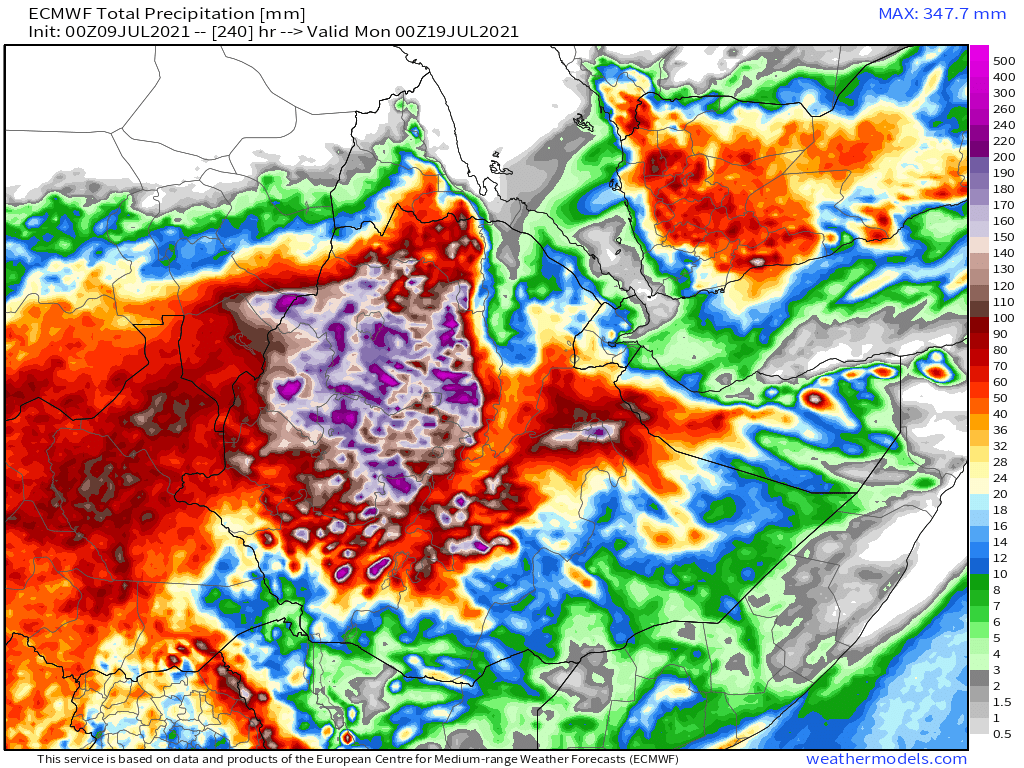
Today's 10-Day Rainfall forecasts for North Africa from July 9th through July 20th. On the left hand side of the plots you can see significant #DesertRain is forecast over Mali due to the processes described earlier.


48-hour rainfall forecasts (today and tomorrow from the same four models: the Euro @ECMWF, U.S. @NOAA's GFS, Canada's CMC and the Korean KMA models.
These plots show that rain in Mali is about to begin.
These plots show that rain in Mali is about to begin.


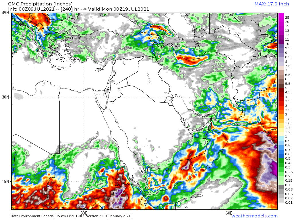
And finally for #NorthAfrica we have the long-range 16-day (GFS) and 12-day (KMA) forecasts - which remain remarkably well aligned.
You will get a better view of the forecast rain over the southern Arabian Peninsula later in the bulletin.
You will get a better view of the forecast rain over the southern Arabian Peninsula later in the bulletin.


4 @NASA satellite images showing the monsoon process this morning.
1. The big storm over Mali today
2. The Indian monsoon where a lot of this water is being elevated into the jet stream
3. The heart of the Nile's rain basin
4. A traces of the monsoon jets over the Arabian Sea
1. The big storm over Mali today
2. The Indian monsoon where a lot of this water is being elevated into the jet stream
3. The heart of the Nile's rain basin
4. A traces of the monsoon jets over the Arabian Sea


This animation shows the storms coming up today over the Horn of Africa in Ethiopia's mountains.
Today's July 9th 10-day rainfall forecasts for #Ethiopia (+1 12-day from KMA) and the #HornOfAfrica including #Somalia, #Somaliland, eastern parts of #SouthSudan, south eastern parts of Sudan, #Djbouti and #Eritrea.
The purple areas cover the #Abbay and #TekezeAtbara basins.
The purple areas cover the #Abbay and #TekezeAtbara basins.


48 Hour forecasts (today and tomorrow) from the same three models. Rains are now forecast in the west of #Somaliland


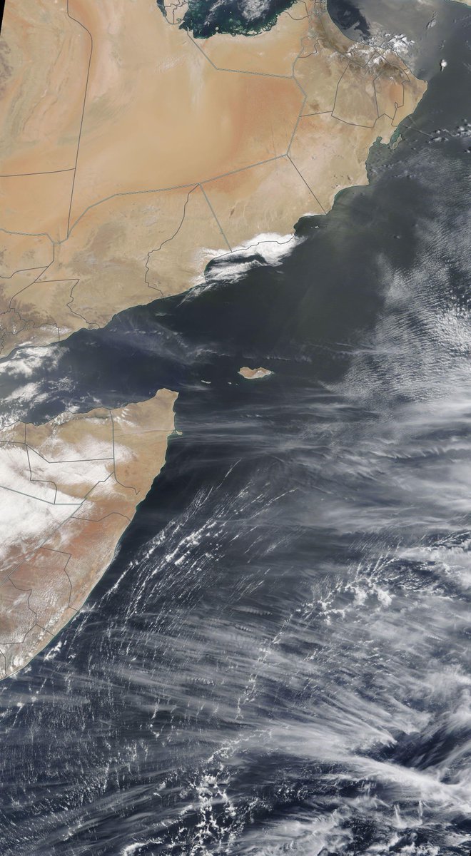
Today's #ArabianStorms were not very intense but they did see some unusual new cloud formations, possibly indicating high altitude water transport en route to join the rain making efforts over Sudan and Chad.
The 10-Day accumulated rain forecasts for the #MiddleEast from the GFS, CMC, KMA & ACG weather models are showing increasingly more #DesertRain in #Yemen and #Oman.
#ArabianStorms
#KSA #Yemen #Oman #Jordan #Sudan #Iran #Syria #GERD #Sudan #DesertRain #UAE
الله أعلم
#ArabianStorms
#KSA #Yemen #Oman #Jordan #Sudan #Iran #Syria #GERD #Sudan #DesertRain #UAE
الله أعلم


48 Hour July 9th (today and tomorrow), accumulated rain forecasts for the #MiddleEast from the GFS, CMC, KMA and ACG weather models.
#ArabianStorms
#KSA #Yemen #Oman #Jordan #Sudan #Iran #Syria #GERD #Sudan #DesertRain
الله أعلم
#ArabianStorms
#KSA #Yemen #Oman #Jordan #Sudan #Iran #Syria #GERD #Sudan #DesertRain
الله أعلم


These rainfall forecasts are long-range July 9th rainfall forecasts. The16-day GFS & GEFS models, the 12 day KMA and the 15 day EPS (Euro ensemble) model forecasts for the #MiddleEast.
KMA & EPS models now show #DesertRain in #UAE as well as #Yemen #Oman #SaudiArabia.
KMA & EPS models now show #DesertRain in #UAE as well as #Yemen #Oman #SaudiArabia.


Our daily rounded picture of the full North Western Hemisphere. Zero hour simulation data (i.e. now) from the GFS.
1. Precipitable water PWAT anomaly
2. PWAT (potential rain + energy)
3. MLSP (Mean Sea Level Pressure)
4. 250Hpa (jet stream winds approx 11kms high)
1. Precipitable water PWAT anomaly
2. PWAT (potential rain + energy)
3. MLSP (Mean Sea Level Pressure)
4. 250Hpa (jet stream winds approx 11kms high)


/ENDS
@Threadreaderapp unroll
@Threadreaderapp unroll
• • •
Missing some Tweet in this thread? You can try to
force a refresh