Thread: @BNPB_Indonesia #Agung update by @Sutopo_BNPB
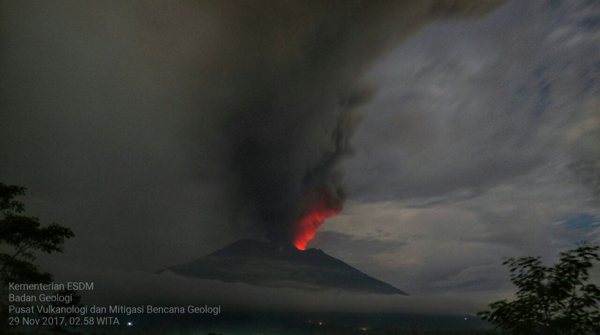
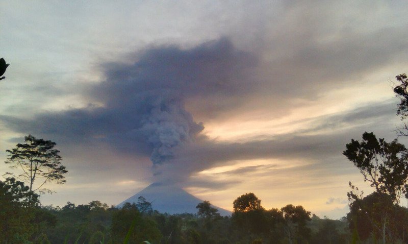
Magmatic eruption of Agung continues with ash plume heights to 2,500 - 3,000 m above the volcano.
facebook.com/HumasBNPB/post…
Magmatic eruption of Agung continues with ash plume heights to 2,500 - 3,000 m above the volcano.
facebook.com/HumasBNPB/post…
Incandescence from lava is visible in the crater at night. Tremor is continuous. Alert level remains at IV, the highest level.
PVMBG continues to record increasing volcanic activity. The potential for a larger eruption is increasing.
PVMBG continues to record increasing volcanic activity. The potential for a larger eruption is increasing.
However, the intensity and timing cannot be predicted with certainty. Estimating the future character of the eruption of Agung tends to be more difficult than other volcanoes due to the absence of instrumental data from previous eruptions for comparison.
The results of Himawari satellite image analysis from BMKG show that the dominant spread of volcanic ash is to the SW, attracted by Tropical Cyclone Cempaka which is currently located in the Indian Ocean to the south of Yogyakarta.
This low pressure center causes volcanic ash to follow the motion of the tropical cyclone.
The direct impact of the distribution of ash is the disruption of aviation safety... The ash is over the airspace of the Denpasar International Airport...
The direct impact of the distribution of ash is the disruption of aviation safety... The ash is over the airspace of the Denpasar International Airport...
The Airport Authority of Region IV Bali Nusra extends the closure of Airport International Airport I Gusti Ngurah Ra until 29/11/2017 at 07:00 WITA. Evaluation will be done every 6 hours. Lombok International Airport reopened from 28/11/2017 at 06:00 WITA.
Everyone should evacuate within 8 km of the Agung crater + sectoral extension to the North-East and Southeast-South-Southwest as far as 10 km from the crater. There are 22 villages in the danger zone.
The number of people living within the danger zone is estimated at 90,000 - 100,000 people. The absence of valid data from various sources makes it difficult to calculate the number of people to be evacuated, ranging from 63,000 to 140,000.
BNPB will conduct a coordination meeting with the local government to ensure the number of residents to be evacuated. Temporary data: 29,023 people are spread across 217 points of refuge. This is not a final total. Additional people have moved to other locations.
Not all people in danger radius are willing to evacuate. Until now there are still many people who remain at home. They are not willing to evacuate due to cattle, farms, trust, etc. Officers continue to persuade people to evacuate & assist in the evacuation of livestock.
In general, the handling of refugees is going well. There is no panic in the community. The previous recent evacuations and education efforts are helping with this.
END---
END---