
Moving on from #Asteroids #Exoplanets #SolarEclipse #StarSpectrum we now focus on #Satellites
Sputnik 1 was the first satellite to be launched (1957). Over 1200 active satellites are currently orbiting Earth.
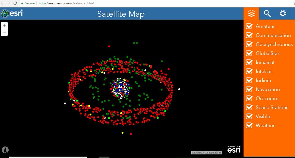
Check out the LIVE Satellite Map maps.esri.com/rc/sat/index.h…
Sputnik 1 was the first satellite to be launched (1957). Over 1200 active satellites are currently orbiting Earth.
Check out the LIVE Satellite Map maps.esri.com/rc/sat/index.h…
Satellites come in different sizes: from the size of a lunch box to that of a small school bus.
And they are used for different purposes: Climate Monitoring, Agriculture, Telecommunications, Research....
And they are used for different purposes: Climate Monitoring, Agriculture, Telecommunications, Research....

Can #CitizenScientists access data from these satellites?
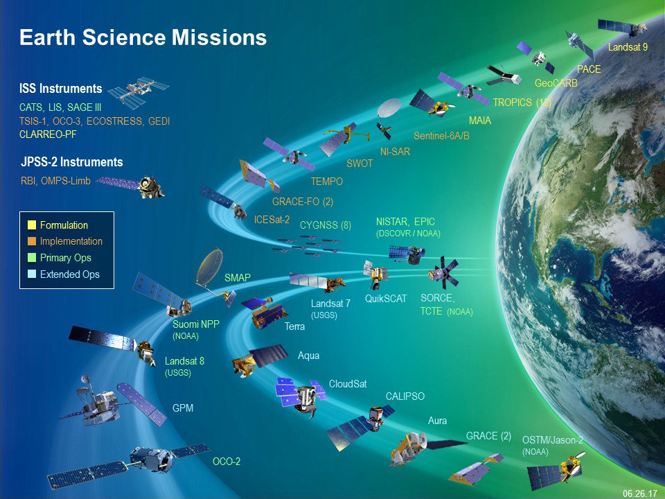
Yes! NASA makes available near LIVE data from many of its satellites in an interactive interface.
Allows browsing full-resolution, global satellite imagery!
worldview.earthdata.nasa.gov
Use it for your projects!
Yes! NASA makes available near LIVE data from many of its satellites in an interactive interface.
Allows browsing full-resolution, global satellite imagery!
worldview.earthdata.nasa.gov
Use it for your projects!
From Earth Observing System Data and Information System (EOSDIS) :
Get data from many satellites: #LandSAT #TerraModis #TerraAqua and in different bands depending on what you want to study - land, water, atmospheric emissions....
Get data from many satellites: #LandSAT #TerraModis #TerraAqua and in different bands depending on what you want to study - land, water, atmospheric emissions....
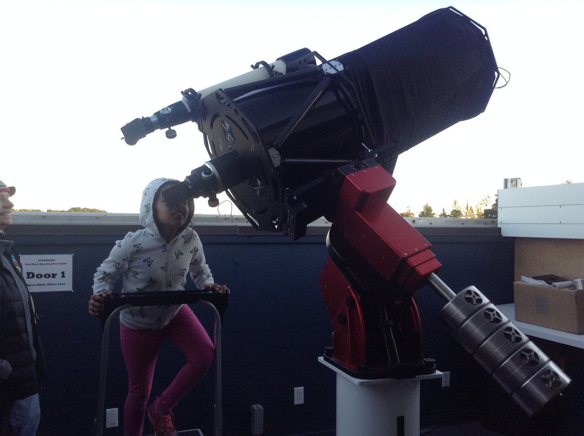
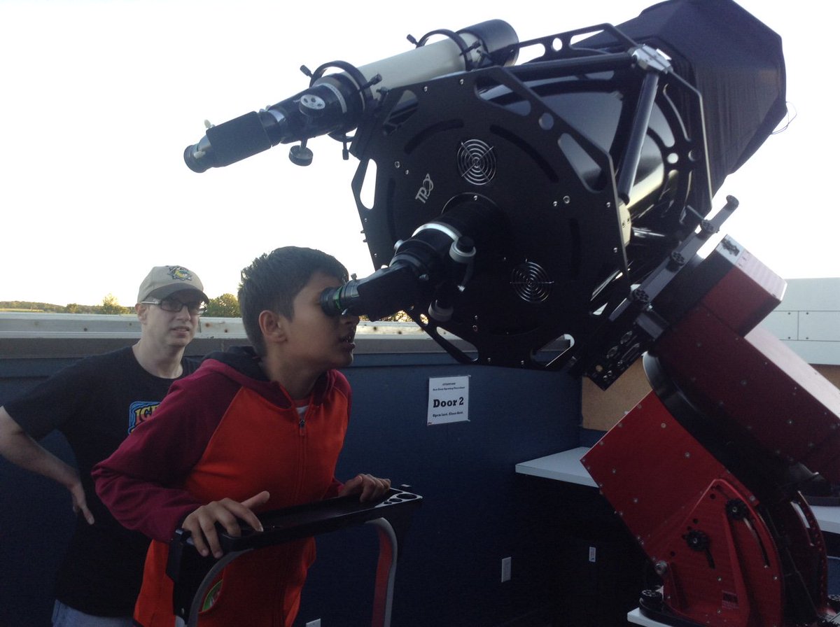
Last night did visual astronomy thru 16 inch scope: saw M57 (Ring Nebula), M81, M82 (Bode & Cigar Galaxies), M17, Swan Nebula, Comets 2017 S3 Panstarrs and 21P/Giacobini–Zinner, Asteroid Vesta.... and many satellite passes. @rasc
Back to conversation on #SatelliteData projects
Back to conversation on #SatelliteData projects
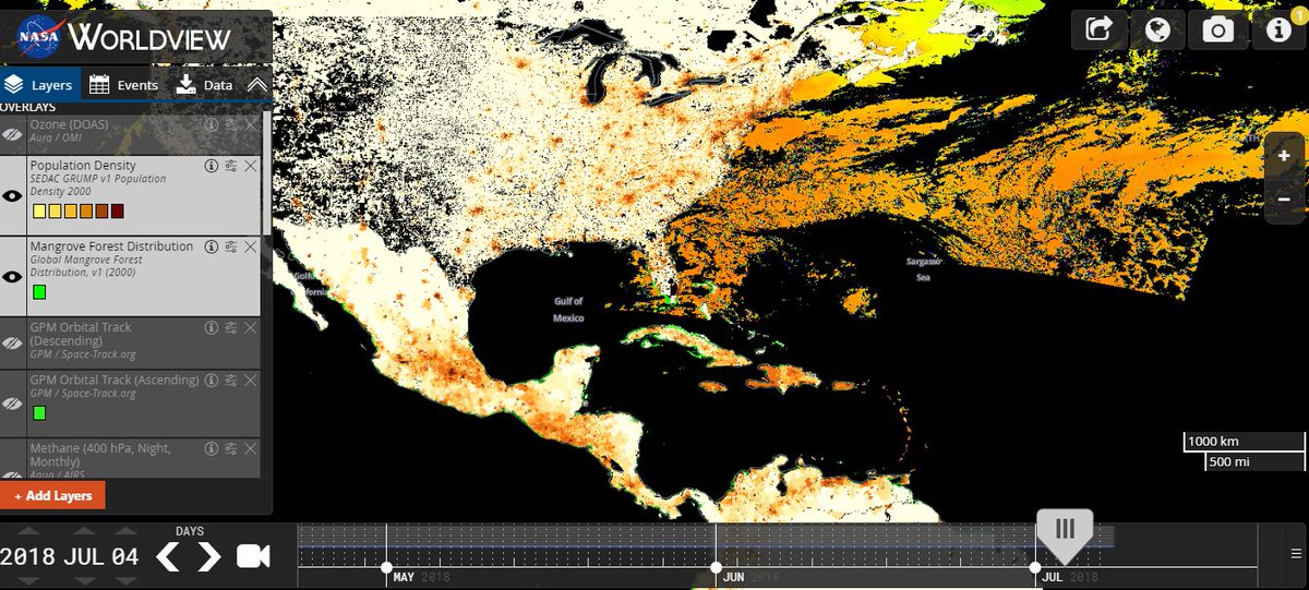
NASA's Earth Observing System Data and Information System (EOSDIS) worldview.earthdata.nasa.gov allows users to get near real time data and overlay it on a range of basemaps.
For eg: putting population density and mangrove distribution over coastline data to monitor changes.
For eg: putting population density and mangrove distribution over coastline data to monitor changes.
We used #EOSDIS Real Time data from #TerraAqua satellite to track Sulfur Dioxide cloud #Bogoslof Volcano 2017eruption move from Alaska, USA to Ontario, Canada
We also used satellite data from #LandSat #TerraModis to predict droughts in Kenya-Uganda Border.
With 20 years of satellite data available on normalized difference vegetation index (NDVI) for every region of World, it is possible to compare existing data with real-time data.
With 20 years of satellite data available on normalized difference vegetation index (NDVI) for every region of World, it is possible to compare existing data with real-time data.
We took land map of the area and overlaid it with the Vegetation data from #LandSat and #TerraModis. Added 2 more layers: Human Settlements and Population Density from NASA @ciesin database.
Analysed 7 months of normalized difference vegetation index (NDVI) data (Oct 2016 - April 2017) by noting changes in vegetation index every 5 days.
Used Stop Motion Simulation package to visually display change in vegetation along the Kenya-Uganda border.
Used Stop Motion Simulation package to visually display change in vegetation along the Kenya-Uganda border.
By Jan 2017 it was clear from the simulation that Kenya will face a drought. As bordering Uganda afforded better food and fodder, it was evident that people and cattle in bordering area will migrate to Uganda.
By Feb 2017, drought was declared in Kenya and migration ensued.
By Feb 2017, drought was declared in Kenya and migration ensued.
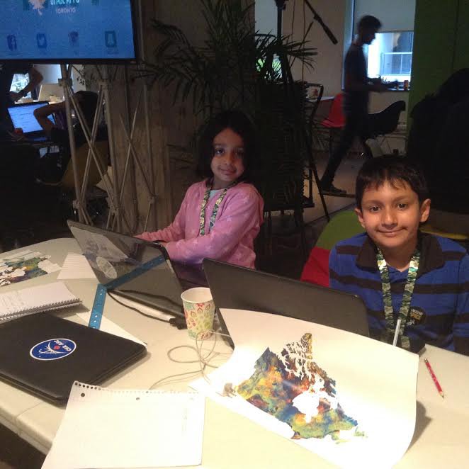
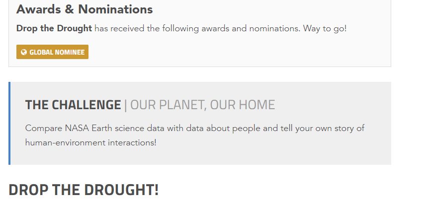
This project "Drop the Drought" to predict drought and migration patterns using #NASA #satellitedata won the first place in @SpaceApps Toronto and was a global nominee.
More details: 2017.spaceappschallenge.org/challenges/our…
More details: 2017.spaceappschallenge.org/challenges/our…

More info about our “Yes I CAN” project that uses data from the Canadian Satellite RadarSat-2 to create a digital mosaic of the Map of Canada, the Canadian Flag, and the logo of the Celebration of 150 years of Canada's Confederation is available at:


