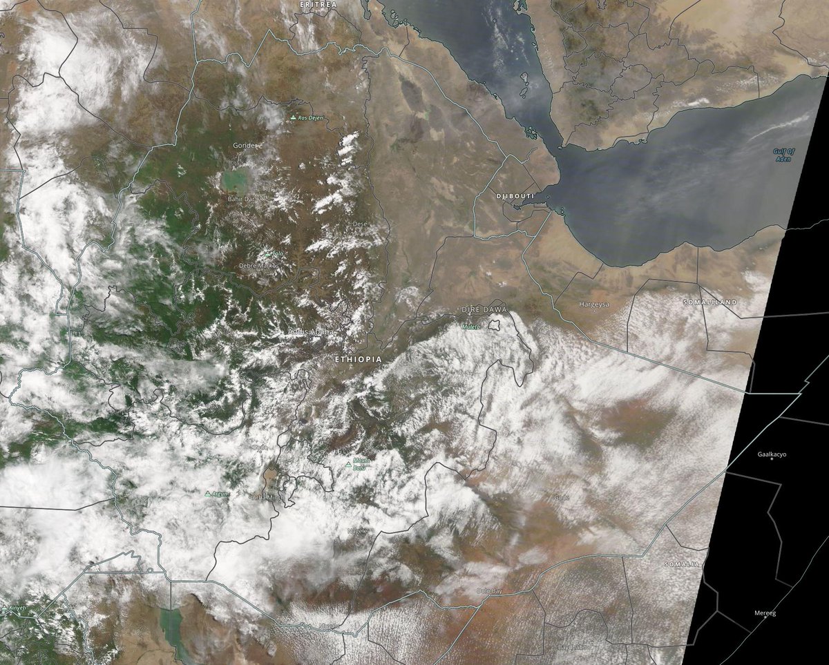
Rain storms rising in the Ethiopian highlands this afternoon via @zoom_earth.
Today's #NorthAfrica #MiddleEast and #HornOfAfrica rainfall forecasts follow.
Today's #NorthAfrica #MiddleEast and #HornOfAfrica rainfall forecasts follow.
The big picture for today shows a broad swathe of the North Western Hemisphere. Here in Europe we have rainclouds over most of Western Europe now. And more wet weather heading in from the West.
In the East the monsoon is still strengthening and we have #ArabianStorms yet again.
In the East the monsoon is still strengthening and we have #ArabianStorms yet again.

This morning we had a lovely clear view of the #HornOfAfrica from space courtesy of @NASA. The big cloud mass bottom right is mostly over Kenya. 

This zoomed in version shows Ethiopia reunited following its 1st ever free and fair elections, which appear to have gone extremely well. 
https://twitter.com/althecat/status/1406940682565079042?s=20

As nightfall approaches we can see here that it was another big day for Arabian Storms. And the more ambitious forecasts for rain there from the CMC model are continuing to prove to be the most reliable. 

And here zooming out a bit we can see that it was a strong day for the monsoon across Africa. Forecasts show rains continuing to push north over the 15 degrees north line into the Sahara Desert in coming days. 

Today's North Africa 10-Day rainfall forecasts for June 22nd. While the 21st is true solstice the day lengths will remain roughly the same for another six days. 


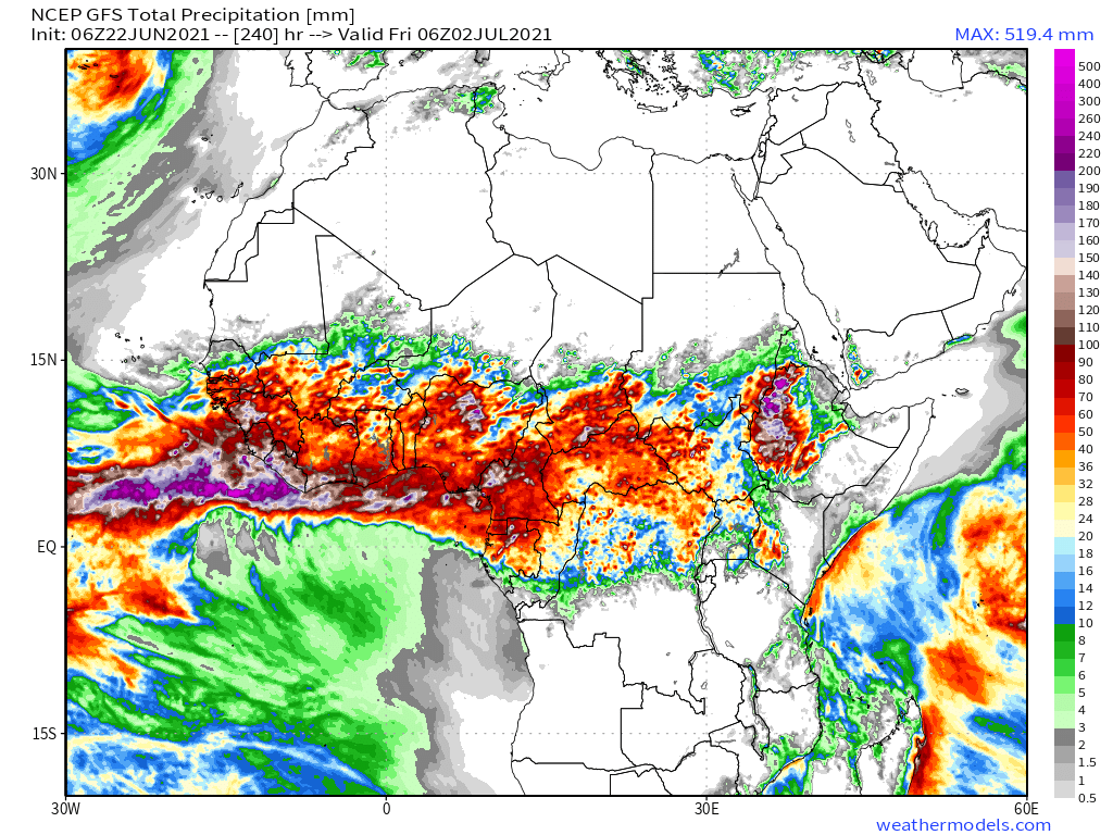
And finally a16-day GFS forecast as well as the 12-day KMA forecast, providing a longer view forward (including for Ethiopia).
The models are now mostly in agreement about significant #DesertRain in Northern Mali in the coming fortnight.

The models are now mostly in agreement about significant #DesertRain in Northern Mali in the coming fortnight.


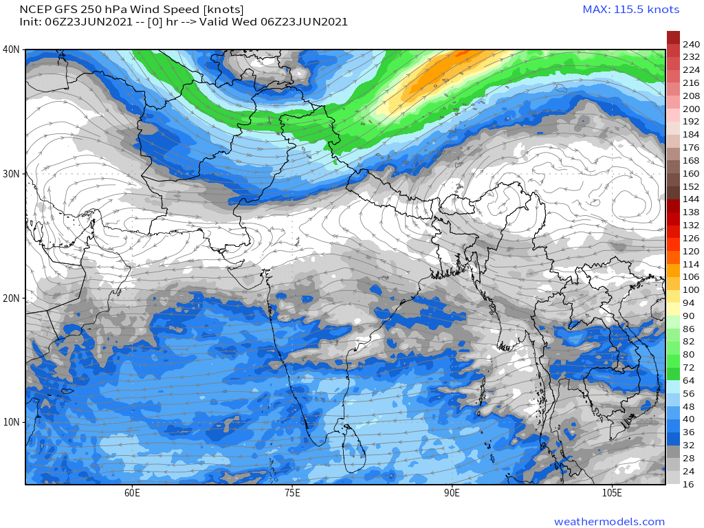
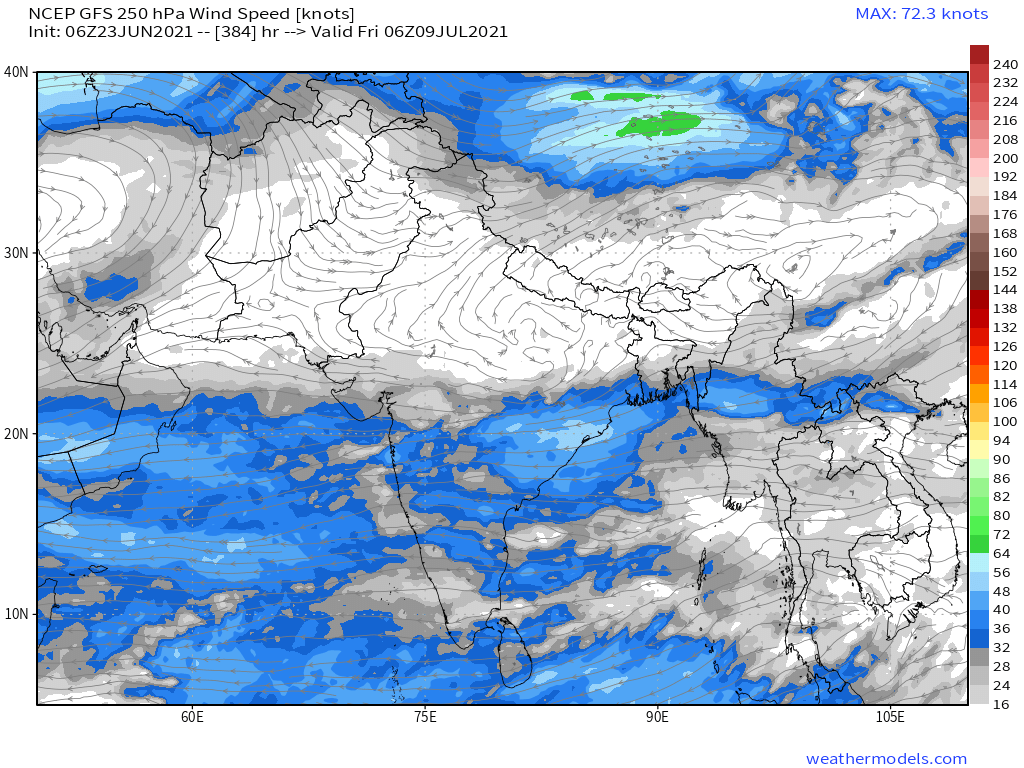
Here are some more visuals showing the source of the airborn moisture which arrives in Eastern Africa over the Arabian Sea. Here we see the Indian Monsoon having a spectacular day.
This image is from immediately south of the image above and shows storms forming over the eastern coastlines and seas west of South East Asia, specifically Thailand, Malaysia and Indonesia.
And finally here we can see those rain-bearing winds coming ashore on the Horn of Africa here we see Kenya and Somalia.
It is impossible to tell how strong the West African Monsoon will get but this image shows you how much water there is over the full weather system. Water is flowing in a clockwise direction starting in India and then moving up and across the Atlantic and then through Europe. 


10-Day rainfall (+1 12-day) forecasts for June 22nd, Election day/Solstice for the #HornOfAfrica including, #Somalia, #Somaliland, #Djibouti, #Ethiopia and parts of #Sudan and #SouthSudan
These are the #Abbay rains which will fill the #GERD.


These are the #Abbay rains which will fill the #GERD.

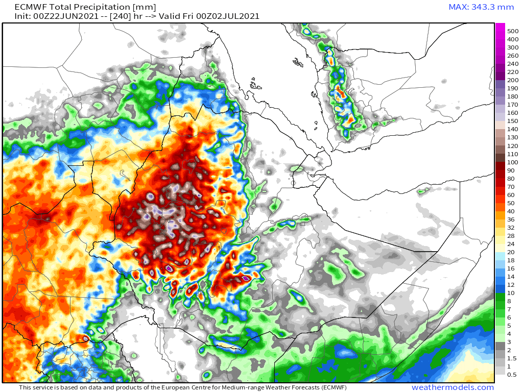


48 hour forecasts for June 22nd (today and tomorrow) for the #HornOfAfrica. Including #Somalia, #Somaliland, #Djibouti, #Ethiopia and parts of #Sudan and #SouthSudan.
#GERD


#GERD


This image is from 18.15hours this evening as night is falling and shows the clouds over the #EthiopiaHighlands, #ArabianStorms along the Red Sea, as well as rain clouds over the west of Sudan. 

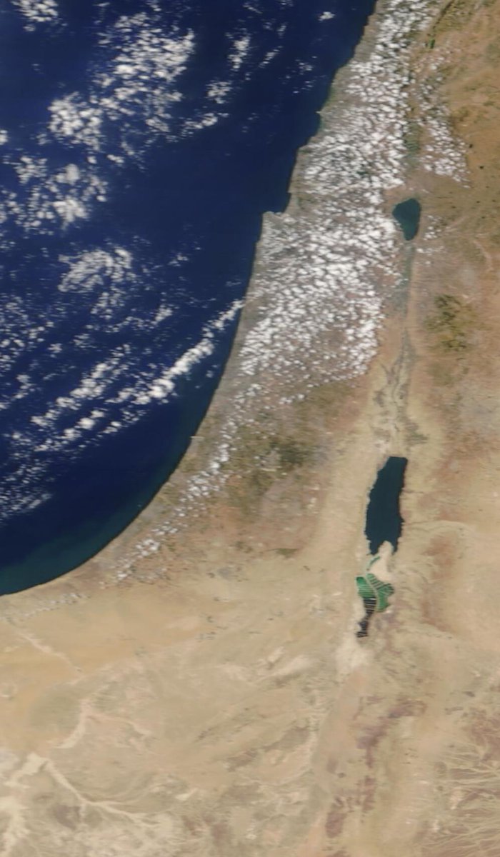
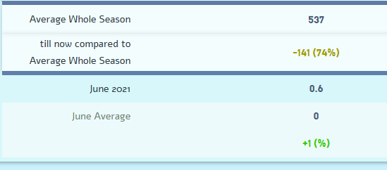
We also had some clouds over Israel today. While Israel has had a very dry June so far over the past week there has been a little rain in Jerusalem. As you can see here the average rainfall in Jerusalem in June, as in Mecca, is zero. [Src: 02ws.co.il/station.php?se…] 

48 Hour June 22nd (today and tomorrow), accumulated rain forecasts for the #MiddleEast from the GFS, CMC & KMA weather models.
#ArabianStorms
#KSA #Yemen #Oman #Jordan #Sudan #Iran #Syria #GERD #Sudan #DesertRain
الله أعلم


#ArabianStorms
#KSA #Yemen #Oman #Jordan #Sudan #Iran #Syria #GERD #Sudan #DesertRain
الله أعلم


And finally, June 22nd, 16-day (GFS) and 12-day (KMA) accumulated rainfall forecasts for the Middle East.
Rainfall on the Arabian Peninsula looks set to continue.
[Note: three of the four models now show rainfall on the Southern Yemen Coast.]
الله أعلم

Rainfall on the Arabian Peninsula looks set to continue.
[Note: three of the four models now show rainfall on the Southern Yemen Coast.]
الله أعلم


/ENDS
@Threadreaderapp unroll
@Threadreaderapp unroll
• • •
Missing some Tweet in this thread? You can try to
force a refresh


