Big day for Nile Basin rains today. The image below [@meteoblue] shows rain at 6pm over the #HornOfAfrica.
The big storm on left is over South Sudan, while the smaller ones on the right are over the Ethiopia Highlands.
Today's Horn, #NorthAfrica & #MiddleEast forecasts follow.
The big storm on left is over South Sudan, while the smaller ones on the right are over the Ethiopia Highlands.
Today's Horn, #NorthAfrica & #MiddleEast forecasts follow.

Today's big picture shows a Western Sahara plume in the process of creating more significant storms in central Europe. Bottom left you can see today's #ArabianStorms.

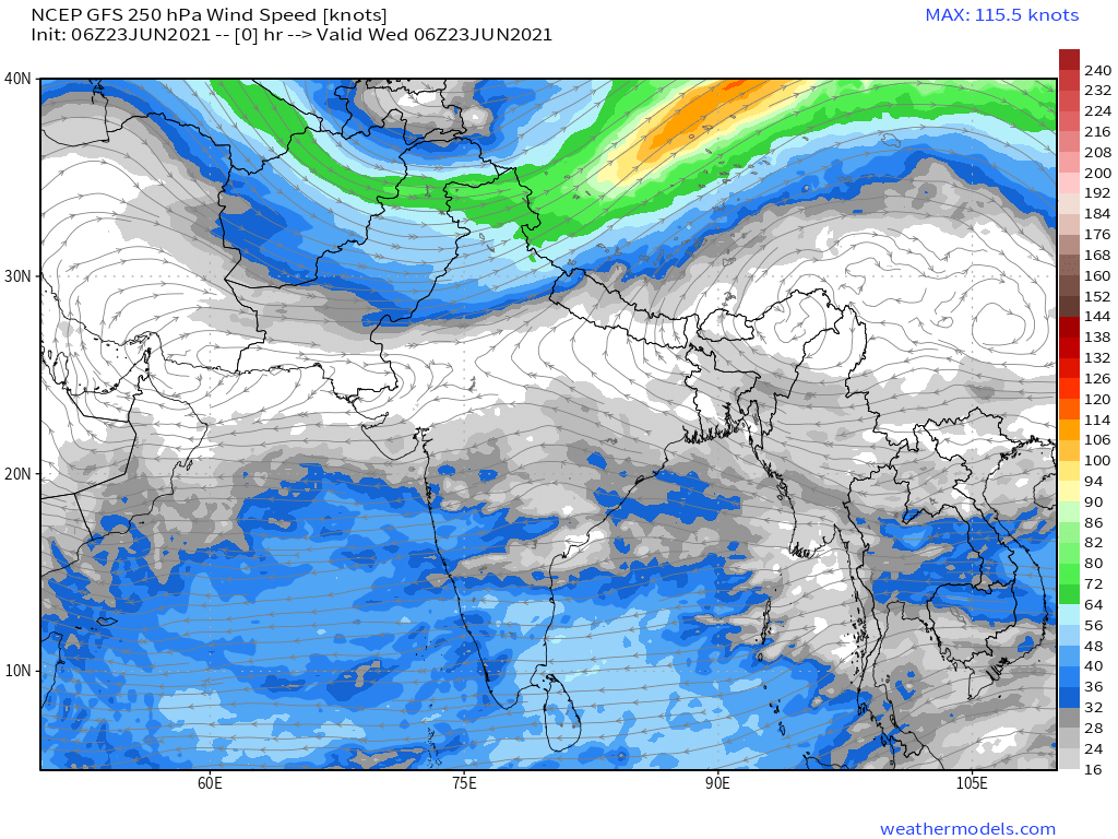
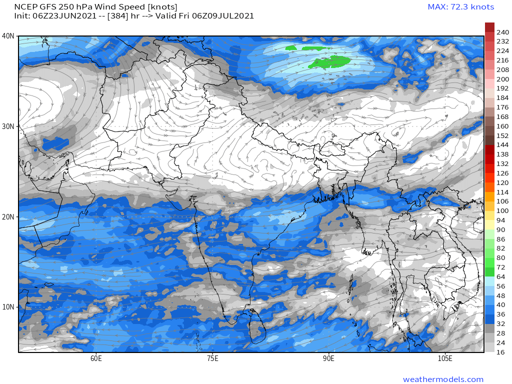
These three images show the winds which are bringing the rains to Africa across the Indian Ocean. The first shows the view as of this morning, the 2nd a forecast for the 7th day and the last one the forecast for the 16th day.
Today's winds were strong.
Today's winds were strong.

This images shows the storms South East Asia which are lifting the water up into jet-stream to be carried West across the ocean to the African monsoons.

This animation shows the full monsoon belt in Africa today moving to the west together producing the rain that waters the mighty equatorial African rain forests.
Today's North Africa 10-Day rainfall forecasts for June 23rd. While the 21st is true solstice the day lengths will remain roughly the same for another five days.


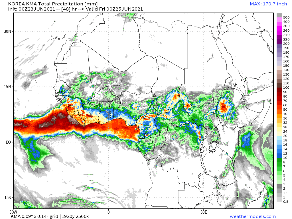
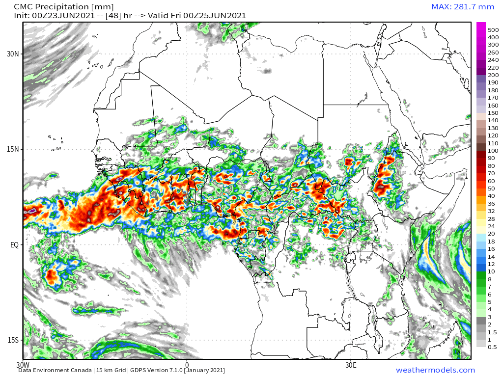
48-Hour North Africa/Sahara rainfall forecasts from the same four models.


The other big source water for the Monsoon winds is India and the Arabian Ocean which produced Cyclone Tauktae back in May.
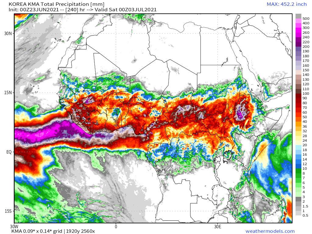
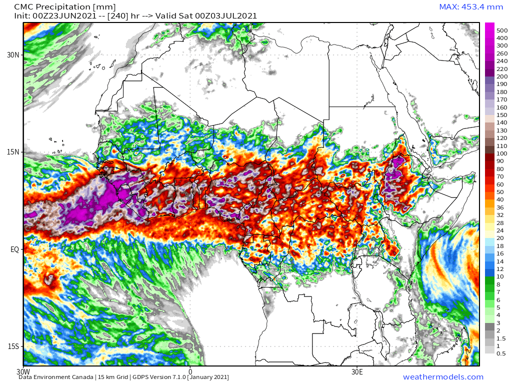
These final two North Africa Forecasts show the GFS (right) and KMA (left) models expectations for rainfall over 12 days and 16 days respectively.
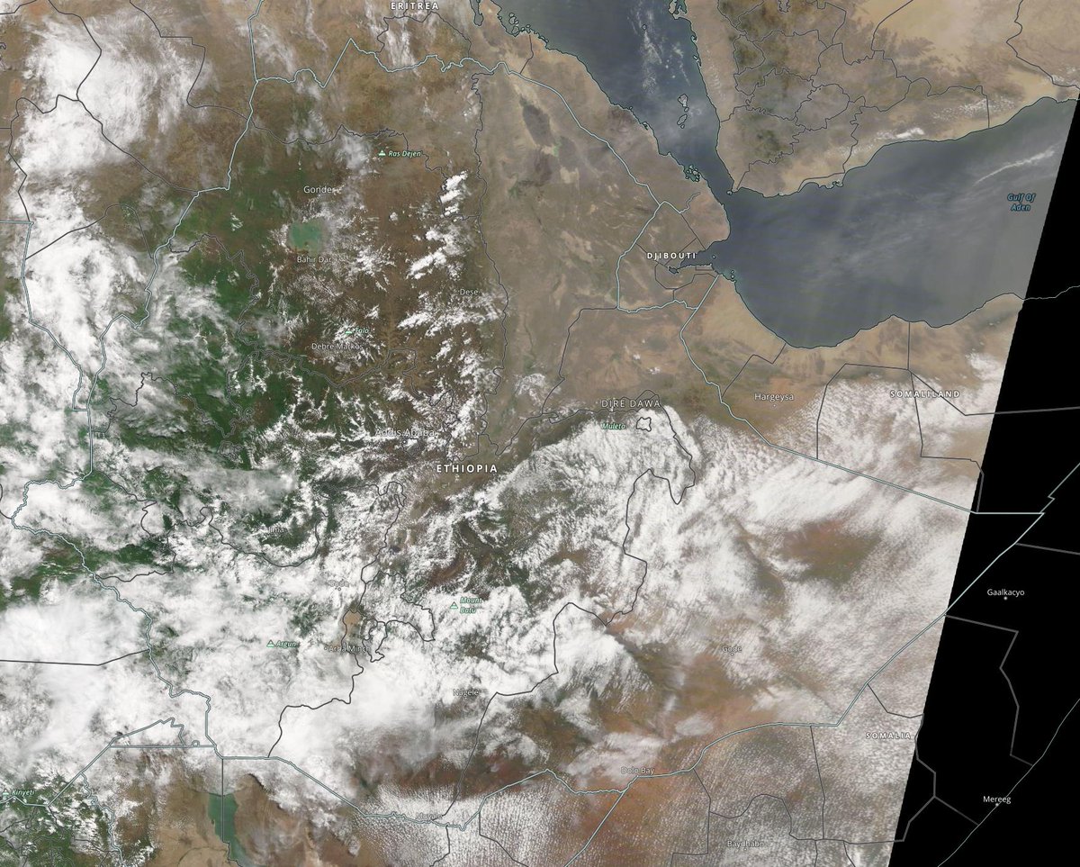
Ethiopia, and the highlands where the #GERD is located stands out spectacularly among areas of highest rainfall.
Ethiopia, and the highlands where the #GERD is located stands out spectacularly among areas of highest rainfall.


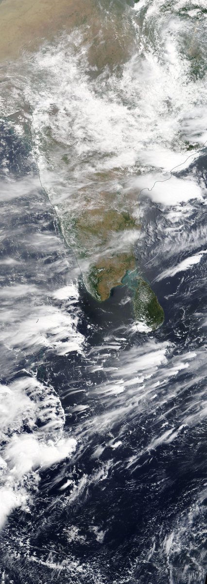
These two images show the highlands at 10am and 1pm today local time. As the winds off the ocean rise with the heat the clouds form.


These two images show the area at 4pm and 7pm as the sun is setting, when some of the heaviest rains are falling.


10-Day rainfall (+1 12-day) forecasts for June 23rd, for the #HornOfAfrica including, #Somalia, #Somaliland, #Djibouti, #Ethiopia and parts of #Sudan and #SouthSudan
These are the #Abbay rains which will fill the #GERD.
These are the #Abbay rains which will fill the #GERD.


48 hour forecasts for June 23rd (today and tomorrow) for the #HornOfAfrica. Including #Somalia, #Somaliland, #Djibouti, #Ethiopia and parts of #Sudan and #SouthSudan.
#GERD
#GERD


In this image we can see very clearly how the #ArabianStorms and the Ethiopian rains are being fed from the same source.
A selection of storm images from @Arab_Storms twitter feed follows.
https://twitter.com/Arab_Storms/status/1407649550177800193?s=20
This one is from the Jazan, in Saudi mountains just north of the Yemeni border, which is one of the wettest parts of #KSA
https://twitter.com/Arab_Storms/status/1407359866377809922?s=20
This storm was in the UAE. The UAE and Oman on the North Eastern corner of the Peninsula has been getting a lot of #ArabianStorms in recent days.
https://twitter.com/Arab_Storms/status/1407346307010895882?s=20
And this one is from Oman.
https://twitter.com/Arab_Storms/status/1407331969613115394?s=20
And this final one from the UAE, videoed by @Arab_Storms himself shows what looks to me like what we call in English a dust devil, a small tornado like formation.
https://twitter.com/Arab_Storms/status/1407294557390319619?s=20
Actually one more, this one from Germany shows what looks like a river of hail running down a mountain road. Its not quite as spectacular as some of the Saudi hail rivers we saw earlier in the year, but it is the first I have seen in Europe.
https://twitter.com/Arab_Storms/status/1407250413217214470?s=20
10-Day June 23rd, accumulated rain forecasts for the #MiddleEast from the GFS, ECMWF, CMC & KMA weather models.
#ArabianStorms
#KSA #Yemen #Oman #Jordan #Sudan #Iran #Syria #GERD #Sudan #DesertRain
الله أعلم
#ArabianStorms
#KSA #Yemen #Oman #Jordan #Sudan #Iran #Syria #GERD #Sudan #DesertRain
الله أعلم


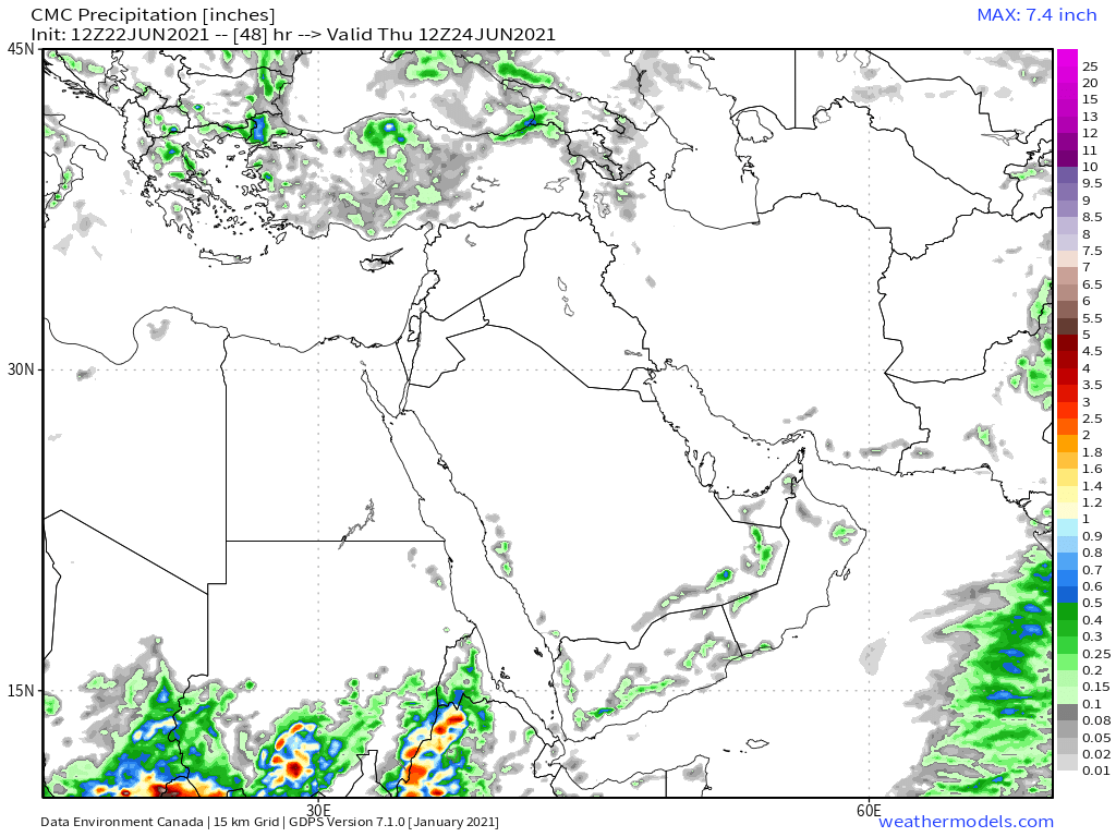
48 Hour June 23rd (today and tomorrow), accumulated rain forecasts for the #MiddleEast from the GFS, CMC & KMA weather models.
#ArabianStorms
#KSA #Yemen #Oman #Jordan #Sudan #Iran #Syria #GERD #Sudan #DesertRain
الله أعلم
#ArabianStorms
#KSA #Yemen #Oman #Jordan #Sudan #Iran #Syria #GERD #Sudan #DesertRain
الله أعلم


And finally, June 23rd, 16-day (GFS) and 12-day (KMA) accumulated rainfall forecasts for the Middle East.
[Note: All four models now show rainfall on the Southern Yemen Coast & CMC forecasts about inland rain in Yemen and Oman and South #KSA appear to be correct. ]
الله أعلم
[Note: All four models now show rainfall on the Southern Yemen Coast & CMC forecasts about inland rain in Yemen and Oman and South #KSA appear to be correct. ]
الله أعلم


As a new regular feature I will provide these three images each day which show the wider picture:
1. Precipitable water (potential for rain)
2. MLSP (Mean Sea Level Pressure)
&
3. 250Hpa (jet stream winds approx 11kms high) which appear to be the most useful parameters.
1. Precipitable water (potential for rain)
2. MLSP (Mean Sea Level Pressure)
&
3. 250Hpa (jet stream winds approx 11kms high) which appear to be the most useful parameters.


In the forecasts for coming days we see winds pushing water down from Europe across the Mediterranean into the Sahara, Algeria to Egypt, which will be a new feature in the over all landscape. It will be interesting to see what impact this has.
/ENDS
@Threadreaderapp unroll
@Threadreaderapp unroll
• • •
Missing some Tweet in this thread? You can try to
force a refresh