A thread on the maps and cartography of ancient Mesopotamia: how the people of Babylon & Assyria made maps, what they used them for, and how they imagined the shape of the world. 
Like much of what we know today, mapmaking began in Mesopotamia.
The people who inhabited the Euphrates and Tigris basins (modern-day Iraq) were fastidious record-keepers, and wrote their findings down in clay.
The people who inhabited the Euphrates and Tigris basins (modern-day Iraq) were fastidious record-keepers, and wrote their findings down in clay.
The first map to come from this region, and one of the earliest surviving maps in existence, is the The Ga-Sur Map, dating to c. 2300 BCE.
This clay tablet was discovered near the city of Kirkuk, Iraq, in 1930-31, and depicts a village.
This clay tablet was discovered near the city of Kirkuk, Iraq, in 1930-31, and depicts a village.
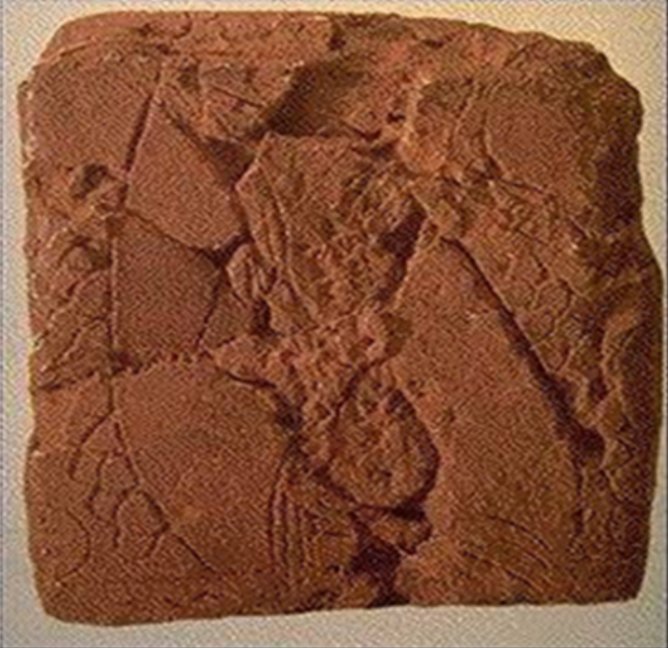
Though the fragment of the Ga-Sur map is quite damaged, it is still possible to make out the lines of hills and rivers surrounding the village.
The exact purpose of the map is unclear, but it may have had a role in the administration of the empire.
The exact purpose of the map is unclear, but it may have had a role in the administration of the empire.
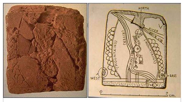
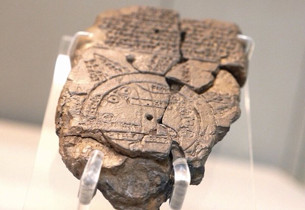
Another incredible example of ancient mapmaking is this C6th BCE map of the known world, discovered at Sippar, southern Iraq.
It shows the world as a disc, surrounded by a ring of water called the "Bitter River".
It shows the world as a disc, surrounded by a ring of water called the "Bitter River".
This Babylonian world map shows Babylon and the other cities of the region, including the Elamite capital of Susa. Beyond the “Bitter River” are seven outlying regions or islands.
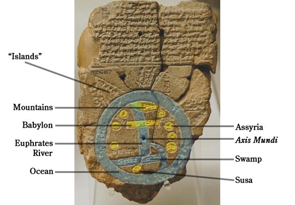
The regions we can read are the "place of the rising sun", the place "beyond the flight of birds" & the place where "the sun is hidden and nothing can be seen”.
(It's hard to say whether Babylonians knew about lands like Britain & Scandinavia, or just inferred their existence)
(It's hard to say whether Babylonians knew about lands like Britain & Scandinavia, or just inferred their existence)
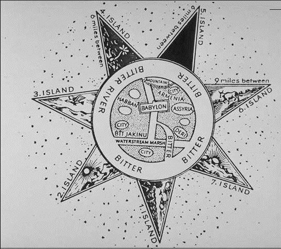
The other side of the tablet describes the strange things to be seen around the world, including,
"ruined cities… the ruined gods… in the midst of the sea… serpent, great dragon… scorpion-man… mountain-goat, gazelle, zebu, leopard, bison… lion, wolf, stag and hyena"
"ruined cities… the ruined gods… in the midst of the sea… serpent, great dragon… scorpion-man… mountain-goat, gazelle, zebu, leopard, bison… lion, wolf, stag and hyena"
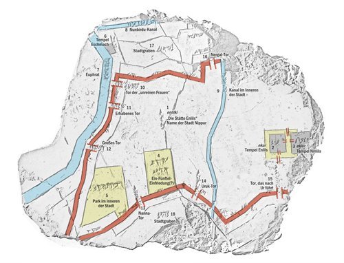
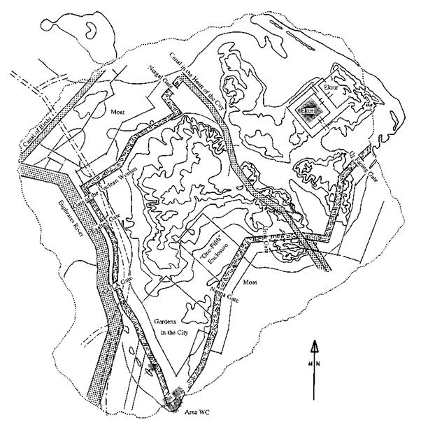
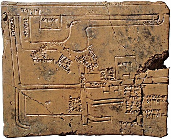
One key use of a map is in city planning. The world’s oldest city plan is around 3,500 years old and shows part of the town of Nippur.
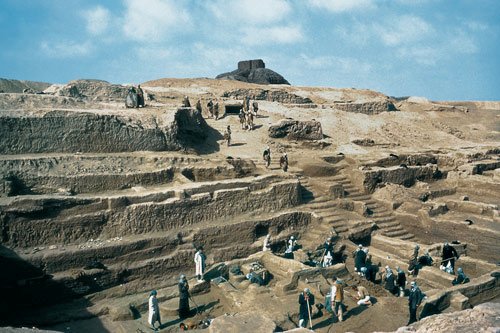
This detailed map of Nippur from the second millennium BCE shows the river Euphrates, several temples and part of the city walls, with captions in cuneiform.
This map of Nippur is remarkably accurate, to the extent that it matches up well to modern maps made of the excavations.
The attention to detail around walls and fortifications suggests it may have been used in extending or repairing the fortifications.
The attention to detail around walls and fortifications suggests it may have been used in extending or repairing the fortifications.
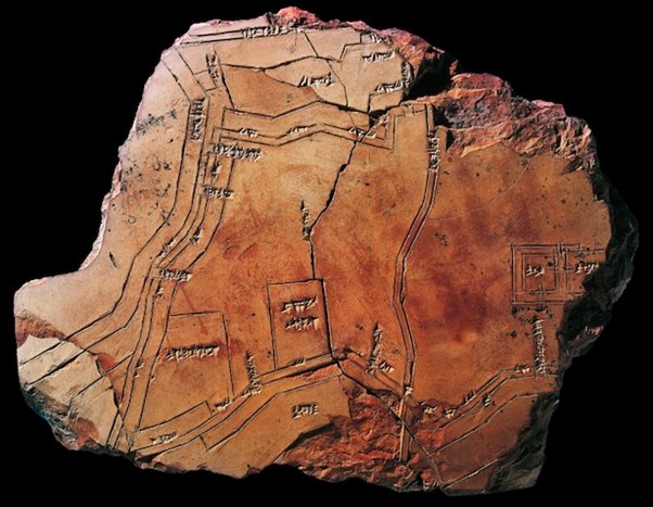
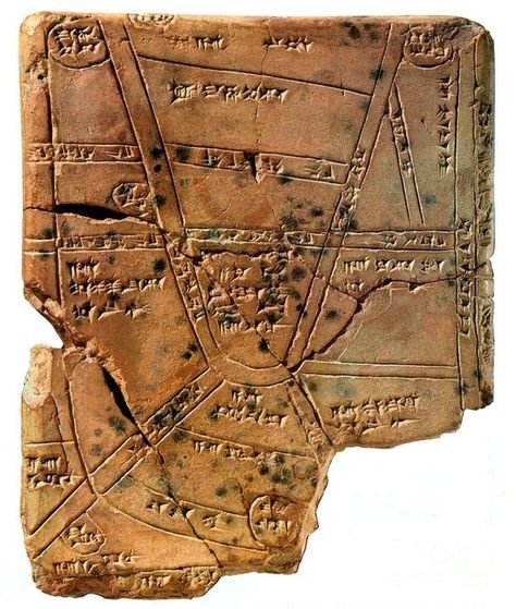
Another map from Nippur (c. 1500 BCE) shows the distribution of fields in the towns surrounding the city, and the networks of roads and canals linking them.
The map shows how closely the empire was administered from the central seats of authority.
The map shows how closely the empire was administered from the central seats of authority.
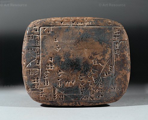
A map might even be used to work out the distribution of land mathematically, as shown in this tablet from Umma, around 2100 BCE.
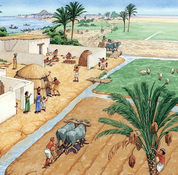
Another important reason to make a map was the incredibly complex systems of water management that made life in the arid river plains possible.
Mesopotamians were expert engineers of canals and irrigation systems.
Mesopotamians were expert engineers of canals and irrigation systems.
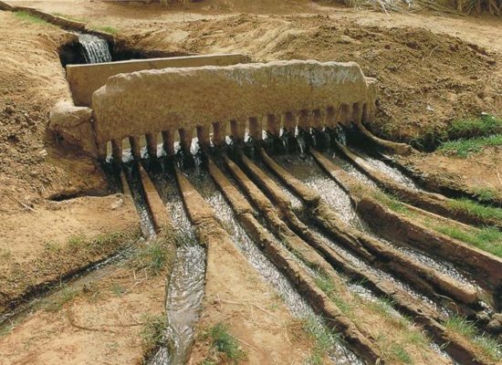
This Babylonian map of canals and water systems (1684-1647 BCE) shows the intricacy and complexity of the water systems used, and also how important it was to keep track of them with maps.
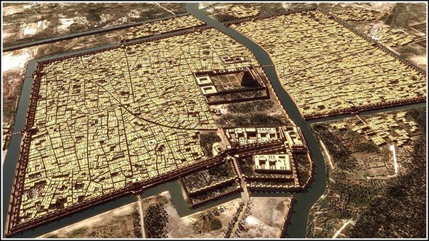
That's all for now - thanks for listening! As a bonus, here’s a modern CGI reconstruction of how the city of Babylon might have looked during its golden age.
If you're interested in learning more about the ancient history of this region, I've gathered all my threads on the subject in one place here: