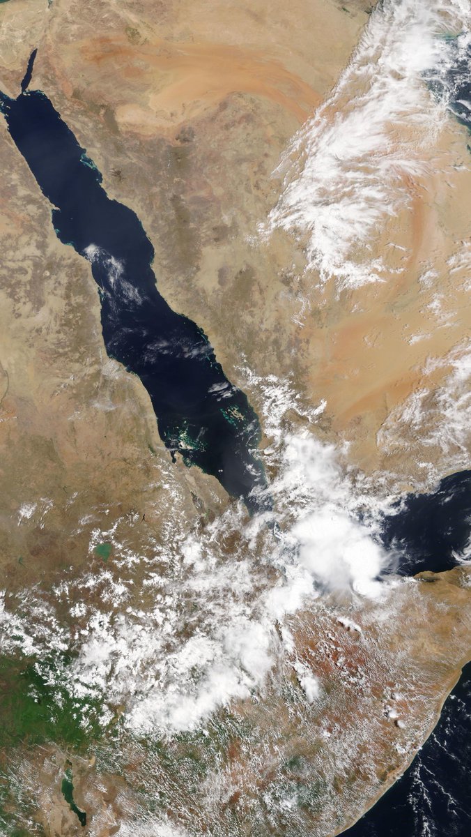
Afternoon update 2.45pm: Both #KSA storms have expanded and we now have significant #ArabianStorms in Oman and the #UAE.
Meanwhile in the #Horn of Africa #Ethiopia rainfall to feed the Nile is getting underway, and storms are sparking up along the #Somaliland coast.
#ArabianStorms are getting busy across the Arabian Peninsula this afternoon. There are signs storms may spread north along the Red Sea coast shortly and a burst of activity is underway in Oman and the UAE.
A close up of #ArabianStorm activity along the north coast of the Arabian Peninsula.
• • •
Missing some Tweet in this thread? You can try to
force a refresh
A high resolution taken today by the NASA Modis satellite of the #NileBasin and the #MiddleEast is below.
The day started with storms in the East of the #HornOfAfrica#Yemen and the #KSA and got very busy over the day.
28 April Rain forecasts follow:
This first animation shows the beginning of a plume of water coming across the Sahara from the Atlantic. Forecasts indicate water from this plume will arrive in the #MiddleEast and #HoA in 10 days time.
This animation shows the West African Monsoon and the plume of précipitable water making its away across over the Sahara over the coming week.
Here you see the beginning of this event. It is much larger than earlier iterations of the same phenomena. These streams of air-born water are roughly 4000 kms long.
This tweet and the next three contain 10-day forecasts of the trajectory of this hydrological atmospheric phenomena. They forecast precipitable water, the quantity of water which is held in the atmosphere measured in inches.
An image of thunderstorm activity in the Ethiopian #Abbay#BlueNile basin this afternoon, also showing significant rains South #Yemen and over most of #Somalia.
Todays, 27th April, accumulated rain forecasts for the #MiddleEast & #HornOfAfrica follow in the thread below.
#ArabianStorms activity was boosted today by moisture flowing from the #Ethiopian monsoon rains in the Ethiopian Highlands, the watershed of the #Abbay#BlueNile catchment.
Below you see a 10-day GFS forecast of accumulated rain over North Africa.
This animation shows the flows of moisture from this morning across the Red Sea. A process which is called the "Southern Gate" by Saudi weather entusiasts. #ArabianStorms#Abbay#BlueNile#GERD