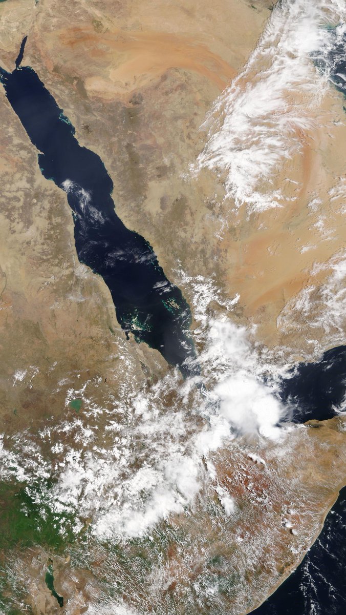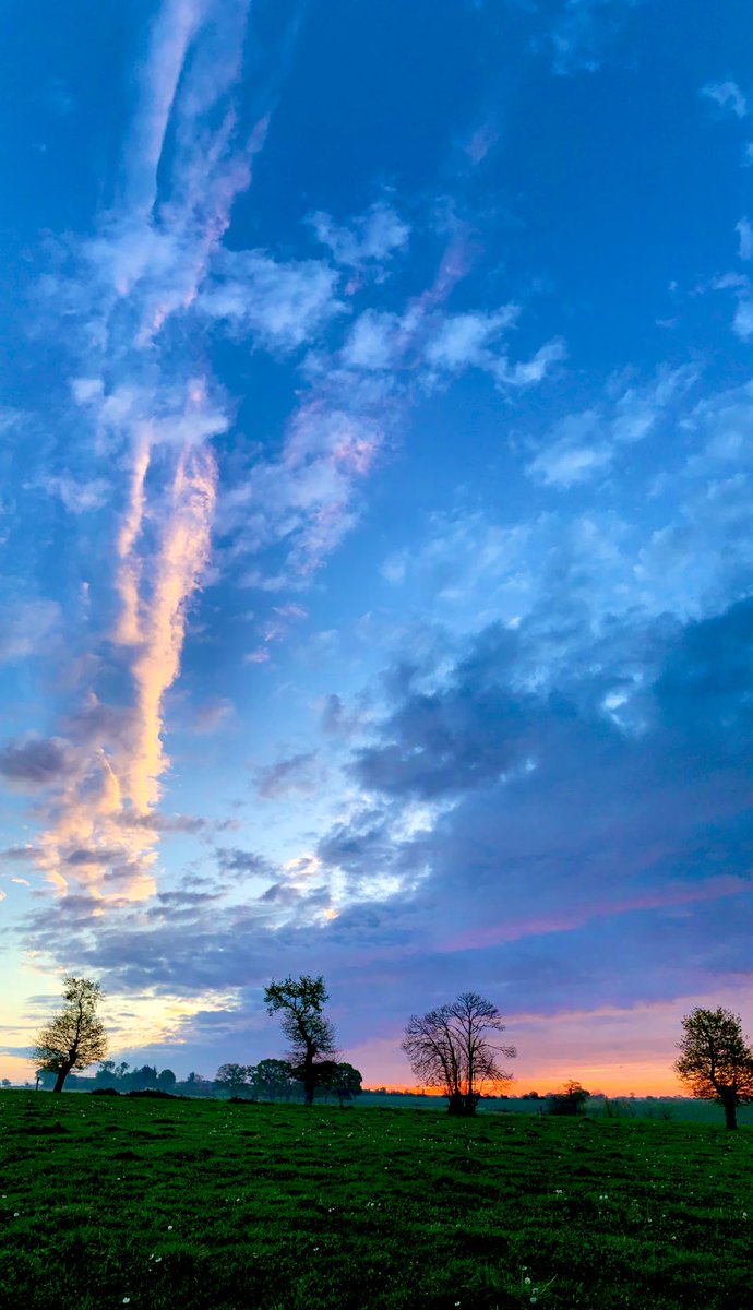
An image of thunderstorm activity in the Ethiopian #Abbay #BlueNile basin this afternoon, also showing significant rains South #Yemen and over most of #Somalia.
Todays, 27th April, accumulated rain forecasts for the #MiddleEast & #HornOfAfrica follow in the thread below.
Todays, 27th April, accumulated rain forecasts for the #MiddleEast & #HornOfAfrica follow in the thread below.
https://twitter.com/althecat/status/1387035399504097281

#ArabianStorms activity was boosted today by moisture flowing from the #Ethiopian monsoon rains in the Ethiopian Highlands, the watershed of the #Abbay #BlueNile catchment.
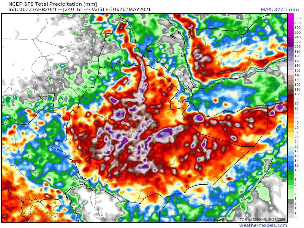
Below you see a 10-day GFS forecast of accumulated rain over North Africa.
Below you see a 10-day GFS forecast of accumulated rain over North Africa.

This animation shows the flows of moisture from this morning across the Red Sea. A process which is called the "Southern Gate" by Saudi weather entusiasts. #ArabianStorms #Abbay #BlueNile #GERD
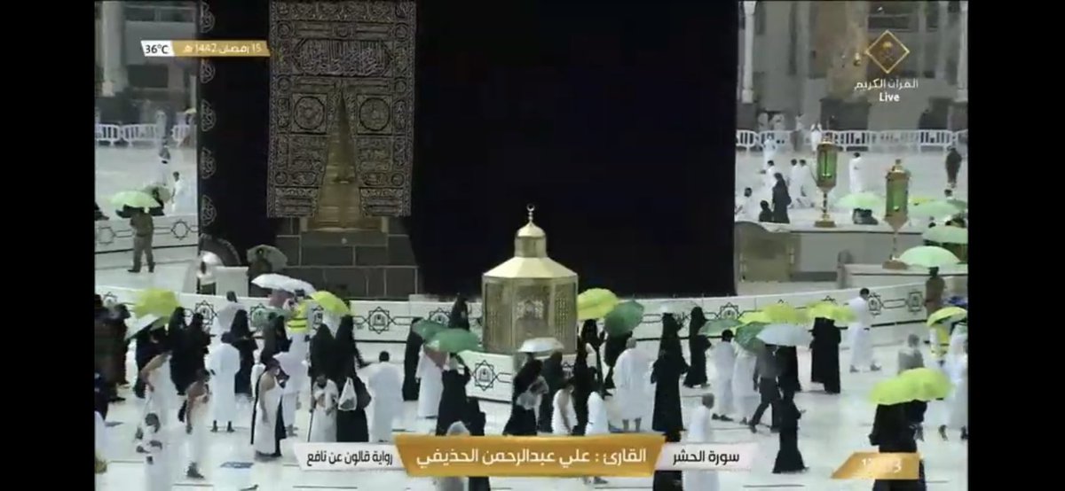
This process strengthened over the day, on a day which has seen an astonishing level of Storm Activity across the Kingdom of #SaudiArabia and has seen significant rainfall on the @HolyKaaba in Mecca / Makkah.
الله أكبر
الله أكبر
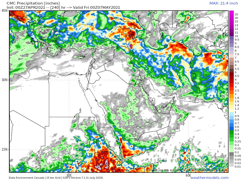
The latest 10-Day accumulated rain forecasts from the ECMWF, GFS and KMA forecast models are below. They are in agreement. Lots of rain across the entire #HornOfAfrica 


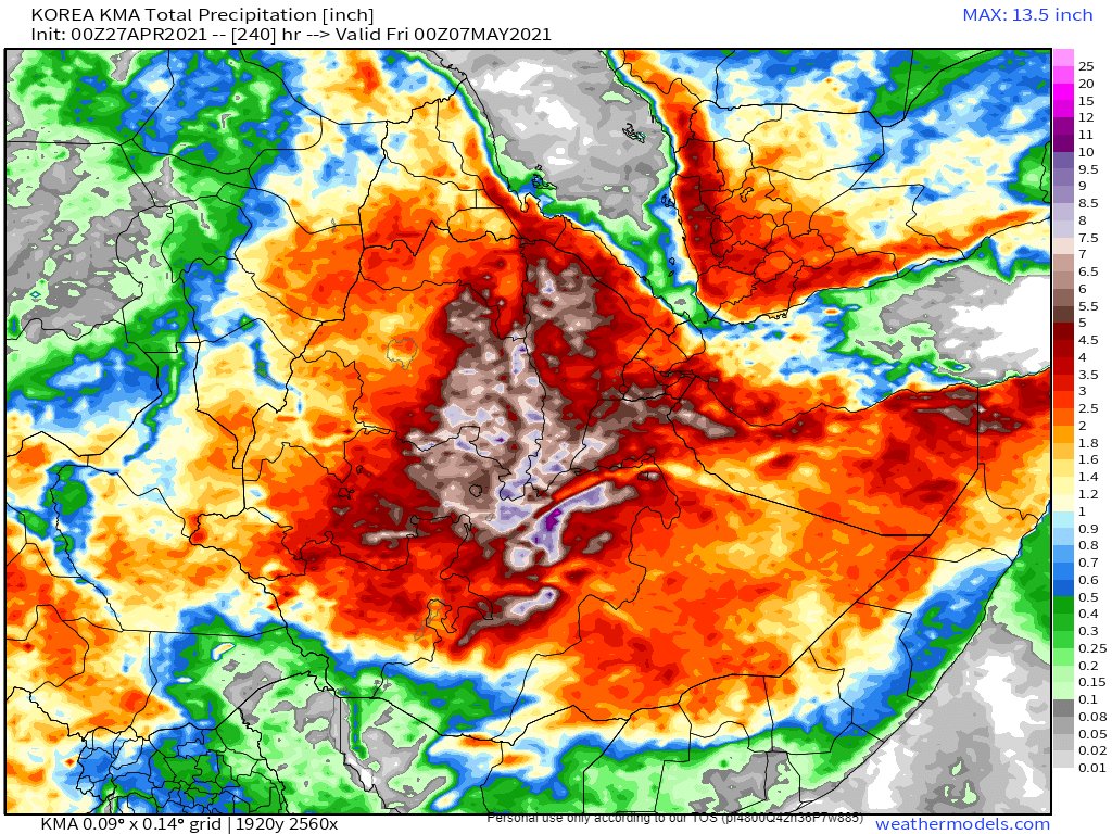
This animation shows the storm activity across the region from Medina to Mogadishu as the sun set over the past hour.
#ArabianStorms #HornOfAfrica #Ethiopia #Somalia #Yemen
#ArabianStorms #HornOfAfrica #Ethiopia #Somalia #Yemen
Two eyewitness #ArabianStorms videos and image tweets from @Arab_Storms follow. The first is a beautiful short clip of #DesertRain today.
https://twitter.com/Arab_Storms/status/1387066722079760386?s=20
The second shows a hail storm settling on the ground.
For more live eyewitness #ArabianStorms & #DesertRain videos follow @Arab_Storms
For more live eyewitness #ArabianStorms & #DesertRain videos follow @Arab_Storms
https://twitter.com/Arab_Storms/status/1387053116105756679?s=20
27 April - 10 day accumulated rain forecasts for the #MiddleEast from GFS, CMC, KMA and GEFS weather models.
@Arab_Storms
#ArabianStorms
#KSA #Yemen #Oman #Levant #Jordan #Sudan #UAE #Iraq #Iran #Syria #Kuwait #GERD #Africa #NileBasin #HornOfAfrica #DesertRain
الله أعلم


@Arab_Storms
#ArabianStorms
#KSA #Yemen #Oman #Levant #Jordan #Sudan #UAE #Iraq #Iran #Syria #Kuwait #GERD #Africa #NileBasin #HornOfAfrica #DesertRain
الله أعلم



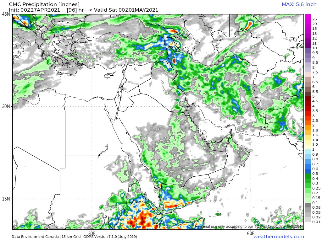
3 day accumulated rain forecasts ( to Friday at Midnight) for the #MiddleEast from the GFS, CMC, KMA and GEFS weather models.
[Note: A lot of this rain fell today!]
@Arab_Storms #ArabianStorms
#KSA #Yemen #Jordan #Sudan #Iran #Syria #GERD #Sudan #DesertRain
الله أعلم


[Note: A lot of this rain fell today!]
@Arab_Storms #ArabianStorms
#KSA #Yemen #Jordan #Sudan #Iran #Syria #GERD #Sudan #DesertRain
الله أعلم



And our final 27th April rain forecast is an set of ultra long-range accumulated rain forecasts for the #MiddleEast from the GFS, GEFS (16 day) and KMA (12 day) weather models.
#ArabianStorms #Ramadan
الله أعلم


#ArabianStorms #Ramadan
الله أعلم


And to complete today's bulletin two more #ArabianStorms videos from @Arab_Storms and @saleh_alazzaz
The first shows an #ArabianStorm ethusiast being buffeted by the wind.
The first shows an #ArabianStorm ethusiast being buffeted by the wind.
https://twitter.com/Arab_Storms/status/1387076227899400192?s=20
And the last tweet for the day is a new one in from Makkah. From @saleh_alazzaz.
The scale of these storms really is remarkable!
The scale of these storms really is remarkable!
https://twitter.com/saleh_alazzaz/status/1387045094272892941?s=20/ends
@Threadreaderapp unroll
• • •
Missing some Tweet in this thread? You can try to
force a refresh

