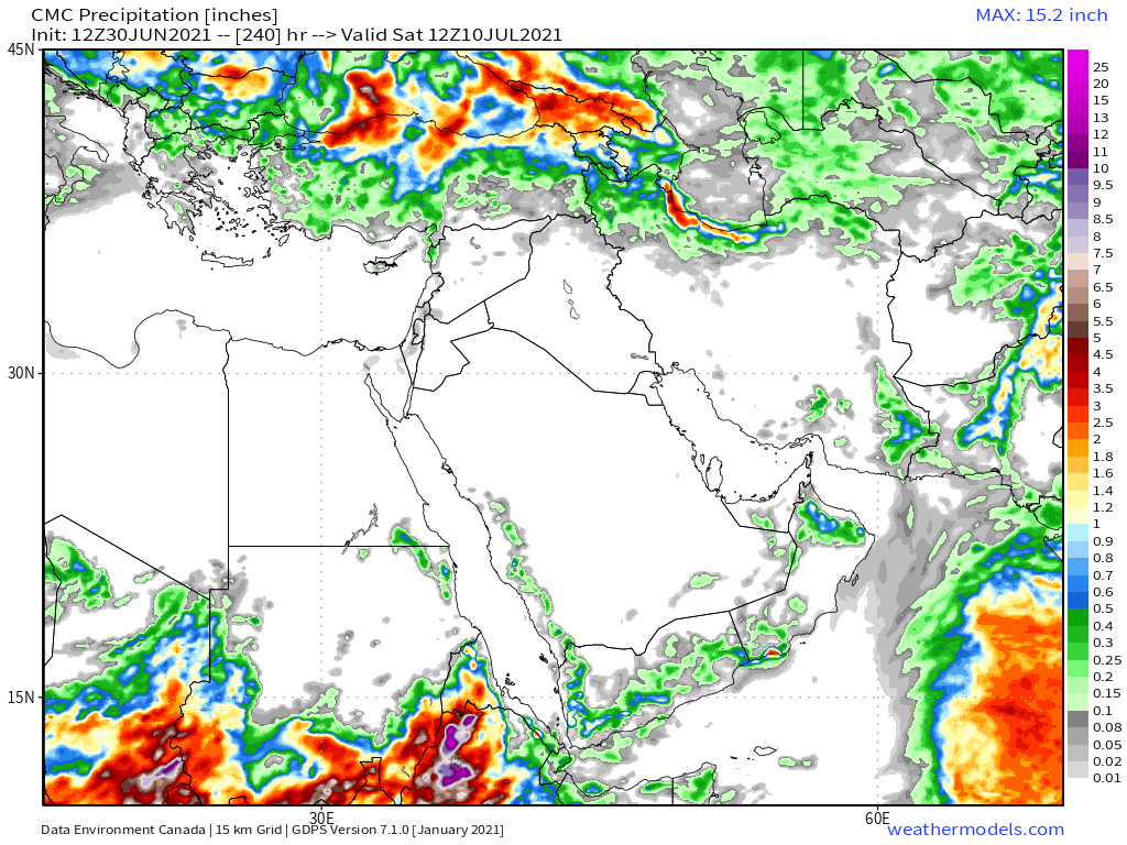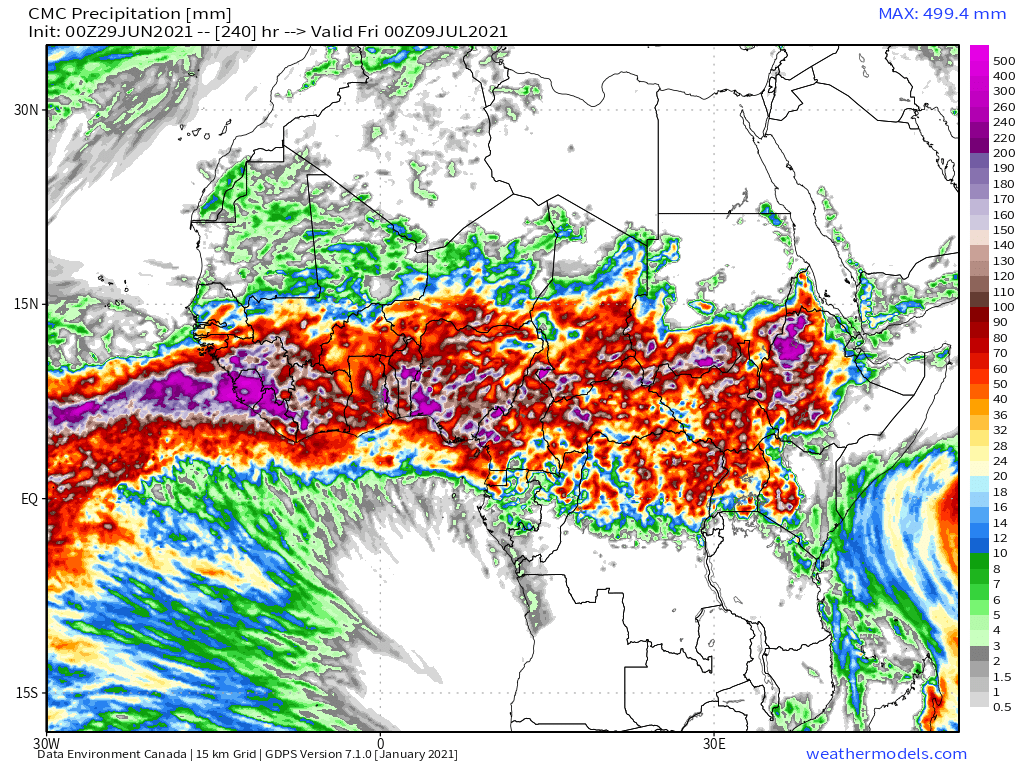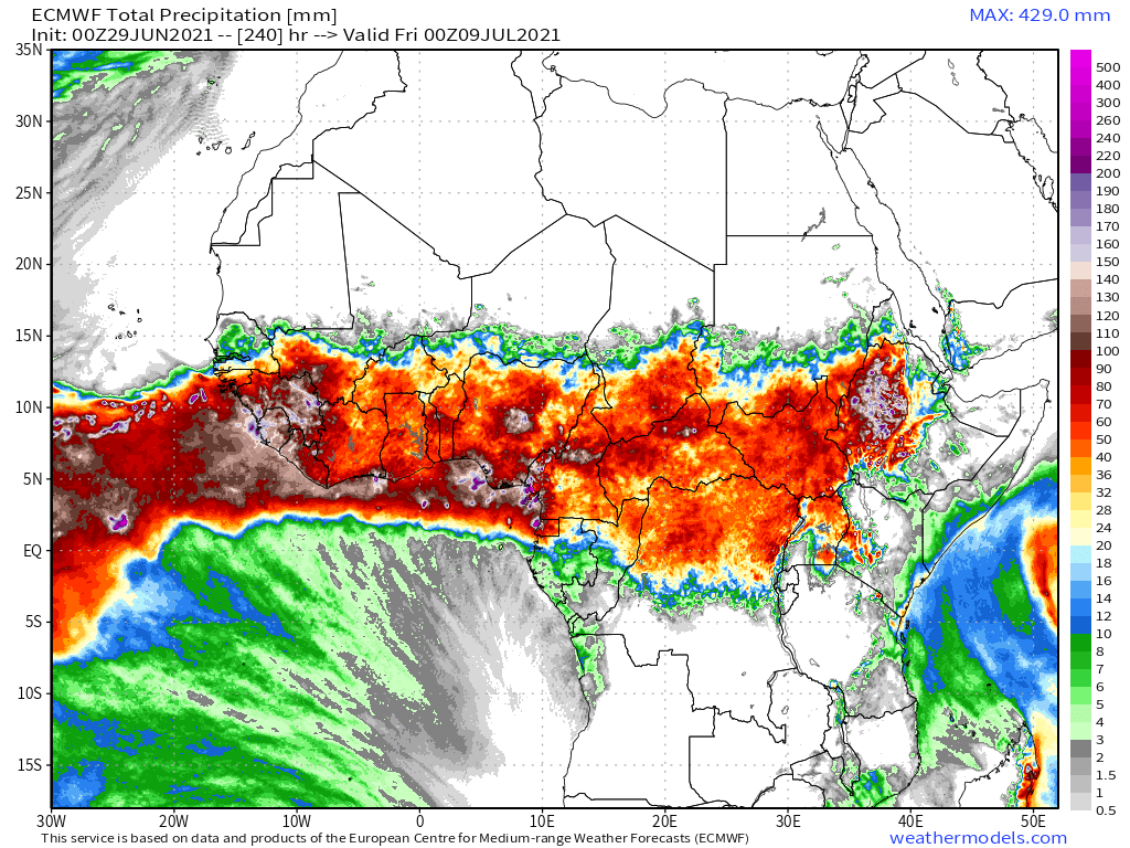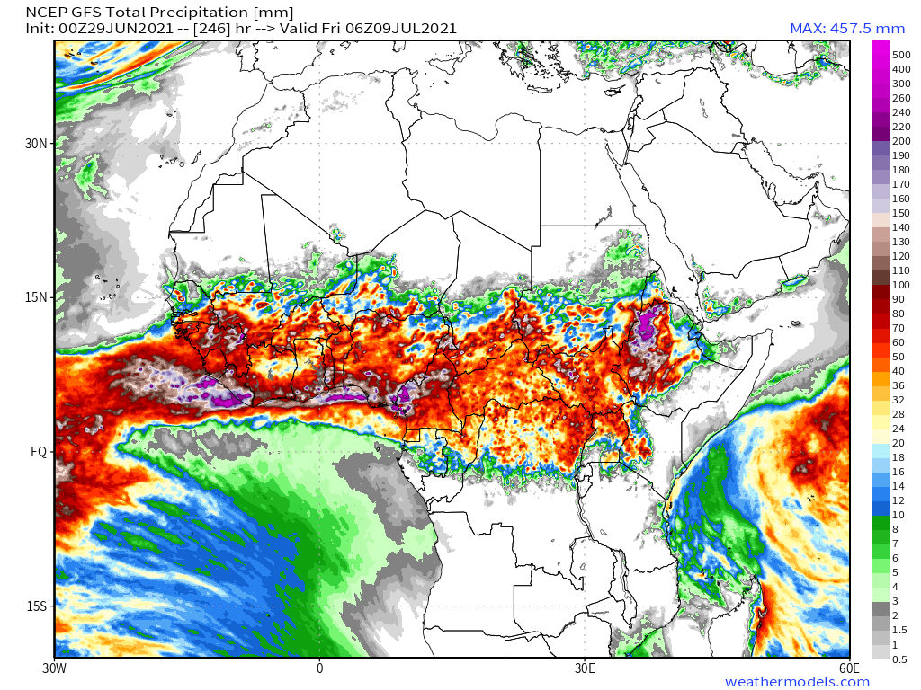
A big day for rains in the #HornOfAfrica and particularly in the #Abbay Basin today, possibly the biggest this year. #GERD
Today's rainfall forecasts for the #HoA, #MiddleEast and #NorthAfrica follows.
Today's rainfall forecasts for the #HoA, #MiddleEast and #NorthAfrica follows.
Here we see a closeup of the storms building this afternoon over the Ethiopia Highlands, including Tigray and Eritrea. As well we can see explosive storms along the Red Sea Coast in Yemen and the Kingdom of #SaudiArabia.
This high resolution satellite image shows the entire Nile Basin this morning, with clouds well north over Sudan as the day began. 

48-hour rainfall forecasts (today and tomorrow from the same four models. @ECMWF, @NOAA's GFS, Canada's CMC and Korea's KMA. 


Today's big picture has two large storm complexes, that over the HoA and another over Western Europe. The second and third images show satellite views of the Western Europe storms this morning, one showing the size of the storm complex. 


This image shows the relative sizes of the two storm complexes. The one over East Africa and the Arabian peninsula is 2.5x the size of the European area of disturbed weather. 

Today's June 30th 10-day rainfall forecasts for the #Ethiopia and the Horn Of Africa including #Somalia, #Somaliland, eastern parts of #SouthSudan, south eastern parts of Sudan, #Djbouti and #Eritrea. 


48 Hour forecasts (today and tomorrow) from the same three models. The official beginning of the big rainy season is tomorrow. 


... Threadfix ...
https://twitter.com/althecat/status/1410316815843143685?s=20
This animation shows the same view again, this time showing the source of the water which brings the Eastern Africa Monsoon, the Arabian Sea.
10-Day June 30th, accumulated rain forecasts for the #MiddleEast from the GFS, ECMWF, CMC & KMA weather models.
#ArabianStorms
#KSA #Yemen #Oman #Jordan #Sudan #Iran #Syria #GERD #Sudan #DesertRain
الله أعلم


#ArabianStorms
#KSA #Yemen #Oman #Jordan #Sudan #Iran #Syria #GERD #Sudan #DesertRain
الله أعلم


48 Hour June 30th (today and tomorrow), accumulated rain forecasts for the #MiddleEast from the GFS, CMC & KMA weather models.
#ArabianStorms
#KSA #Yemen #Oman #Jordan #Sudan #Iran #Syria #GERD #Sudan #DesertRain
الله أعلم


#ArabianStorms
#KSA #Yemen #Oman #Jordan #Sudan #Iran #Syria #GERD #Sudan #DesertRain
الله أعلم


And some eyewitness tweets from @Arab_Storms today of #ArabianStorms, the first from @SaudiArabia
https://twitter.com/Arab_Storms/status/1410219385390837765?s=20
And another also from #KSA
https://twitter.com/Arab_Storms/status/1410215767967211522?s=20
And one from #Oman of a thunderstorm.
https://twitter.com/Arab_Storms/status/1410127184027652098?s=20
And as always the final forecasts today are long-range, June 30th, 16-day (GFS) and 12-day (KMA) accumulated rainfall forecasts for the Middle East.
الله أعلم

الله أعلم


And for a rounded picture of the entire greater region. Zero hour simulation data from the GFS.
1. Precipitable water (potential rain + energy)
2. MLSP (Mean Sea Level Pressure)
3. 250Hpa (jet stream winds approx 11kms high) which appear to be the most useful parameters.


1. Precipitable water (potential rain + energy)
2. MLSP (Mean Sea Level Pressure)
3. 250Hpa (jet stream winds approx 11kms high) which appear to be the most useful parameters.


Finally today saw 49.6 degree celsius temperatures in British Columbia. Here you can see wild fire smoke mixing with a thunderstorm flare from space.
And a view of the same storm from the ground. Pyro-cumulonimbus are clouds from thunderstorms supercharged by fires.
https://twitter.com/KyleTWN/status/1410101766515937280?s=20
/ENDS
@threadreaderapp unroll
@threadreaderapp unroll
• • •
Missing some Tweet in this thread? You can try to
force a refresh


