There is something glorious about the images that @zoom_earth captures. I especially like the large symmetrical and fairly stationary area of cloud in the North Atlantic in this image.
Today's May 1sy Forecasts for #Ethiopia and #MiddleEast rainfall follow.
Today's May 1sy Forecasts for #Ethiopia and #MiddleEast rainfall follow.

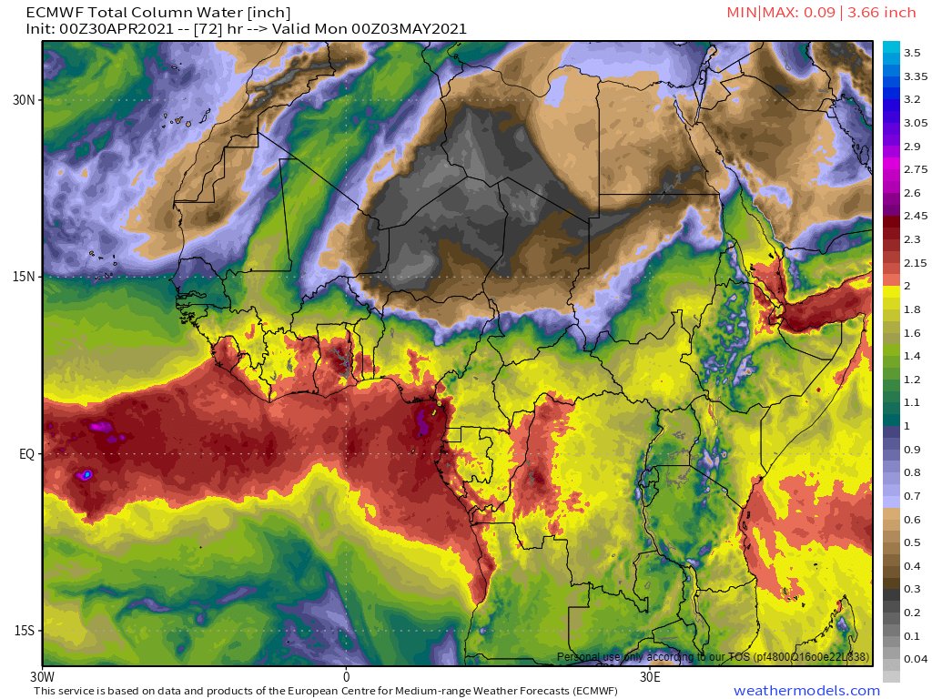
The main action today was in Europe where the strengthening #WestAfricaMonsoon #WMA has today had a spectacular impact on European Weather.
A detailed thread covering those events can be found here.
A detailed thread covering those events can be found here.
https://twitter.com/althecat/status/1388420393741037568?s=20
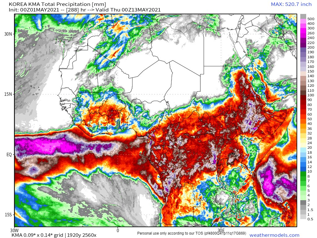
Today's North African long range (12 day) rain forecast is taken from the Korean KMA model as it looks to be a lot closer to what we are seeing in the skies today. 

Today saw another day of strengthening of the #Ethopian #HornOf Africa little rainy season which is no longer that little. Rains are now very active in the highlands, in the south of Sudan, and are increasingly moving up the Sudan Red Sea Coast towards Eqypt.
This second animation starts at 4pm and runs to 7pm. The ongoing flow of #WestAfricanMonsoon air north east from the Central African Republic is continuing to fuel the #Saudi, #Ethiopia and Yemen rains.
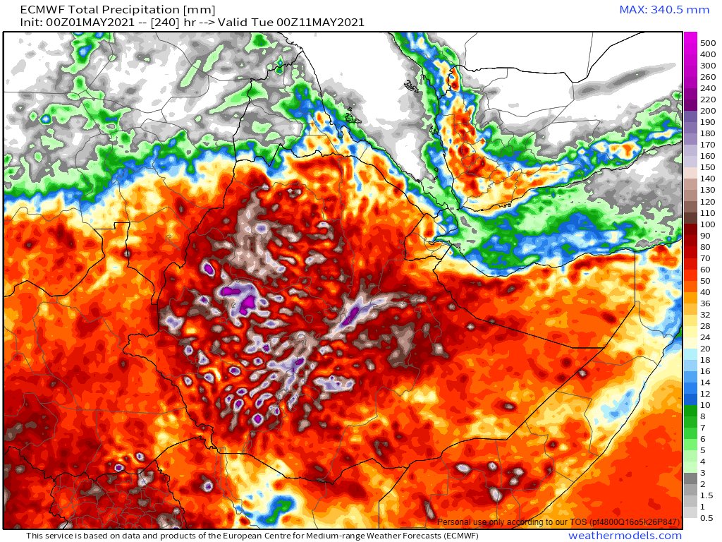
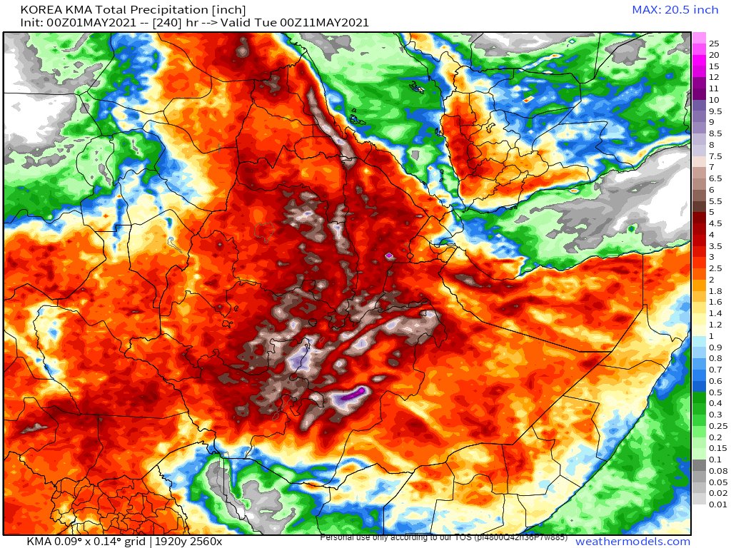
May 1st, 10-day accumulated rain forecasts, for Ethiopia, from the ECMWF, GFS and KMA models.
#Sudan #SouthSudan #Ethiopia #GERD #Africa #HornOfAfrica #DesertRain


#Sudan #SouthSudan #Ethiopia #GERD #Africa #HornOfAfrica #DesertRain


Again today thunderstorms over the holy city of Mecca brought rain into the Holy Mosque Masjid al-Haram and rainfall on the @HolyKaaba.
@saleh_alazzaz tweeted a video of the heaviest rains.
الله أكبر
@saleh_alazzaz tweeted a video of the heaviest rains.
الله أكبر
https://twitter.com/saleh_alazzaz/status/1388504252495147012?s=20
And last night saw spectacular storms across Oman. Tweeted about here by @Arab_Storms
https://twitter.com/Arab_Storms/status/1388206532160999427?s=20
May 1st (#MayDay), 10-day accumulated rain forecasts for the #MiddleEast from GFS, ECMWF, CMC, & KMA weather models.
@Arab_Storms
#ArabianStorms
#KSA #Yemen #Oman #Levant #Jordan #Sudan #UAE #Iraq #Iran #Syria #Kuwait #GERD #NileBasin #HornOfAfrica #DesertRain
الله أعلم


@Arab_Storms
#ArabianStorms
#KSA #Yemen #Oman #Levant #Jordan #Sudan #UAE #Iraq #Iran #Syria #Kuwait #GERD #NileBasin #HornOfAfrica #DesertRain
الله أعلم


May 1st (#MayDay), 3 day, accumulated rain forecasts (to Tuesday at Midnight), for the #MiddleEast from the GFS, ECMWF, CMC & KMA weather models.
@Arab_Storms
#ArabianStorms
#KSA #Yemen #Oman #Jordan #Sudan #Iran #Syria #GERD #Sudan #DesertRain
الله أعلم


@Arab_Storms
#ArabianStorms
#KSA #Yemen #Oman #Jordan #Sudan #Iran #Syria #GERD #Sudan #DesertRain
الله أعلم


Two more images from today's #ArabianStorms coverage by @Arab_Storms follow. The first a fantastic video of the rain falling on and from the @HolyKaaba in Makkah/Mecca.
[Note: Please end me DMs with #EthiopiaStorm images and video.]
https://twitter.com/Arab_Storms/status/1388526383102455810?s=20
[Note: Please end me DMs with #EthiopiaStorm images and video.]
And from the other side of the Sahara, a video of snow falling in Morocco late last night. [HT: @Arab_Storms]
https://twitter.com/Arab_Storms/status/1388421941871136774?s=20
And to end today's bulletin. Three May 1st, ultra long-range, accumulated rain forecasts for the #MiddleEast from the GFS, GEFS (16-day) and KMA (12 day) models.
#ArabianStorms #Ramadan
[NOTE: There is a consensus view on significant rain #Sudan and #Egypt here.]
الله أعلم


#ArabianStorms #Ramadan
[NOTE: There is a consensus view on significant rain #Sudan and #Egypt here.]
الله أعلم


• • •
Missing some Tweet in this thread? You can try to
force a refresh


