,
17 tweets,
10 min read
Read on Twitter
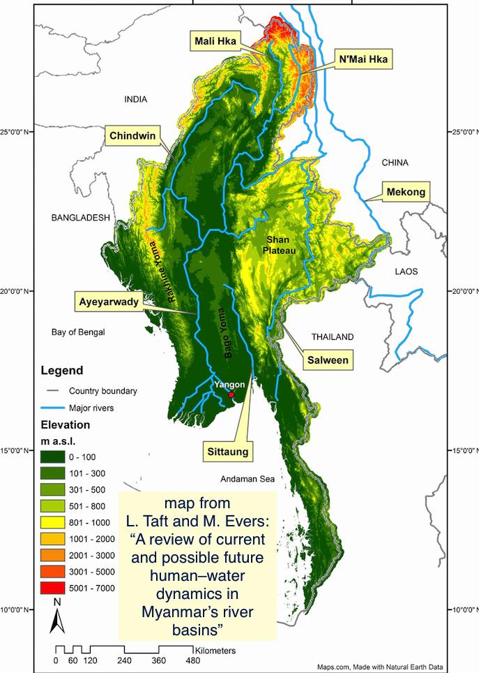
1. This History Thread is about the mighty rivers that have defined Myanmar (Burma.) North-south river valley geology shaped regional history. #Rivers, their tributaries & watersheds continue to have enormous political, agricultural & environmental importance. #dams #biodiversity 
2. From 12th C. BCE populations migrated along #Irrawaddy (Ayeyarwady), #Chindwin, #Salween river valleys to settle in lands that are now known as Myanmar (Burma.) Powerful dynasties rose and fell along the Irrawaddy, including Pyu, Pagan, Ava.

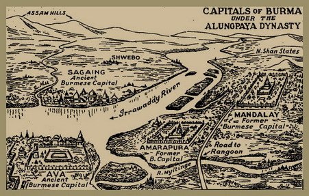
3. British made river port Rangoon (Yangon) colonial capital in 1853. Burma became “rice bowl of Asia” under their exploitation especially in fertile Irrawaddy Delta. River inundation/irrigation can augment monsoon rain for wet rice cultivation. Padi harvest transported by river.
4. River fish have always been an important food source for peoples of Burma/Myanmar. Irrawaddy dolphins still help some fishing communities with catch. In recent years decreasing fish supply and biodiversity due to unsustainable practices, pollution. smithsonianmag.com/videos/fishing…
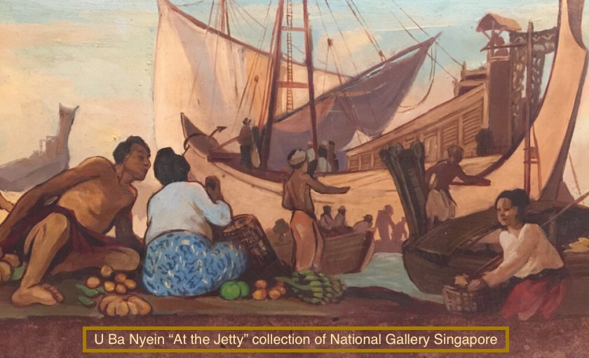
5. Burma (Myanmar) rivers have long been navigated by trading vessels. From dugout canoes to large ferries, river craft powered by oar, sail, steam, petrol. River pirates preyed on cargo boats. Teak logs floated in rafts to sawmills. Goods exported from harbors.

6. During World War 2 as Japan invaded Burma and Allied troops fought to retake the British colony, rivers including Chindwin, Salween, Irrawaddy, Rangoon were strategic barriers and pinch-points. Notably the battle for railway bridge on Sittang River in 1942.

7. Under SLORC/SPDC military dictatorship ‘90s-‘00s Thai schemes to build large dams for energy export & divert water for Thailand included plans for several large Salween dams. None completed yet and community opposition is clear. 60% Myanmar electricity now hydro-generated.

8. A rare free-flowing long river, Salween has major electricity export (Thailand, China) dam projects pending in Shan, Karenni, Karen Sts: Kunlong, Nong Pha, Mong Ton, Ywathit, Hatgyi. Risks: earthquakes, land-grabbing, conflict, siltation, deforestation.
9. 2006 China Power Invest. Corp. project Irrawaddy confluence of Mali & N'Mai Rivers, power for China. #Myitsone revered site #Kachin land. Opponents: neocolonialism, land-grab, earthquake breach, sediment, floods. Suspended 2011; China trying to revive. thediplomat.com/2019/03/myanma…
10. Irrawaddy (Ayeyarwady ) continues through Central Myanmar. As well as Myitsone Dam threat, river suffers from #sandmining on banks, disastrous storm exposure in Delta. Joern Kristensen of MIID calls for better management of “basin’s complex ecosystem” frontiermyanmar.net/en/governing-t…
11. Chindwin River flows from Kachin St. through Sagaing to join Irrawaddy River in Magway. It is polluted by gold mining and agricultural chemicals. Loss of biodiversity, erosion, sedimentation and flooding due to deforestation & coal mining also ongoing. thethirdpole.net/en/2018/10/15/…
12. Kaladan River runs from Mizoram NE India thru S. Chin & Rakhine States. Kaladan, Lemro in Arakan Army war zone. India/Myanmar Kaladan Multi-Modal Transit Project includes river dredging. Manipur River also NE India through Chin St. (dam project on hold since 2011) to Sagaing.

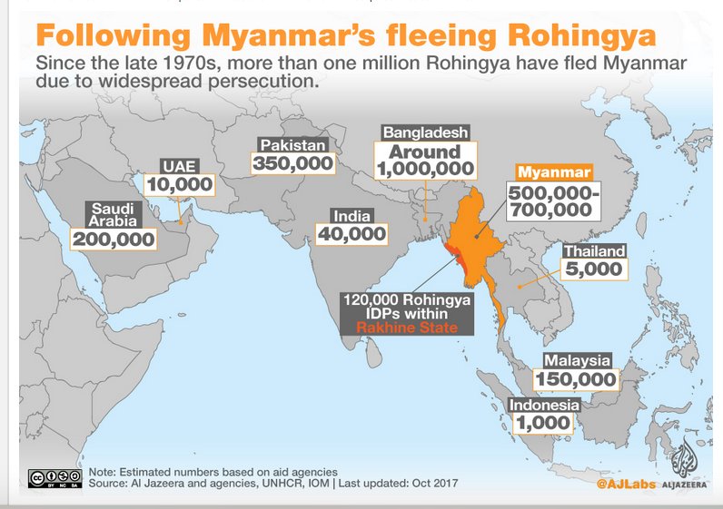
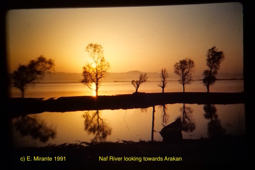
13. Naf River part of border between Bangladesh and Myanmar Rakhine St. (Arakan.) Fishing, transport, smuggling vessels plied wide waterway. In recent years major escape route for Rohingya refugees fleeing N. Rakhine state. 2017 report by @AlexCrawfordSky news.sky.com/story/rohingya…
14. Myanmar Shan State has #Mekong River border w. Laos. Fishing, seaweed gathering, smuggling. Lahu National Development Org. reported blasting rapids & reefs 2002-04 for Chinese transport caused erosion, decreased fish. Watershed logging causes flooding. mmtimes.com/news/mine-lars…
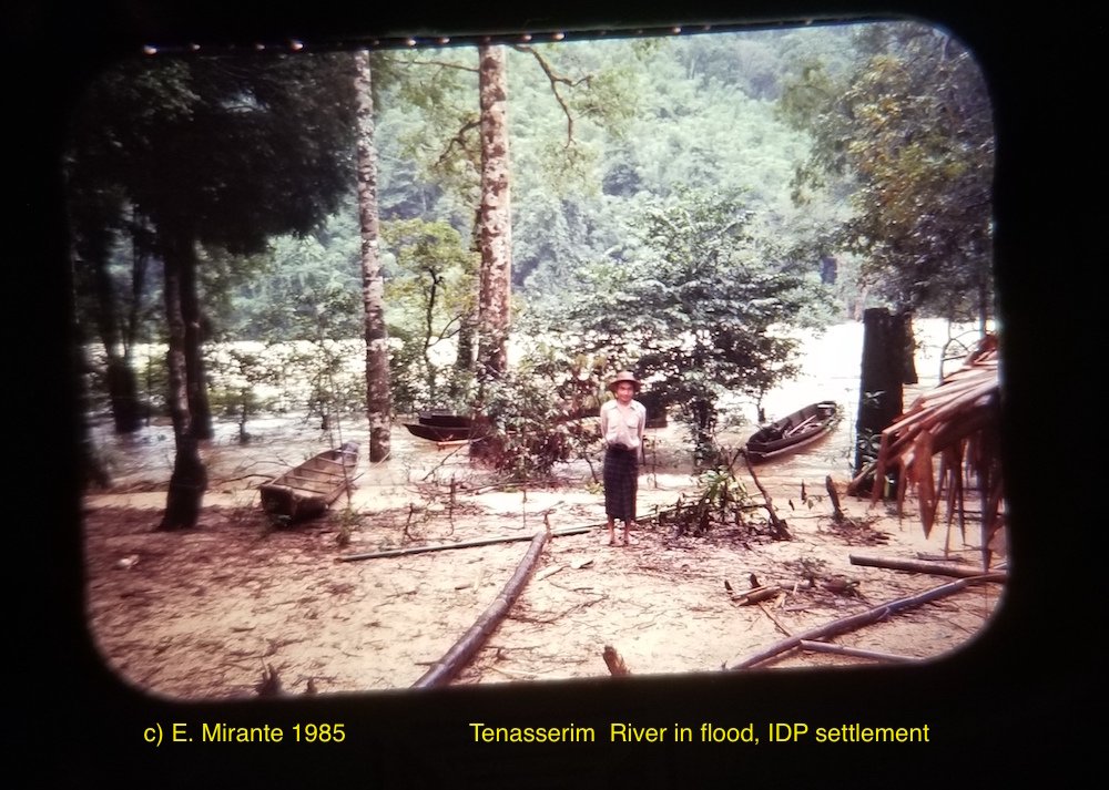
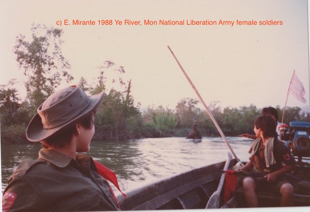
15. Rivers in south incl. Tavoy (Dawei), Ye. Paw Klo & Kamoethway tributaries of Tenasserim (Tanintharyi) which reaches Andaman Sea. Watershed polluted by tin, tungsten, gold, coal mines. Deforestation = severe flooding. Community fish conservation zones.
16. Riparian Myanmar highly vulnerable to Climate Crisis. Melting glaciers headwaters of Salween, Irrawaddy, Mekong. Mangrove cutting on Irrawaddy Delta increased ’08 Cyclone Nargis devastation. 2018 monsoon flooding included dam breach Bago (Pegu) region. nytimes.com/2018/07/30/wor…
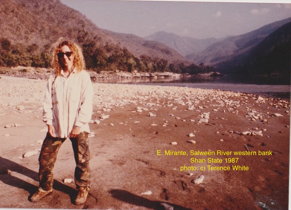
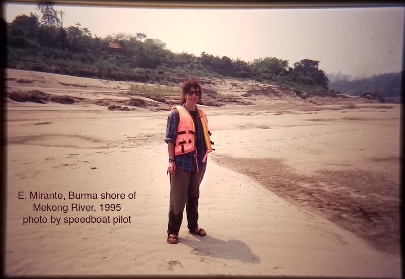
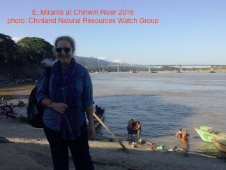
17/17. Many dedicated groups & individuals in Burma (Myanmar) work to save their rivers & watersheds. @BRN_Tweets distributes information and connects activists. My previous Burma History Threads and Project Maje report archive are at projectmaje.org Pix of me + rivers: