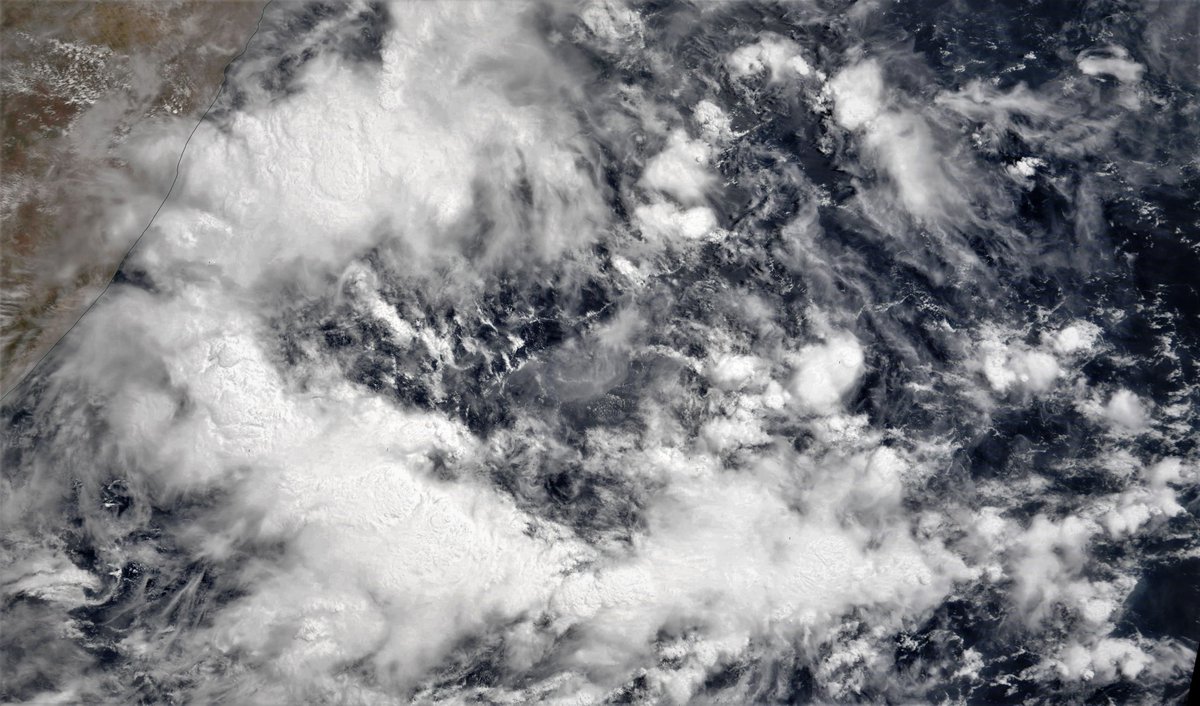
#Ethiopia the #RedSea coast of #SaudiArabia #Yemen #Somalia and #Oman all experienced spectacular thunderstorm activity today.
Today's #HornOfAfrica and #ArabianStorm rainfall forecasts follow:
Today's #HornOfAfrica and #ArabianStorm rainfall forecasts follow:
First up today, long range @NOAA forecast models are now forecasting a cyclone may form in the Arabian Sea, providing a timely warning of the risk to those in the region. See thread here >> 
https://twitter.com/althecat/status/1390316493938831364?s=20
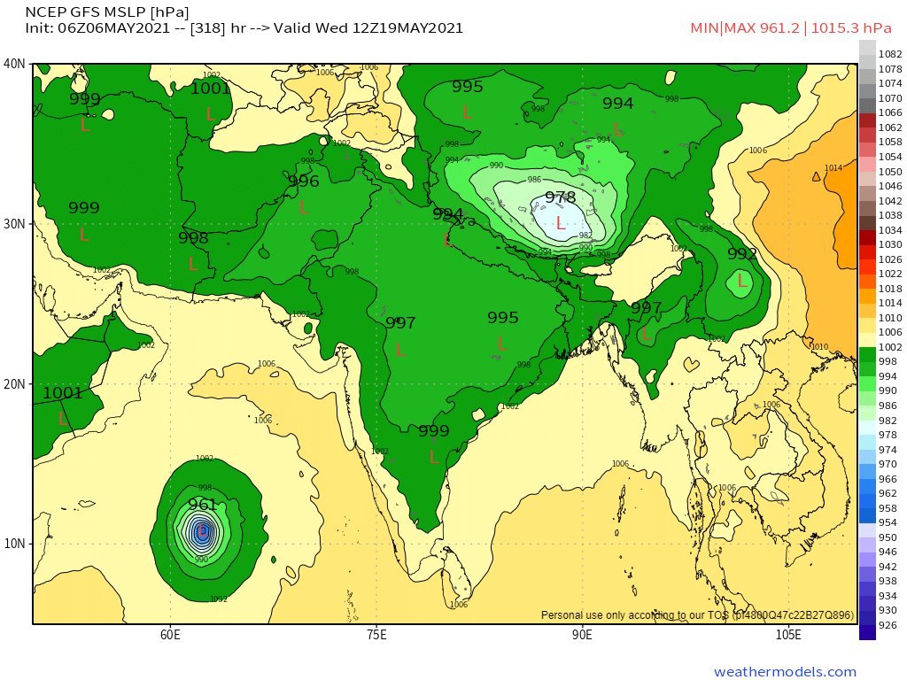
The most important thing about these forecasts is to understand they are an early warning system about the possibility of a cyclone forming, not a forecast that one will do so.
If a threat materialises you will see official advice and warnings here >>
metoc.navy.mil/jtwc/jtwc.html
If a threat materialises you will see official advice and warnings here >>
metoc.navy.mil/jtwc/jtwc.html
The long range KMA 10 day forecast for North Africa now shows possible rainfall from the cyclone on the right hand side.

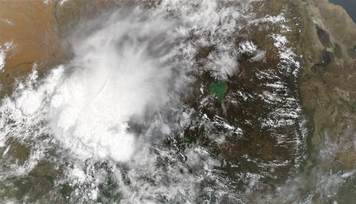
A satellite image, taken this morning by @NASA
Modis, shows the horn-like part of the Horn of Africa and most of the ancient lands of Somaliland and Somalia which have recently experienced flooding due to high levels of rainfall in the Ethiopian Highlands.
Modis, shows the horn-like part of the Horn of Africa and most of the ancient lands of Somaliland and Somalia which have recently experienced flooding due to high levels of rainfall in the Ethiopian Highlands.

@walia_x tweeted these photographs of flooding in the Ethiopia Somali region a few days ago. Since then the floods got a lot worse.
@Arab_Storms and I are seeking eyewitness reports of storm and rain related events. (just tag us)
@Arab_Storms and I are seeking eyewitness reports of storm and rain related events. (just tag us)
https://twitter.com/walia_x/status/1386021320442384394?s=20
May 5th, 10-day accumulated rain forecasts, for Ethiopia and the Horn of Africa from the @ECMWF, GFS and KMA weather models.
#Sudan #SouthSudan #Ethiopia #GERD #Africa #HornOfAfrica #DesertRain
#Sudan #SouthSudan #Ethiopia #GERD #Africa #HornOfAfrica #DesertRain


Correction^^ these are for May 6th.
And here areMay 6th, 3-day accumulated rain forecasts, to Midnight Sunday, for #Ethiopia and the Horn of Africa, again from the @ECMWF, GFS and KMA weather models.
#Sudan #SouthSudan #Ethiopia #GERD #Africa #HornOfAfrica #DesertRain
And here areMay 6th, 3-day accumulated rain forecasts, to Midnight Sunday, for #Ethiopia and the Horn of Africa, again from the @ECMWF, GFS and KMA weather models.
#Sudan #SouthSudan #Ethiopia #GERD #Africa #HornOfAfrica #DesertRain


And now a couple of tweets from @Arab_Storms who is based in the #UAE. Here we see an image taken today in the @HolyKaaba where it is currently raining again. #RamadanRain #Makkah.
https://twitter.com/Arab_Storms/status/1390329302755864578?s=20
And here is a video of flooding today in Algeria.
https://twitter.com/Arab_Storms/status/1390332611550089223?s=20
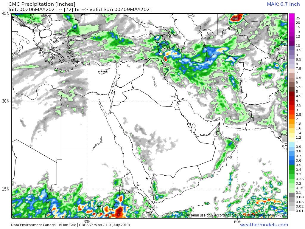
Here are today's, May 5th, 10 day accumulated rain forecasts, for the #MiddleEast from the GFS, ECMWF, CMC & KMA weather models.
@Arab_Storms
#ArabianStorms
#KSA #Yemen #Oman #Jordan #Sudan #Iran #Syria #GERD #Sudan #DesertRain
الله أعلم
@Arab_Storms
#ArabianStorms
#KSA #Yemen #Oman #Jordan #Sudan #Iran #Syria #GERD #Sudan #DesertRain
الله أعلم


As you can see the latest GFS model is predicting that the Cyclone (as yet hypothetical) will make landfall near the border of #Oman and #Yemen.
This animation shows two more spectacular #ArabianStorms in the early hours this morning.
This animation shows two more spectacular #ArabianStorms in the early hours this morning.
And here are today's May 6th, 3 day accumulated rain forecasts (to Saturday at Midnight), for the #MiddleEast from the GFS, ECMWF, CMC & KMA weather models.
@Arab_Storms
#ArabianStorms
#KSA #Yemen #Oman #Jordan #Sudan #Iran #Syria #GERD #Sudan #DesertRain
الله أعلم
@Arab_Storms
#ArabianStorms
#KSA #Yemen #Oman #Jordan #Sudan #Iran #Syria #GERD #Sudan #DesertRain
الله أعلم


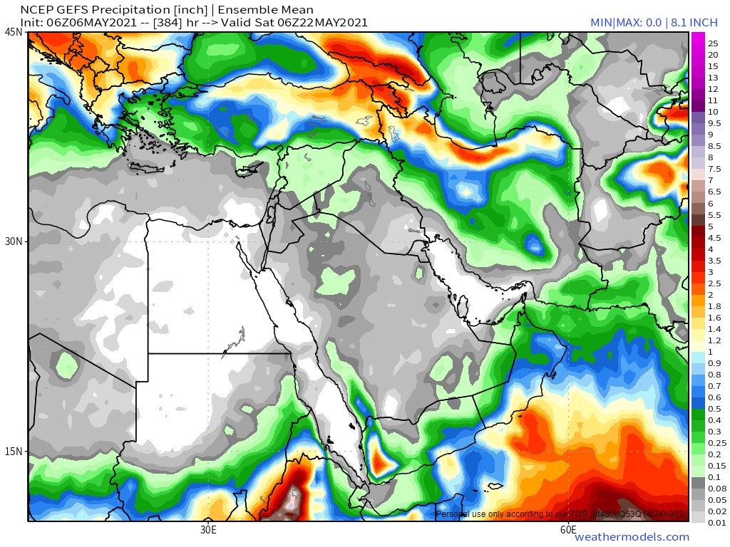
And the final forecast for tonight for the #MiddleEast contains the two ultra-long range computer model forecasts, NOAA's 16-Day GFS (of which the GEFS is the Ensemble version - averaging out many model runs) + Korea's 12 day KMA model.
الله أعلم
ENDS
الله أعلم
ENDS


• • •
Missing some Tweet in this thread? You can try to
force a refresh