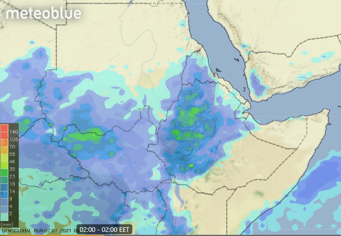
Today we open the #NorthAfrica #MiddleEast #HornOfAfrica #GERD rainfall forecasts with some new plots, courtesy of @meteoblue. This first one is a 24 hour estimate of rainfall till 9pm today over Ethiopia.
Green = 1 inch of rain over the #Abo & #Abbay basins.
Green = 1 inch of rain over the #Abo & #Abbay basins.

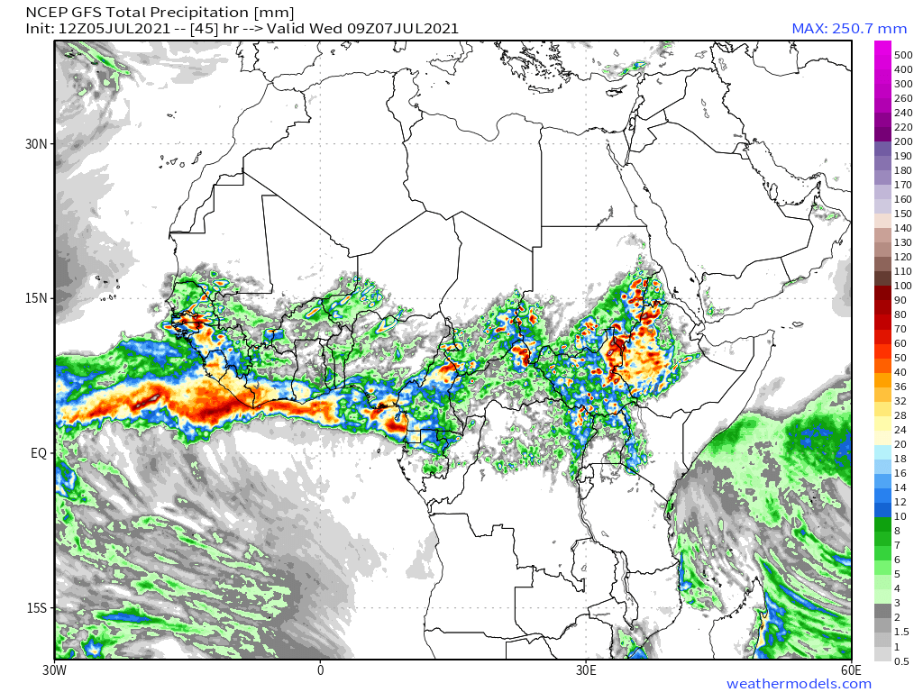
This satellite data based plots shows estimated rainfall over the last three days of rainfall across North Africa. #DesertRain is falling across all the Sahel. In Sudan and Chad nearly an inch in the past three days.

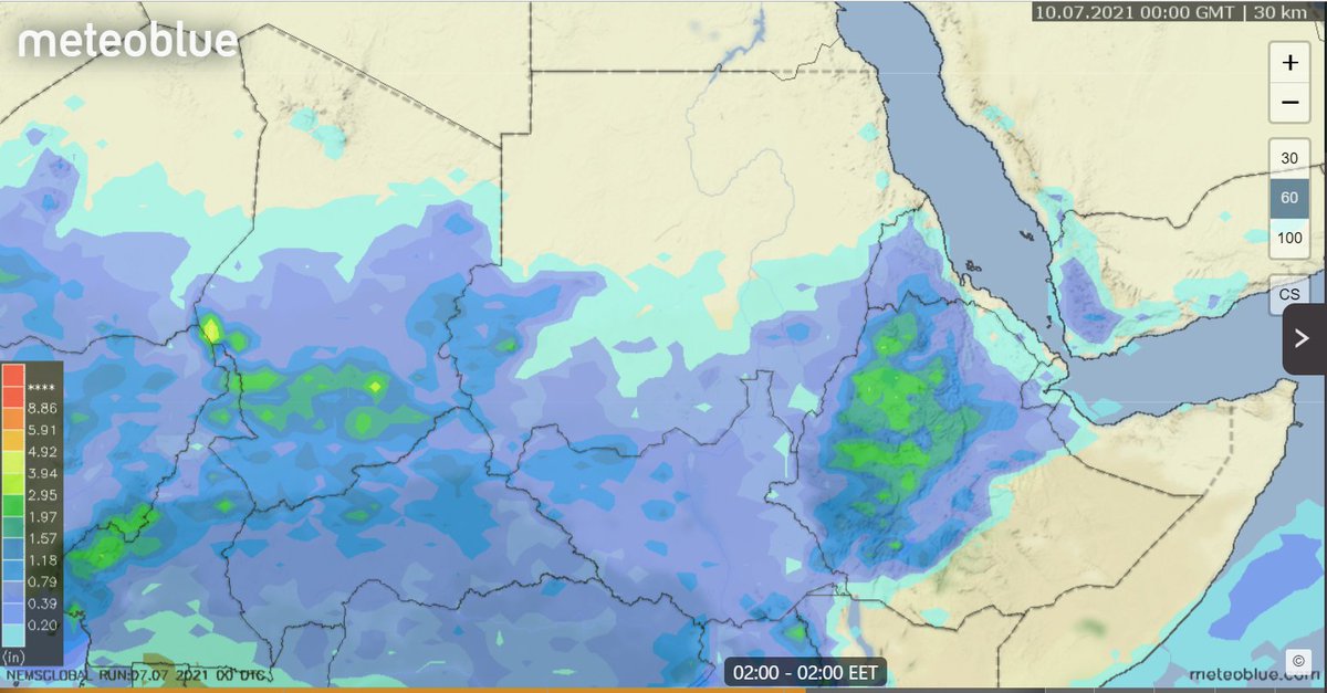
This one shows a close up over the horn of Africa which shows the rainfall during days 3-6 of the #GERD filling period over the #Abbay basin - where 3 to 5 inches of rain has fallen.

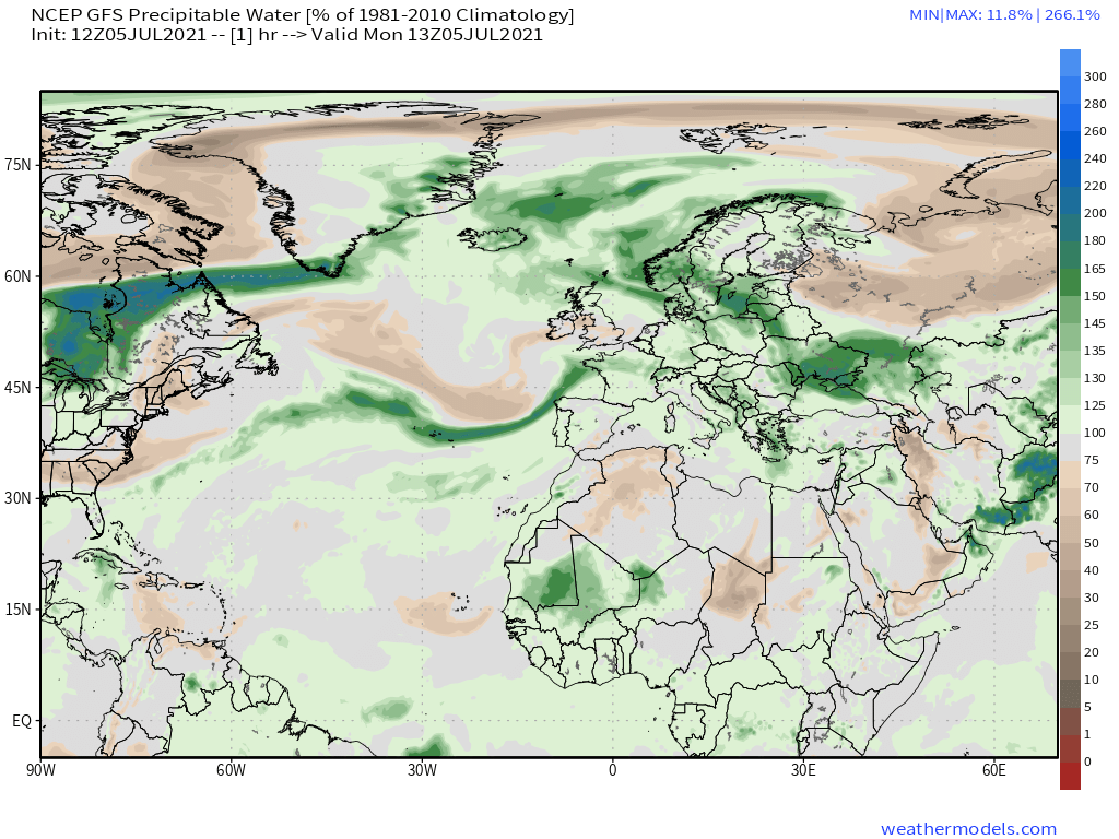
And the full monsoon is yet to begin. The first of these maps shows PWAT (precipitable water in the atmosphere) over the Middle East as of today.
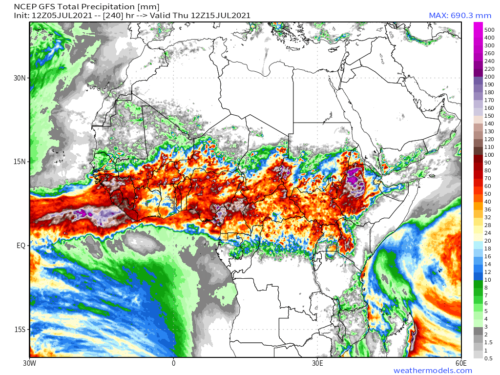
The 2nd and third images show the GFS model forecasts July 10th and July 15th.
The fortnight ahead will be very interesting.
The 2nd and third images show the GFS model forecasts July 10th and July 15th.
The fortnight ahead will be very interesting.


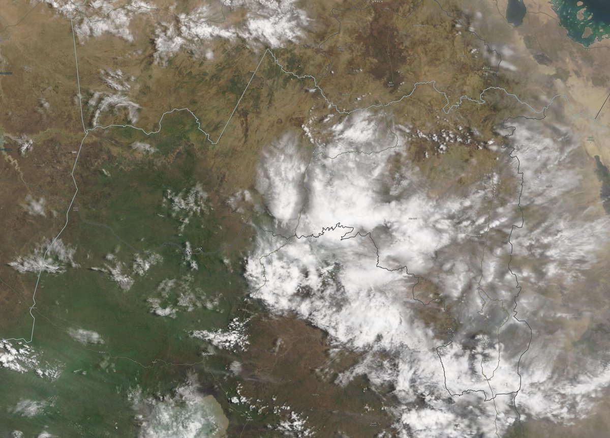
This image shows clouds over Ethiopia as night was falling this evening.
We know, thanks to @TirusewAsefa, that the little rainy season was unusually intense in rainfall terms. We are about to find out whether Nile basin rainfall is about to push past historical highs again.
We know, thanks to @TirusewAsefa, that the little rainy season was unusually intense in rainfall terms. We are about to find out whether Nile basin rainfall is about to push past historical highs again.

Today's big picture again shows the full North Western Hemisphere.
As this bulletin is being published TS #Elsa is crossing Cuba and bringing torrential rains.
In the north east where I am in France it is currently raining, and will do for the next week it seems.
As this bulletin is being published TS #Elsa is crossing Cuba and bringing torrential rains.
In the north east where I am in France it is currently raining, and will do for the next week it seems.

This animation shows the Western Sahara this evening where nightfall is now consistently bringing cloud formation as the temperature falls.
Today's 10-Day Rainfall forecasts for North Africa from July 5th through July 16th. The GFS and CMC and KMA models are now forecasting widespread rainfall over Yemen towards the end of the forecast period.


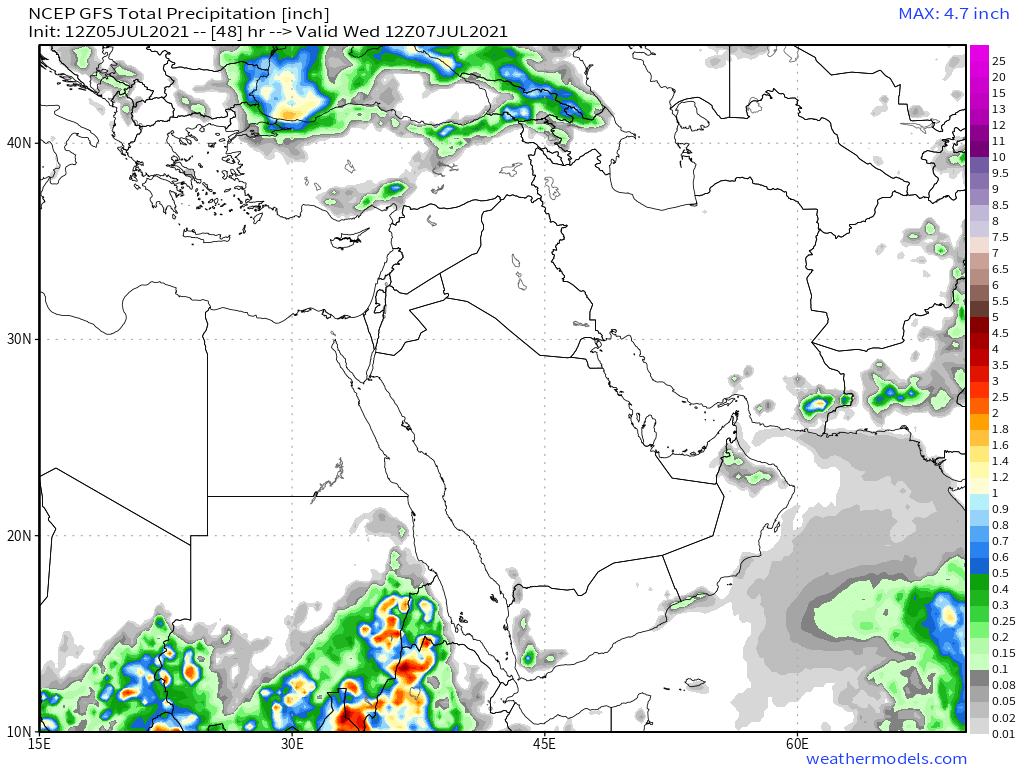
48-hour rainfall forecasts (today and tomorrow from the same four models: the Euro @ECMWF, U.S. @NOAA's GFS, Canada's CMC and the Korean KMA and models.


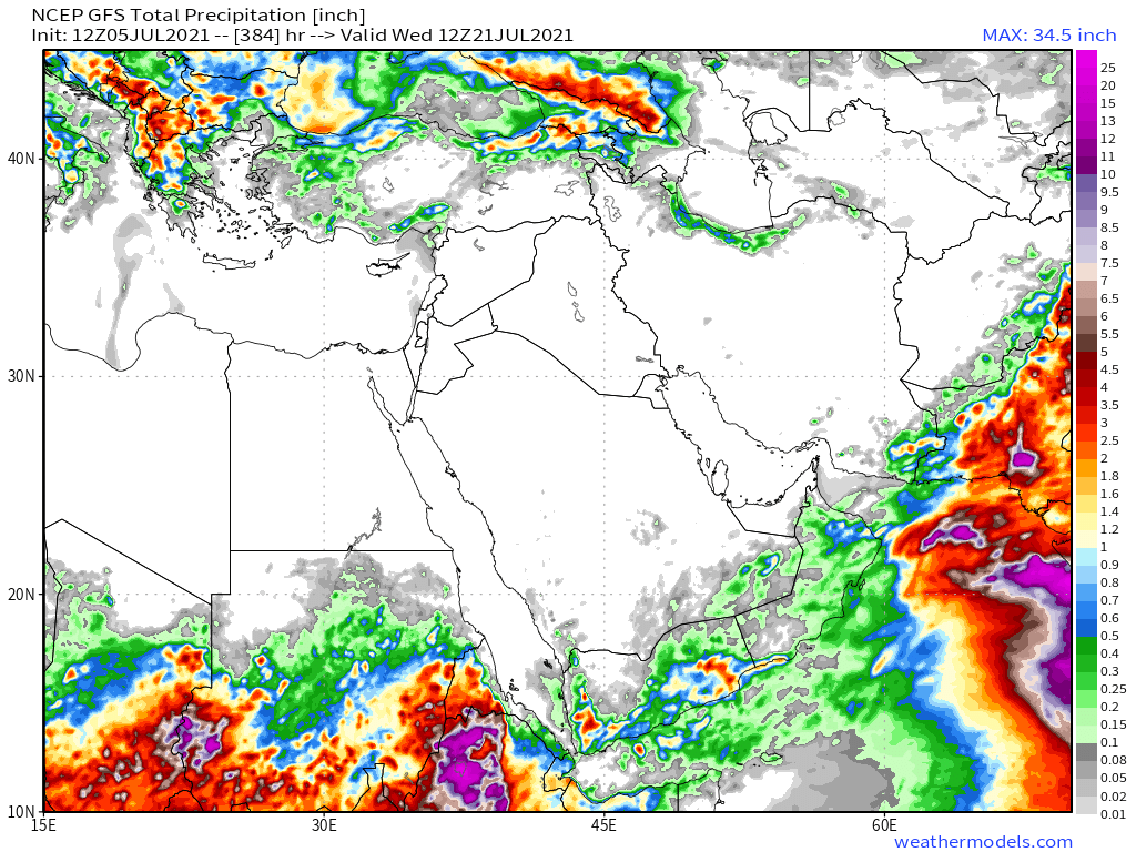
And finally for #NorthAfrica we have the long-range 16-day (GFS) and 12-day (KMA) forecasts - which are now remarkably well aligned.


This animation shows the first part of today's setup over the Horn of Africa. In the morning cloud is dispersed and then the new storms form over the #Abbay in the afternoon.
This animation picks up after the first one ends and shows the storms building up towards sunset.
Today's July 5th 10-day rainfall forecasts for #Ethiopia and the #HornOfAfrica including #Somalia, #Somaliland, eastern parts of #SouthSudan, south eastern parts of Sudan, #Djbouti and #Eritrea.
Significant rains are now forecast for Somaliland.
Significant rains are now forecast for Somaliland.


48 Hour forecasts (today and tomorrow) from the same three models. Over this period significant rainfall is not yet forecast for #Somaliland, but it does appear to be coming soon. #Tigray however has widespread rain.


Finally here we see the 12-day KMA forecast which shows up to 3 inches of rain falling in Western #Somaliland .

Here's a view of today's #ArabianStorms. The most spectacular storms are on the Western Coast of #Yemen and once again we see explosive convective storms in #Oman. In #SaudiArabia along the coast light rain is shown in radar data.
Courtesy of @Arab_Storms we have some new eyewitness videos. This first one shows one of those amazing storms over Oman.
https://twitter.com/Arab_Storms/status/1412123029077901315?s=20
... And here we see the consequences a raging torrent of water coming down an #Oman mountain valley.
https://twitter.com/Arab_Storms/status/1412098940099461122?s=20
... And here a spectacular waterfall. Also in #Oman.
https://twitter.com/Arab_Storms/status/1412065376981094404?s=20
This video shows what it is like to be out driving in one of these storms.
https://twitter.com/Arab_Storms/status/1412065026018529281?s=20
And here we see the downstream consequences in populated areas.
https://twitter.com/Arab_Storms/status/1412016491587907585?s=20
10-Day July 5th, accumulated rain forecasts for the #MiddleEast from the GFS, CMC, KMA & ACG weather models.
#ArabianStorms
#KSA #Yemen #Oman #Jordan #Sudan #Iran #Syria #GERD #Sudan #DesertRain
الله أعلم
#ArabianStorms
#KSA #Yemen #Oman #Jordan #Sudan #Iran #Syria #GERD #Sudan #DesertRain
الله أعلم


48 Hour July 5th (today and tomorrow), accumulated rain forecasts for the #MiddleEast from the GFS, CMC, KMA and ACG weather models.
#ArabianStorms
#KSA #Yemen #Oman #Jordan #Sudan #Iran #Syria #GERD #Sudan #DesertRain
الله أعلم
#ArabianStorms
#KSA #Yemen #Oman #Jordan #Sudan #Iran #Syria #GERD #Sudan #DesertRain
الله أعلم


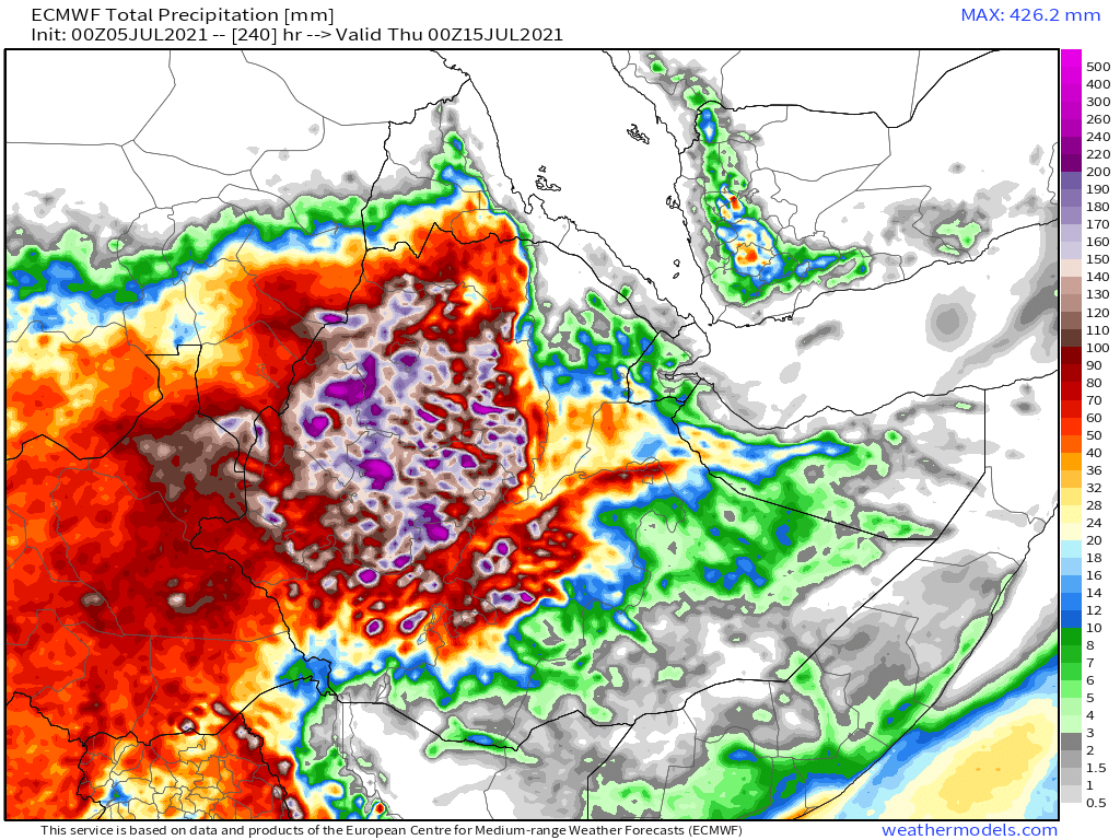
As always the final rainfall forecasts are long range July 4th forecasts. Today we have 16-day GFS & GEFS models, the 12 day KMA and the 15 day EPS (Euro ensemble) model forecasts for the #MiddleEast.
All now show #DesertRain in #Yemen #Oman and Southern #SaudiArabia
الله أعلم
All now show #DesertRain in #Yemen #Oman and Southern #SaudiArabia
الله أعلم


& here is our daily rounded picture of the full North Western Hemisphere. Zero hour simulation data from the GFS.
1. PWAT (potential rain + energy)
2. MLSP (Mean Sea Level Pressure)
3. Precipitable water PWAT anomaly
4. 250Hpa (jet stream winds approx 11kms high)
1. PWAT (potential rain + energy)
2. MLSP (Mean Sea Level Pressure)
3. Precipitable water PWAT anomaly
4. 250Hpa (jet stream winds approx 11kms high)


^^ This16 day GFS animation is my starting point for understanding the dynamics of the North Western Hemisphere's changes.
The water comes in at the bottom right (from India and SEA) and then circles up through the Atlantic arriving where I live in France about a month later.
The water comes in at the bottom right (from India and SEA) and then circles up through the Atlantic arriving where I live in France about a month later.
It's long range predictive accuracy is not great except at a large scale systemic and intensity level. In those areas it is pretty good.
/ENDS
@Threadreaderapp unroll
/ENDS
@Threadreaderapp unroll
... Threadfix ...
https://twitter.com/althecat/status/1412133353470447619?s=20
• • •
Missing some Tweet in this thread? You can try to
force a refresh