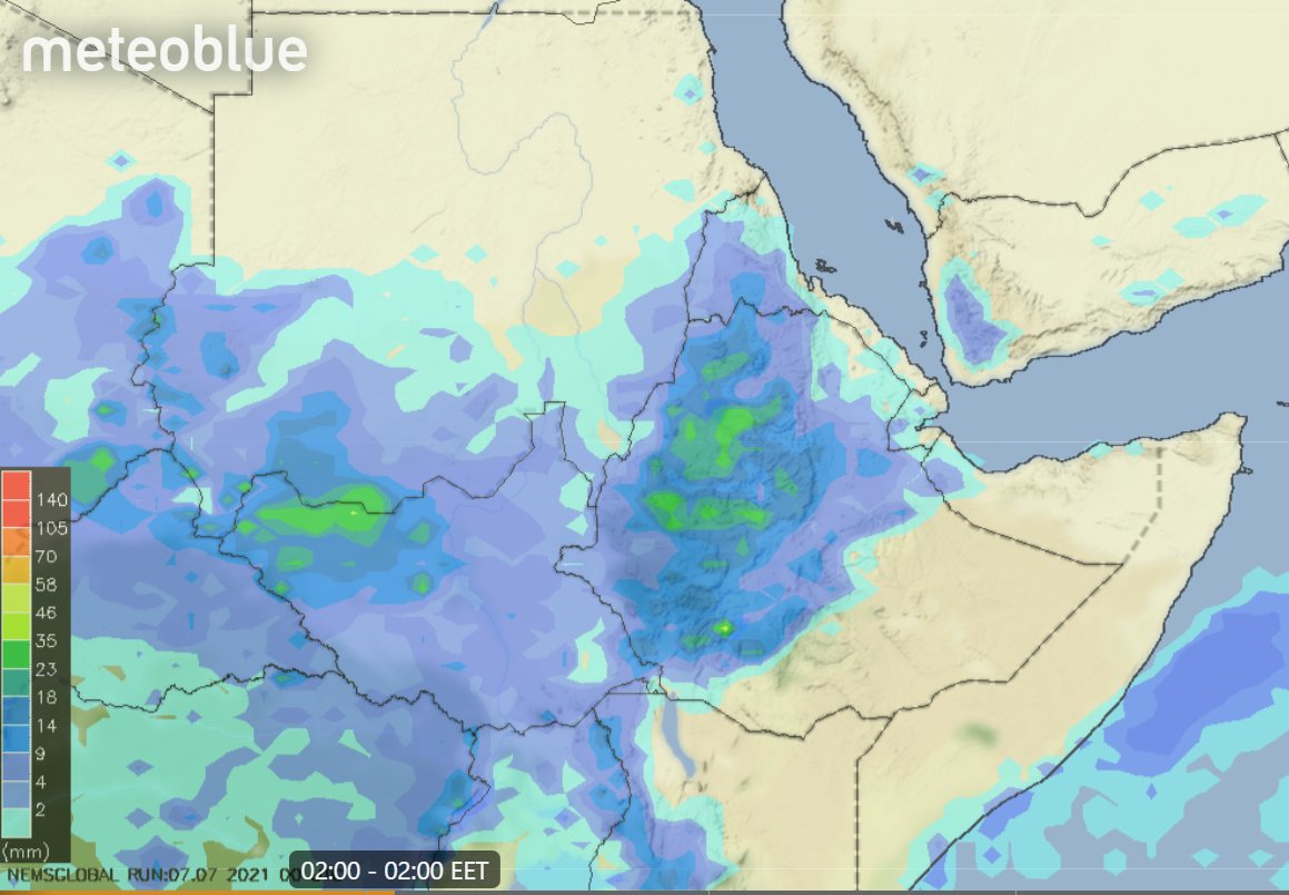
Over 24hrs 25-60mms rain has fallen over all three Nile tributaries with the heaviest falling over the #Abbay in Ethiopia's highlands which feeds the #GERD. Here we see an image of storms starting up this morning.
Rain forecasts will follow.
Thread contains rainfall update.
Rain forecasts will follow.
Thread contains rainfall update.
https://twitter.com/althecat/status/1412364266682957838
I jumped the gun calling the beginning of #GERD filling on1 July - as the big rainy season began.
Official news of filling came yesterday in the form of an objection to the filling from Egypt after being notified by #Ethiopia that it is underway.
Official news of filling came yesterday in the form of an objection to the filling from Egypt after being notified by #Ethiopia that it is underway.
https://twitter.com/althecat/status/1412166136049831940?s=20
#GERD filling is expected to be less than 13.5 Billion Cubic Meters as time ran out to raise the dam to the height needed to hold this amount of water.
When the filling is completed spilling over the center of the dam will resume as you can see in this image below from 2020.
When the filling is completed spilling over the center of the dam will resume as you can see in this image below from 2020.

On Thursday the UN Security Council will meet for the second time in 2 years to discuss the dispute over the #GERD filling between Ethiopia and Egypt+Sudan. This @AJEnglish report from last year is about the first meeting.
Full video of the last UNSC meeting is available from the UN Audiovisual Library here >> unmultimedia.org/avlibrary/asse…

[NOTE: These daily rainfall weather bulletins are intended - in large part - to provide useful information to inform this dispute.
Thanks to bountiful rainfall, there is no real concern in 2021 of shortage of water. The larger risk now may be flooding issues.]
Thanks to bountiful rainfall, there is no real concern in 2021 of shortage of water. The larger risk now may be flooding issues.]
Today's rainfall forecasts for the #HornOfAfrica, #NorthAfrica & the #MiddleEast follow. Beginning with North Africa.
Today's big picture shows the region today including a massive storm over West Sudan and today's storms starting up over Ethiopia's highlands.
Today's big picture shows the region today including a massive storm over West Sudan and today's storms starting up over Ethiopia's highlands.

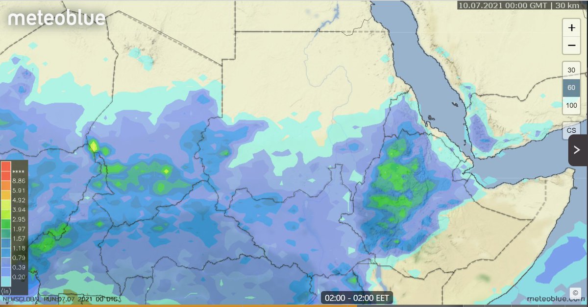
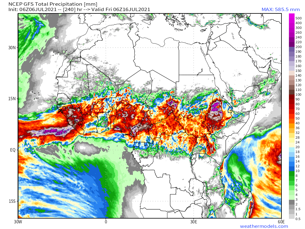
Today's 10-Day Rainfall forecasts for North Africa from July 6th through July 17th.
All models are now forecasting widespread rainfall over Yemen towards the end of the forecast period.
All models are now forecasting widespread rainfall over Yemen towards the end of the forecast period.


This image shows rain over the region over the last 48 hours as measured by satellite [Src @Meteoblue]

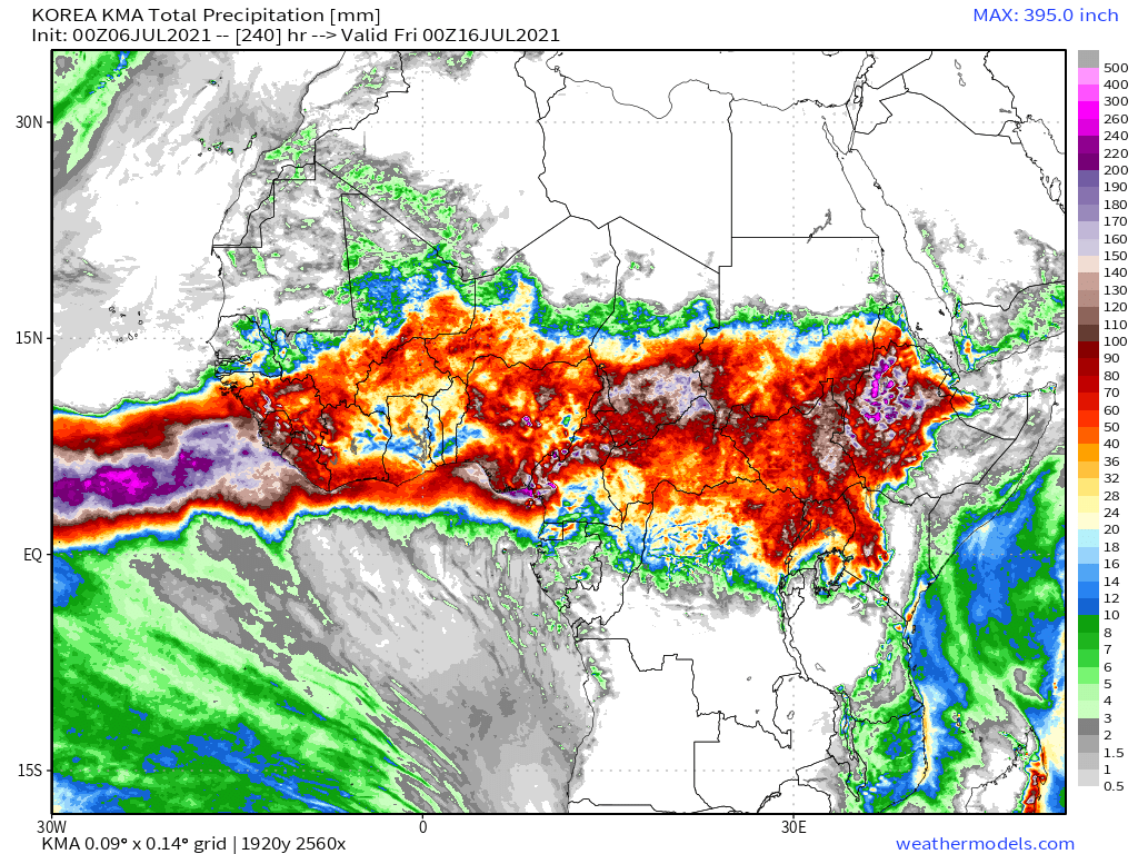
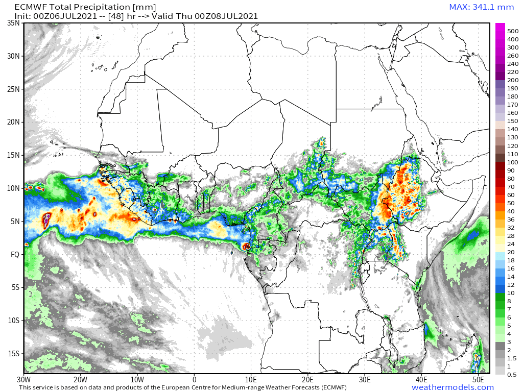
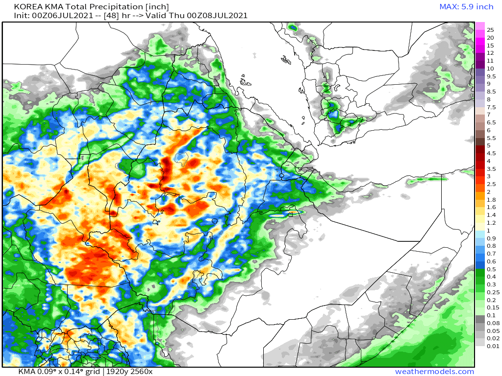
48-hour rainfall forecasts (today and tomorrow from the same four models: the Euro @ECMWF, U.S. @NOAA's GFS, Canada's CMC and the Korean KMA models.


And finally for #NorthAfrica we have the long-range 16-day (GFS) and 12-day (KMA) forecasts - which are now remarkably well aligned, albeit with the KMA now forecasting rain across Sudan up to the Egyptian border.


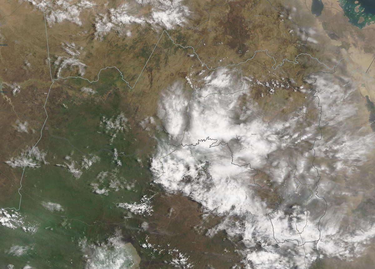
Satellite images from this morning.
The first image shows a glimpse of one of the arms of the #GERD dam lake.
The second image shows the entire area of Nile Basin watersheds, including a massive storm front extending from Sudan to Uganda.
The first image shows a glimpse of one of the arms of the #GERD dam lake.
The second image shows the entire area of Nile Basin watersheds, including a massive storm front extending from Sudan to Uganda.


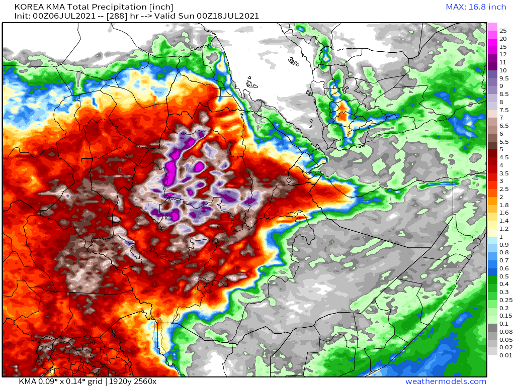
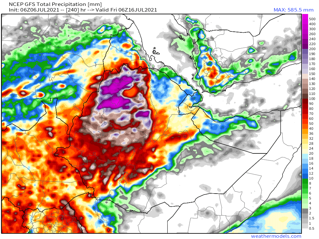
Today's July 6th 10-day rainfall forecasts for #Ethiopia (+1 12-day) and the #HornOfAfrica including #Somalia, #Somaliland, eastern parts of #SouthSudan, south eastern parts of Sudan, #Djbouti and #Eritrea.
Significant rains are now forecast for Somaliland.
Significant rains are now forecast for Somaliland.


48 Hour forecasts (today and tomorrow) from the same three models. Over this period significant rainfall is not yet forecast for #Somaliland, but it does appear to be coming soon. #Tigray however has widespread rain.


Today's #ArabianStorms this afternoon.
In today's @Arab_Storms eyewitness videos we have hail in Abha, Saudi Arabia and more torrents in Oman.
https://twitter.com/Arab_Storms/status/1412426689980870656?s=20
.. this last Oman torrent is particularly wide.
https://twitter.com/Arab_Storms/status/1412404319178178570?s=20
10-Day July 7th, accumulated rain forecasts for the #MiddleEast from the GFS, CMC, KMA & ACG weather models showing even more #DesertRain in #Yemen and #Oman.
#ArabianStorms
#KSA #Yemen #Oman #Jordan #Sudan #Iran #Syria #GERD #Sudan #DesertRain
الله أعلم
#ArabianStorms
#KSA #Yemen #Oman #Jordan #Sudan #Iran #Syria #GERD #Sudan #DesertRain
الله أعلم


48 Hour July 5th (today and tomorrow), accumulated rain forecasts for the #MiddleEast from the GFS, CMC, KMA and ACG weather models.
#ArabianStorms
#KSA #Yemen #Oman #Jordan #Sudan #Iran #Syria #GERD #Sudan #DesertRain
الله أعلم
#ArabianStorms
#KSA #Yemen #Oman #Jordan #Sudan #Iran #Syria #GERD #Sudan #DesertRain
الله أعلم


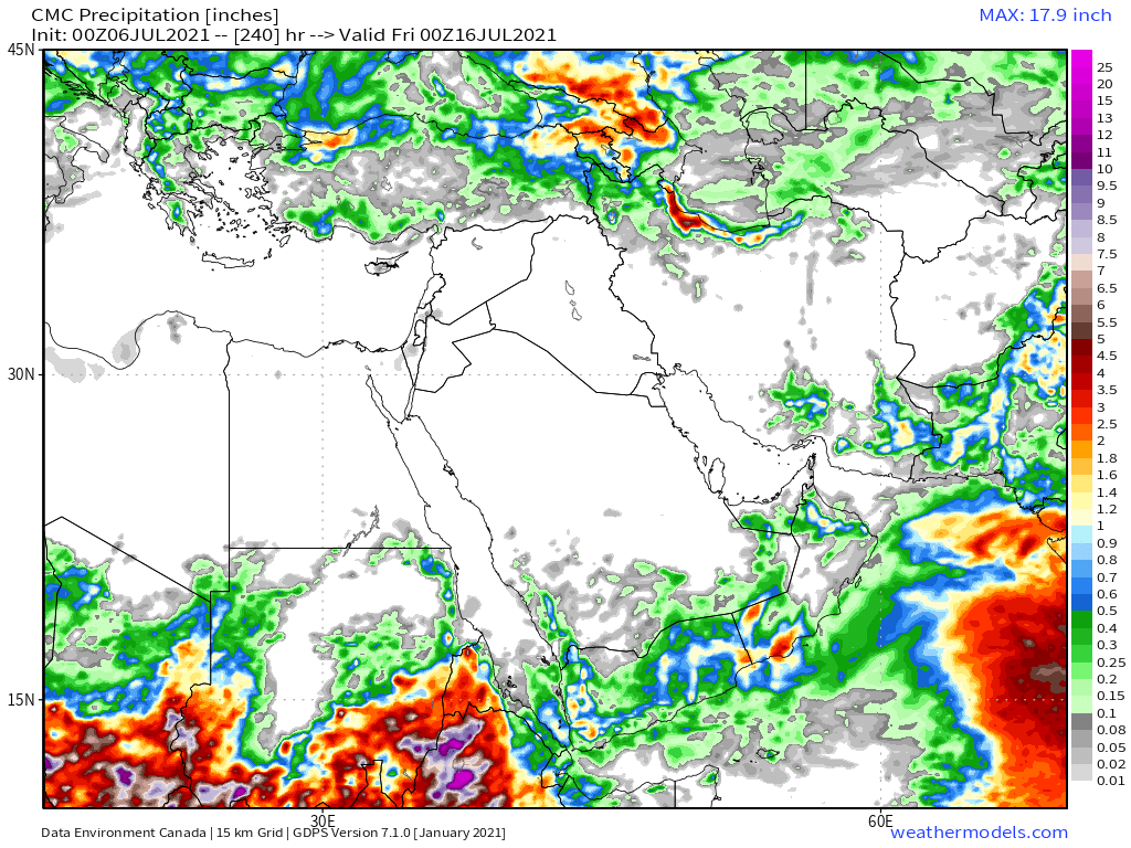
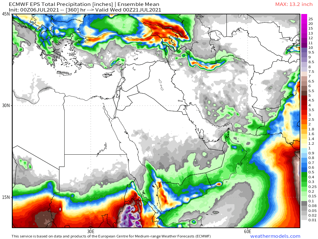
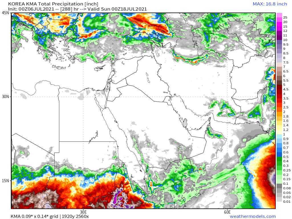
Our final rainfall forecasts are long range July 6th rainfall forecasts. The16-day GFS & GEFS models, the 12 day KMA and the 15 day EPS (Euro ensemble) model forecasts for the #MiddleEast.
All now show #DesertRain in #Yemen #Oman and Southern #SaudiArabia
الله أعلم
All now show #DesertRain in #Yemen #Oman and Southern #SaudiArabia
الله أعلم


Our daily rounded picture of the full North Western Hemisphere. Zero hour simulation data from the GFS.
3. Precipitable water PWAT anomaly
2. PWAT (potential rain + energy)
3. MLSP (Mean Sea Level Pressure)
4. 250Hpa (jet stream winds approx 11kms high)
3. Precipitable water PWAT anomaly
2. PWAT (potential rain + energy)
3. MLSP (Mean Sea Level Pressure)
4. 250Hpa (jet stream winds approx 11kms high)


The final animation's today shows an interesting development which may bring #DesertRain even further north in Chad and Sudan in coming days - and a couple of days later in the Western Sahara.
/ENDs
@Threadreaderapp unroll
@Threadreaderapp unroll
• • •
Missing some Tweet in this thread? You can try to
force a refresh