In this thread, a summary of my OSINT analysis of a DRDO video of the Mar 27 Indian #ASAT test. I will show that the kill vehicle hit #Microsat-r in an upwards direction, not "head on" as the DRDO claims.
@ssc_nl @nktpnd @brianweeden @wslafoy @planet4589 @Genevaexpat
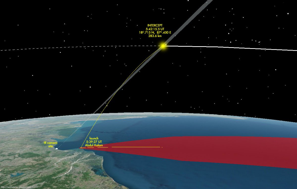
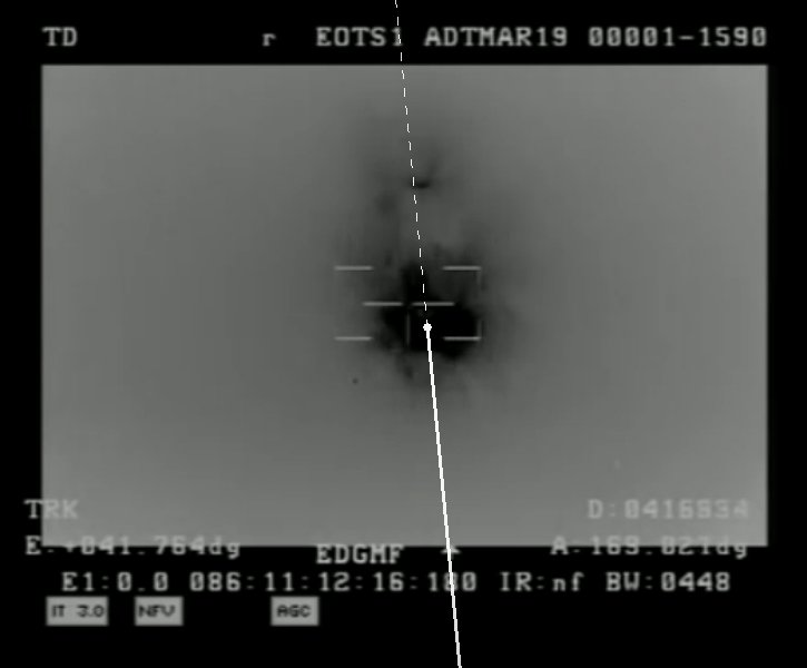
The Indian DRDO released a video documentary on #MissionShakti. Part of this video is imagery from an earth-based IR camera, that shows the missile hit and destroy Microsat-r:
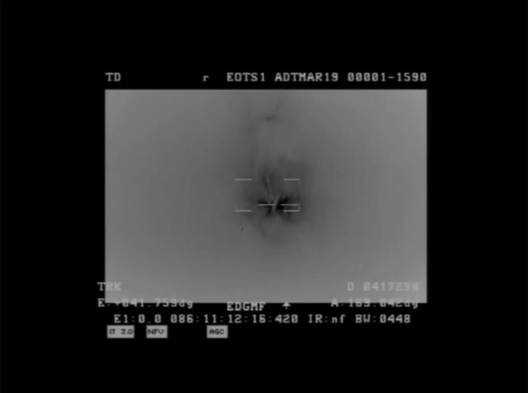
I first thought the range and azimuth data concerned the satellite (and for the impact moment it by definition does), but after noting the range data went up instead of down, it was clear that these data actually concern telemetry from the missile (!).
And what is more: these telemetry data provide proof that the missile did *not* hit the target satellite "head-on", i.e. contradicting what DRDO chairman Sateehs is claiming here:
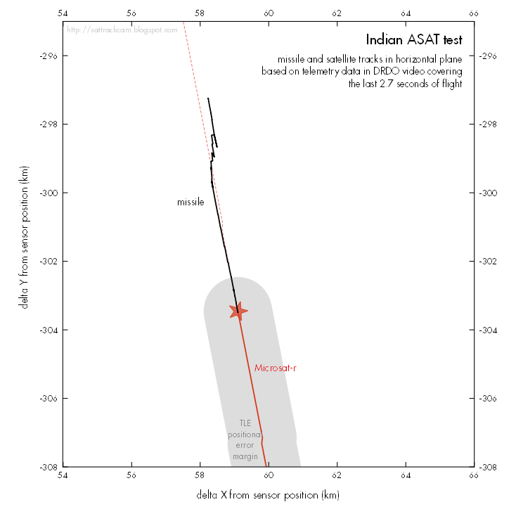
Knowing that position, the telemetry data (azimuth, elevation and range) from the other video frames can then be used to map the missile location, and in doing so reconstruct the final part of the missile trajectory!
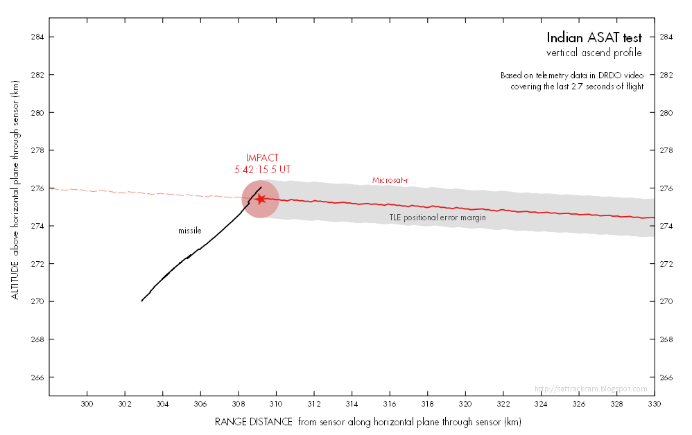
Hence, it is important to realise that altitudes in the diagrams below, are *not* altitudes with respect to Mean Sea Level or the WGS84 geoid: but altitudes (in km) above this flat reference plane. These are lower than the MSL altitudes (how much, depends on the range)!
From azimuth, elevation and range information extracted from the video frames, I calculated delta X, delta Y distances relative to the IR camera sensor location, as well as the altitude Z above the flat reference plane.
From the orbital data, I did the same for Microsat-r.
In other words: the Indian claim of a "head-on" hit minimizing the risk of debris ejected to higher altitudes, rather than upwards hit, seems to be contradicted by the telemetry data in the video they themselve released.
(note that TLE's, the orbital elements of Microsat-r, have an intrinsic uncertainty in position of about 1 km. This is indicated by the gray area around the nominal positions for the satellite. Within the error margin, the missile and satellite trajectories meet).
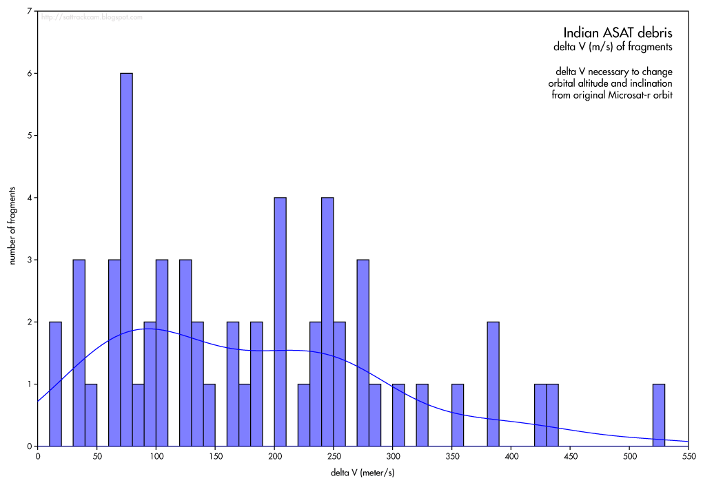
Finally, using tracking data from CSpOC on these debris fragments, I calculated the delta V (the extra ejection speed relative to the original Microsat-r speed) necessary to get them into these orbits, taking into account changed orbital altitudes & the inclination change.
That's it, as far as the current state of my OSINT analysis is concerned. As said, I will write this up more comprehensively as a more formal publication, but that might take a few days.


