On 19 August 2014 @Birdyword tweeted "It's been a long-term idea of mine to construct a Greggs:Pret ratio of cultural northern-ness for every part of England. But I'm too lazy." -- and that was when I started working on the Greggs:Pret ratio problem.
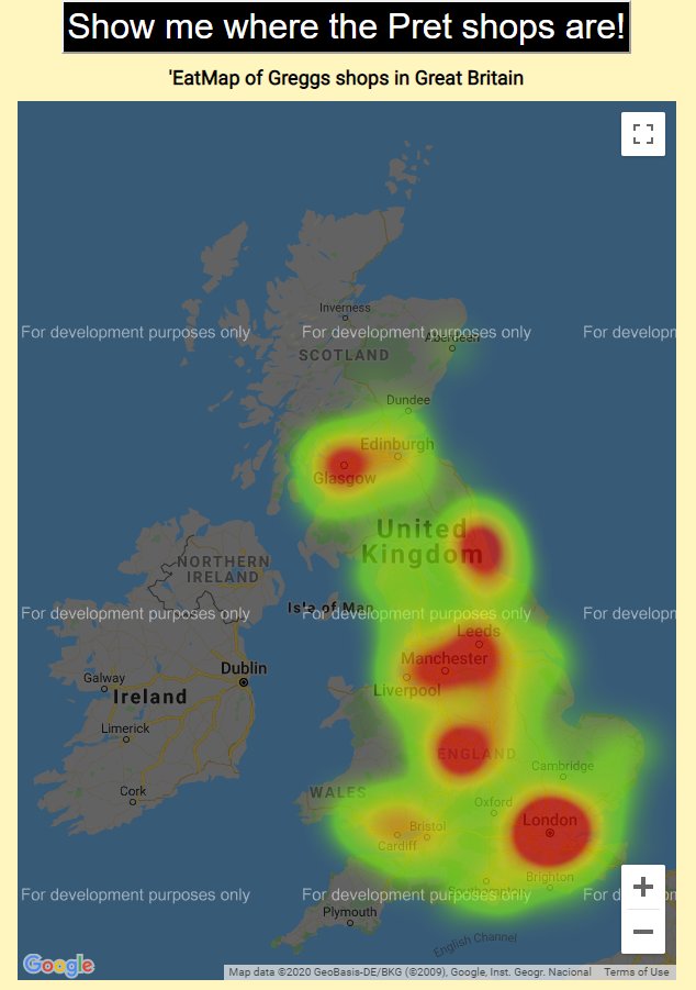
@Birdyword My first effort (so old that Google have since hiked up the price of their maps API beyond what it's worth me paying) is still at tomforth.co.uk/eatmap/ --- and is a useful reminder of how far we've come in five years on #opendata and tools for online mapping and data analysis. 
@Birdyword The real breakthrough came after a tech talk I'd done in 2018 in Leeds. @helngram -- who works at @foodgov in York -- said that their #opendata could probably help with locating food businesses (she wasn't specifically talking about Greggs and Pret). And she was so right!
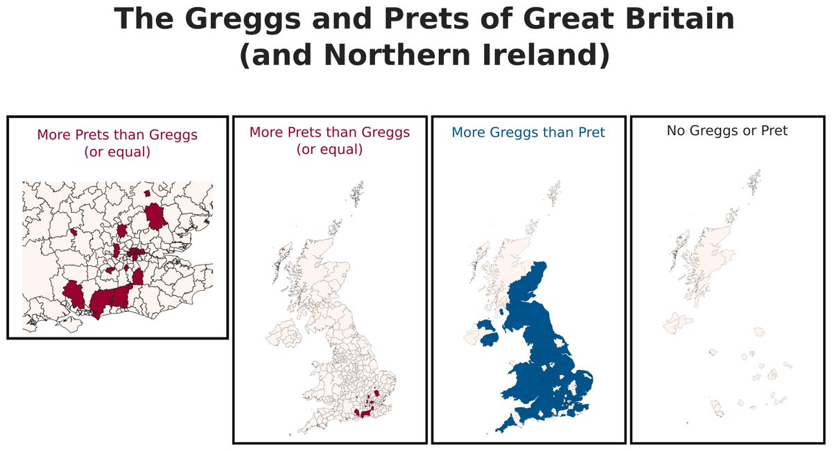
@Birdyword @helngram @foodgov So I downloaded their #opendata, I wrote some code to extract the Greggs and Prets, and I did a few maps, all the local authorities in the UK with more Prets than Greggs, more Greggs than Prets, and no Greggs nor Prets. And it was great, it worked.
@Birdyword @helngram @foodgov But now in 2020, I want to take the next step. I've released my code, you can download it here. And I've re-run it with the January 2020 data. In the new data there are 2089 Greggs (up 133 from 1956 in Jan 2019) and 381 Prets (up 22 from 359 in Jan 2019). github.com/thomasforth/FS…
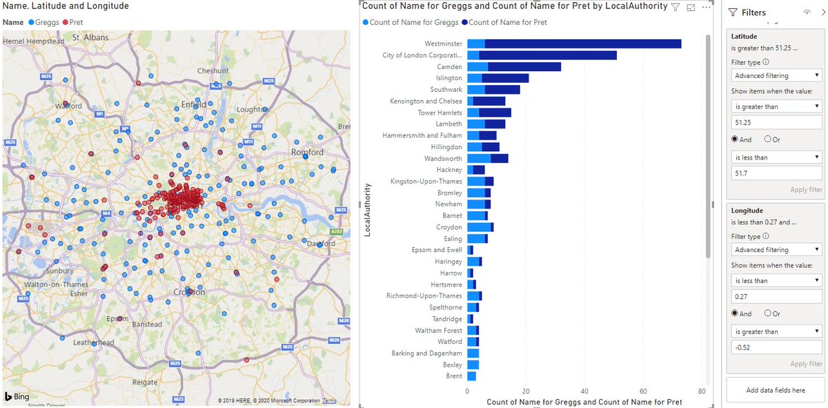
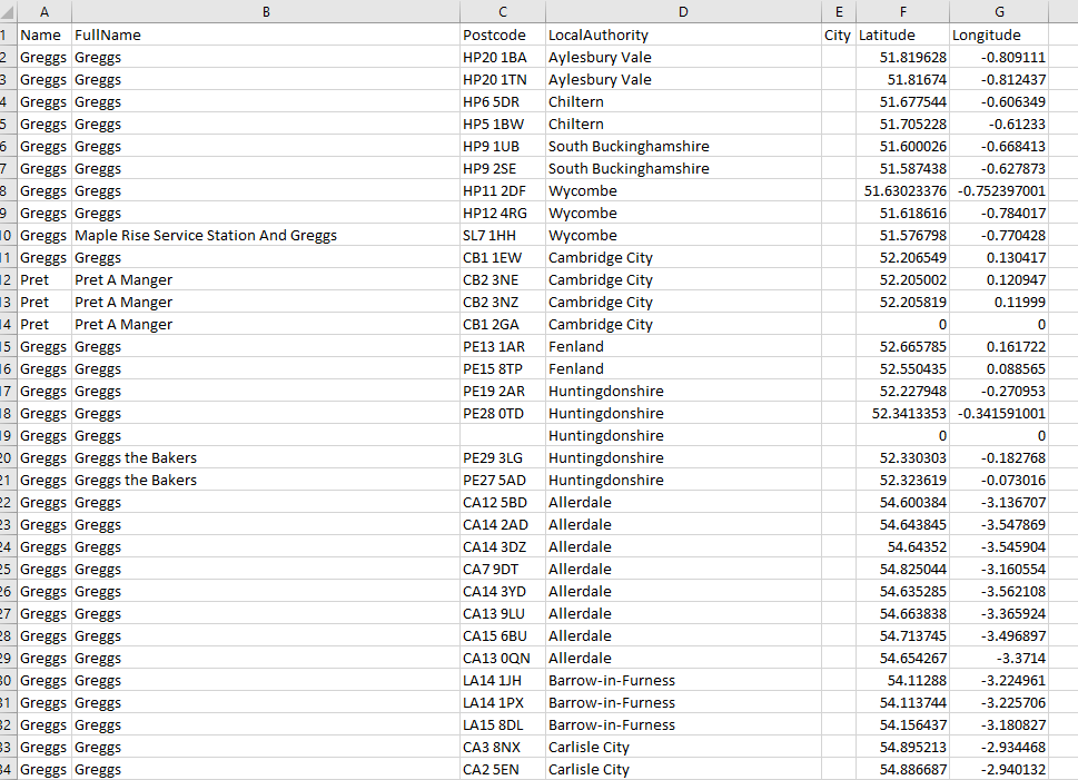
@Birdyword @helngram @foodgov The data includes name, postcode, local authority (though with a weird naming system), latitude, longitude. I think the list is close to complete, but it may not be perfect due to the large range of trading names each chain's franchises use. I do my best.
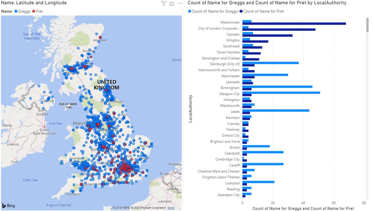
@Birdyword @helngram @foodgov Data analysis tools have improved so significantly in the last five years. Now I can take the output CSV, and with 5 minutes in PowerBI I can draw them all on a map, calculate the Greggs:Pret ratio in every local authority. With 30 minutes I could do just about anything.
@Birdyword @helngram @foodgov Last but not least. The M25 is a square(ish). So I can filter that quickly and just get the data for LAs in Greater London(ish). Doing that means that I can confirm that (someone asked me) there are more Prets (237) in Greater London than Greggs (203) in Greater London. About.