Cross-referencing @mjranum's recent post about using Google Maps to identify CIA "Black" sites in Djibouti, with the #Strava heat-map, appears to offer corroboration freethoughtblogs.com/stderr/2018/01… 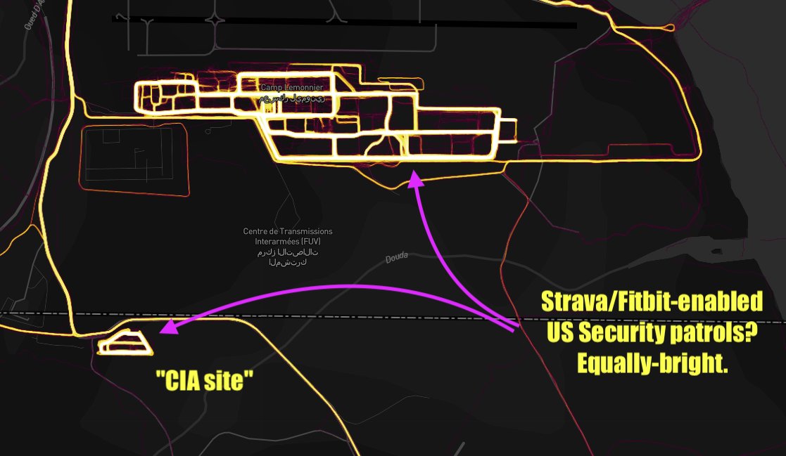
Also there are more drones on the (but older?) DigitalGlobe/Mapbox imagery (Strava) imagery of Chabelly airport, than the (more recent?) equivalent GoogleMaps: google.com/maps/place/11%… 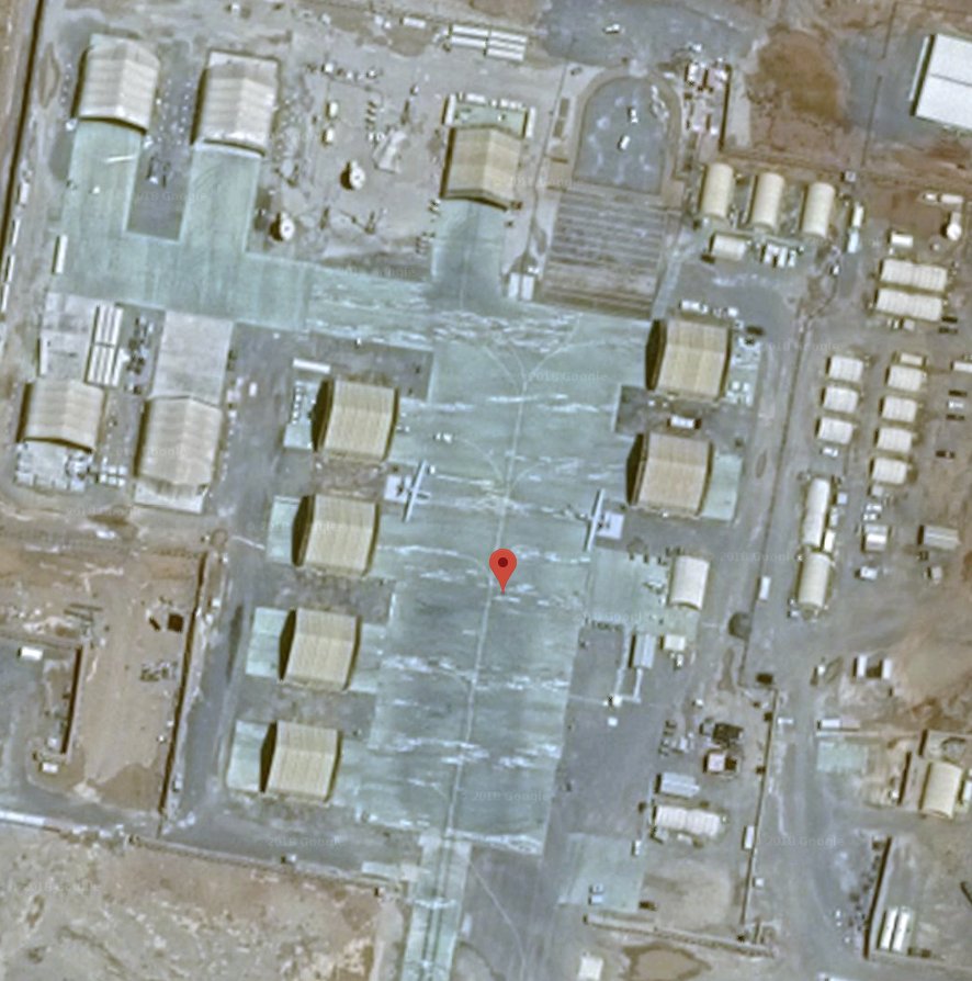
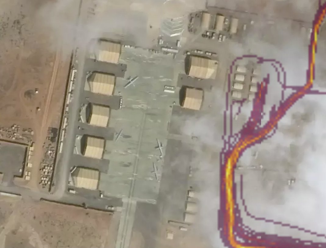
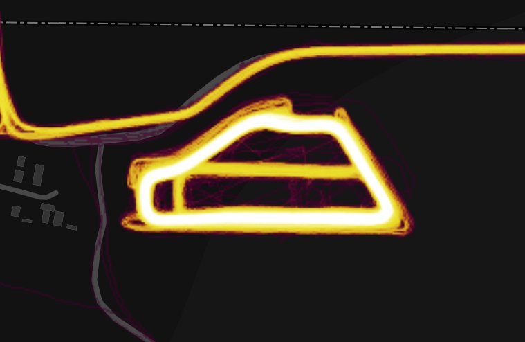
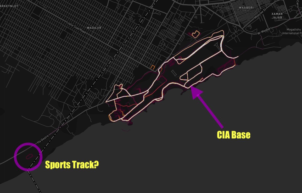
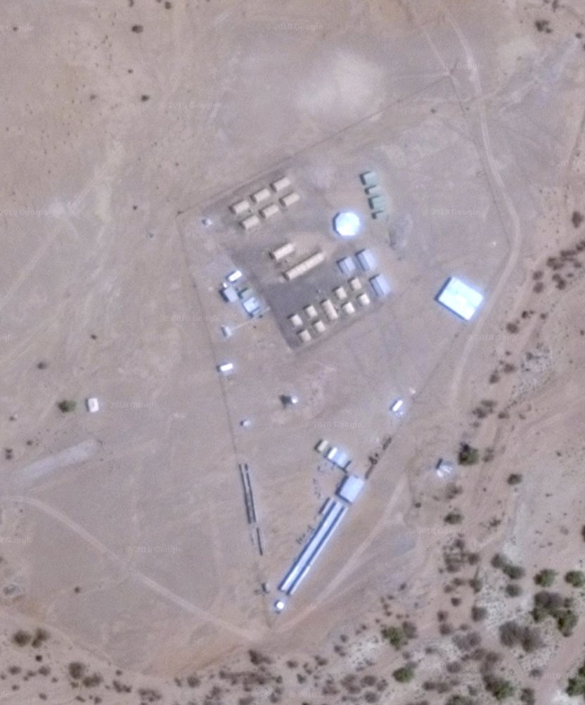
Seems like this is the exercise ground: 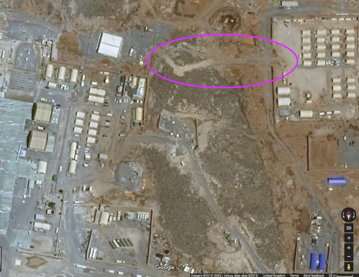
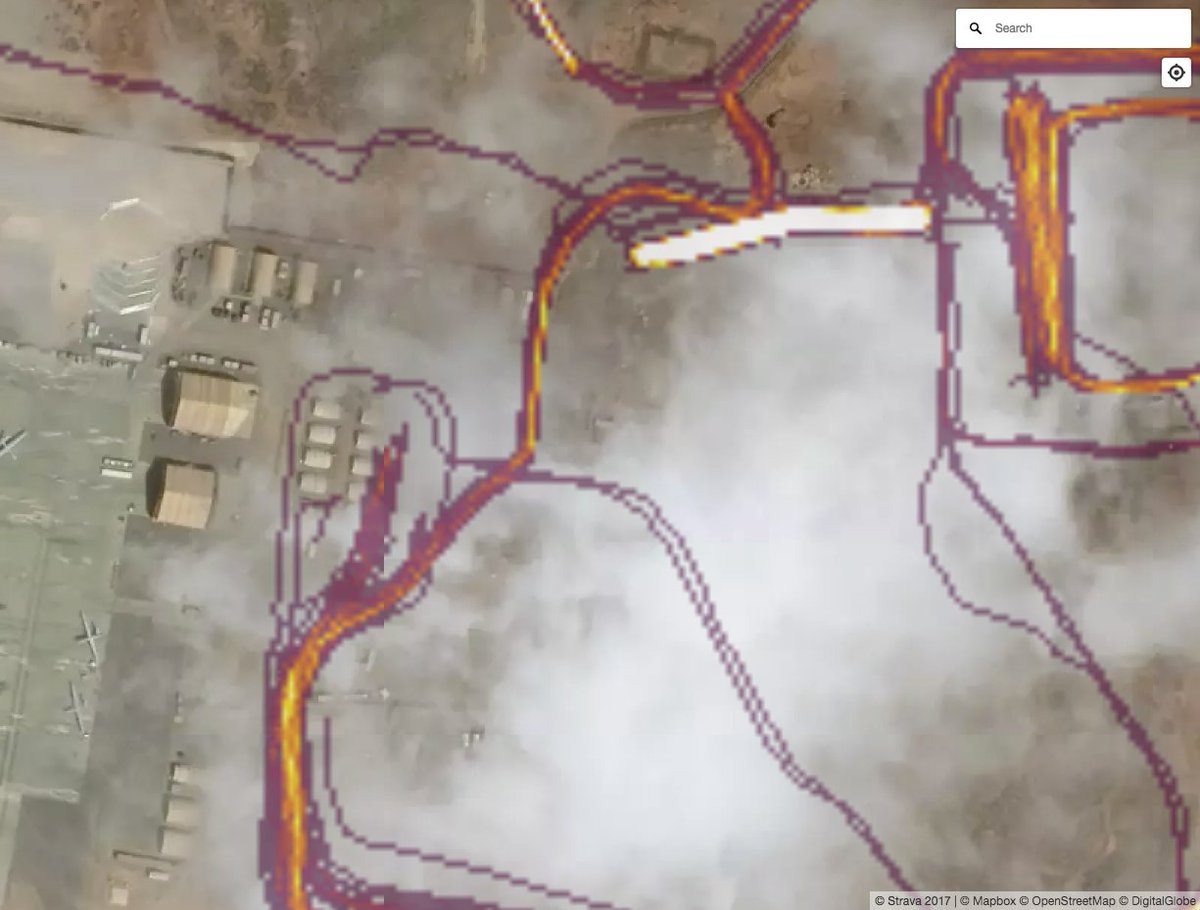
This one is weird because it has perimeter security, but almost nobody goes into it wearing a fitbit / carrying a phone; perhaps _this_ is the CIA site? 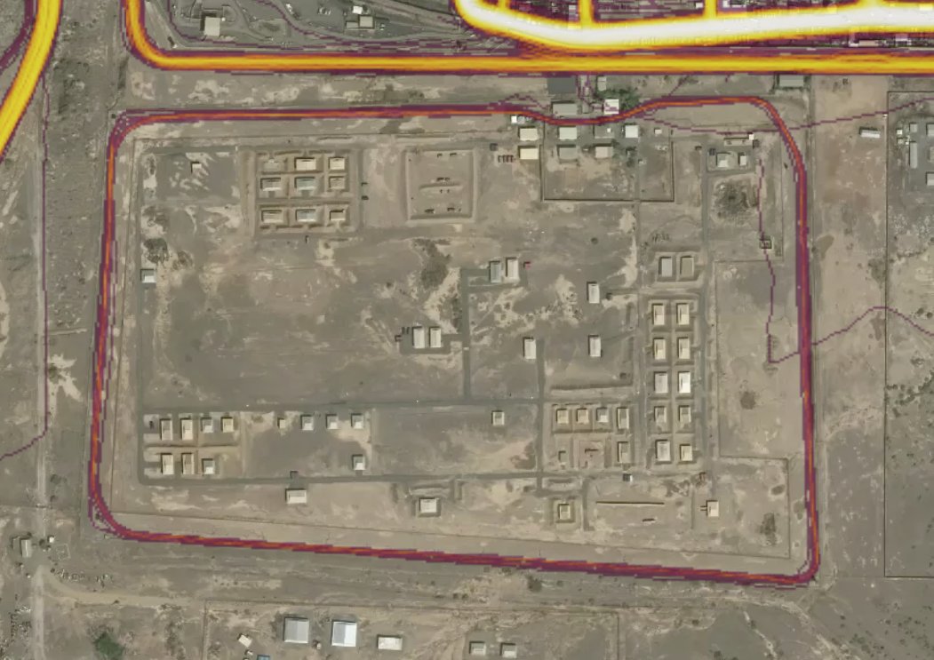
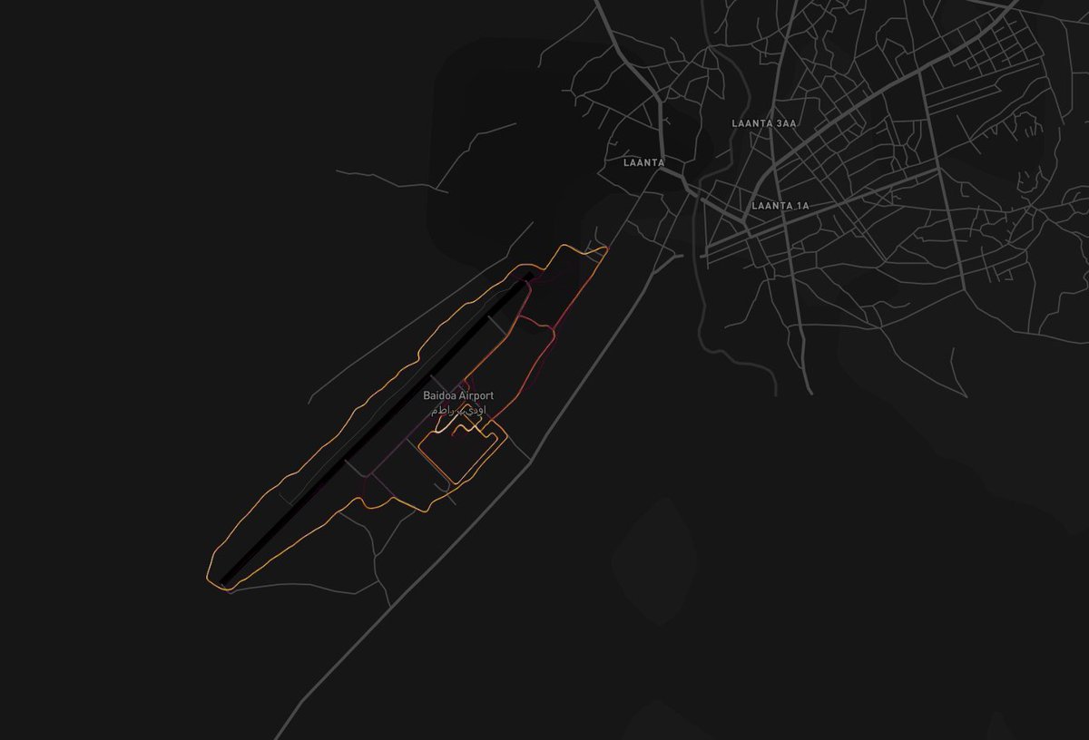
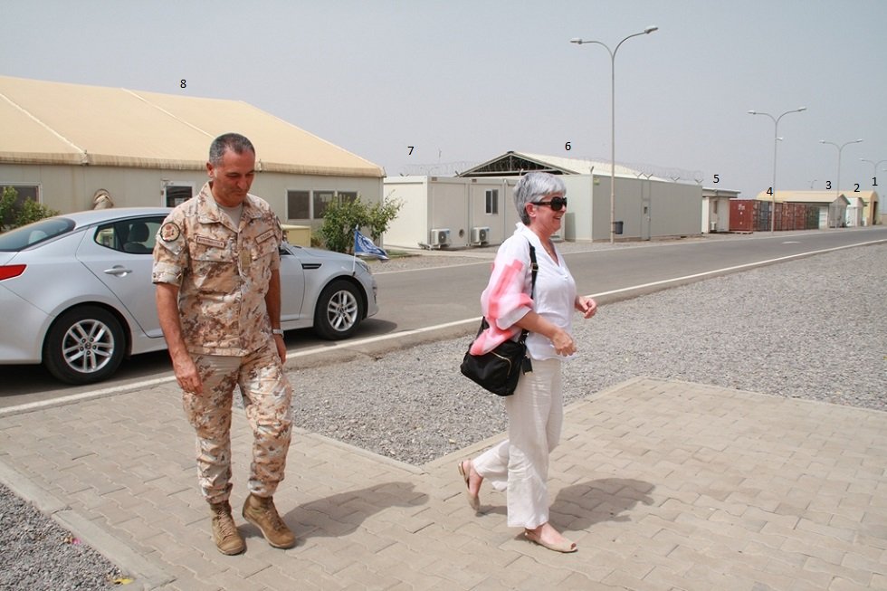
#Mogadishu. You might as well start calling this the "First World People In Third World Countries" dataset. 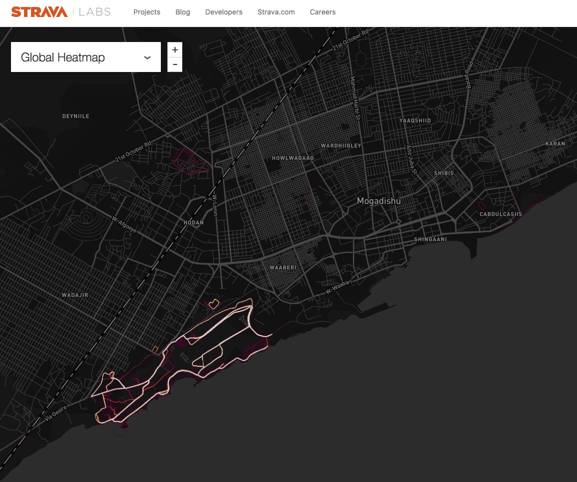

It's probably a good time to remind people that this is an excellent example of what Michael Hayden said; we should all be aware. 
In case you missed it:
And they do. They all do. All the Governments, or at least the ones who have people killed, do.
This one is quite impressive: deep in Antarctica labs.strava.com/heatmap/#11.43… 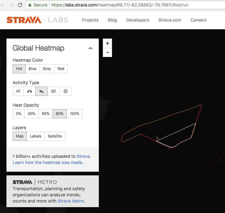
Presumably this is someone's Polar expedition, straight down: 
Looks like BurningMan gets offset year-on-year, or else consistently wrong devices are brought to the site. 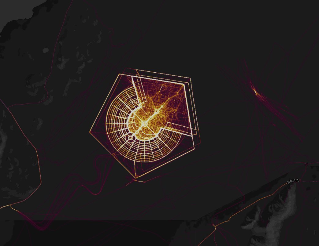
But: Back to the spooky stuff, it's not like the US Government are incapable of enforcing good operational security. Groom Lake / "Area 51" is well-mapped, yet basically Strava-free: labs.strava.com/heatmap/#13.47… 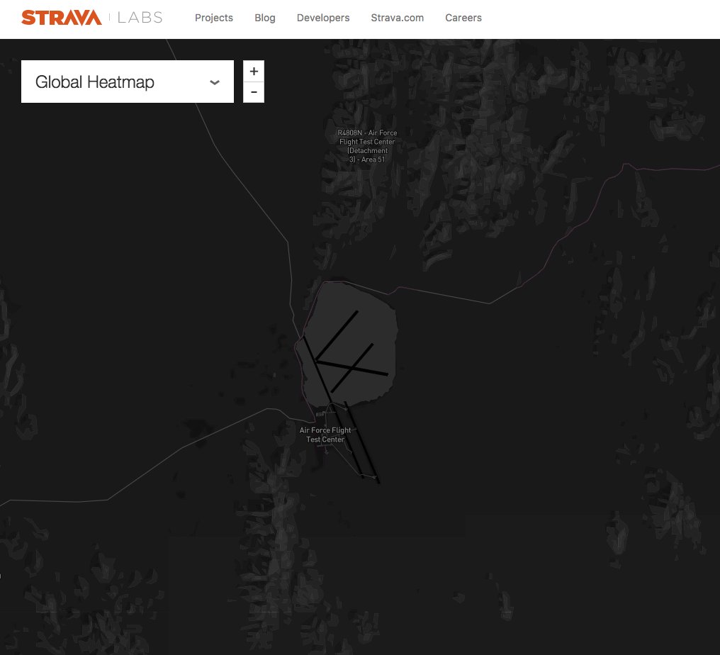
So I think it's worthwhile reiterating that I don't think Strava are doing anything "wrong" here; as in my first post of this thread, one can do this sort of research for general interest (link below) - or @bellingcat make a living from similar.
freethoughtblogs.com/stderr/2018/01…
freethoughtblogs.com/stderr/2018/01…
By coincidence, in my village a company is headquartered, which in 2002 faced criticism that publishing its aerial photography would "compromise" secret sites in the UK. The world failed to end: news.bbc.co.uk/1/hi/uk/203072… @GetmappingPLC 
"Getmapping.com openly advertises aerial pictures of the centres on its website, which it calls a complete photo survey of the country." — in 2002 this was mildly shocking. Today it (and similar) is on every phone.

I wonder what @ShoebridgeC's perspective would be of the modern environment, now 16 years later when we have all manner of GoogleMaps, mini-drones and whatnot? news.bbc.co.uk/1/hi/uk/203072…
For my money, anyone who somehow blames #Strava for sharing this information is on-par with those who instituted "Selective Availability" for GPS, thereby setting back an entire ecology of location-aware devices (later, apps) by YEARS gps.gov/systems/gps/mo… 
Also, while we're at it, the #Strava heatmap information enables us, and brings us together, in much the same way that this does/did in 2010: bbc.co.uk/news/science-e…
Looks at all similar? 
The world is better, more creative, more open and more livable place when we are not slaves to our irrational, or rational-but-exceedingly-rare fears. I can say this because I am a security expert, but not one of _those_ security experts. news.bbc.co.uk/1/hi/uk/203072… 
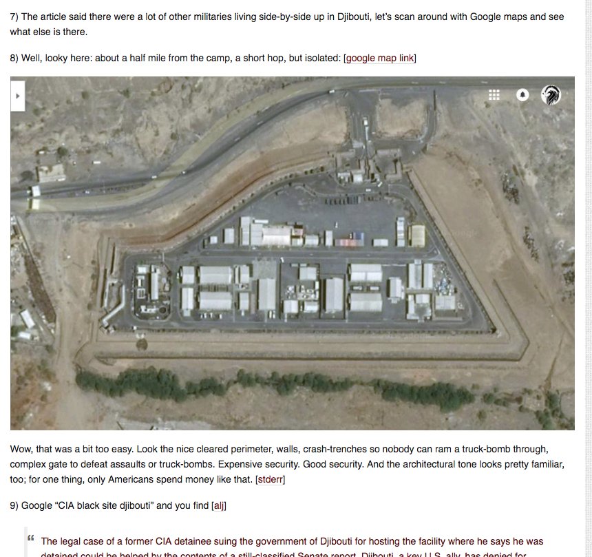
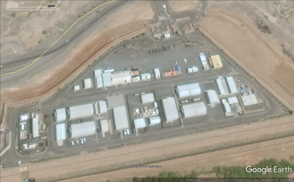
More CIA / similar bases from @mjranum with GoogleMaps & public news reporting freethoughtblogs.com/stderr/2017/01… 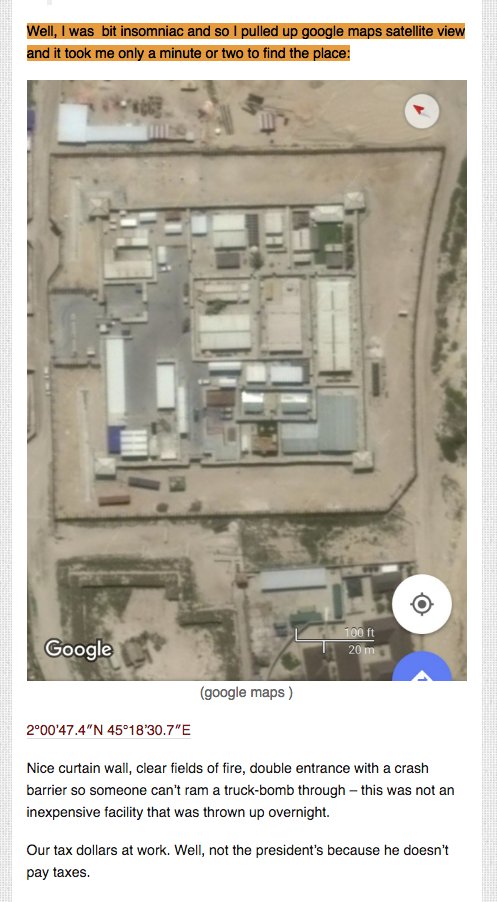
#Strava environs of Mogadishu: 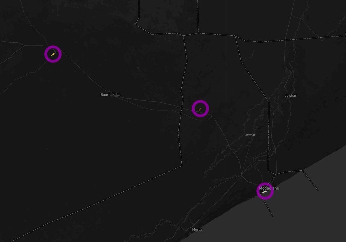

And, at a whim, we have confirmation: 
Thinks: there's also some activity at Kismaayo… oh, right… I wonder what the curious square ghost is/was? 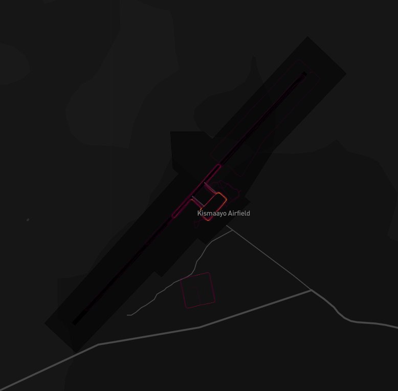

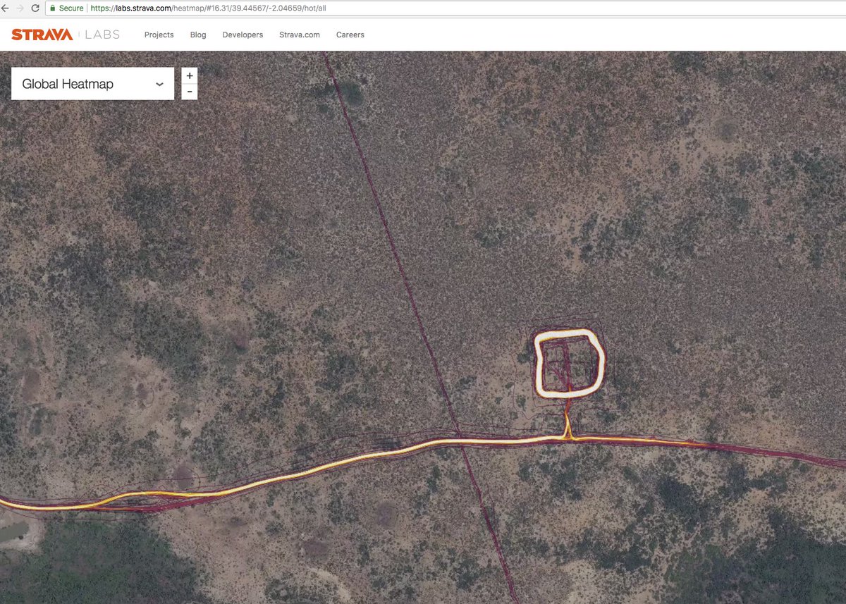
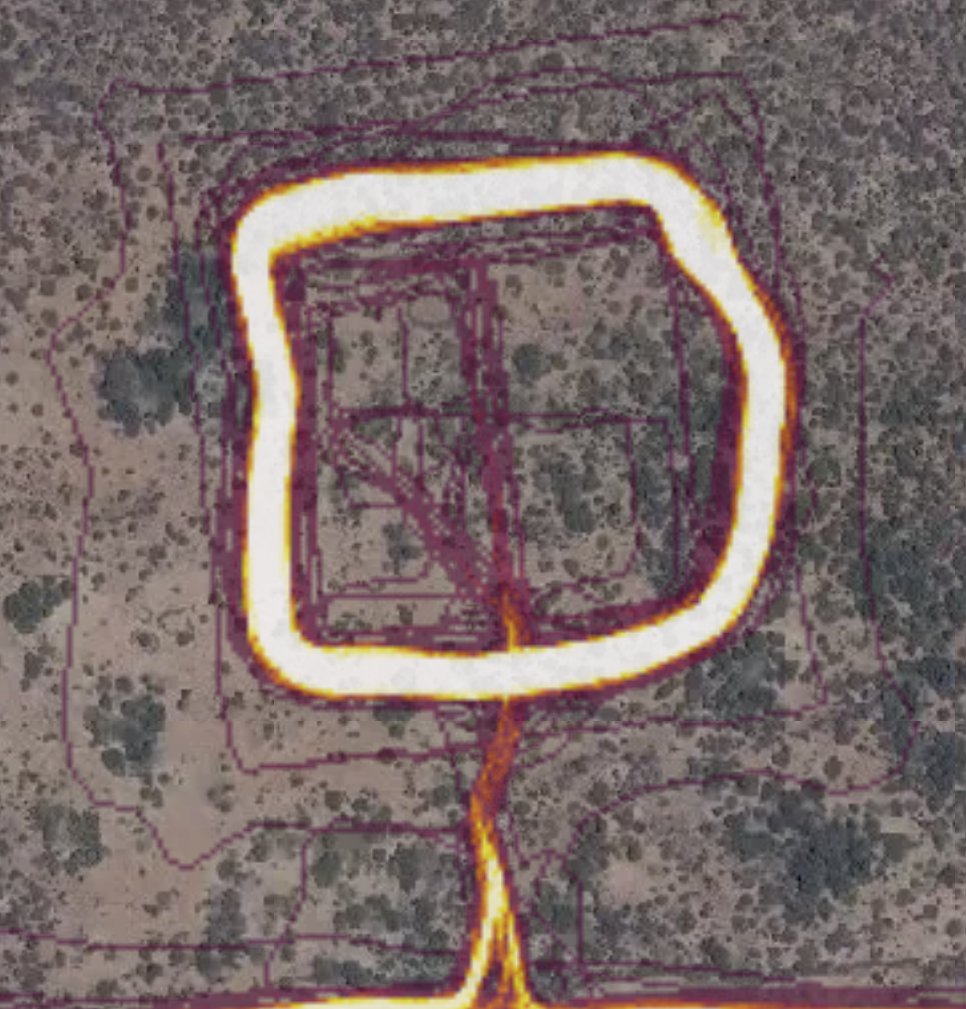
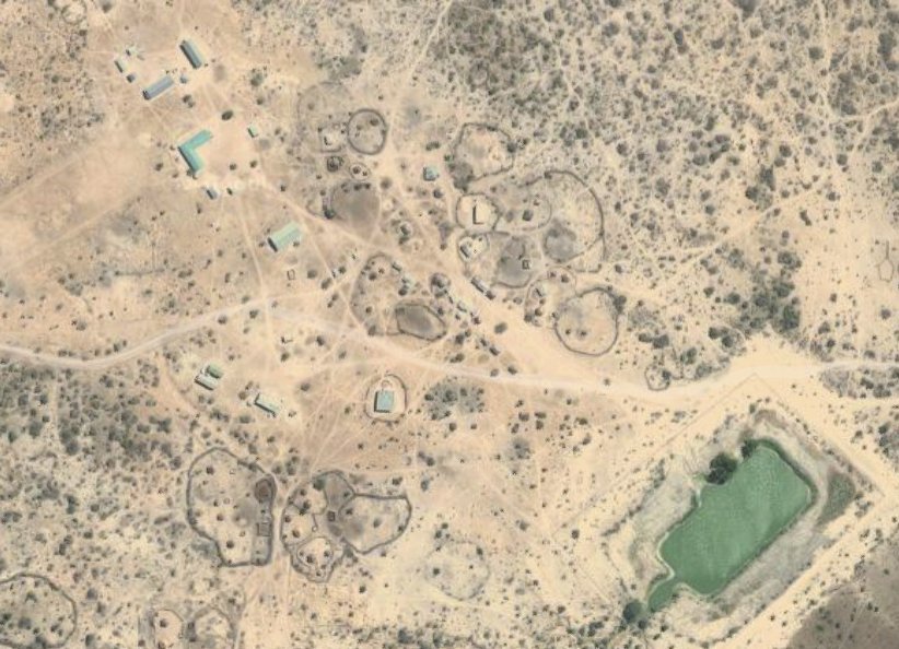
Let's take a punt: this is a strange amount of activity for a bare field; but it's in a national park in Kenya, and there are huts near west/south (eg: 4th pic) so it might be a wildlife thing? Or it might not...
labs.strava.com/heatmap/#16.38…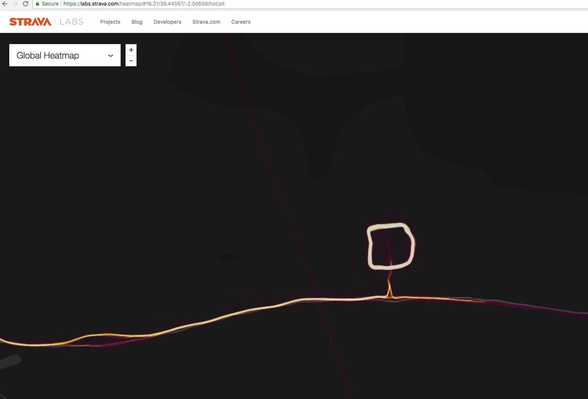
labs.strava.com/heatmap/#16.38…
The weird thing about the Kenya one are some really straight lines which go either through, or near to, the site; could be GPS artifacts, or maybe a helicopter? Marked-up in dashed purple and projected to the coast for an experiment. labs.strava.com/heatmap/#16.27… 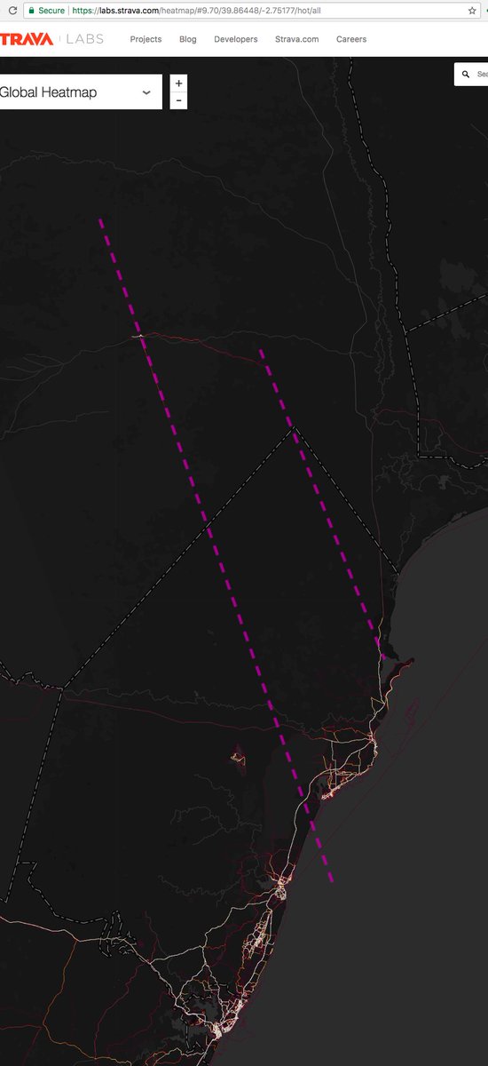
Wow! Awesome research by @JakeGodin — 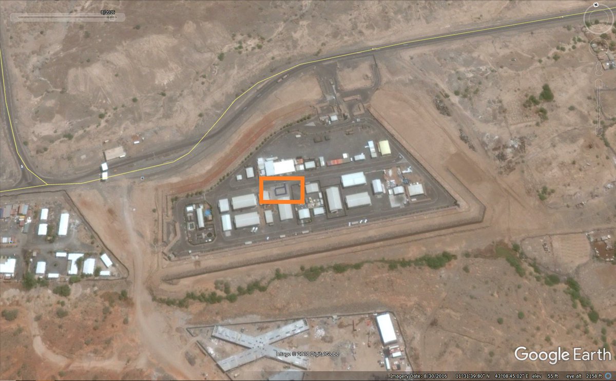
Looks like this is the airbase documented by @nickturse in @theintercept, however…
article: theintercept.com/2016/09/29/u-s…
link: labs.strava.com/heatmap/#14.04…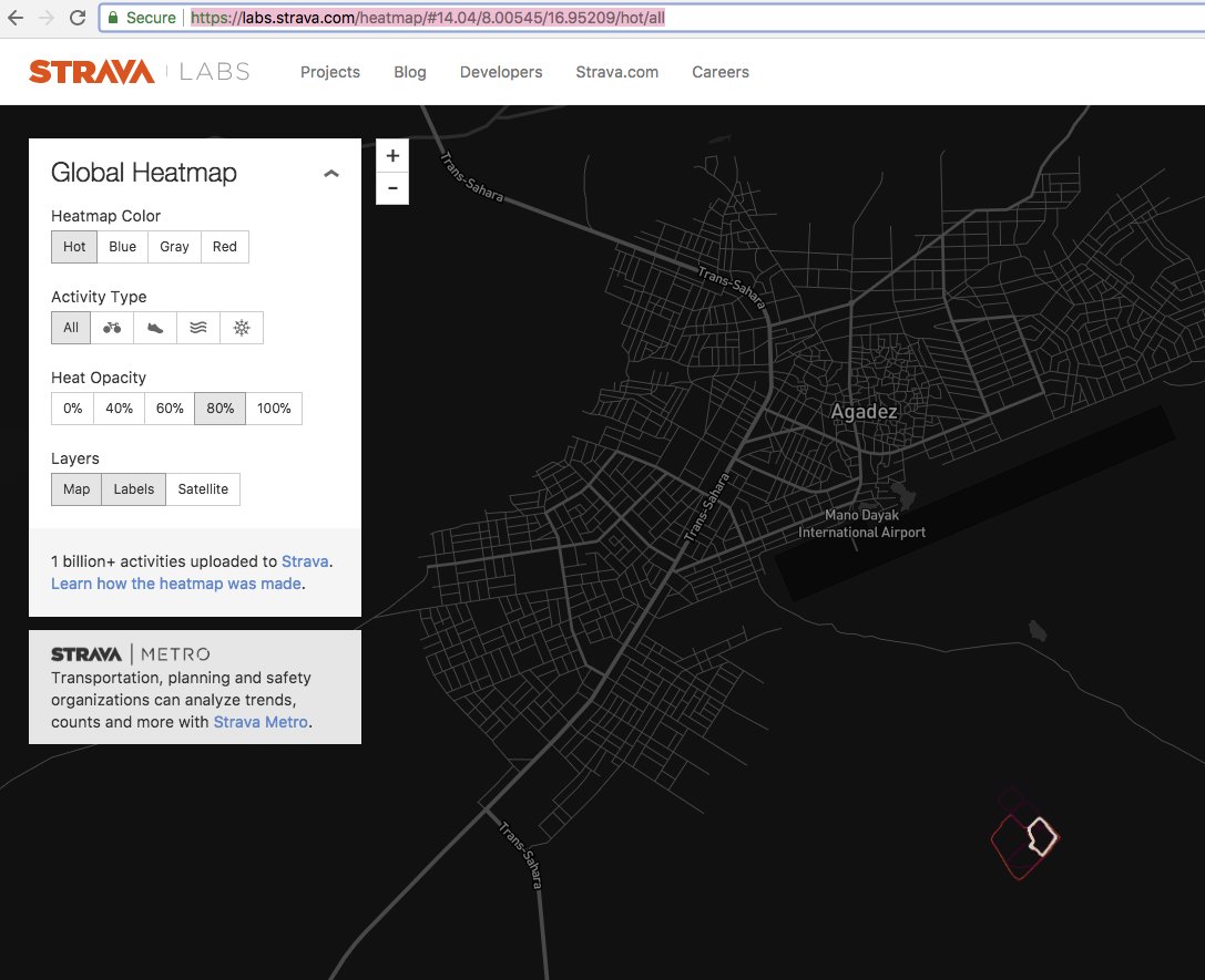

article: theintercept.com/2016/09/29/u-s…
link: labs.strava.com/heatmap/#14.04…
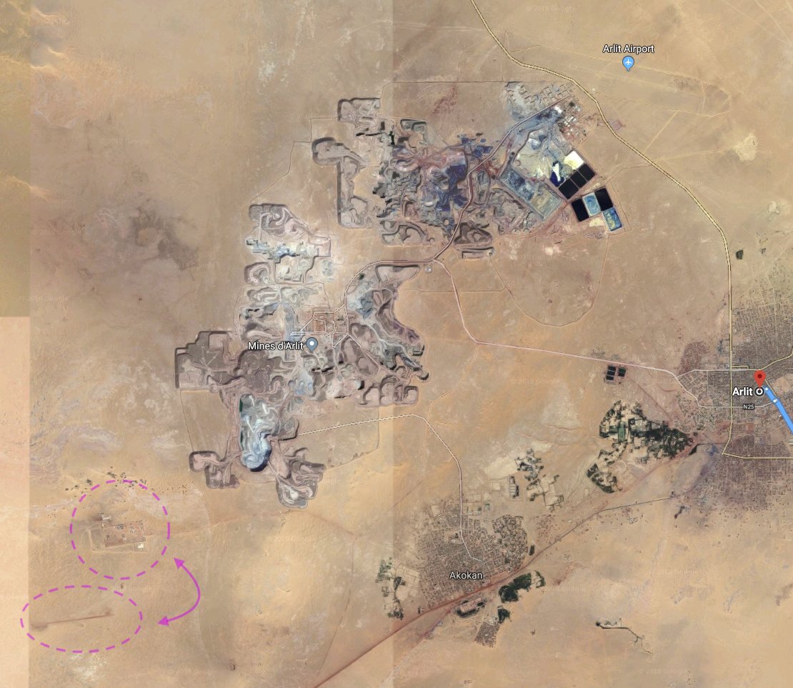
However as @bentaub91 points out, there is another (this: helicopter) base, further north towards Arlit, but well SW of the city and apparently served by a rough airstrip, rather than the main airport.
tweet:
map: labs.strava.com/heatmap/#13.50…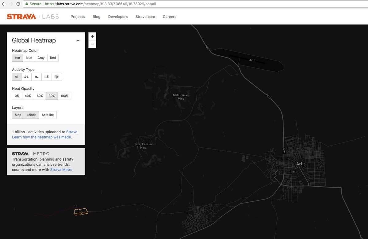
tweet:
map: labs.strava.com/heatmap/#13.50…
Halfway between the two, this weirdness; no idea what the "pipes" are, centre-bottom: goo.gl/maps/aeTV6BaMr… 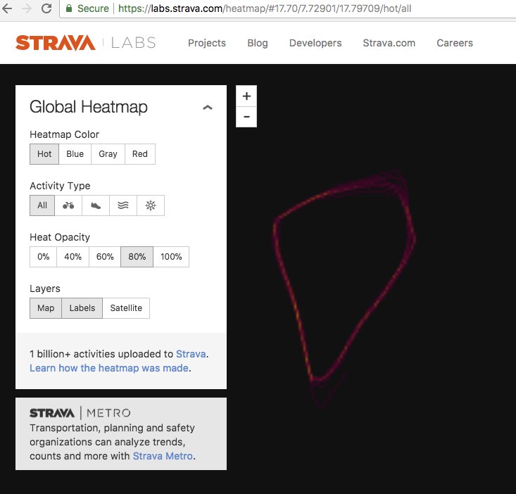
Jeez; you most certainly don't need #Strava for this. You just need to know how and what to Google. thedrive.com/the-war-zone/8…