,
14 tweets,
15 min read
Read on Twitter
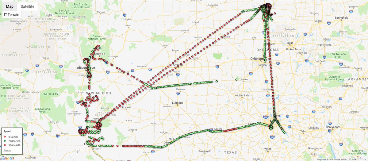
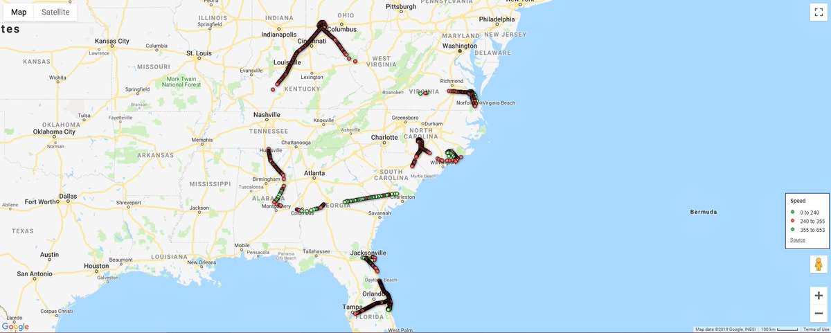
🇷🇺 #Russia|n Air Force #RuAF Tu-154M-ON #OpenSkiesTreaty plane RF-85655|#194E97 conducted ops over the United States March 25-29 2019. Here is a dynamic map so you can name what they were looking at. #MLAT
(Green = roughly correct altitude to take pics)
fusiontables.google.com/embedviz?q=sel…
(Green = roughly correct altitude to take pics)
fusiontables.google.com/embedviz?q=sel…
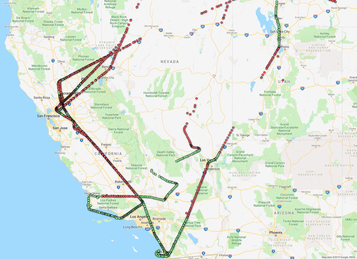
The green dots show you where the plane was triangulated (MLAT) by ground stations, and the altitude is a tell for where they might be taking pictures, but to further refine your guess, check the speed with which they are flying.
They should be ~10,800 ft AGL doing ~300kn.
They should be ~10,800 ft AGL doing ~300kn.

The speed and alt are not consistent yr to yr or even flight to flight, but it's *likely* they fly the whole flight with the same limits; it makes planning easier. The USAF observers' job (partially) is to make sure they're on the right flight path, right alt, and right speed. ✈

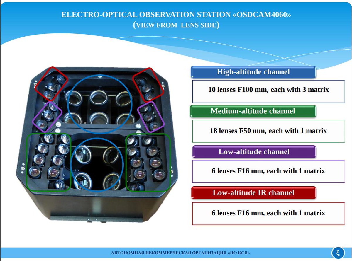
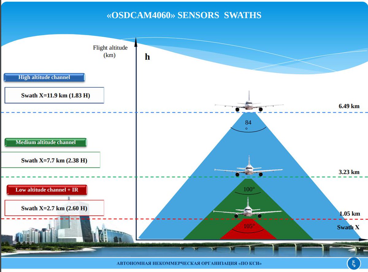
But how wide is their panoramic view?
The swath of imagery taken is ~4.8 Miles wide, per the spec sheet for the OSDCAM4060, which is the digital electro-optical sensor approved and certified for use on the Tu-154M-ON in 2016 by the Obama administration.
poksi.ru/files/OSDCAM40…
The swath of imagery taken is ~4.8 Miles wide, per the spec sheet for the OSDCAM4060, which is the digital electro-optical sensor approved and certified for use on the Tu-154M-ON in 2016 by the Obama administration.
poksi.ru/files/OSDCAM40…
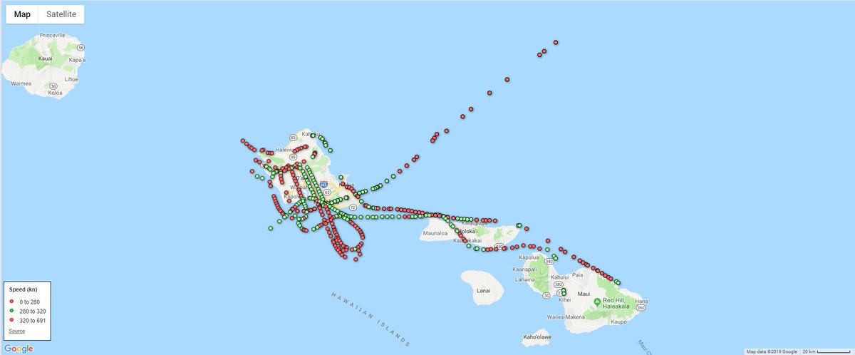
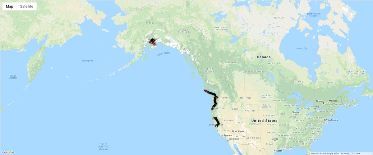
🇷🇺 #Russia|n Air Force #RuAF Tu-154M-ON #OpenSkiesTreaty plane RF-85655|#194E97 conducted ops over the United States October 2-6 2017 (over Hawaii).
Here is a dynamic map so you can see & name what they were looking at.
(Green = Picture-taking speed)
fusiontables.google.com/embedviz?q=sel…
Here is a dynamic map so you can see & name what they were looking at.
(Green = Picture-taking speed)
fusiontables.google.com/embedviz?q=sel…
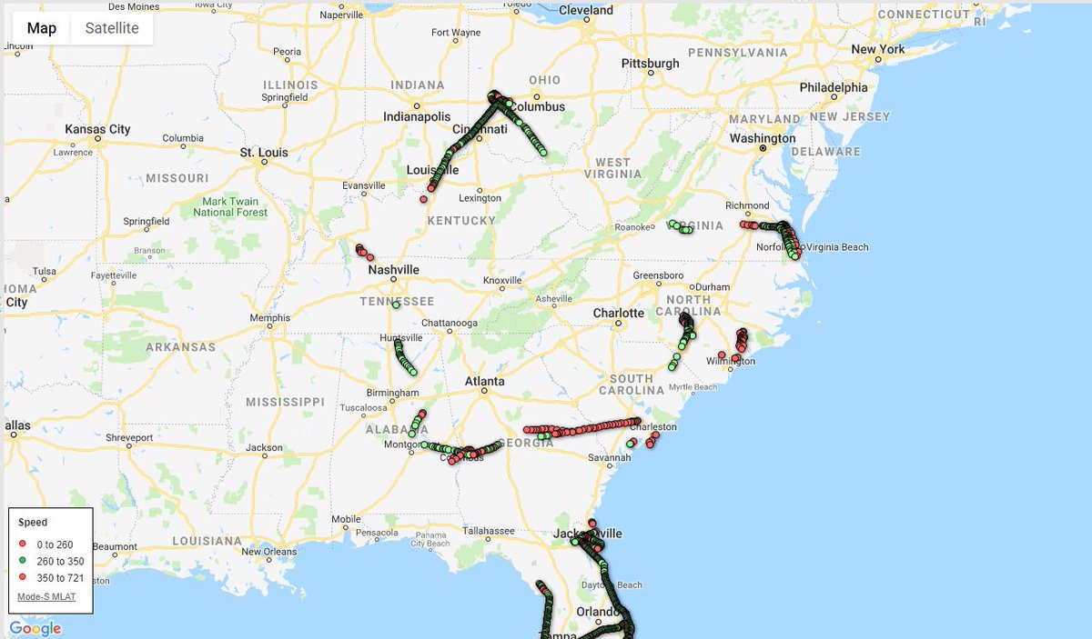
🇷🇺 #Russia|n Air Force #RuAF Tu-154M-ON #OpenSkiesTreaty plane RF-85655|#194E97 conducted ops over the United States September 25-29, 2017.
Here is a dynamic map so you can see & name what they were looking at.
(Green = Picture-taking speed)
fusiontables.google.com/embedviz?q=sel…
Here is a dynamic map so you can see & name what they were looking at.
(Green = Picture-taking speed)
fusiontables.google.com/embedviz?q=sel…
🇷🇺 #Russia|n Air Force #RuAF Tu-154M-ON #OpenSkiesTreaty plane RF-85655|#194E97 conducted ops over the United States August 6-11 2017
("Buzzing" the White House, remember?)
Here is a dynamic map so you can see yourself.
(Green = Picture-taking speed)
fusiontables.google.com/embedviz?q=sel…
("Buzzing" the White House, remember?)
Here is a dynamic map so you can see yourself.
(Green = Picture-taking speed)
fusiontables.google.com/embedviz?q=sel…
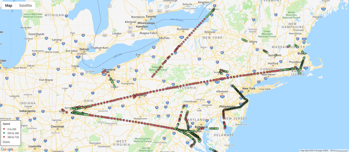
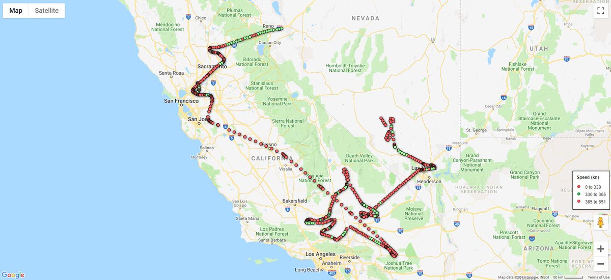
🇷🇺 #Russia|n Air Force #RuAF Tu-154M-ON #OpenSkiesTreaty plane RF-85655|#194E97 conducted ops over the United States June 26-30 2017
(back-to back weeks)
Here is a dynamic map, so you can follow along
(Green = Picture-taking speed)
fusiontables.google.com/embedviz?q=sel…
(back-to back weeks)
Here is a dynamic map, so you can follow along
(Green = Picture-taking speed)
fusiontables.google.com/embedviz?q=sel…
🇷🇺 #Russia|n Air Force #RuAF Tu-154M-ON #OpenSkiesTreaty plane RF-85655|#194E97 conducted ops over the United States June 19-23, 2017.
(Alaska has poor FR24 coverage)
Here is a dynamic map so you can see for yourself.
(Green = Picture-taking speed)
fusiontables.google.com/embedviz?q=sel…
(Alaska has poor FR24 coverage)
Here is a dynamic map so you can see for yourself.
(Green = Picture-taking speed)
fusiontables.google.com/embedviz?q=sel…
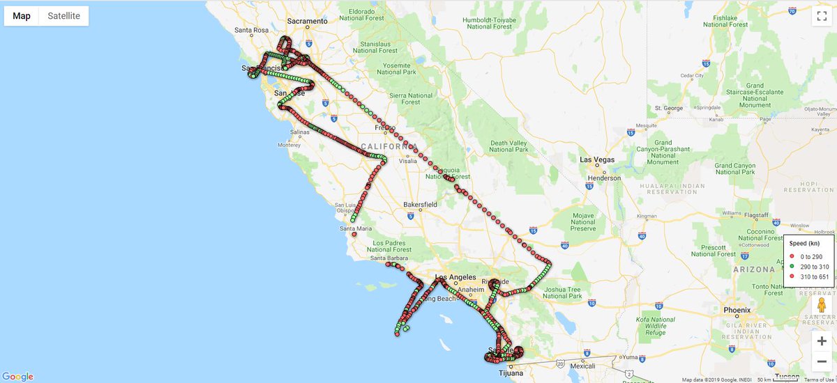
🇷🇺 #Russia|n Air Force #RuAF Tu-154M-ON #OpenSkiesTreaty plane RF-85655|#194E97 conducted ops over the United States May 15-19, 2017
Here are two dynamic maps, one for each day they were flying.
Look familiar?
fusiontables.google.com/embedviz?q=sel…
fusiontables.google.com/embedviz?q=sel…
Here are two dynamic maps, one for each day they were flying.
Look familiar?
fusiontables.google.com/embedviz?q=sel…
fusiontables.google.com/embedviz?q=sel…
🇷🇺 #Russia|n Air Force #RuAF Tu-154M-ON #OpenSkiesTreaty plane RF-85655|#194E97 conducted ops over the United States April 10-14, 2017
Here is the data in a dynamic format that you can zoom and scroll around seeing what they were looking at.
fusiontables.google.com/embedviz?q=sel…
Here is the data in a dynamic format that you can zoom and scroll around seeing what they were looking at.
fusiontables.google.com/embedviz?q=sel…
If you're interested in the #OpenSkiesTreaty and want to know where it came from, have a look at this, which was written in 1993. A very large number of today's issues, that opponents of the treaty raise, have always been issues, accepted from the start.
This makes for light #OpenSkiesTreaty reading... sort of...