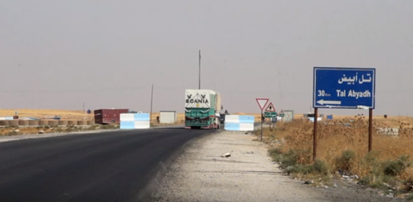
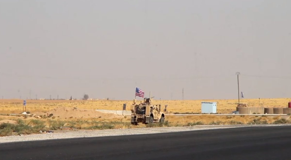
On Monday [Oct 7] our cameraman filmed exclusive footage of US forces withdrawing from their position close to Tell Abyad near the Turkey-Syria border. Our footage shows the convoy moving through Tell Abyad.
Ruptly footage:
ruptly.tv/en/videos/2019…
Ruptly footage:
ruptly.tv/en/videos/2019…
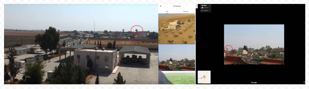
Before filming, our cameraman sent us this image of him at the position where he filmed US forces assembled along the 712 highway, approx 6 kilometers to the east of Tell Abyad. 

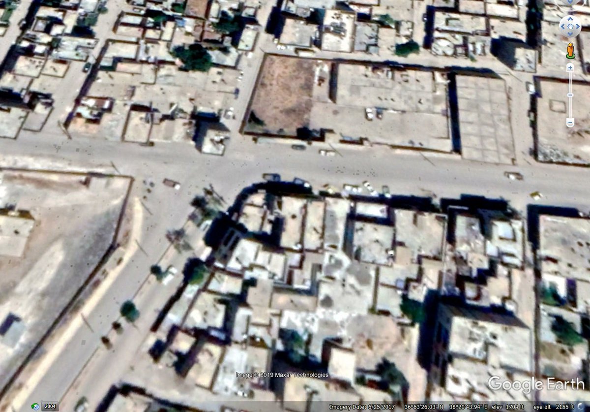
In this scene of our footage, showing the US convoy approaching Tell Abyad, we matched elements of the landscape using geopinned open-source images available on Google Maps.


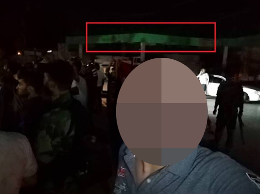
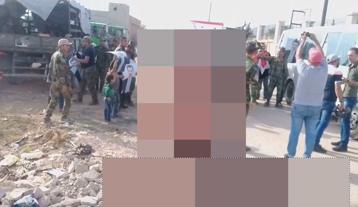
As US forces withdrew from their border positions, civilians held protests across Kurdish areas of north Syria. Our cameraman in Tell Abyad covered a protest that took place on Monday afternoon [Oct 7].
Ruptly footage:
ruptly.tv/en/videos/2019…
Ruptly footage:
ruptly.tv/en/videos/2019…
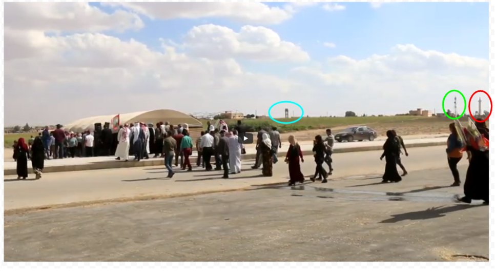
We got the cameraman's perspective of filming by matching tall visible structures in the distance of our footage. We pinned the visual elements using @googleearth to draw the perspective - the water tower [blue], the communications tower [green] and the minaret [red].
We received a video on Tuesday [Oct 8] showing the towns of Tel Abyad and Ain al-Arab/Kobani in Syria, as viewed from the Turkish side in Suruç and Akçakale.
Ruptly footage:
ruptly.tv/en/videos/2019…
Ruptly footage:
ruptly.tv/en/videos/2019…
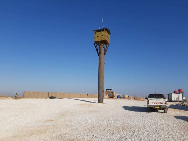
Our cameraman’s location pin placed him within 300m of the crossing into Syria. We see the observation tower on the Turkish side in our footage and in a photo shared on Google Maps.
Location: google.com/maps/place/36%…
Location: google.com/maps/place/36%…
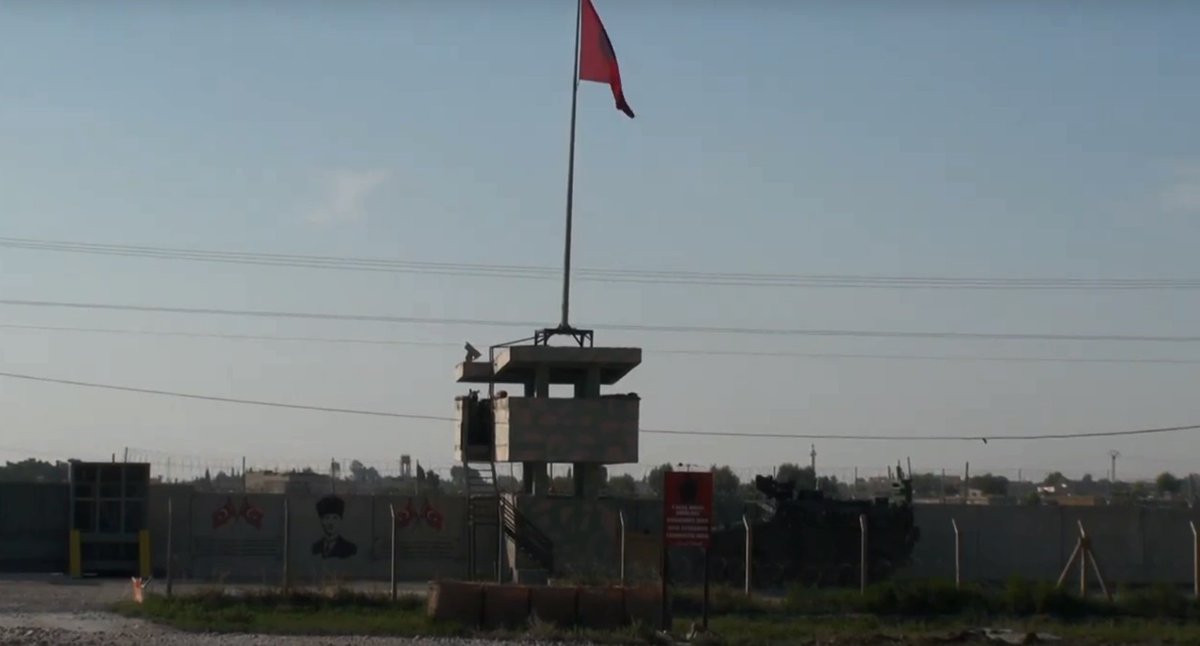
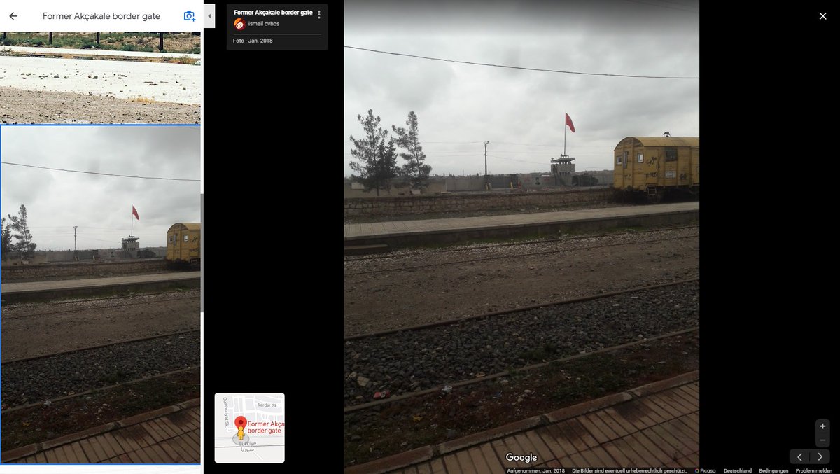
No photos of this particular crossing point could be found via Google Maps. But a UGC photo dating back to December 2018 confirmed that this structure can be found in the vicinity of Akçakale.


Beyond the border wall where Turkish troops were assembling, the Tel Abyad skyline can be seen.


On Tuesday [Oct 8] another of our cameramen in the area sent us footage of the vacated US military outpost at Tell Arqam, further east near the border at Ras Al-Ain and Ceylanpınar.
Ruptly footage:
ruptly.tv/en/videos/2019…
Ruptly footage:
ruptly.tv/en/videos/2019…
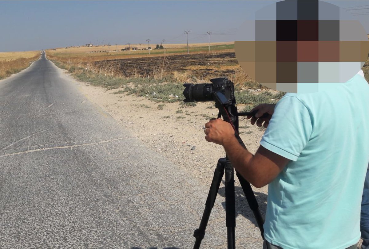
Our cameraman sent us an image of him inside the old US base and sent us a geopin on Google Maps, identifying the exact location where he recorded the footage.
Location: google.com/maps/place/36%…
Location: google.com/maps/place/36%…
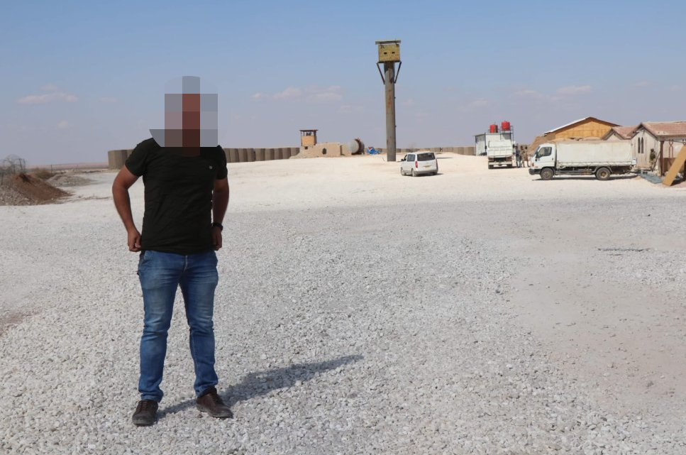
We corroborated the location of the US base using @wikimapia. We then worked to connect some of the visual elements seen in our footage and get our cameraman’s perspective of filming.
Wikimapia:
wikimapia.org/#lang=en&lat=3…
Wikimapia:
wikimapia.org/#lang=en&lat=3…
Later on Tuesday [Oct 8] we were focused on validating more footage from Tell Abyad, as our cameraman there delivered us video of another protest against the looming Turkish military operation.
Ruptly footage:
ruptly.tv/en/videos/2019…
Ruptly footage:
ruptly.tv/en/videos/2019…
Our cameraman sent us a selfie and his geolocation from Tell Abyad. We then matched the footage to visual elements available by open-source. Here we see the border crossing to Akçakale on the Turkish side.
Location:
google.com/maps/place/Ak%…
Location:
google.com/maps/place/Ak%…
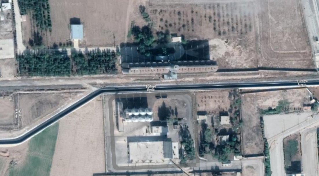
On Wednesday [Oct 9], as Turkey announced the start of its military operation, we validated more footage from Akçakale. In this footage, we see cars waving FSA-aligned Syria flags driving on the Syrian side of the border near Tell Abyad.
Ruptly footage:
ruptly.tv/en/videos/2019…
Ruptly footage:
ruptly.tv/en/videos/2019…
Our cameraman sent us his location pin, which placed him on the outskirts of the town, close to the border crossing.
Location: google.com/maps/place/Akc…
Location: google.com/maps/place/Akc…
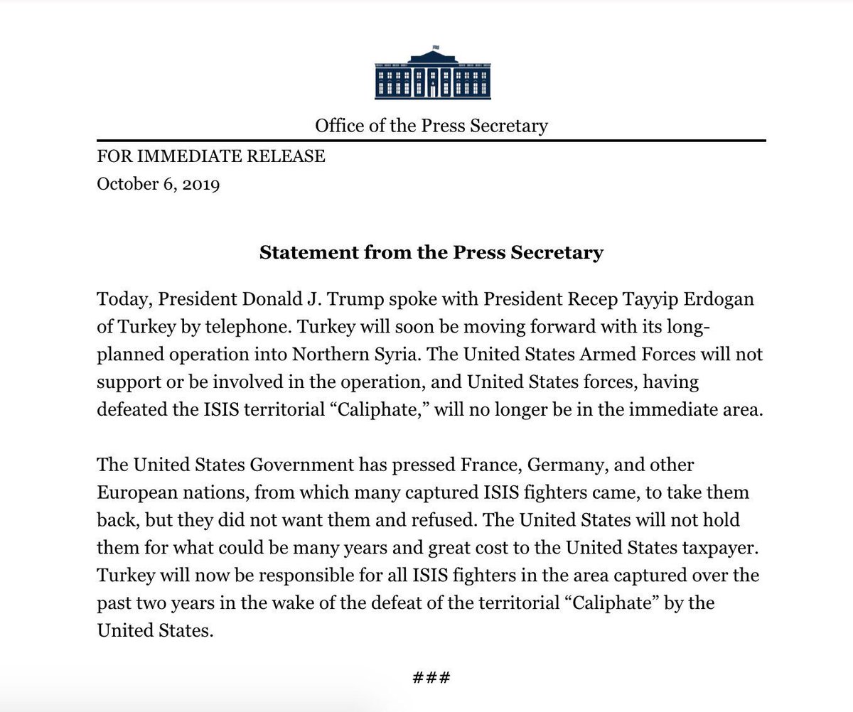
Turkey’s military incursion into north-east #Syria continued with combatant casualties mounting and growing displacement as civilians fled their homes.
Here we continue our account of the behind-the-scenes verification work behind our coverage.
Here we continue our account of the behind-the-scenes verification work behind our coverage.
Thousands of people fled the Syrian towns along the border with Turkey. In this footage, from Wednesday [Oct 9], we see civilians fleeing from Tell Abyad toward Hasaka province, held by the Kurdish-led Syrian Democratic Forces.
Ruptly footage:
ruptly.tv/en/videos/2019…
Ruptly footage:
ruptly.tv/en/videos/2019…
Our cameraman in Tell Abyad sent us another selfie while covering events for us in the town. In his footage there is a road sign that reads: “The town of Tal Abyad thanks you for your visit.”


Footage filmed from the border town of Ceylanpinar inside Turkey, shows smoke rising from locations hit in Ras al-Ain on Thursday [Oct 10], as well as a convoy of Turkish military vehicles moving into the area.
Ruptly footage:
ruptly.tv/en/videos/2019…
Ruptly footage:
ruptly.tv/en/videos/2019…
Our cameraman captured airstrikes and artillery shelling hitting Ras al-Ain as Turkey's operation got underway. Our cameraman sent us a selfie from his position and we took a screenshot from his live broadcast.


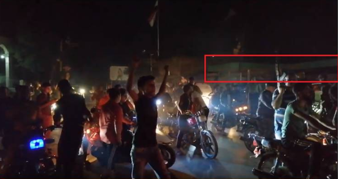
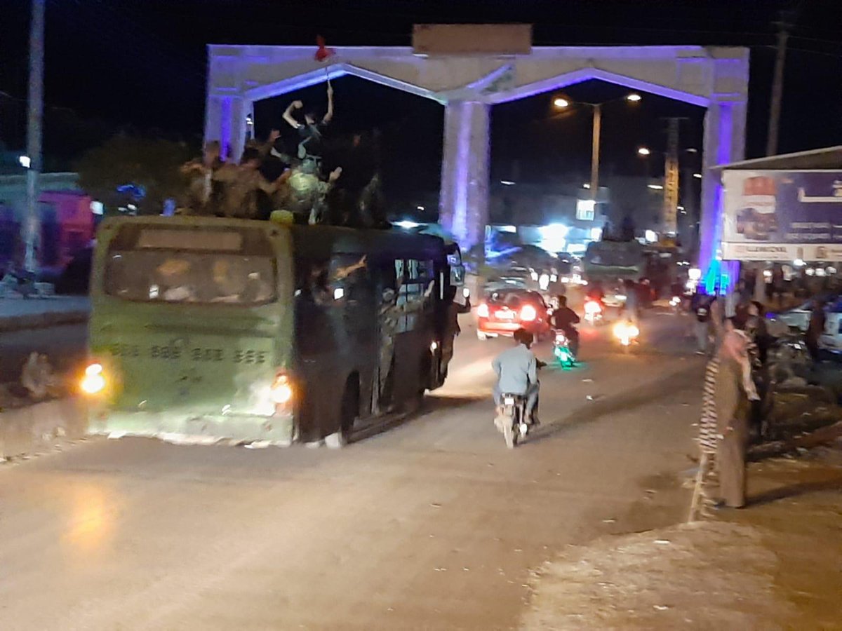
Turkish-backed Free Syrian Army (FSA) was celebrated as they crossed the Syrian-Turkish border in Akcakale on Thursday [Oct 10] to join the Turkish operation into northern Syria.
Ruptly footage:
ruptly.tv/en/videos/2019…
Ruptly footage:
ruptly.tv/en/videos/2019…
Our footage shows armoured vehicles and other vehicles of Turkish-backed fighters arriving in the Turkish border town in Sanliurfa province. We validated the event through geotagged UGC uploads to Instagram Stories and Snapmap.
Snapmap upload: map.snapchat.com/ttp/snap/W7_ED…
Snapmap upload: map.snapchat.com/ttp/snap/W7_ED…
Several people were reportedly killed in the northern Syrian city of Qamishli on Thursday [Oct 10] as 'Operation Peace Spring' targeted the region for the second day.
GRAPHIC - Ruptly footage::
ruptly.tv/en/videos/2019…
GRAPHIC - Ruptly footage::
ruptly.tv/en/videos/2019…
Footage from our cameraman in Qamishli showed families mourning victims. Our cameraman captured selfies on-scene and we analysed the metadata of his raw video file.
Location: google.com/maps/place/Qam…
Location: google.com/maps/place/Qam…
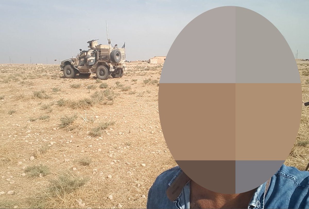
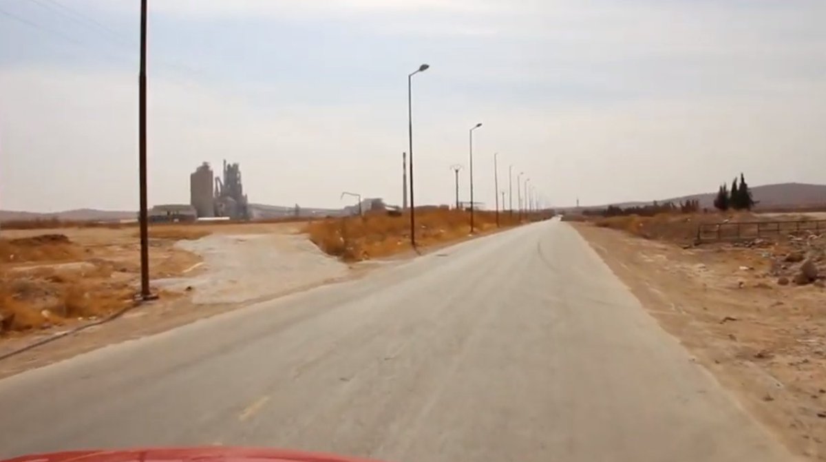
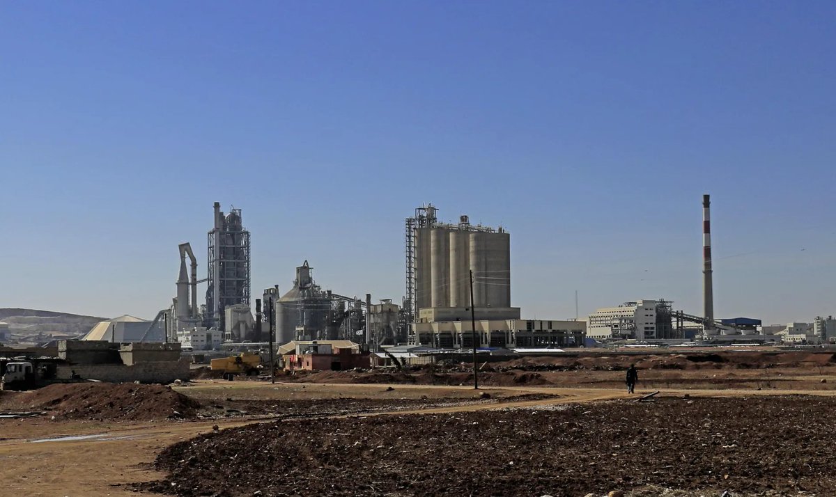
US forces were seen about 30km outside Tell Abyad, some 5 days after withdrawing from the border area. Our footage from Friday [Oct 11] shows armoured vehicles 40km from the former Lafarge cement factory now used as a US military base.
Ruptly footage:
ruptly.tv/en/videos/2019…
Ruptly footage:
ruptly.tv/en/videos/2019…
Our cameraman sent us a selfie from the location where US forces were assembled. The road sign gave us the location by measuring the distance on Google Maps against the information provided by our cameraman.
Location: google.com/maps/place/36%…
Location: google.com/maps/place/36%…
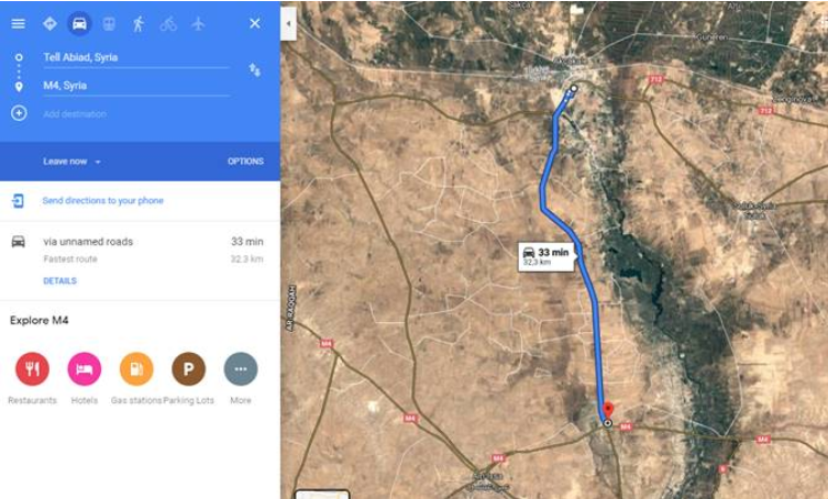
Our cameraman’s footage showed the US forces travelling toward the US military base at the former Lafarge Cement plant.
Wikimapia: wikimapia.org/#lang=en&lat=3…
YouTube:
Wikimapia: wikimapia.org/#lang=en&lat=3…
YouTube:
Turkey and its SNA-aligned allies continue their military operation against Kurdish fighters in northeast Syria, now in its sixth day.
We’re validating & verifying the footage we receive from our cameramen on-the-ground - here’s an insight into our behind-the-scenes work.
We’re validating & verifying the footage we receive from our cameramen on-the-ground - here’s an insight into our behind-the-scenes work.
Kurdish forces fought gun battles with the Turkish-aligned Syrian National Army in the countryside west of Tell Abyad in north-eastern Syria, as seen in our footage filmed on Saturday [Oct 12].
Ruptly footage:
ruptly.tv/en/videos/2019…
Ruptly footage:
ruptly.tv/en/videos/2019…
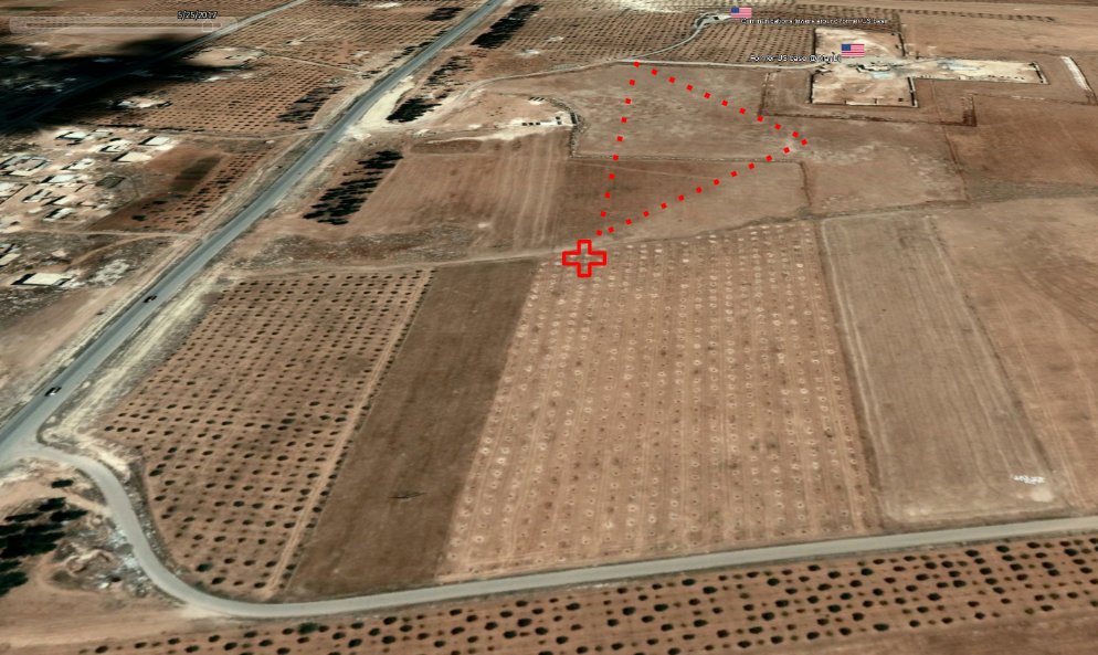
Our cameraman travelling with the SNA sent us his location - placing him 8km outside Tell Abyad. We matched his location on Google Maps, paying close attention to road and street line patterns in both.
Location: google.de/maps/dir/Tell+…
Location: google.de/maps/dir/Tell+…
We used a Tweet from a journalist embedded with Turkish forces to help corroborate the information we received for our cameraman - this gave us the location of the clashes. Once confirmed, we set about determining a precise geolocation.
Tweet:
Tweet:
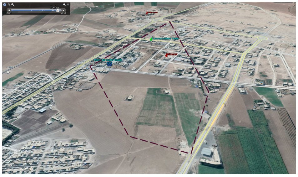
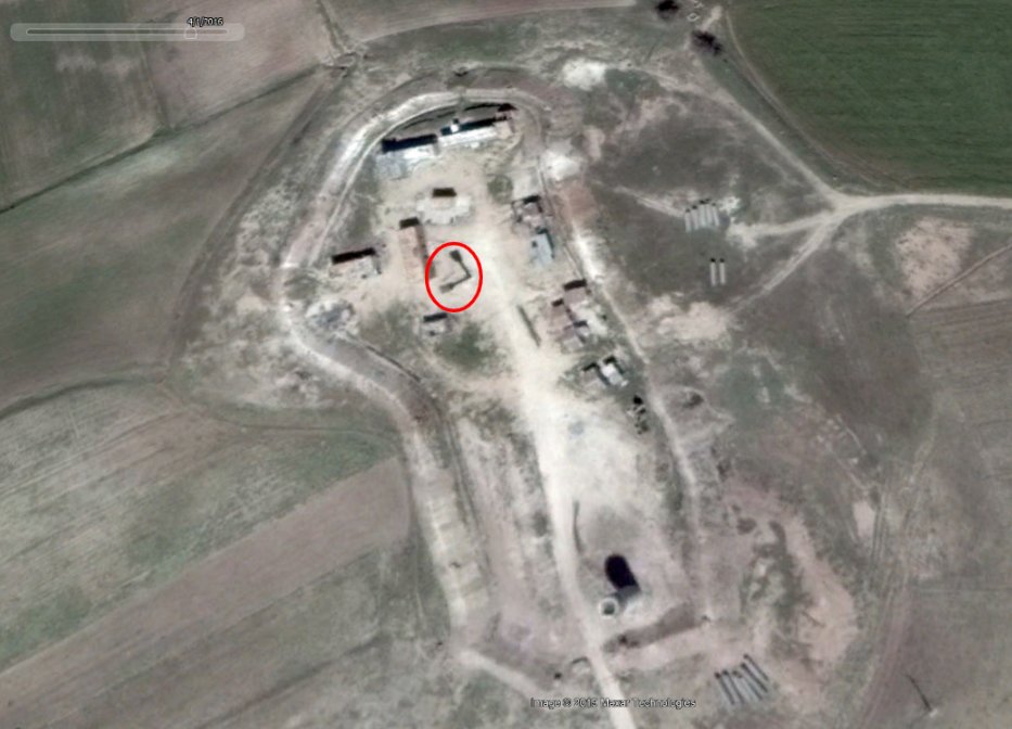
In one of the shots in our video, we see two SNA fighters in position near two low structures with an electric pole in between them. We got our cameraman’s position and distance to the structure which corroborate with the story and images he sent to us.


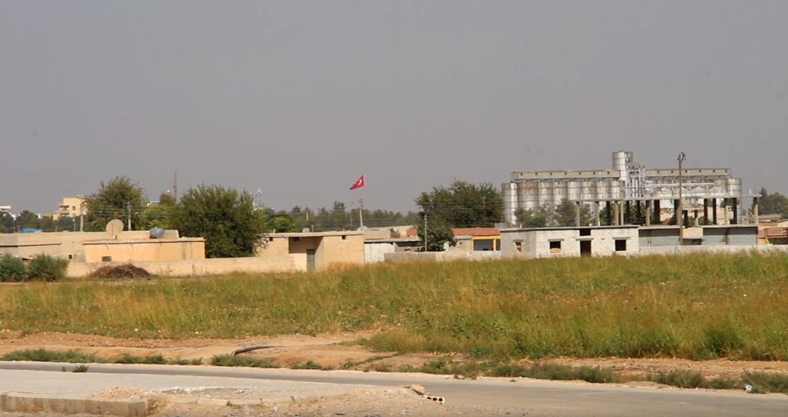
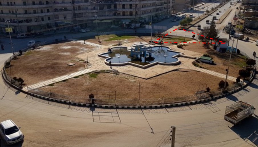
Turkish-aligned SNA forces advanced into Tell Abyad on Sunday [Oct 13]. Our footage shows fighters patrolling the town on foot and with armoured vehicles, streets deserted and buildings left empty.
Ruptly footage:
ruptly.tv/en/videos/2019…
Ruptly footage:
ruptly.tv/en/videos/2019…
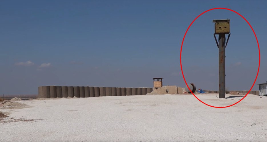
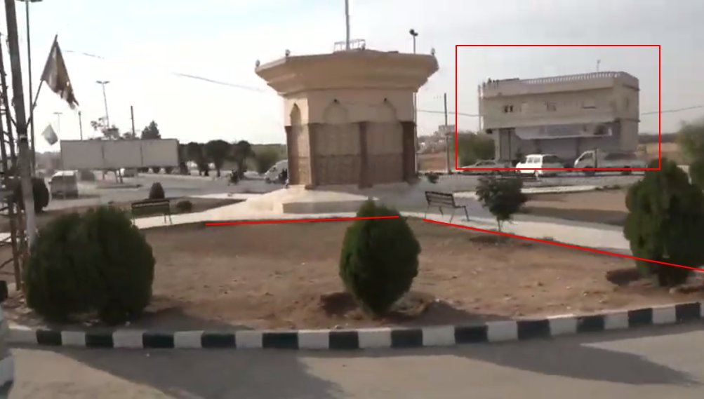
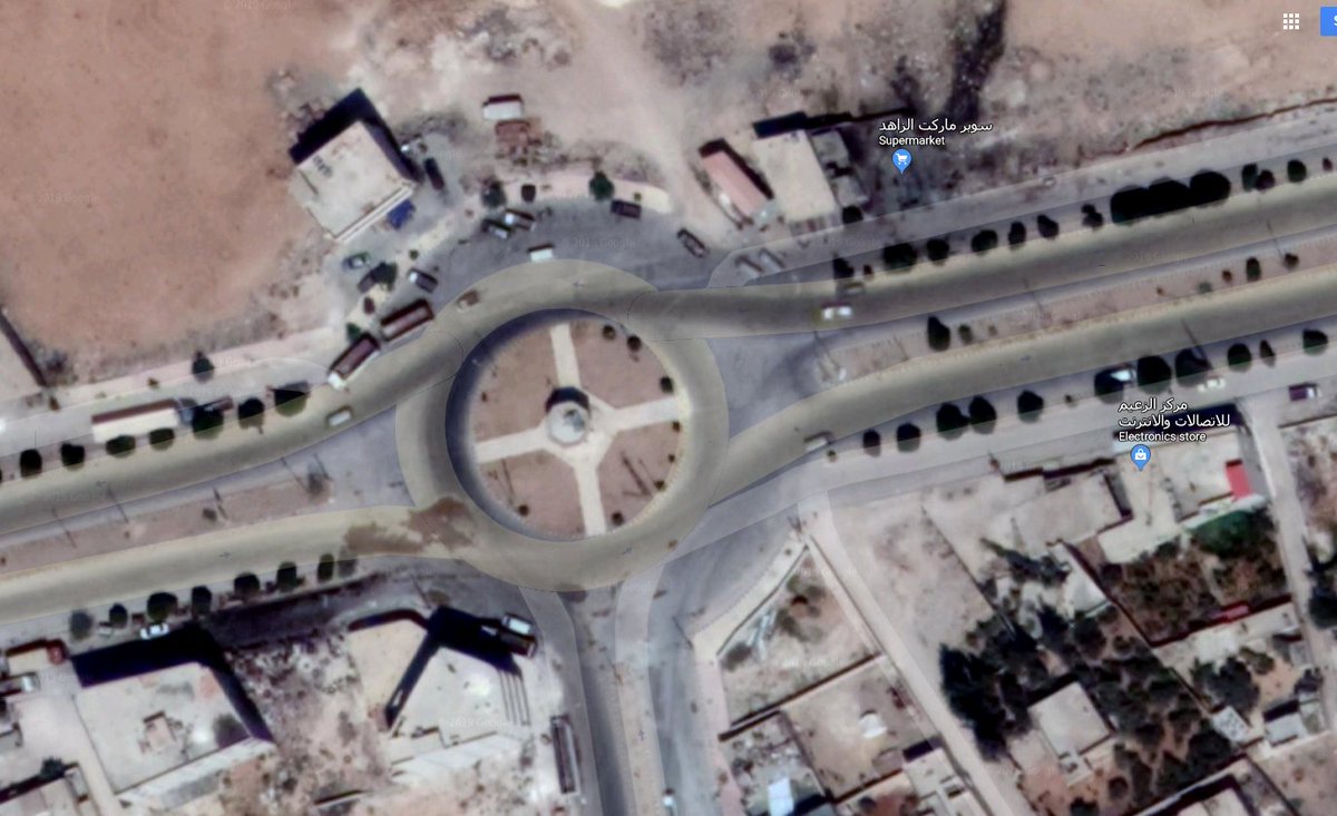
Images in our footage, sent by our cameraman on-the-ground, show a sign post that reads: Tell Abyad Hospital. We also matched the same communications mast in our footage to images geotagged to Tell Abyad on Google Maps.


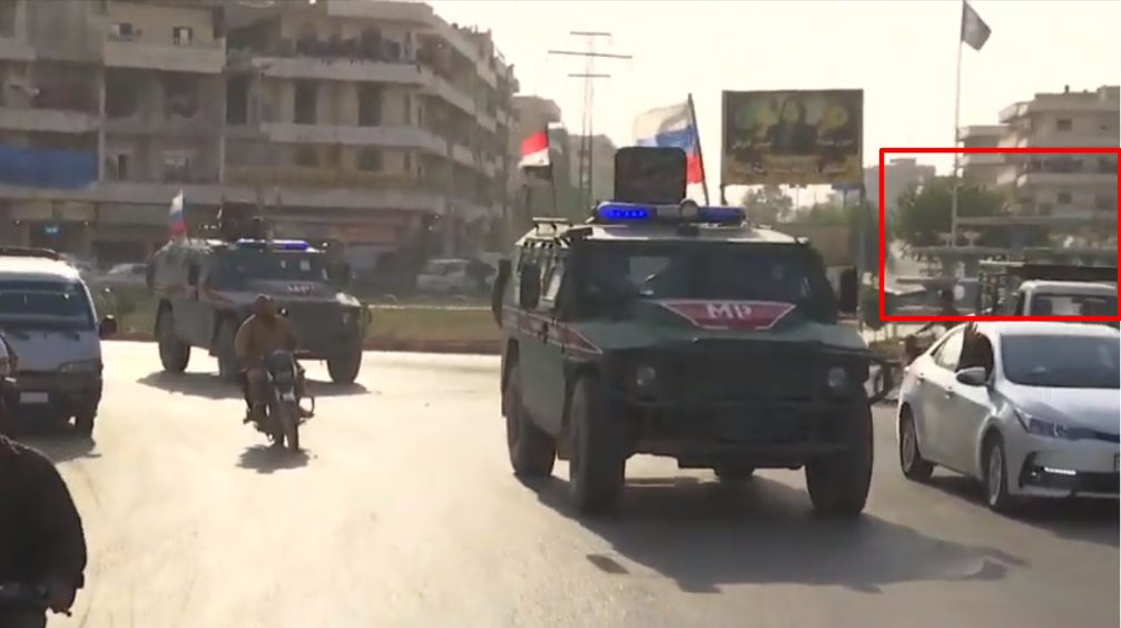
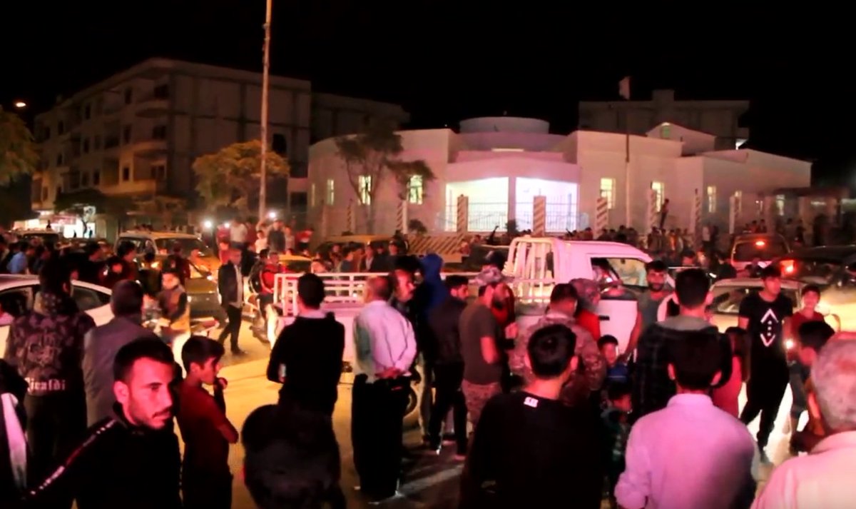
Syrians in Qamishli celebrated on Sunday [Oct 13] the announcement that Syrian troops would be deployed to the north of Syria. Our footage shows people dancing in the streets and waving Syrian flags.
Ruptly footage:
ruptly.tv/en/videos/2019…
Ruptly footage:
ruptly.tv/en/videos/2019…
We received a location pin and a selfie from our cameraman in Qamishli, which matched scenes in the footage we received from him.
Location: google.com/maps/place/37%…
Location: google.com/maps/place/37%…
On Monday [Oct 14] Syrian soldiers entered Tal Tamr in the countryside of Hasakah Governorate, after reaching a deal with Kurdish groups to help defend the north of Syria from the ongoing Turkish incursion.
Ruptly footage:
ruptly.tv/en/videos/2019…
Ruptly footage:
ruptly.tv/en/videos/2019…
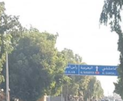
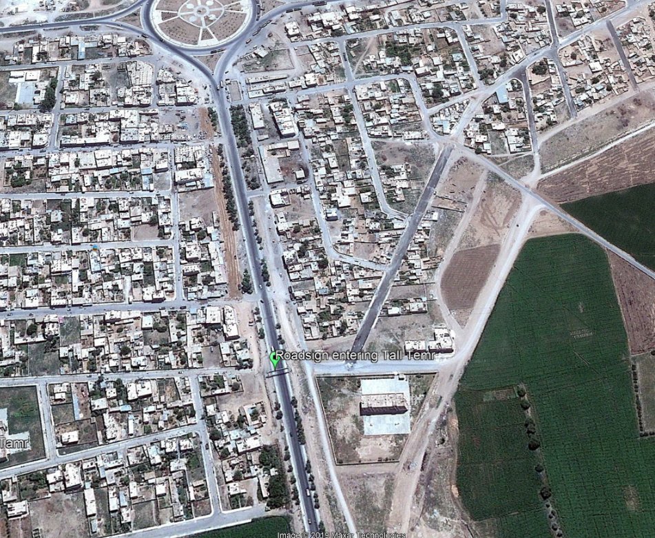
Our cameraman in the area sent us an image of a road sign visible when entering Tal Tamr from the west. We measured the distances seen in the road sign using Google Maps direction feature - all the distances matched.
Location: google.com/maps/place/36%…
Location: google.com/maps/place/36%…
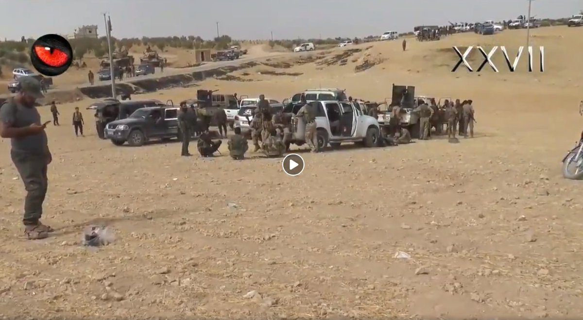
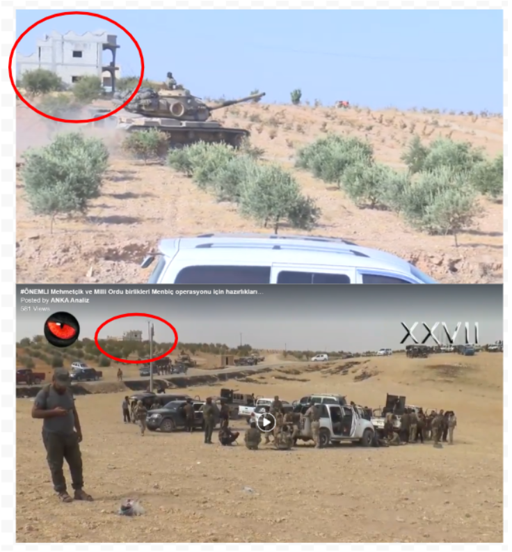
Movement on the border: Syrian army soldiers deployed to assist Kurdish-led SDF. Turkey and SNA-aligned allies press forward toward Manbij. US forces pass Syrian army soldiers on Manbij-Kobani highway.
This thread looks at how we validated our frontline footage.
This thread looks at how we validated our frontline footage.
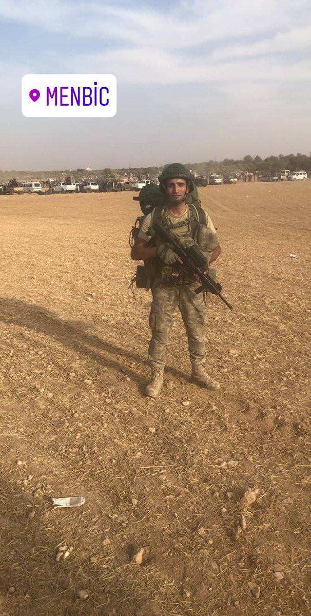
Turkish forces were approaching the town of Manbij on Monday [Oct 14], in a bid to oust Kurdish-led fighters from the north-eastern Syrian city.
Ruptly footage: ruptly.tv/en/videos/2019…
Ruptly footage: ruptly.tv/en/videos/2019…
We gathered an Instagram Stories post shared by a Turkish soldier that was geotagged as Manbij - we matched its background to that seen in a video posted on a Facebook page aggregating Turkish military content.
Facebook video: facebook.com/watch/?v=25208…
Facebook video: facebook.com/watch/?v=25208…
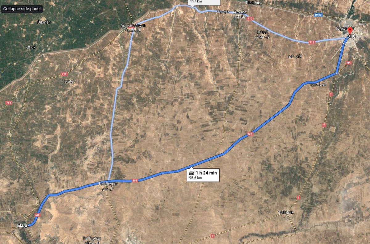
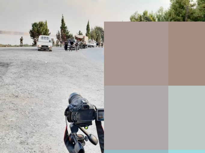
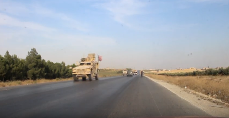
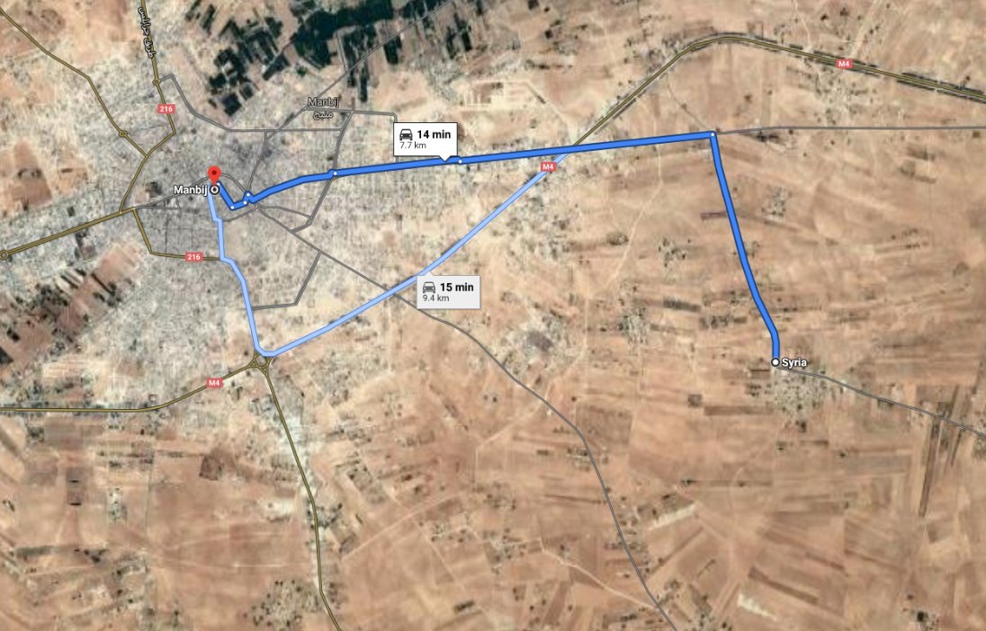
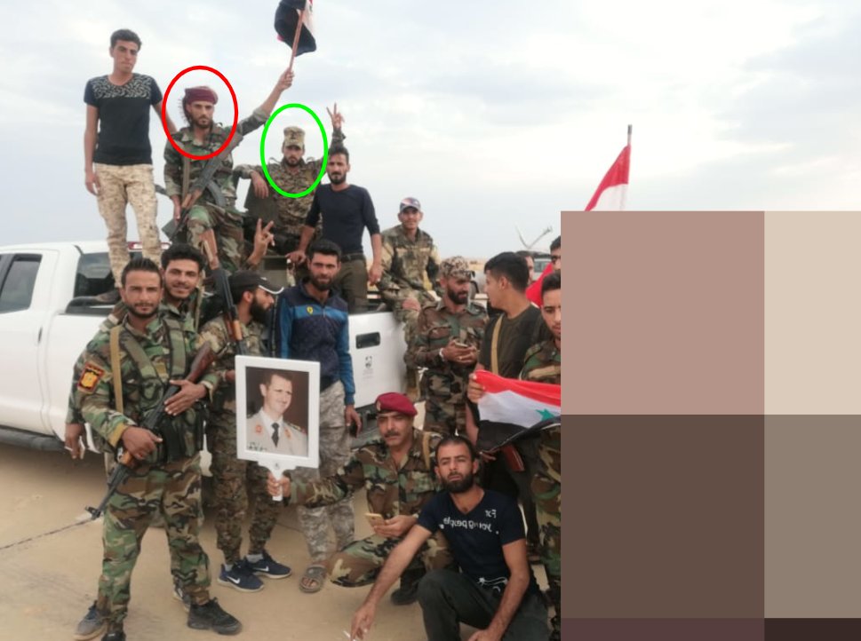
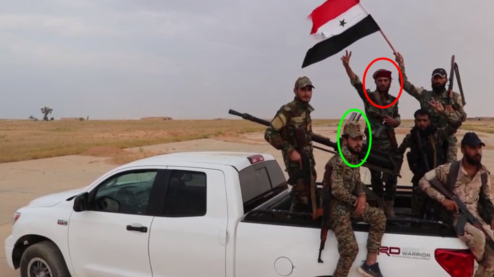
The US Army and the Syrian Army were seen driving past each other on the road linking Manbij and Kobani, on the M4 highway in north-eastern Syria, on Monday [Oct 14].
Ruptly footage:
ruptly.tv/en/videos/2019…
Ruptly footage:
ruptly.tv/en/videos/2019…
Our cameraman sent us a selfie with Syrian army soldiers assembled in the background - in his footage we see both the flags of the US and Syria. He also sent us a geopin of where this encounter took place.
Location: google.com/maps/place/36%…
Location: google.com/maps/place/36%…
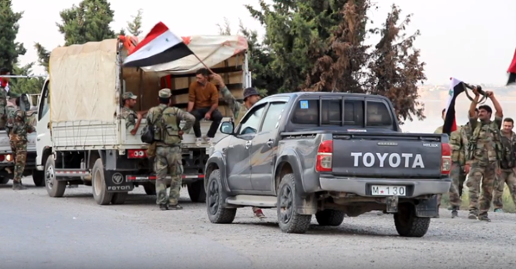
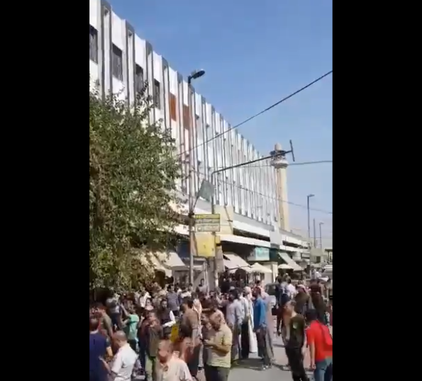
Residents in Manbij celebrated on the streets on Tuesday [Oct 15] following the announcement that the Syrian army were arriving to the city after reaching a deal with Kurdish groups.
Ruptly footage:
ruptly.tv/en/videos/2019…
Ruptly footage:
ruptly.tv/en/videos/2019…
We matched our cameraman’s footage against other footage circulating online - we found this Instagram Stories video geopinned to Manbij. We used this video to corroborate the event, its date & location.
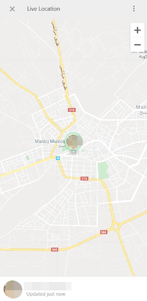
Our cameraman also sent us his WhatsApp live location - it placed him at the municipality in the center of Manbij. We matched his footage against a Twitter video of the same event & found a corresponding image of the municipal building.
Twitter video:
Twitter video:


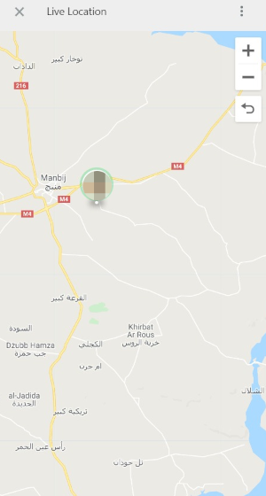
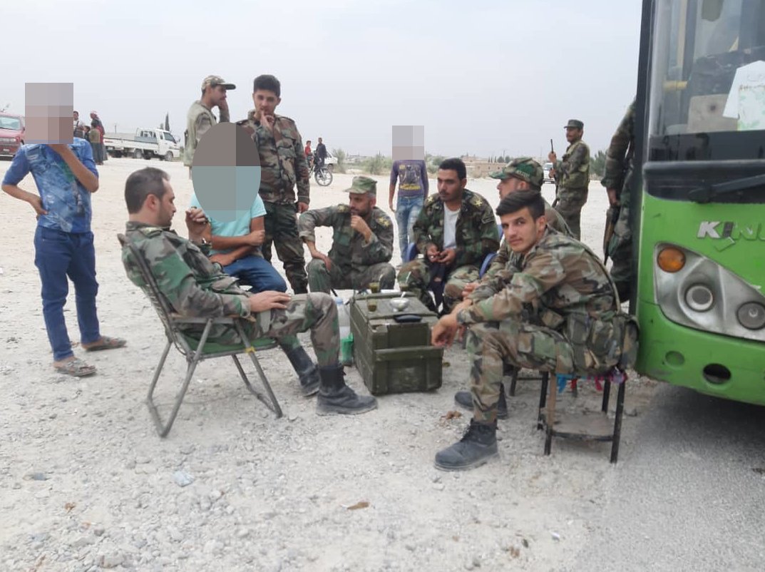
The Syrian army reached the outskirts of Manbij on Tuesday [Oct 15] - not entering the city but gathering at a school building some 7km east of the city. Our footage shows local residents & soldiers mixing together.
Ruptly footage:
ruptly.tv/en/videos/2019…
Ruptly footage:
ruptly.tv/en/videos/2019…
Our cameraman in Manbij sent us his selfie & WhatsApp live location as he filmed the Syrian army deployment. We reviewed his location on Google Maps and next switched to Google Earth to geolocate the exact buildings seen in our footage.
Location: google.com/maps/place/Man…
Location: google.com/maps/place/Man…
Using Google Earth we matched the building's main door staircase [red], the positioning of the gated entrance [green], the smaller square-shaped building [orange] and the vertical positioning of the main building [purple].


We next validated footage taken on Tuesday [Oct 15] from inside the former US military base near Manbij. We also received UGC from our cameraman from outside the base. In the video he says: “The base is empty, the Americans withdrew. The American flag was removed. 15.10.2019.”
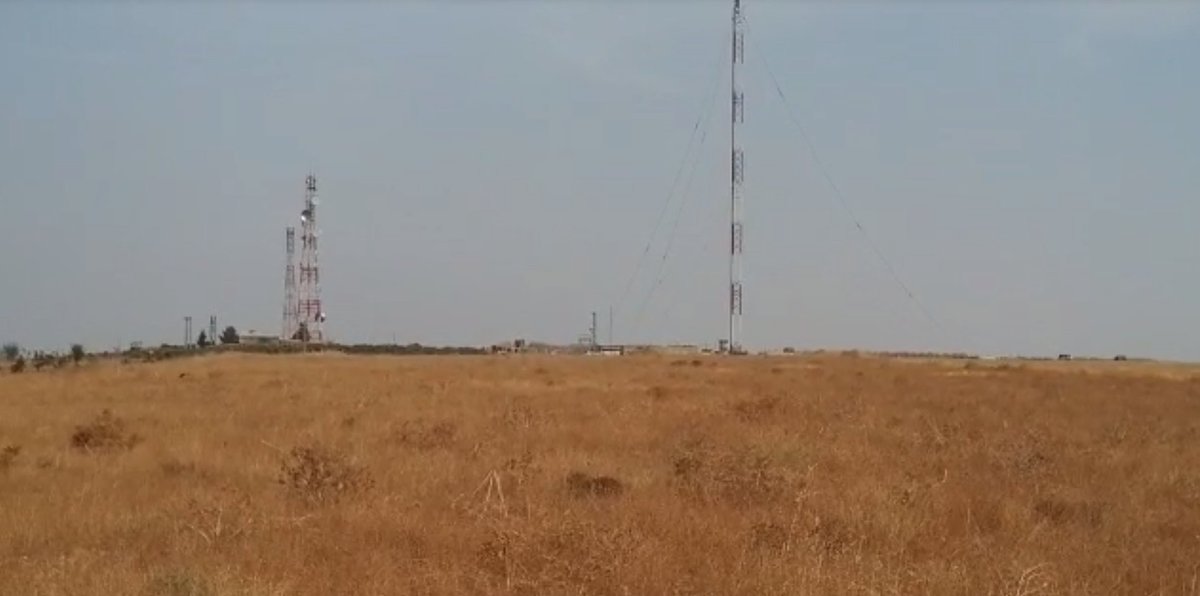
The location of the former US base is 12km west of Manbij. We matched our footage against the 3 large communications towers - 1 inside the base & 2 more outside the base parameter wall. We then worked out the exact location of filming.
Wikimapia: wikimapia.org/#lang=en&lat=3…
Wikimapia: wikimapia.org/#lang=en&lat=3…
Russian military police were seen patrolling Manbij on Tuesday [Oct 15] in footage released by the Russian MoD. Footage shows Tiger armoured cars traversing through Manbij city.
Ruptly footage:
ruptly.tv/en/videos/2019…
Ruptly footage:
ruptly.tv/en/videos/2019…
The Russian MoD released the footage on Wednesday [Oct 16] but we discovered it was filmed a day previous because our cameraman in Manbij sent us footage of the exact same event, along with his live location. We made an exact match of the sequence of vehicles.


The Russian vehicles enter Manbij from the west roundabout (coming from the direction where the former US base is located ). We see straight-angle pavement work around the monument, with four pavements at equal angles.
Location: google.com/maps/place/36%…
Location: google.com/maps/place/36%…
We also see the armound cars pass the Memorial Park roundabout, travelling west out of Manbij. This tells us that the footage is not edited in sequence.
Location: google.com/maps/place/36%…
Location: google.com/maps/place/36%…
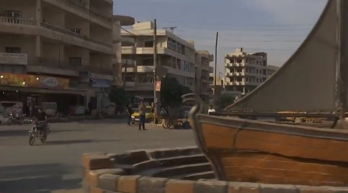
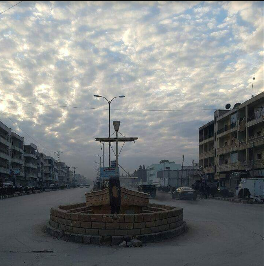
We also see the Russian armoured vehicles turn left - travelling north - at a boat monument roundabout in central Manbij.
Location: google.com/maps/place/36%…
Location: google.com/maps/place/36%…
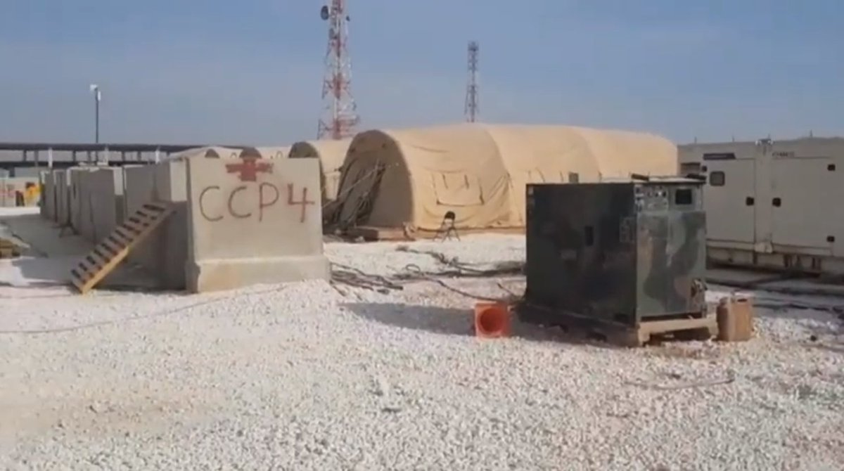
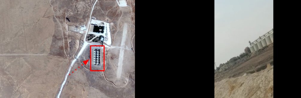
We next validated cellphone footage recorded from outside the former US military base in Tell Beyder. Our cameraman recorded the footage on Wednesday [Oct 16].
Our cameraman also sent us a selfie and a shorter cellphone clip taken from directly outside the former US base. In this clip we can see a row of six large steel cylinders, which are present on the site of the vacant base.
The cameraman’s selfie shows the cylinders too. We also matched exactly where our cameraman recorded his short UGC clip - again using the cylinders as our point of reference.
Location: google.com/maps/place/36%…
Location: google.com/maps/place/36%…
We received more footage of another former US base on Wednesday [Oct 16] at the site of a ruined airbase at Al-Tabqa. Our cameraman travelling with the Syrian army recorded the soldiers at the base for the first time in six years.
Ruptly footage: ruptly.tv/en/videos/2019…
Ruptly footage: ruptly.tv/en/videos/2019…
We received a selfie from our cameraman matching an exact scene in our footage - we matched the identities of soldiers seen in the background of the selfie. The location of the former US base at Al-Tabqa is below.
Location: google.com/maps/place/35%…
Location: google.com/maps/place/35%…
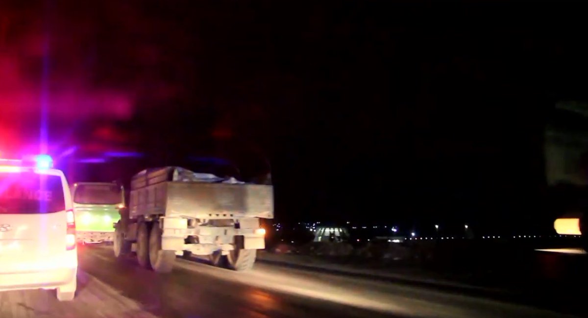
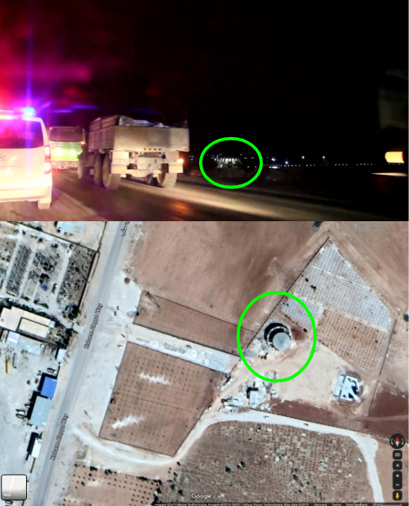
Later on Wednesday [Oct 16], our cameraman travelling with the Syrian army near Kobane filmed soldiers entering the key border town. Our cameraman sent us an image earlier in the day, taken with Syrian soldiers 10km outside Kobane.
Ruptly footage:
ruptly.tv/en/videos/2019…
Ruptly footage:
ruptly.tv/en/videos/2019…
Our video shows troops entering Kobane from the south, passing the domed roof of this building near a cemetery, visible on Google Maps satellites on the Kobane-Aleppo Way.
Location: google.com/maps/place/36%…
Location: google.com/maps/place/36%…
At the top of Kobane-Aleppo Way, as the road becomes part of the city, a building with a distinctly shaped roof can be found. We also geolocated the location of the monument representing the gate to the city.
Location: google.com/maps/place/36%…
Location: google.com/maps/place/36%…
Our coverage of key developments in #Syria and the verification work behind the footage we publish to our global clients continues.
The process behind our coverage detailed in full here...
The process behind our coverage detailed in full here...
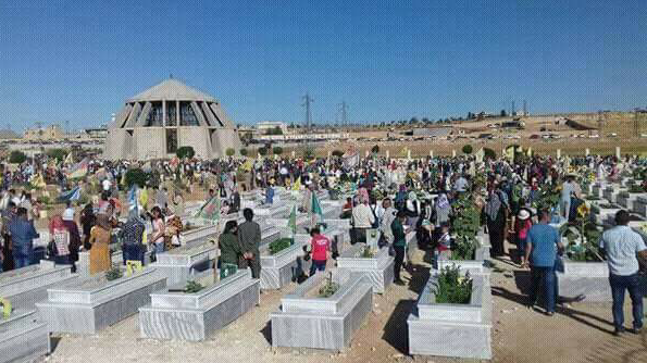
Thousands of Kurdish protesters rallied in Kobane on Friday [Oct 18] to protest against Turkish military action in northern Syria and the resulting civilian death toll.
Ruptly footage: ruptly.tv/en/videos/2019…
Ruptly footage: ruptly.tv/en/videos/2019…
Before filming, our cameraman sent us this image of him at Resistance monument - Qada Arîn Mîrkan - where protesters were gathered.


In this scene of our footage - showing the Resistance monument - we matched the location of the cameraman & monument using geopinned open-source images available on Google Maps.

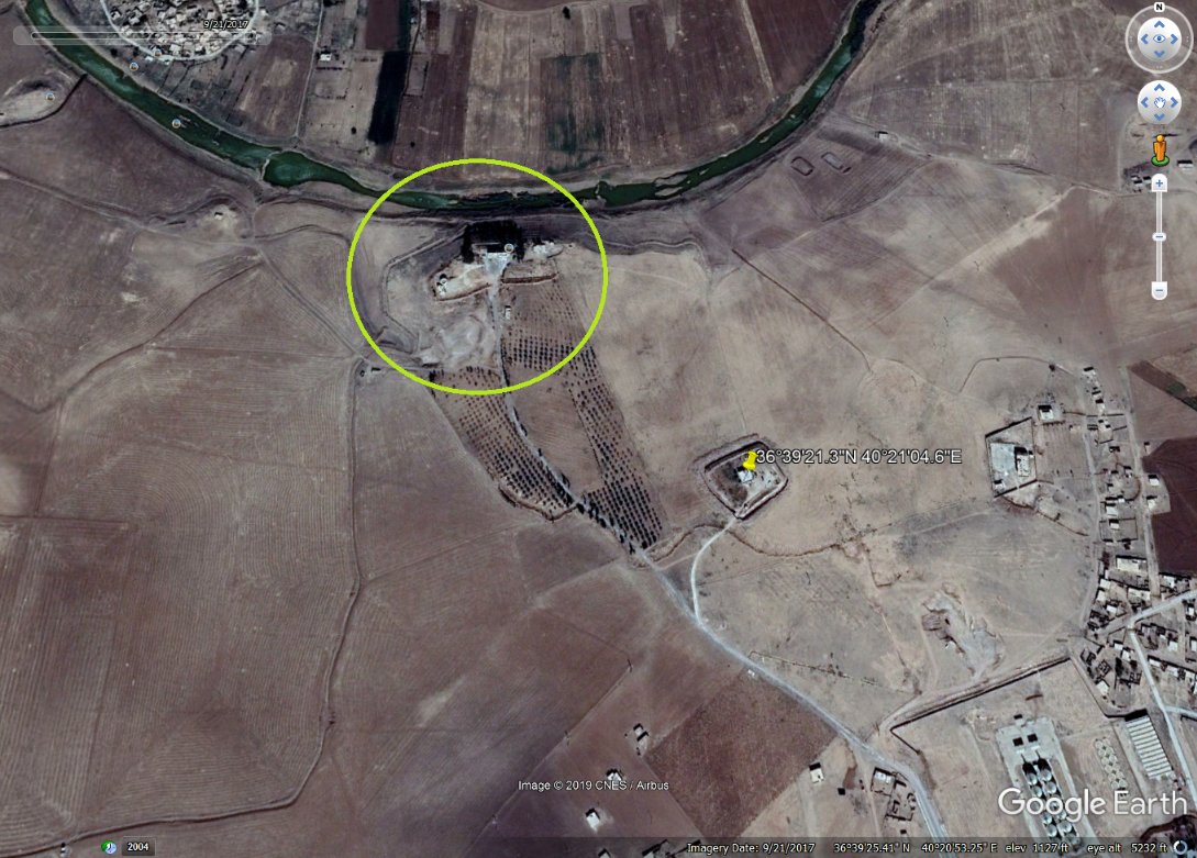
US forces started to withdraw from their largest base near Sarrin in northern Syria on Sunday [Oct 20], after the US confirmed they would leave for western Iraq to continue fighting ISIS factions.
Ruptly footage:
ruptly.tv/en/videos/2019…
Ruptly footage:
ruptly.tv/en/videos/2019…
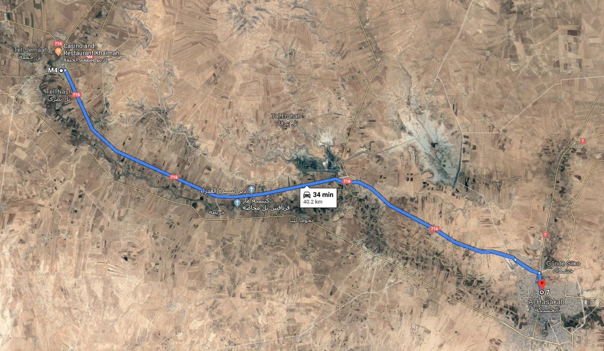
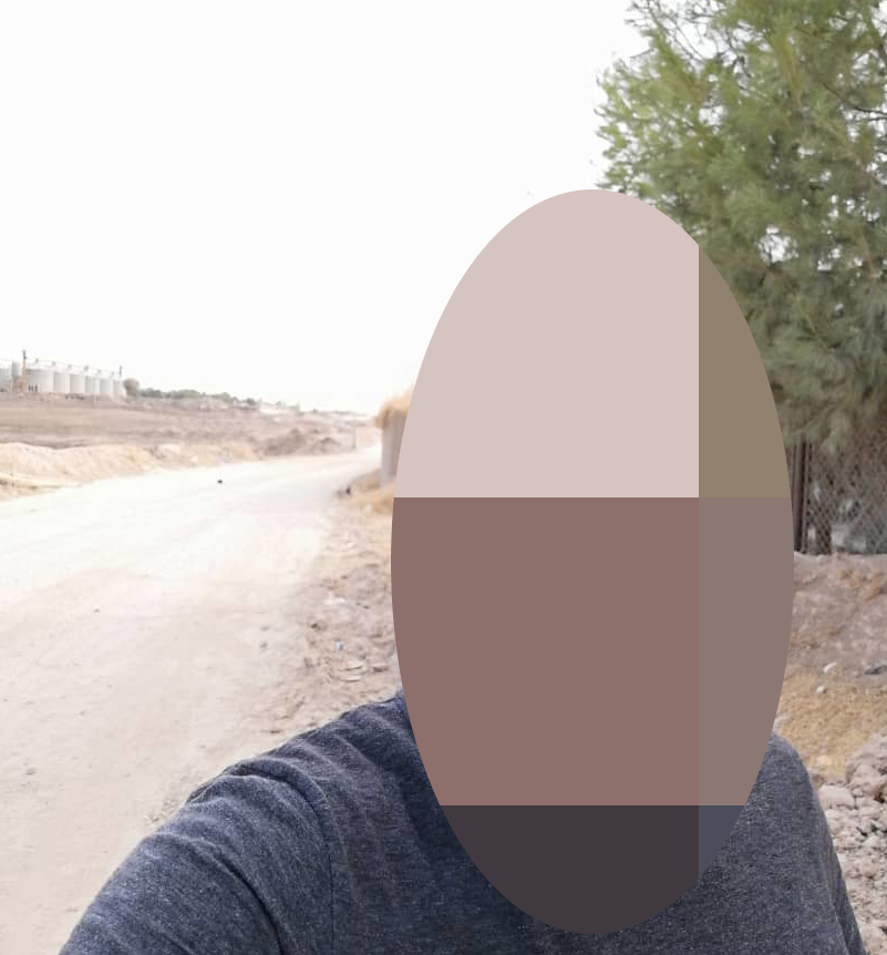
Our cameraman sent us a selfie showing a large US convoy. He also sent us his geopin, placing him close to the town of Tell Brak.
Location:
google.com/maps/place/36%…
Location:
google.com/maps/place/36%…
The Syrian army entered Qasr Yalda northwest of the town of Tall Tamr on Saturday [Oct 19], a location formerly used by the US military as an operating base in the region.
Ruptly footage:
ruptly.tv/en/videos/2019…
Ruptly footage:
ruptly.tv/en/videos/2019…
Our cameraman sent us an image and his geolocation from the former US base. We then matched the footage to visual elements available by open-source.
Location: zoom.earth/#view=36.65889…
Location: zoom.earth/#view=36.65889…
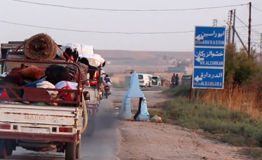
Footage filmed on Sunday [Oct 20] shows civilians., who fled Ras al-Ain due to Turkey's continuing military offensive, passing through a checkpoint near Tall Tamr in northern Syria.
Ruptly footage:
ruptly.tv/en/videos/2019…
Ruptly footage:
ruptly.tv/en/videos/2019…
Our cameraman sent us a selfie matching his footage. He also sent us a geopin from the vicinity of the checkpoint at Tall Tamr - we used a scene showing road signs to corroborate his location.


Our cameraman on-the-ground spoke with @DaveEubankFBR, a humanitarian with the @FreeBurmaRangrs, who also published a brief account of his work while in Ras al-Ain helping to get civilians and wounded away from the frontline.
On Monday [Oct 21], US military vehicles were hit with rocks and vegetables by local residents as they withdrew through the northern Syrian city of Qamishli.
Ruptly footage: ruptly.tv/en/videos/2019…
Ruptly footage: ruptly.tv/en/videos/2019…
This video was recorded by one of our local media partners. We checked this footage for existing archive content and, once satisfied, we geolocated the exact position of the US vehicles in Qamishli.